
A heat wave over the Southwest will intensify late week, peaking and expanding into the Intermountain West and northern High Plains this weekend. Severe thunderstorms and heavy rain are expected over portions of the Plains and Mississippi Valley tonight, which will shift to parts of the Upper Midwest and mid-Mississippi Valley Friday. Monsoonal showers and flooding persist in the Desert Southwest. Read More >

For Moderate/High/Extreme hazard risk, more detailed information will be provided via emailed briefings to core partners.
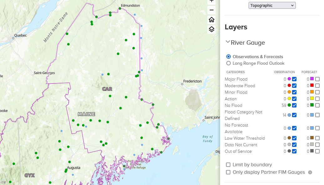 |
River Forecast PointsMap displays river points in Maine and New Hampshire. Just click on the point where you want a forecast. Map is updated every time a new observation or forecast is generated. |
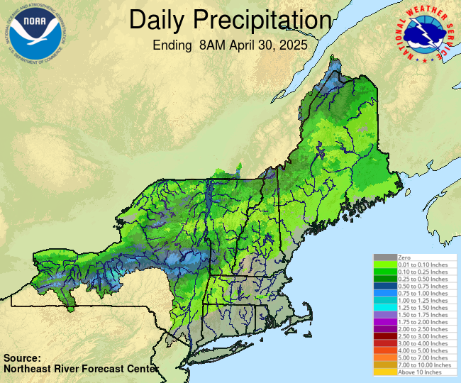 |
Observed PrecipitationNortheast River Forecast Center |
 |
24Hr QPF ForecastMap displays 24hr forecasted precipitation amounts. Map is updated every time the forecaster issues a new forecast. |
 |
2.5 Day QPF ForecastMap displays 2.5 Day forecasted precipitation amounts. Map is updated every time the forecaster issues a new forecast. |
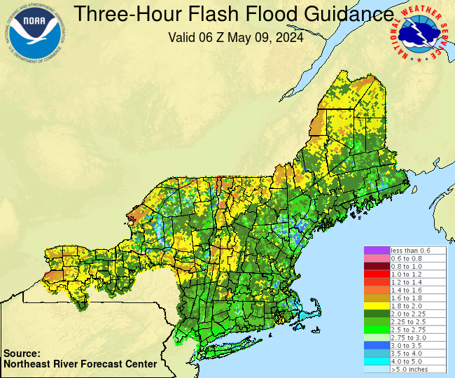 |
Flash Flood GuidanceFlash Flood Guidance is an estimate of the amount of rainfall required over a given area during a given duration to cause small streams to flood issued by Northeast River Forecast Center. |
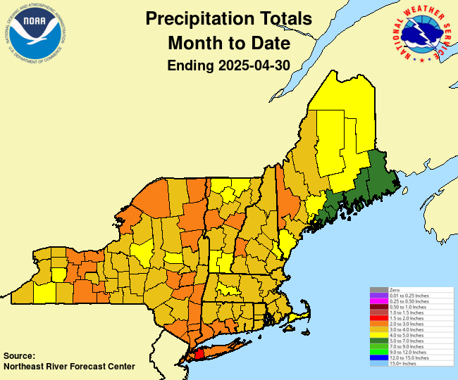 |
Precipitation / DepartureThe precipitation totals used in these graphics and the accompanying text products are from the 6-hourly county mean areal precipitation calculated for use in the NERFC's Community Hydrologic Prediction System. |
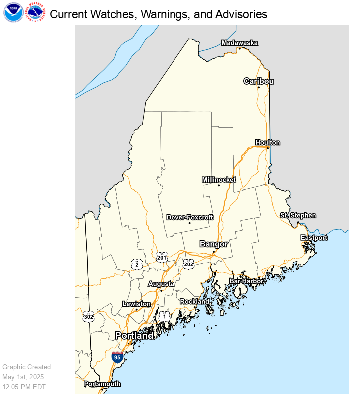 |
Weather HazardsMap displays active watch, warnings, advisories and short term forecasts in the lower 48 states. Map automatically refreshes every five minutes. |
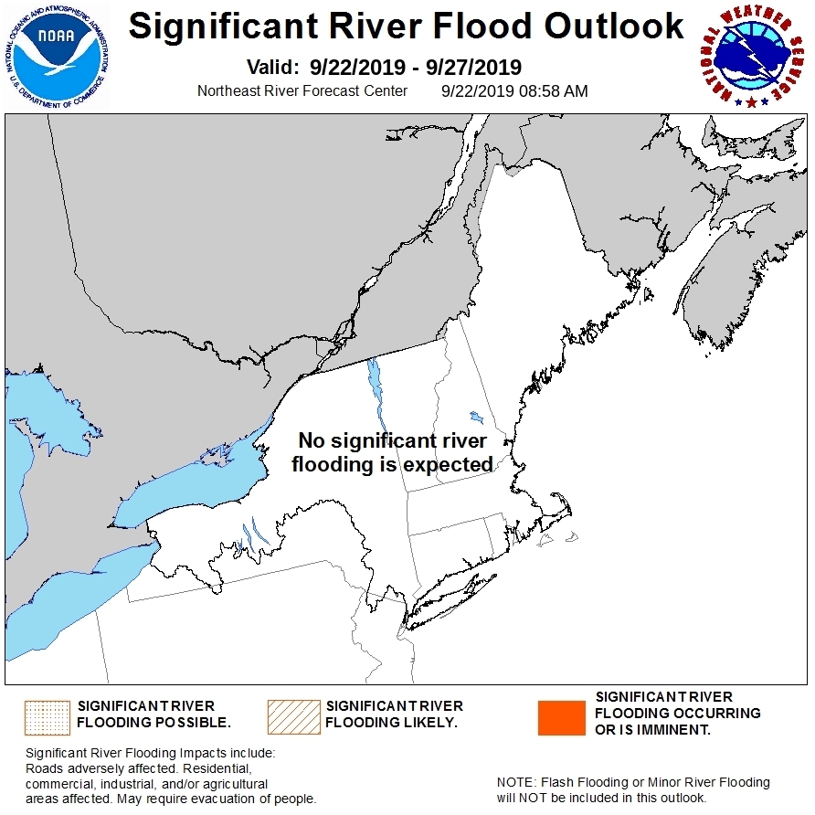 |
Significant River Flood OutlookThis Flood Outlook is intended to provide a general outlook for significant river flooding. It is not intended to depict all areas of minor flooding or small-scale events such as localized flooding and/or flash flooding. |
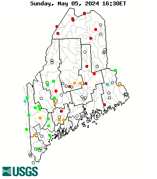 |
Historical StreamflowMap of real-time streamflow compared to historical streamflow for the day of the year. |
 |
National Snow AnalysesIncludes data on snow water equivalent, snow depth and more. The data can be view for a day or animated for a two week period or a seaon. NERFC: Observed Snow Maps |


 Coastal Flood