Atlantic Basin Tropical Systems Which Have
Affected The Upper Mississippi River Valley
1850 - Current
Since 1850, the remnants of 31 Atlantic Basin tropical systems have moved within 450 miles of La Crosse, WI. While none of the system centers have tracked across the NWS La Crosse Hydrologic Service Area, 12 did get close enough to produce some rain in the area. In addition, only 2 have directly moved across Iowa and 3 have moved across Wisconsin. In Wisconsin they were the Galveston Hurricane of September 1900 (also known as Isaac's Storm) on September 10 & 11 and an unnamed hurricane of September/October 1949 on October 6 & 7.
No tropical system has ever directly moved through Minnesota. Here is more information from the Minnesota DNR - "Can Tropical Weather Systems Affect Minnesota?"
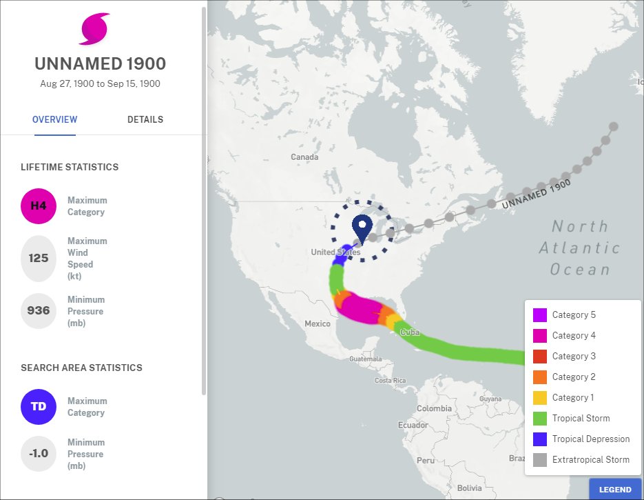
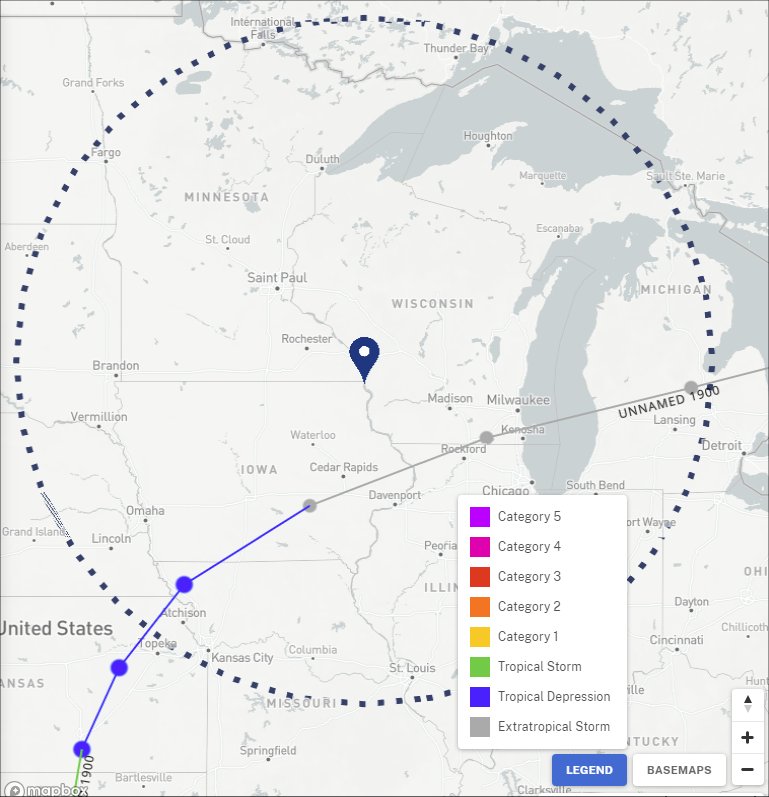
Galveston 1900 Hurricane (Also known as Isaac's Storm)
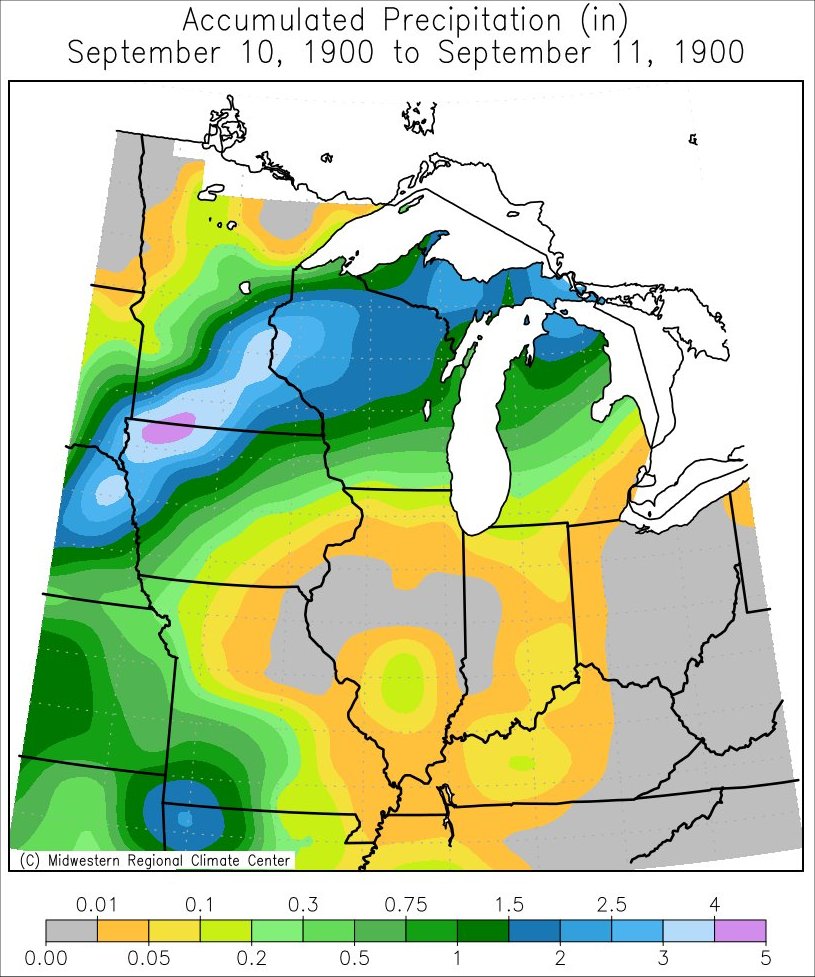
The remnants from this Category 4 hurricane produced rain across the Upper Mississippi River Valley from September 10-11, 1900. Over 2 inches of rain fell Grand Meadow, MN (2.65"); La Crosse, WI (2.05"); Medford, WI (2.00"); Pepin, WI (2.29"); and St. Charles, MN (2.80"). This is the first of 3 tropical system remnants to directly track across the state of Wisconsin.
 |
 |
 |
| Track & Statistics | Track through Region | Precipitation |
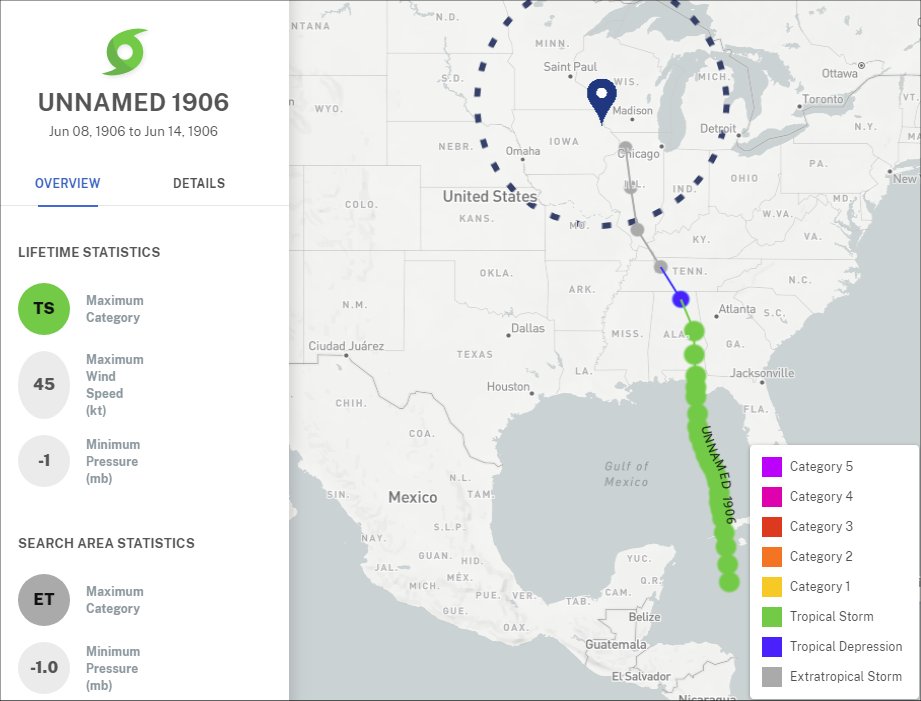
Unnamed Tropical Storm of June 1906
The remnants from this tropical storm produced light rain across southern and eastern Wisconsin on June 14, 1906 Only 0.03" fell across Hillsboro, WI (Vernon County).
 |
 |
 |
| Track & Statistics | Track through Region | Precipitation |
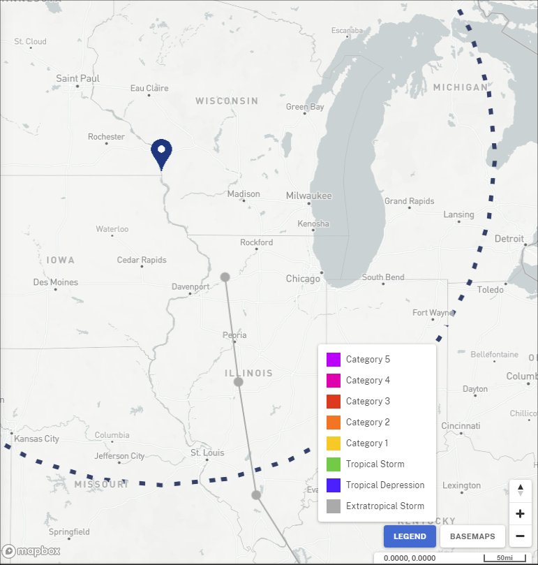
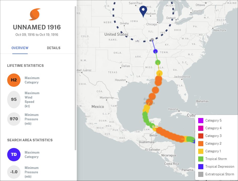
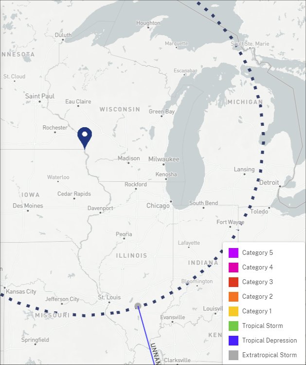
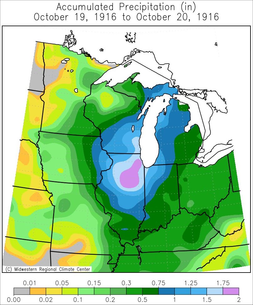
Unnamed Hurricane of October 1916
The remnants from this unnamed hurricane produced rain across much of the Upper Mississippi River Valley on October 19-20 1916 With the exception of Taylor County which saw no rain, the area saw anywhere from 0.4 to 1" of rain.
 |
 |
 |
| Track & Statistics | Track through Region | Precipitation |
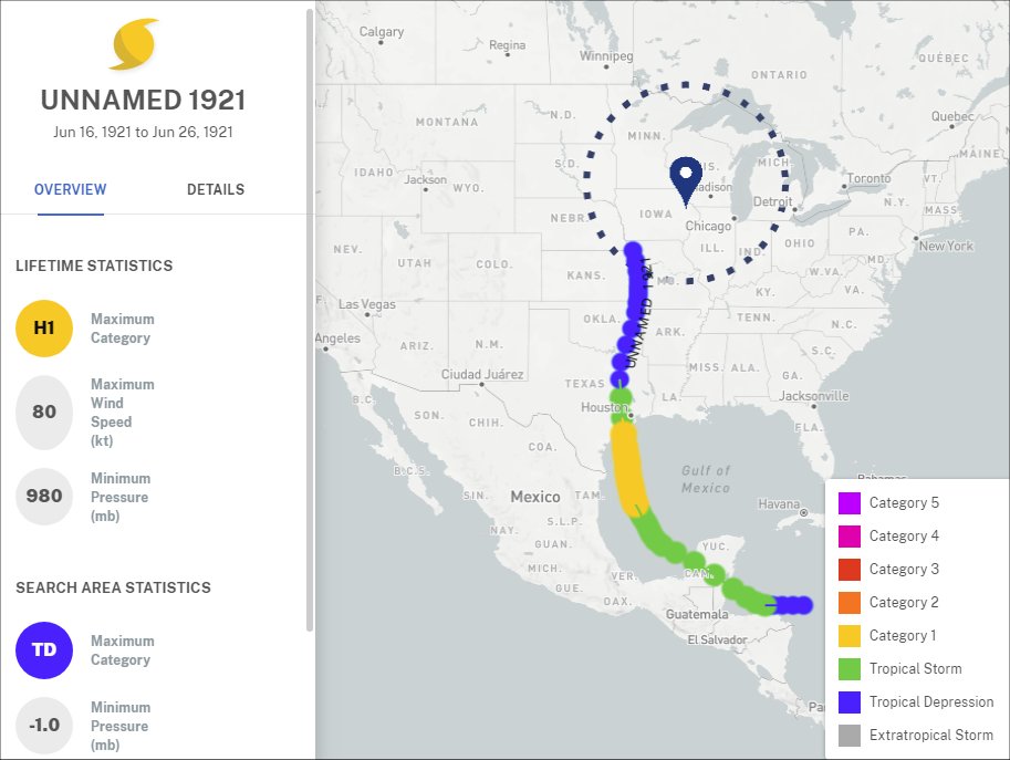
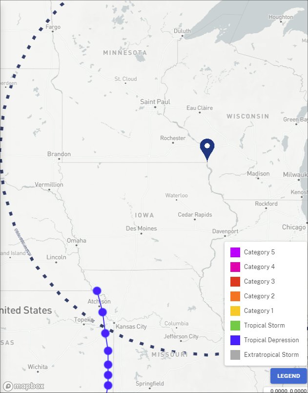
Unnamed Hurricane of June 1921
The remnants from this unnamed hurricane produced light rain across much of the Upper Mississippi River Valley on June 26, 1921
 |
 |
 |
| Track & Statistics | Track through Region | Precipitation |
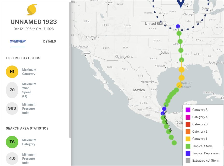
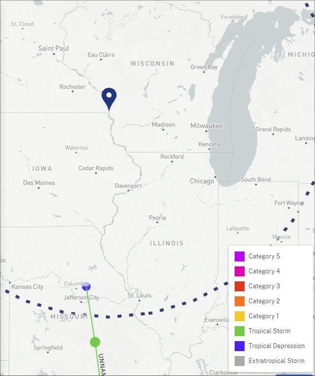
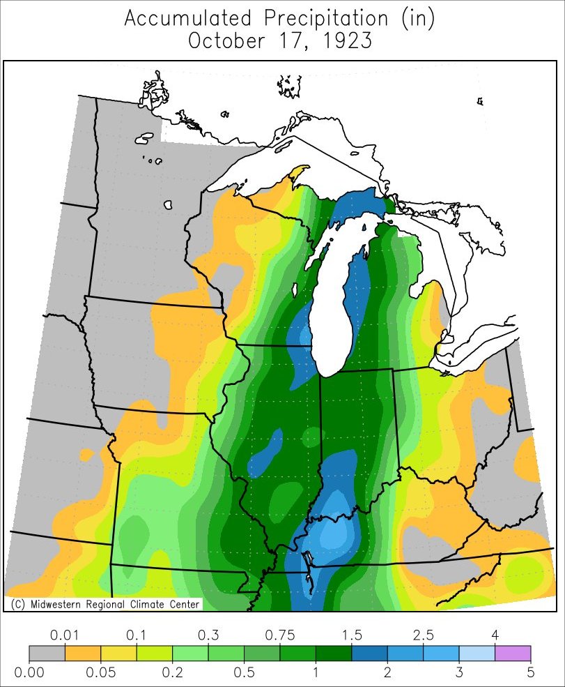
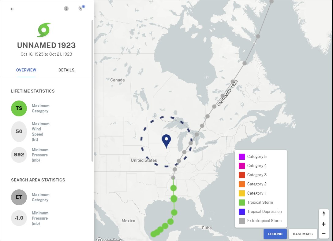
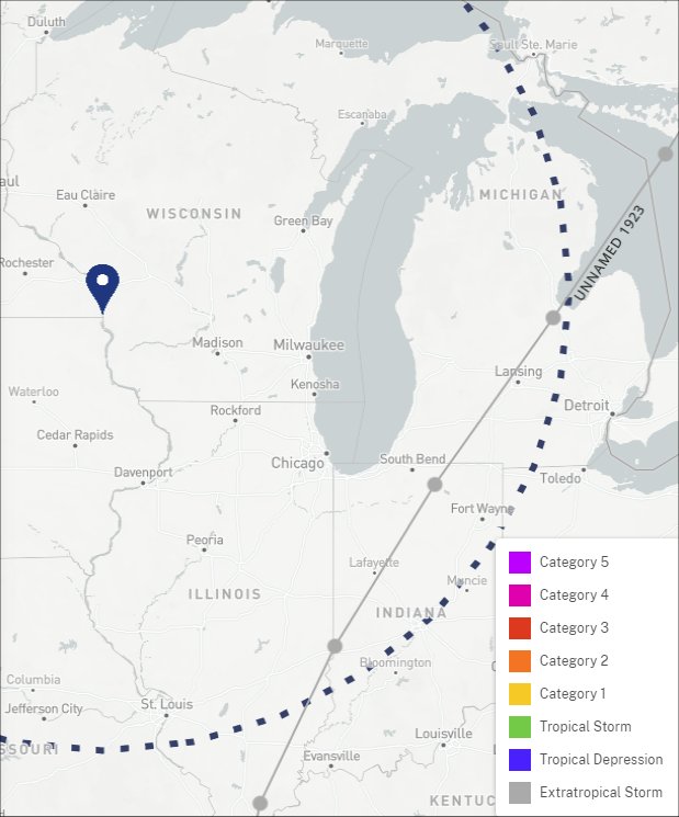
Unnamed Hurricane of October 1923
The remnants from this unnamed hurricane produced light rain across much of the Upper Mississippi River Valley on October 17, 1923.
 |
 |
 |
| Track & Statistics | Track through Region | Precipitation |
Unnamed Tropical Storm of October 1923
The remnants from this unnamed tropical storm produced rain across much of the Upper Mississippi River Valley on October 18-19, 1923.
 |
 |
|
| Track & Statistics | Track through Region | Precipitation |
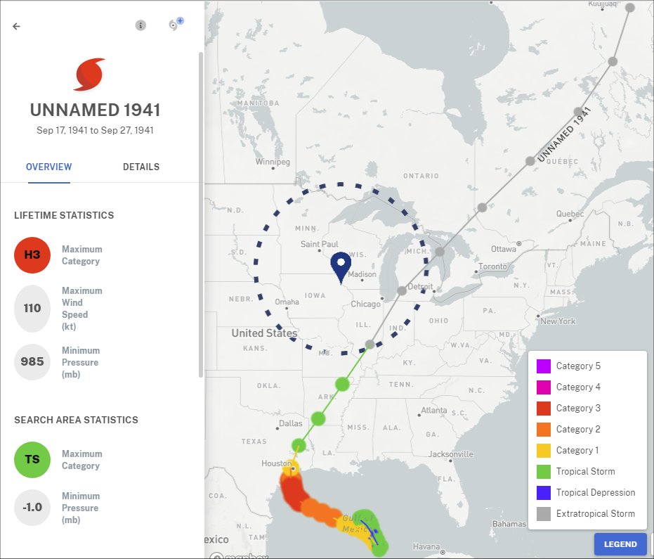
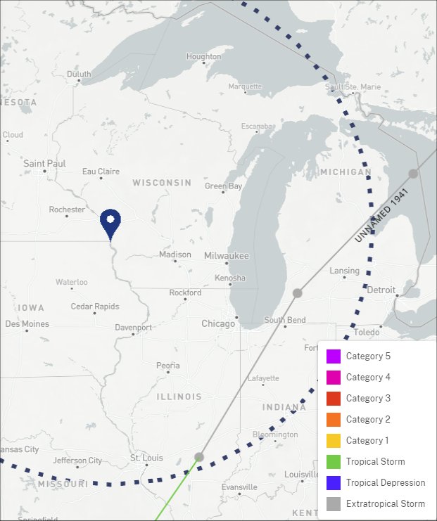
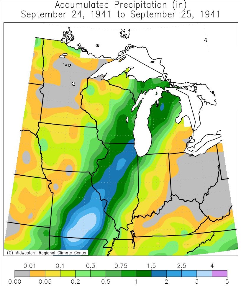
Unnamed Hurricane of September 1941
The remnants from this unnamed hurricane produced rain across much of the Upper Mississippi River Valley on September 24-25, 1941.
 |
 |
 |
| Track & Statistics | Track through Region | Precipitation |
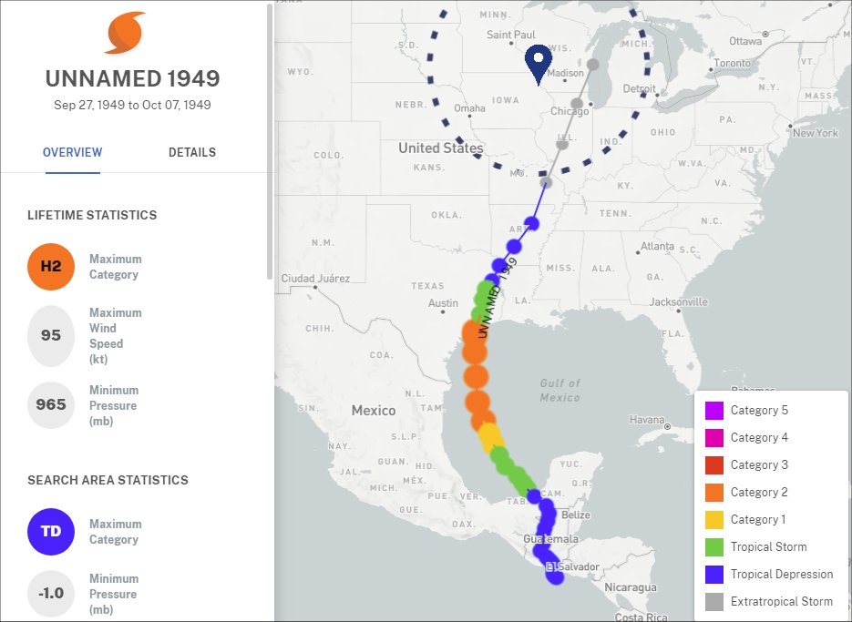
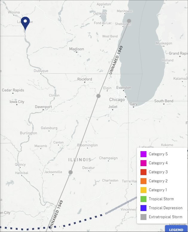
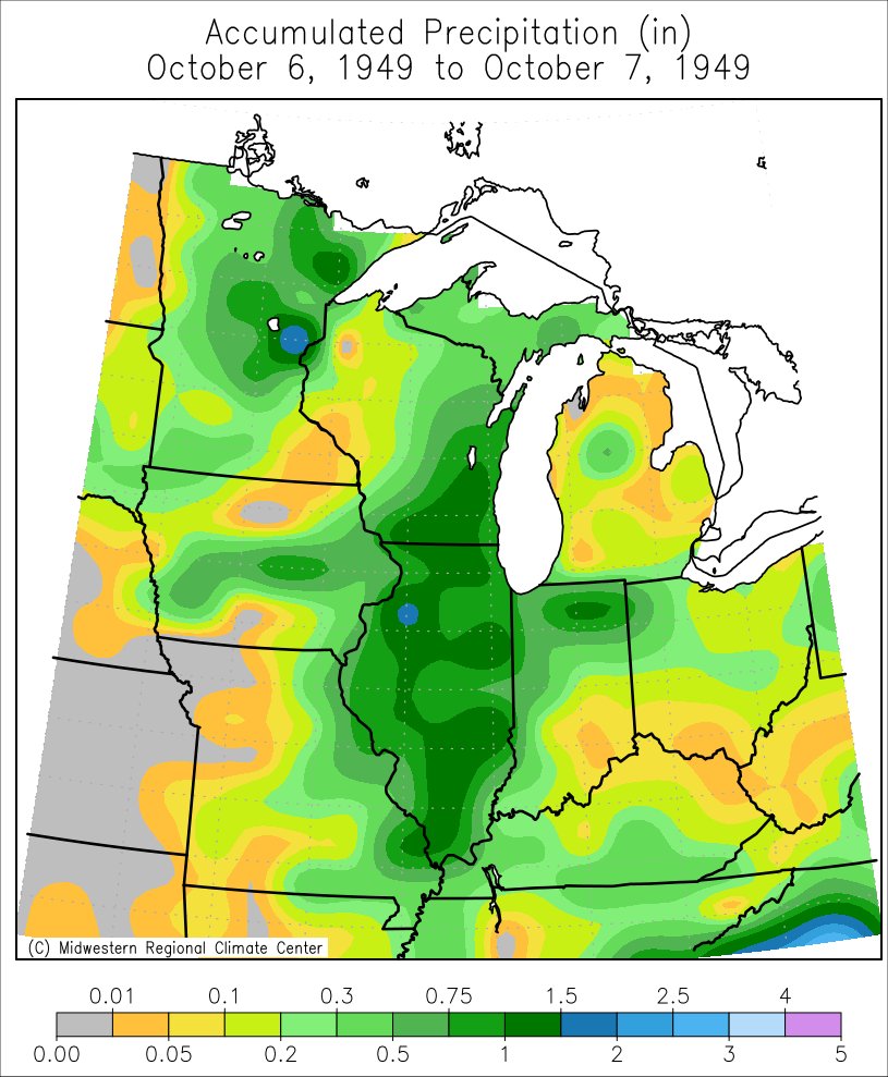
Unnamed Hurricane of September-October 1949
The remnants from this unnamed hurricane produced rain across much of the Upper Mississippi River Valley on October 6-7, 1949. This is the second of 3 tropical system remnants to directly track across the state of Wisconsin.
 |
 |
 |
| Track & Statistics | Track through Region | Precipitation |
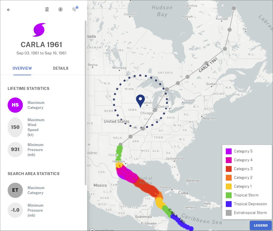
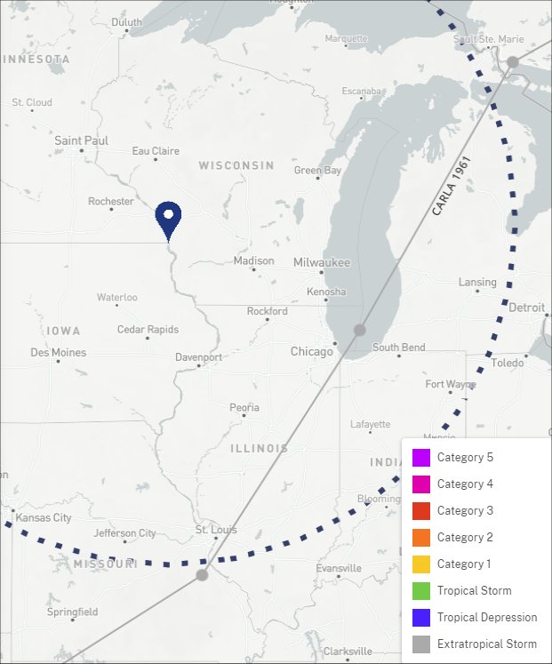
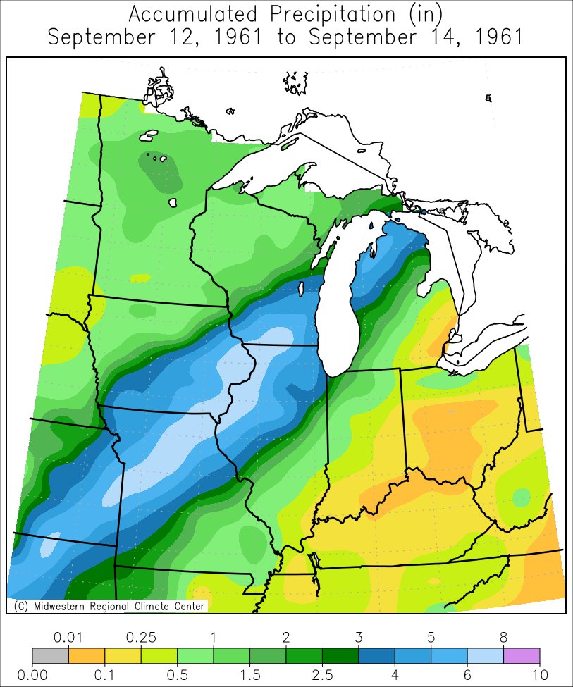
Hurricane Carla 1961
From September 12-14, the remnants from Hurricane Carla produced the highest tropical rainfall from either a North Atlantic and Northeast Pacific tropical cyclone remnant in both Iowa (9.03" - Chariton 1E - Lucas County) and Wisconsin (7.58" - Brodhead - Green County). Locally, 2 to nearly 7" of rain fell south of a line from New Hampton, IA to Mauston, WI. Elsewhere, rainfall totals ranged from a third to 2 inches. The highest rainfall totals inlcuded: Lancaster 4 WSW, WI (6.90"); Platteville, WI (5.98"); Richland Center, WI (5.21"); Guttenberg Lock & Dam 10, IA (5.17"); and Oelwein 2 S, IA (4.12").
 |
 |
 |
| Track & Statistics | Track through Region | Precipitation |
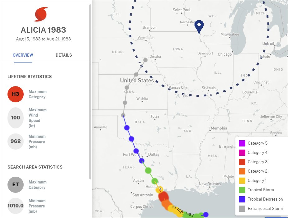
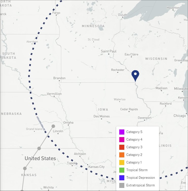
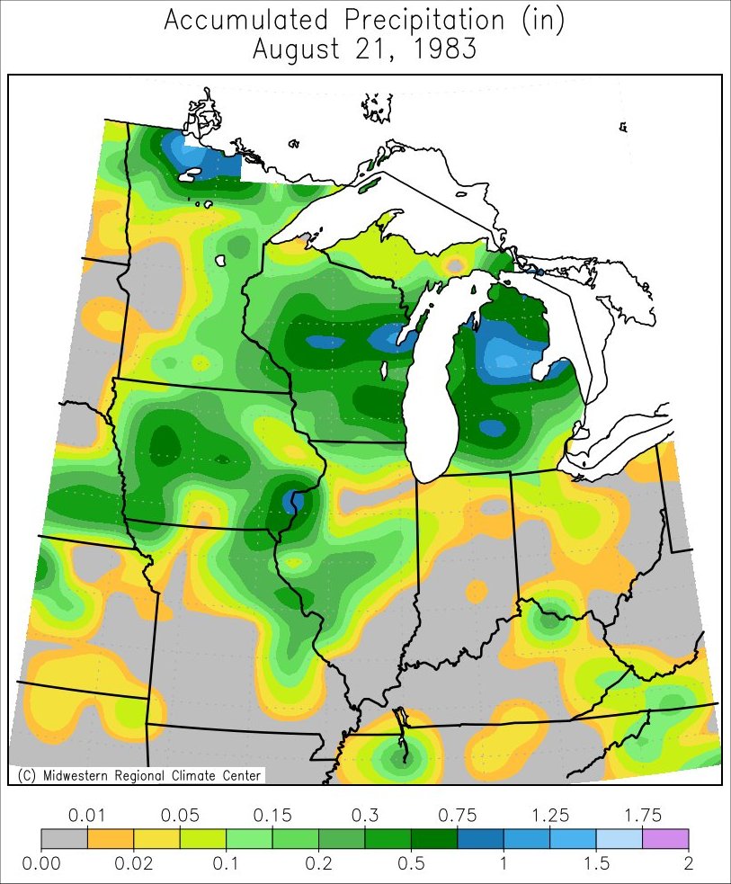
Hurricane Alicia 1983
The remnants from Hurricane Alicia (1983) produced rain across much of the Upper Mississippi River Valley on August 21, 1983.
 |
 |
 |
| Track & Statistics | Track through Region | Precipitation |
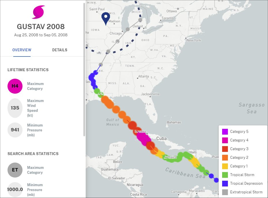
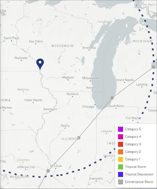
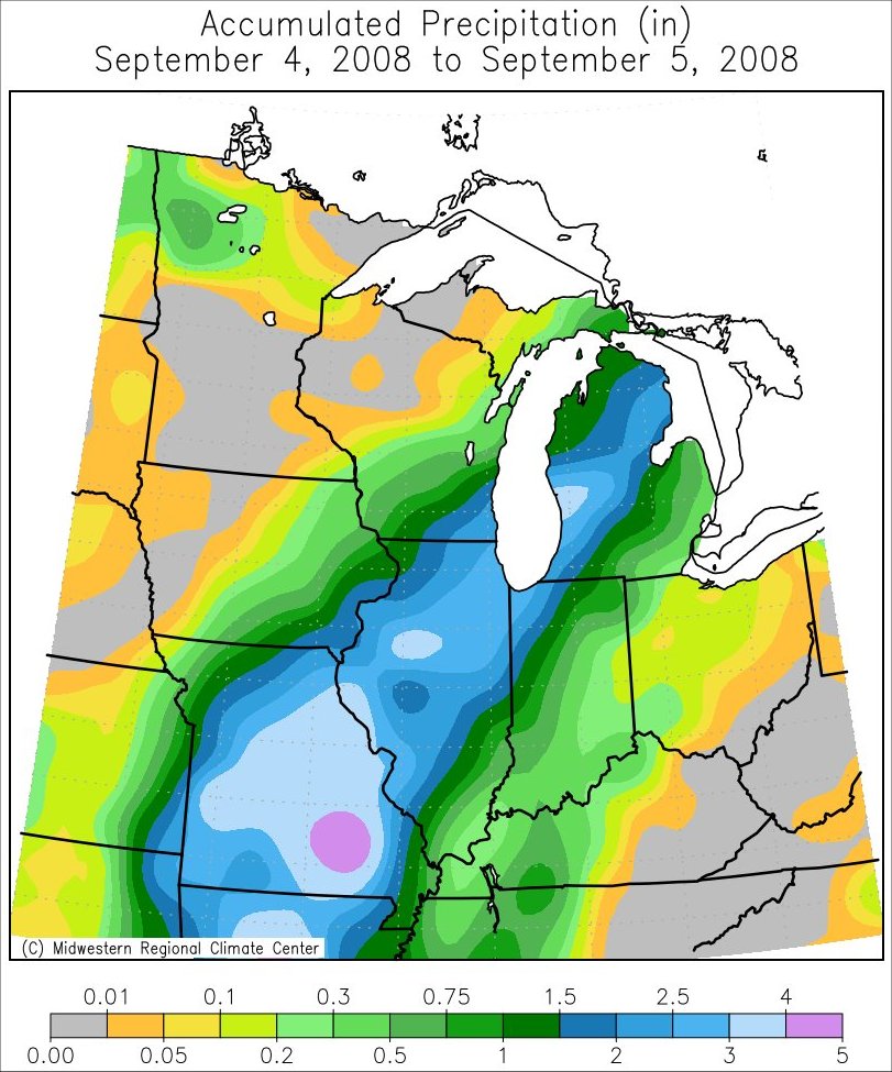
Hurricane Gustav of 2008
The remnants from Hurricane Gustav (2008) produced mainly light rain across much of the Upper Mississippi River Valley on September 4-5, 2008.
 |
 |
 |
| Track & Statistics | Track through Region | Precipitation |
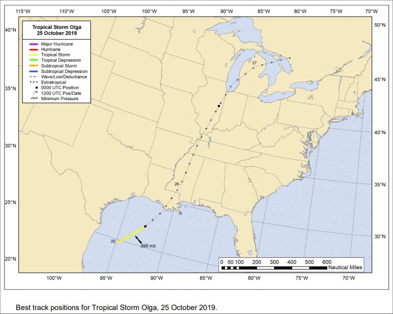
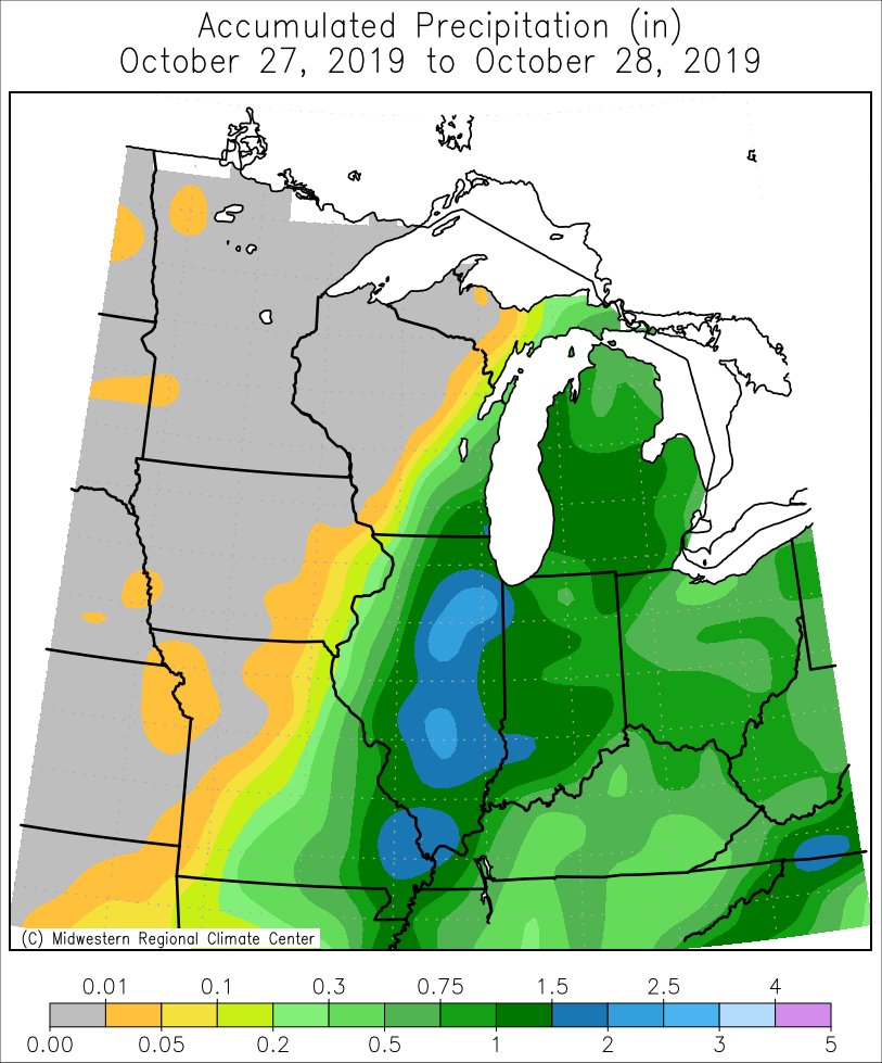
Tropical Storm Olga of 2019
The remnants from Tropical Storm Olga (2019) stayed mainly south and east of the region. The only place to receive any rain from this system on October 27-28, 2019 was Grant County in southwest Wisconsin.
 |
 |
| Track & Statistics | Precipitation |
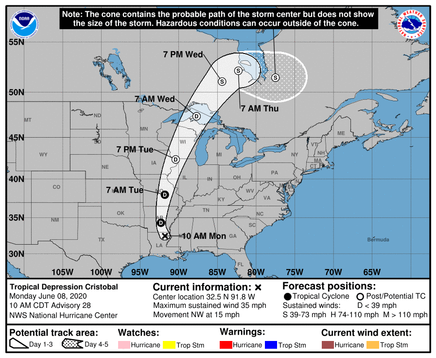
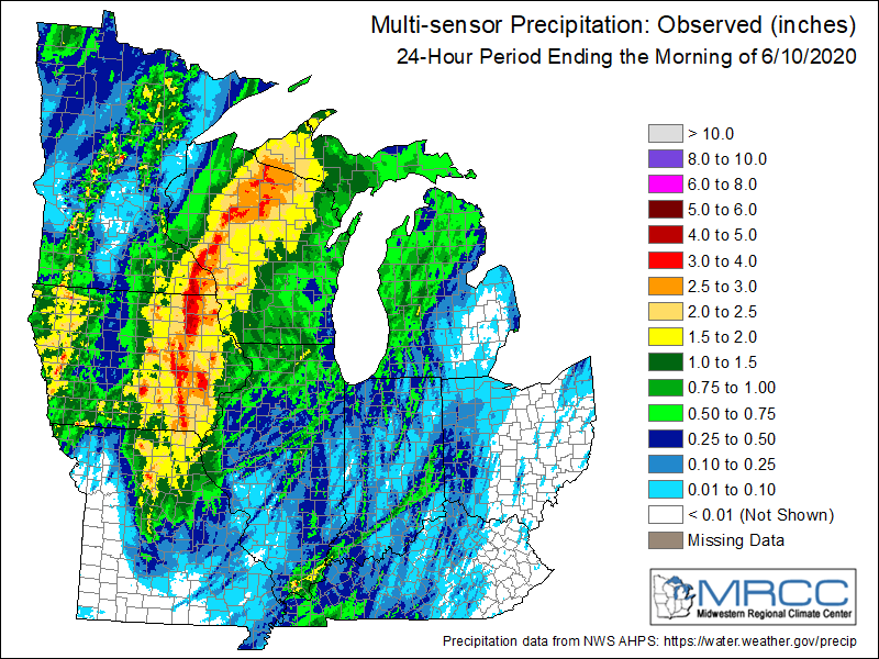
Tropical Storm Cristobal of 2020
The remnants from Tropical Storm Cristobal (2020) moved directly north out of the Gulf of America and into the region on Tuesday, June 9, 2020. The center of the tropical depression crossed through eastern Iowa and into Wisconsin. Very heavy rain fell (widespread 1-3") with some amounts exceeding 5". This led to flash flooding and significant rises on area rivers.
 |
 |
| Track & Statistics | Precipitation |

