La Crosse, WI
Weather Forecast Office
 Glenville/Austin MN tornado - F2/F1
Picture of the tornado track.
Picture of the tornado when near Glenville.
Three tornadoes hit parts of Freeborn and Mower Counties in southern Minnesota on Tuesday, May 1, 2001.
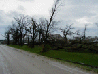
The tornado that hit Glenville, MN actually dissipated while still in Freeborn County. A second tornado formed around 7:15 pm about 8 miles southwest of Austin, MN, hitting several farms as it tracked northeast. Several hog farms were destoyed. This tornado crossed Interstate 90 between mile markers 173 and 174 west of Austin, tracked just southeast of Oakland, MN and continued toward the community of Lansing, MN before lifting about 4 miles north of Austin.
The tornado hit numerous farms, outbuildings, power poles, and crossed fields that were still bare of crops. Hardest hit were several homes in the small community of Andyville north of Austin, just off of Highway 218. Roofs were torn off and trees sheared off, with estimated F-2 damage on the Fujita Scale. This second tornado dissipated around 7:37pm. Peak width was approx. 250 yards.
A small tornado also touched down between Rose Creek and Elkton, MN around 7:52pm and will be rated an F0.
Our Office
Staff
Community Involvement
Station / Location Info
Follow Us On Social Media
Student Opportunities
Additional Information
Storm Summaries
Cooperative Observers
Educational Resources
Science / Research
Weather Phenomenon
Mayfly Tracking
Latest
Temp/Pcpn Summary
Precipitation Reports
Forecast Discussion
Hazardous Weather Outlook
Hourly Weather
Public Information Statement
Local Storm Report
Lightning Plot Archive
River Stages
Water Temp
Observations
Precipitation Plotter
Soil Temps
US Dept of Commerce
National Oceanic and Atmospheric Administration
National Weather Service
La Crosse, WI
N2788 County Road FA
LaCrosse, WI 54601
608-784-7294
Comments? Questions? Please Contact Us.


