La Crosse, WI
Weather Forecast Office
|
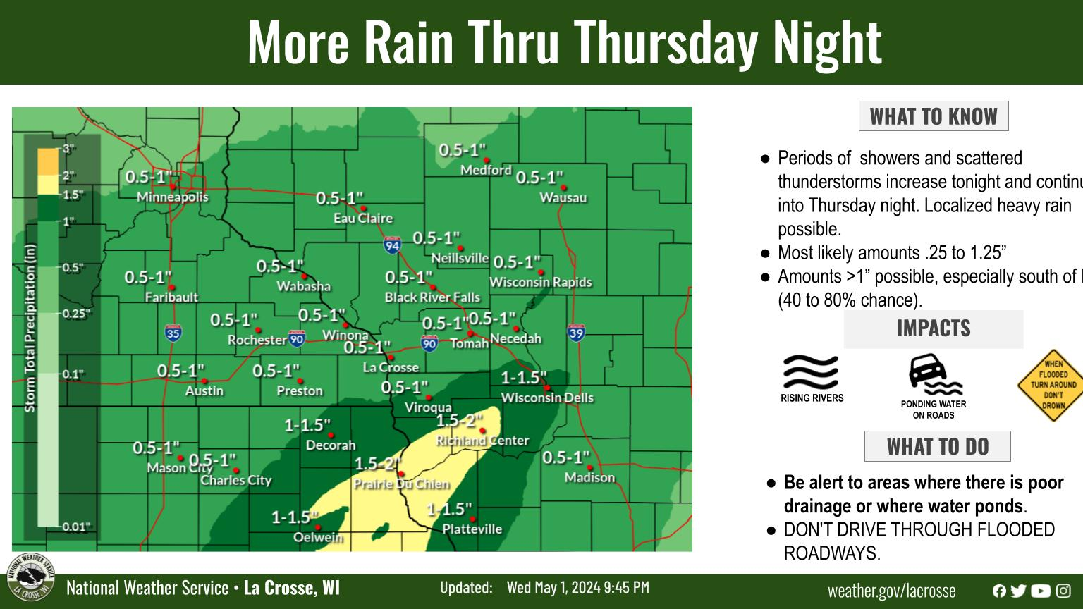
A winter storm will bring hazardous travel to the region starting Tuesday night through Wednesday. Initial rain Tuesday could cause ponding on roadways before a change to snow overnight into Wednesday morning. A band of heavier snow from 3" to 6" expected from northeast Iowa, southeast Minneosta, and west-central into central Wiscosnin. The combination with strong winds near 50 mph will lead to blowing snow causing rapid reductions in visibilities and hazardous travel conditions. Broken tree limbs and subsequent power outages will also be a concern. The wednesday morning commute will be impacted. If you have travel plans keep tabs on the forecast.
Tuesday Night/Wednesday: Snow, Heavy At Times & Strong Winds
|
• Submit Report • Winter Monitor Precipitation Reports Snowfall Plotter Hazardous Weather Outlook Latest Winter Statement Latest Weather Statement Storm Reports Latest Reports Current Conditions
Weather Story 
Radar |
Our Office
Staff
Community Involvement
Station / Location Info
Follow Us On Social Media
Student Opportunities
Additional Information
Storm Summaries
Cooperative Observers
Educational Resources
Science / Research
Weather Phenomenon
Mayfly Tracking
Latest
Temp/Pcpn Summary
Precipitation Reports
Forecast Discussion
Hazardous Weather Outlook
Hourly Weather
Public Information Statement
Local Storm Report
Lightning Plot Archive
River Stages
Water Temp
Observations
Precipitation Plotter
Soil Temps
US Dept of Commerce
National Oceanic and Atmospheric Administration
National Weather Service
La Crosse, WI
N2788 County Road FA
LaCrosse, WI 54601
608-784-7294
Comments? Questions? Please Contact Us.


