La Crosse, WI
Weather Forecast Office
|
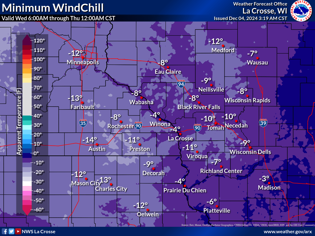
Snow will end from west to east overnight. Highest accumulations of 4-7" are expected for parts of southeast Wisconsin and northeast Iowa before ending with far lower totals (0.5"-2" ) expected north of that area. Continue to monitor trends. If you have travel plans, allow extra time and extra braking distances. The morning commute may be affected by slick spots and some lingering snow covered roads.
Tonight: Snow Ending
Overnight - Thu Morning: Bitter Cold
Additional Information:
|
• Submit Report • Winter Monitor Precipitation Reports Snowfall Plotter Latest Winter Statement Storm Reports Latest Reports Current Conditions

Weather Story 
Radar |
Our Office
Staff
Want a tour?
Looking for a speaker?
Community Involvement
Station / Location Info
Follow Us On Social Media
Student Opportunities
Weather Safety
SkyWarn
Preparedness
Preparedness (En Espanol)
Weather Radio
StormReady
WRN Ambassadors
Additional Information
Storm Summaries
Cooperative Observers
Educational Resources
Science / Research
Weather Phenomenon
Mayfly Tracking
Latest
Temp/Pcpn Summary
Precipitation Reports
Forecast Discussion
Hazardous Weather Outlook
Hourly Weather
Public Information Statement
Local Storm Report
Lightning Plot Archive
River Stages
Water Temp
Observations
Precipitation Plotter
Soil Temps
US Dept of Commerce
National Oceanic and Atmospheric Administration
National Weather Service
La Crosse, WI
N2788 County Road FA
LaCrosse, WI 54601
608-784-7294
Comments? Questions? Please Contact Us.