La Crosse, WI
Weather Forecast Office
|
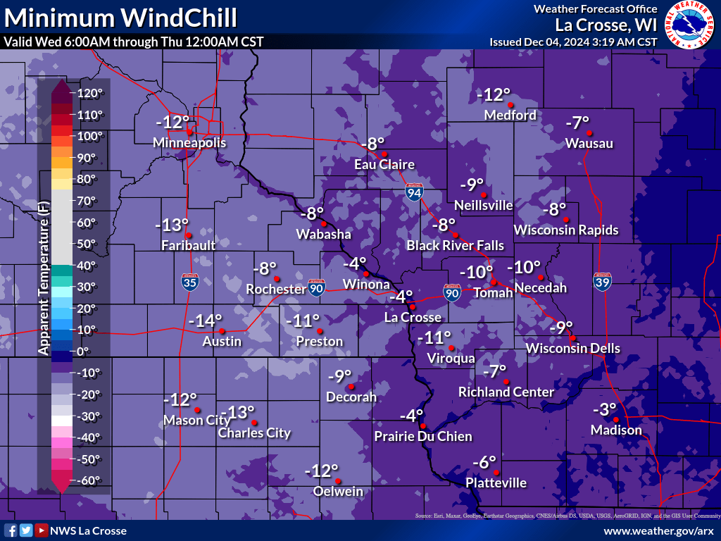
A storm system will bring strong northwest winds to region Wednesday, strongest in the afternoon and evening with gusts from 35 to 45 mph areawide. In addition, scattered showers will dash southeast across the area Wednesday, providing another potential travel (sudden reductions in visibility) aside from the wind. The storm will also bring much colder air the region (although briefly). Expect steady to falling temperatures Wednesday afternoon, with single digit lows for most by Thursday morning. Add in those winds and commuters that morning should be prepared for -5 to -15 wind chills. Bundle up!
Wed-Wed Night: Strong Winds
Thu Morning: Bitter Cold Wind Chills
Additional Information:
|
• Submit Report • Winter Monitor Hazardous Weather Outlook Latest Weather Statement Storm Reports Latest Reports

Weather Story 
Radar |
Our Office
Staff
Want a tour?
Looking for a speaker?
Community Involvement
Station / Location Info
Follow Us On Social Media
Student Opportunities
Weather Safety
SkyWarn
Preparedness
Preparedness (En Espanol)
Weather Radio
StormReady
WRN Ambassadors
Additional Information
Storm Summaries
Cooperative Observers
Educational Resources
Science / Research
Weather Phenomenon
Mayfly Tracking
Latest
Temp/Pcpn Summary
Precipitation Reports
Forecast Discussion
Hazardous Weather Outlook
Hourly Weather
Public Information Statement
Local Storm Report
Lightning Plot Archive
River Stages
Water Temp
Observations
Precipitation Plotter
Soil Temps
US Dept of Commerce
National Oceanic and Atmospheric Administration
National Weather Service
La Crosse, WI
N2788 County Road FA
LaCrosse, WI 54601
608-784-7294
Comments? Questions? Please Contact Us.


