Overview
|
During the evening hours of August 5th, a line of thunderstorms moved through portions of southeast Minnesota, northeast Iowa and southwestern Wisconsin, producing pockets of wind damage along its track. Most notably, an embedded supercell tracked from far south-central Minnesota into northeast Iowa after sunset. This storm produced numerous circulations on radar along with at least five documented tornadoes along a swath from Mower County, MN to Allamakee County, IA. Additionally, heavy rainfall across the region produced localized flooding with rainfall reports of 1-2"--locally higher in spots. |
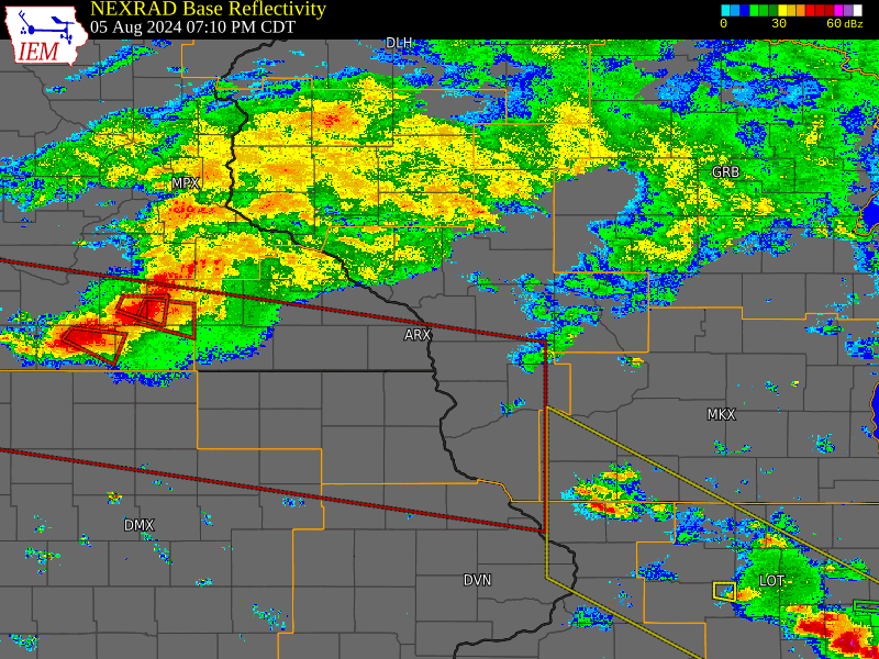 Radar reflectivity animation of the storm complex as it moved through the region with tornado (red) and severe thunderstorm (yellow) watches and warnings. Watches are the large boxes while warnings are the smaller polygons. |
Tornadoes:
Interactive Damage Survey Map - Zoom in and click the points to see damage information and pictures. Please zoom in to see tracks from smaller tornadoes.

|
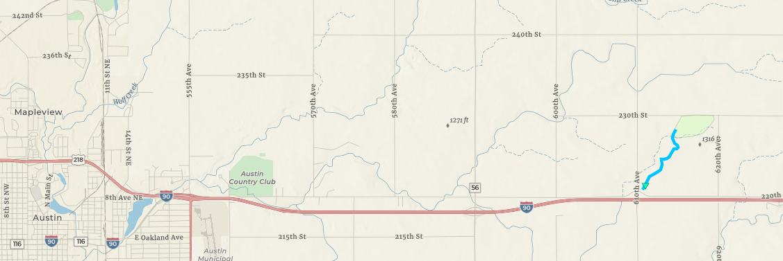
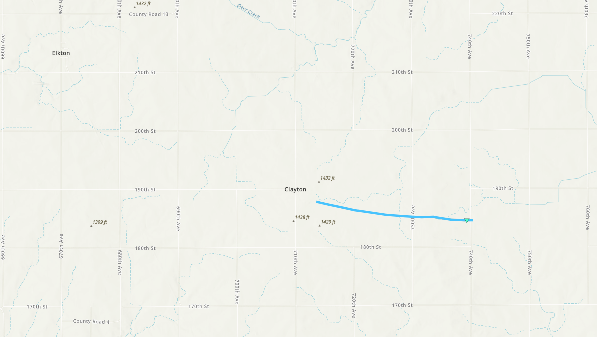
Tornado - 7 Miles East of Austin MN
|
||||||||||||||||
|
Tornado - 5 Miles North of Taopi, MN
|
||||||||||||||||
|
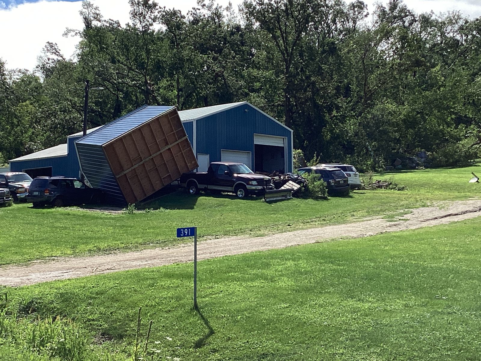
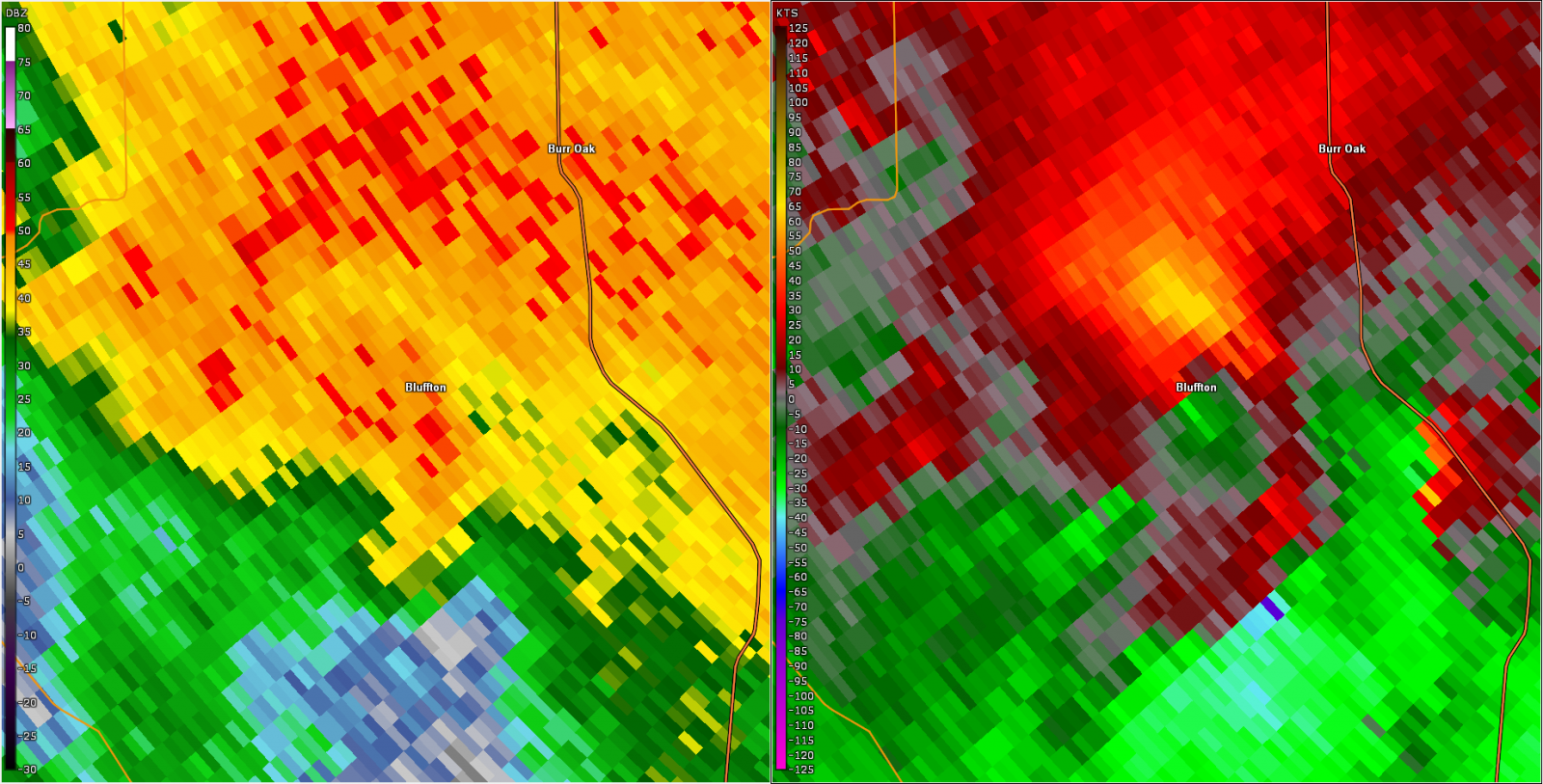
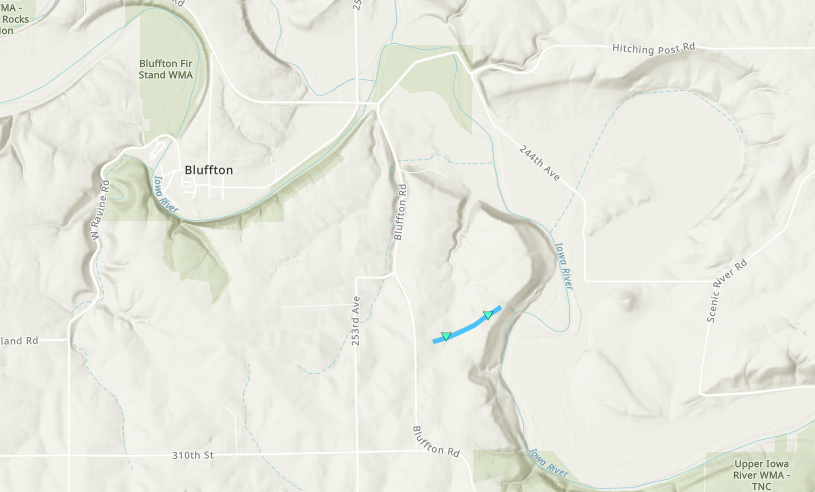
Tornado - 2 Miles SE of Bluffton, IA
|
||||||||||||||||
|
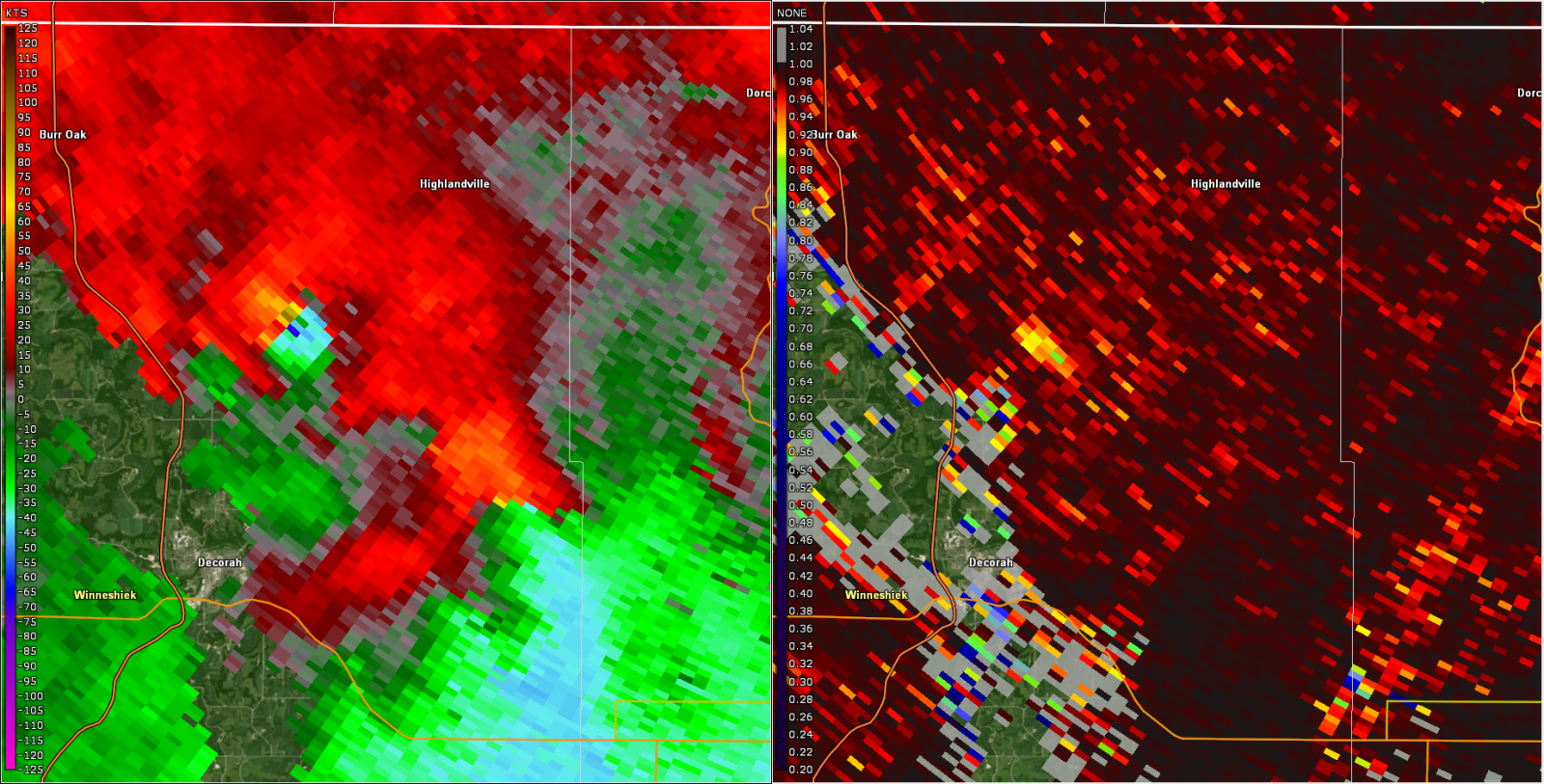
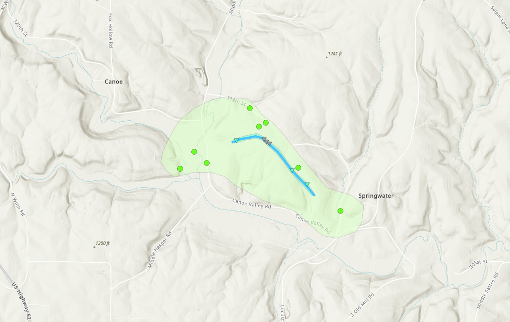
Tornado - 5 Miles North of Decorah, IA
|
||||||||||||||||
|
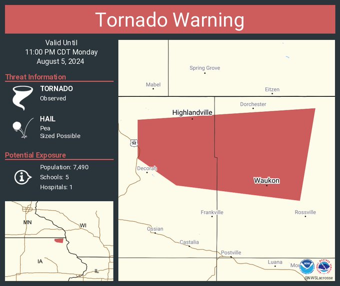
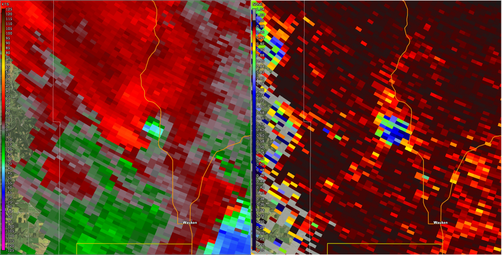
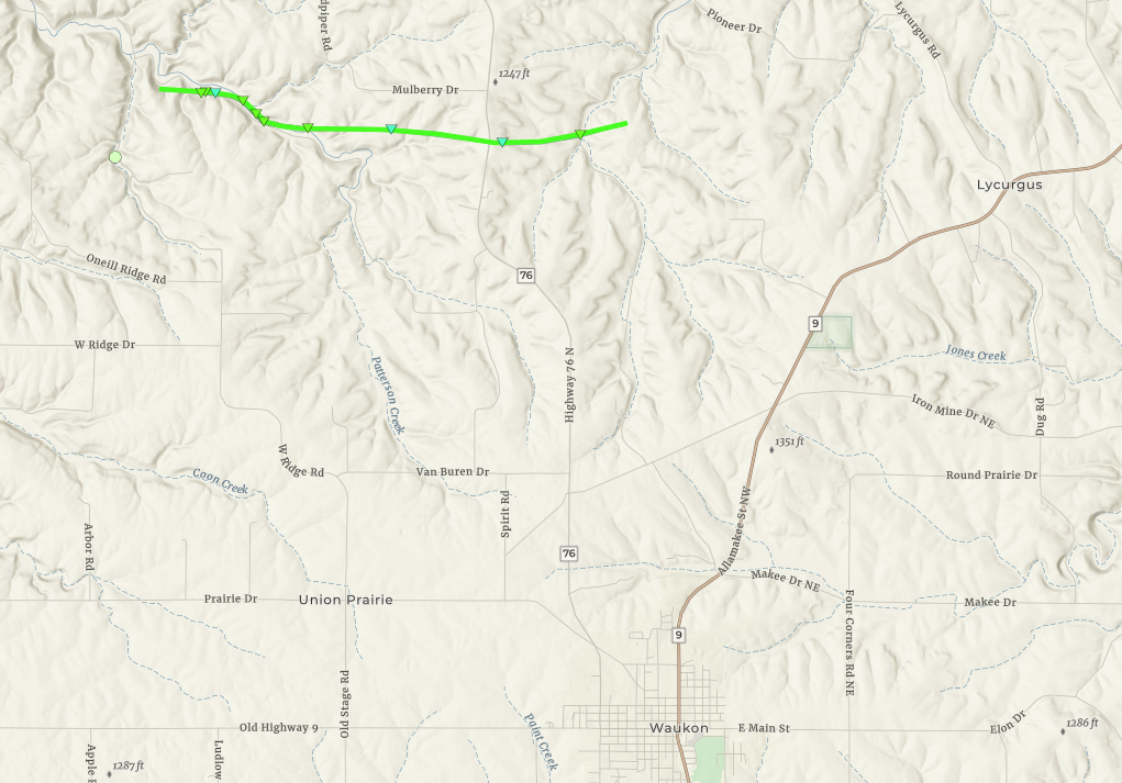
Tornado - 5 Miles North of Waukon IA
|
||||||||||||||||
The Enhanced Fujita (EF) Scale classifies tornadoes into the following categories:
| EF0 Weak 65-85 mph |
EF1 Moderate 86-110 mph |
EF2 Significant 111-135 mph |
EF3 Severe 136-165 mph |
EF4 Extreme 166-200 mph |
EF5 Catastrophic 200+ mph |
 |
|||||
| Tornadoes that fail to impact any ratable structures on the EF-Scale are rated EF-Unknown (EF-U) | |||||
Services
.jpg) |
.jpg) |
.jpg) |
 |
| Severe Storm Threat Graphic | Severe Weather Risk Graphic | Tornado Watch #600 | Tornado Warning for Winneshiek and Allamakee Co. example |
Photos & Video:
 |
 |
 |
 |
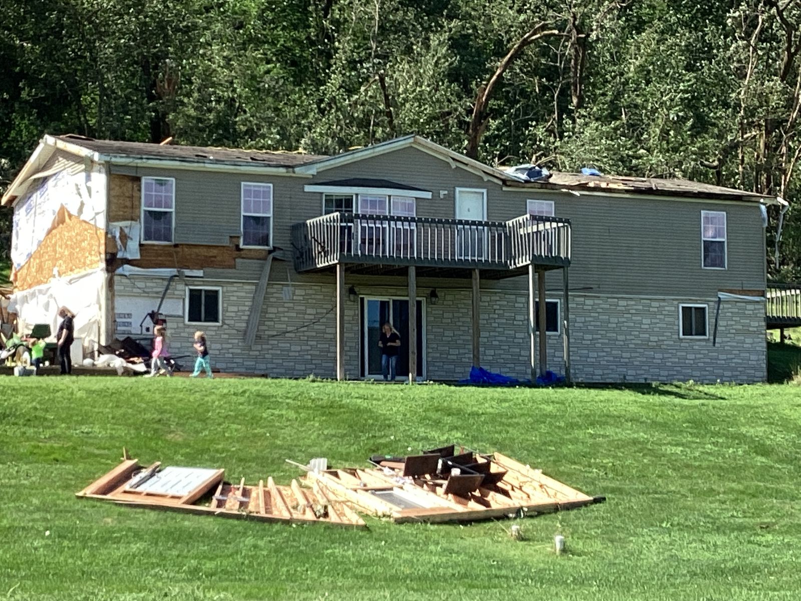
| House garage damaged along Patterson Creek Dr. near the start of the tornado path. (NWS Storm Survey) |
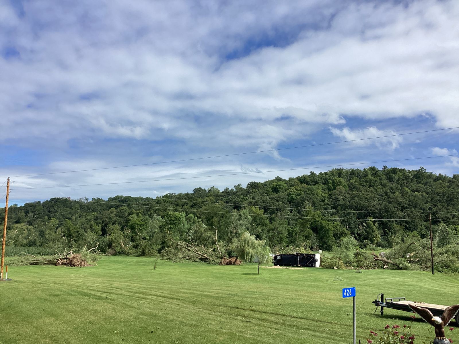
Trees uprooted and camper flipped along Patterson Creek Dr. (NWS Storm Survey) |
A manufactured shed flipped along Patterson Creek Dr.. (NWS Storm Survey) |
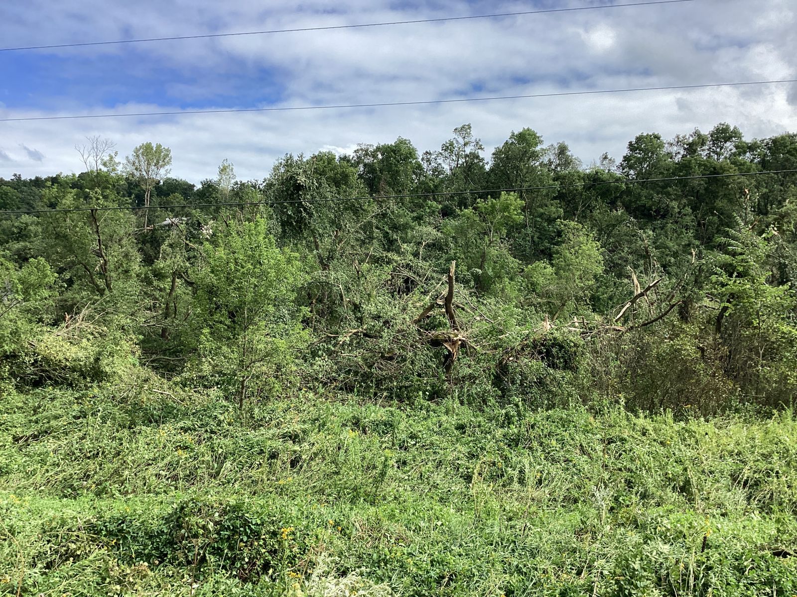
Extensive EF1 tree damage along the tornado track. (NWS Storm Survey) |
Radar:
 |
 |
 |
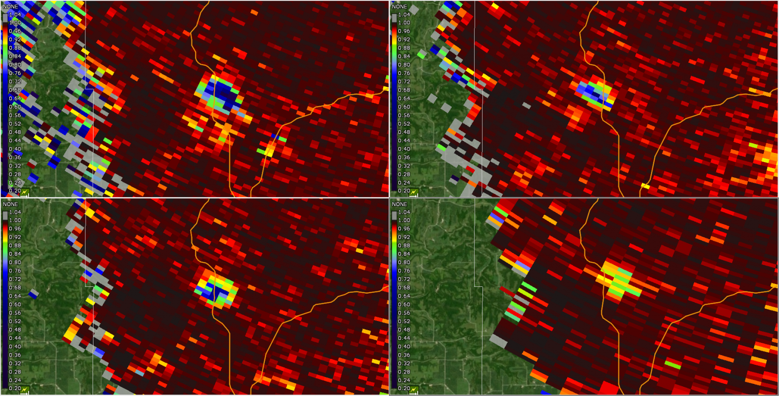 |
| A small area of rotation over the Bluffton, IA area that produced a brief tornado. | Multiple circulations evident on radar near Decorah, one of which produced a TDS just north of town (small circular yellow area in right panel). | Tight velocity couplet on radar north of Waukon (left panel) along with a tornadic debris signature (blue area on right panel) associated with the tornado. | The TDS north of Waukon extended well up through the depth of the storm as seen in multiple tilts on the radar. The TDS reached a maximum height of around 10,000 ft AGL. |
Storm Reports
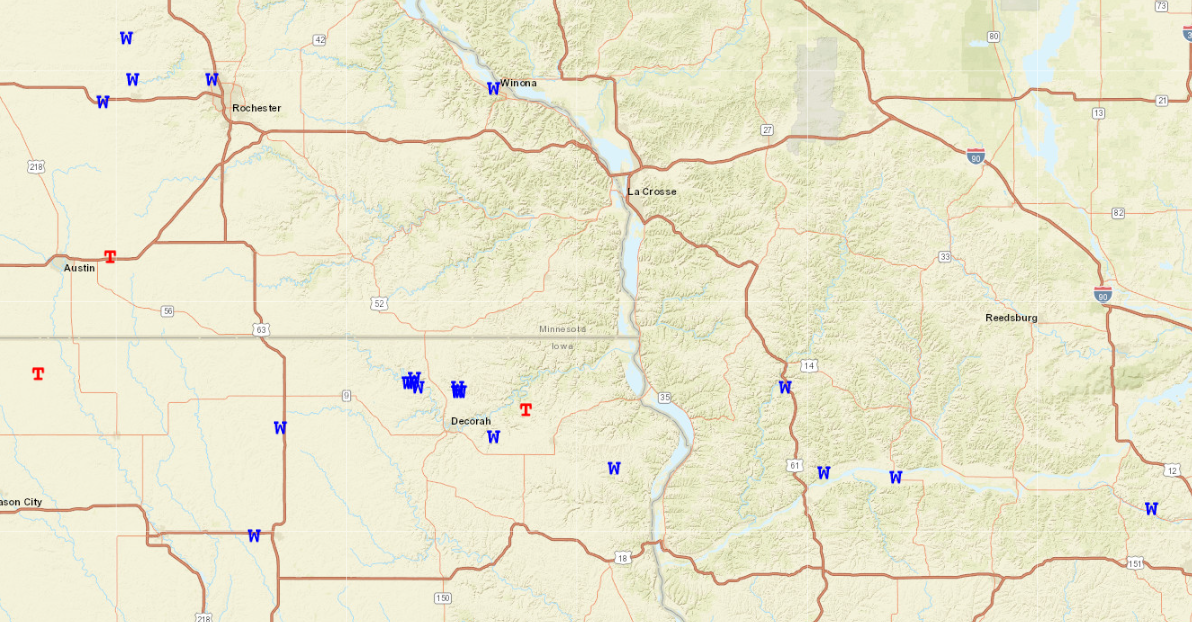
T reports are tornadoes and W reports are wind damage. Click here for an interactive map of these reports.
Rain Reports
...PRECIPITATION REPORTS...

Location                     Amount    Time/Date       Lat/Lon

...Iowa...

...Allamakee County...
3 S Dorchester               1.58 in   0100 AM 08/06   43.42N/91.51W

...Chickasaw County...
New Hampton                  0.92 in   0145 AM 08/06   43.06N/92.32W
Ionia 2W                     0.69 in   1245 AM 08/06   43.03N/92.50W

...Clayton County...
1 WSW Marquette              0.34 in   0100 AM 08/06   43.04N/91.21W
Big Spring Fish Hatchery     0.20 in   0100 AM 08/06   42.91N/91.47W

...Floyd County...
2 WNW Colwell                1.25 in   0955 PM 08/05   43.17N/92.62W

...Minnesota...

...Fillmore County...
1 NNW Fillmore               1.77 in   0130 AM 08/06   43.76N/92.27W
Lanesboro                    1.40 in   0130 AM 08/06   43.72N/91.98W

...Houston County...
Mound Prairie                1.16 in   1245 AM 08/06   43.78N/91.45W

...Mower County...
Dobbins Creek                1.34 in   0130 AM 08/06   43.68N/92.94W
Lansing - Cedar River        1.17 in   0130 AM 08/06   43.75N/92.96W

...Olmsted County...
Elba 4.7 SW                  1.42 in   1000 PM 08/05   44.04N/92.09W
Rochester International Airp 1.22 in   0107 AM 08/06   43.90N/92.50W
3 NE Rochester               1.10 in   0835 PM 08/05   44.04N/92.44W
3 ENE Rochester              0.93 in   0130 AM 08/06   44.03N/92.43W
3 W Rochester                0.87 in   0130 AM 08/06   44.02N/92.53W
Rochester-Beltline Bear Cree 0.85 in   0130 AM 08/06   44.01N/92.45W
1 W Oronoco                  0.73 in   0130 AM 08/06   44.17N/92.55W
6 NNW Genoa                  0.45 in   0100 AM 08/06   44.19N/92.65W
Rochester-Cascade Creek      0.36 in   0130 AM 08/06   44.03N/92.47W

...Wabasha County...
1 N Kellogg                  0.91 in   0100 AM 08/06   44.32N/92.00W
3 ESE Mazeppa                0.58 in   0130 AM 08/06   44.26N/92.49W

...Winona County...
Beaver                       1.34 in   1245 AM 08/06   44.15N/92.00W
1 WSW Elba                   1.30 in   1245 AM 08/06   44.09N/92.03W
Whitewater State Park        1.26 in   0130 AM 08/06   44.05N/92.05W
3 SW Elba                    1.21 in   0130 AM 08/06   44.06N/92.05W
Dakota                       0.89 in   0115 AM 08/06   43.91N/91.36W
3 NE Nodine                  0.34 in   0130 AM 08/06   43.94N/91.41W

...Wisconsin...

...Buffalo County...
Dodge                        0.16 in   1245 AM 08/06   44.13N/91.55W

...Clark County...
COLBY                        1.85 in   0135 AM 08/06   44.91N/90.32W

...Crawford County...
2.8 E Harpers Ferry          1.10 in   0115 AM 08/06   43.21N/91.10W

...Juneau County...
NECEDAH NWR                  1.39 in   0110 AM 08/06   44.06N/90.17W
Volk Field                   0.60 in   0110 AM 08/06   43.93N/90.27W
0.6 W Necedah                0.28 in   1248 AM 08/06   44.02N/90.08W

...La Crosse County...
La Crosse Regional Airport   0.86 in   0136 AM 08/06   43.88N/91.25W

...Trempealeau County...
Blair                        1.82 in   1210 AM 08/06   44.30N/91.23W
0.8 SW Pigeon Falls          1.77 in   0112 AM 08/06   44.42N/91.22W
Whitehall                    1.39 in   1121 PM 08/05   44.37N/91.32W

...Vernon County...
Ontario                      1.07 in   0100 AM 08/06   43.72N/90.59W
Genoa Dam 8                  0.99 in   0115 AM 08/06   43.57N/91.23W
 |
Media use of NWS Web News Stories is encouraged! Please acknowledge the NWS as the source of any news information accessed from this site. |
|


 Weather Story
 Weather Map
 Local Radar