 |
 |
|
|
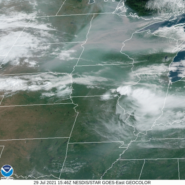
GOES-16 Upper Mississippi Valley Geocolor Satellite Imagery Valid: 07/29/2021 3:00PM CDT |
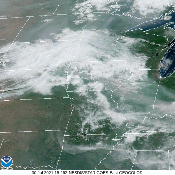
GOES-16 Upper Mississippi Valley Geocolor Satellite Imagery Valid: 07/30/2021 3:00PM CDT |
The darker gray colors over Minnesota and Wisconsin in the geocolor satellite imagery (above) shows the smoke primarily originating from wildfires in Manitoba and Ontario, Canada during the afternoon of Thursday July 29. The active fire map (below) from the Canadian Wildland Fire Information System (CWFIS) shows multiple hotspots near Lake Winnipeg, north of Lake of the Woods, MN providing the stream of darker gray smoke in the left image. In the right image, suspended smoke particles over the Dakotas and Minnesota can be seen advecting east into Wisconsin. According to the Canadian Broadcasting Company (CBC), multiple fires have morphed into one giant fire east of Lake Winnipeg. Wildfire smoke contains Particulate Matter 2.5 (PM2.5), microscopic particle solids that measure less than 2.5 micrometers in diameter. These microscopic particles can get deep into your lungs and may be even in your bloodstream causing health concerns.
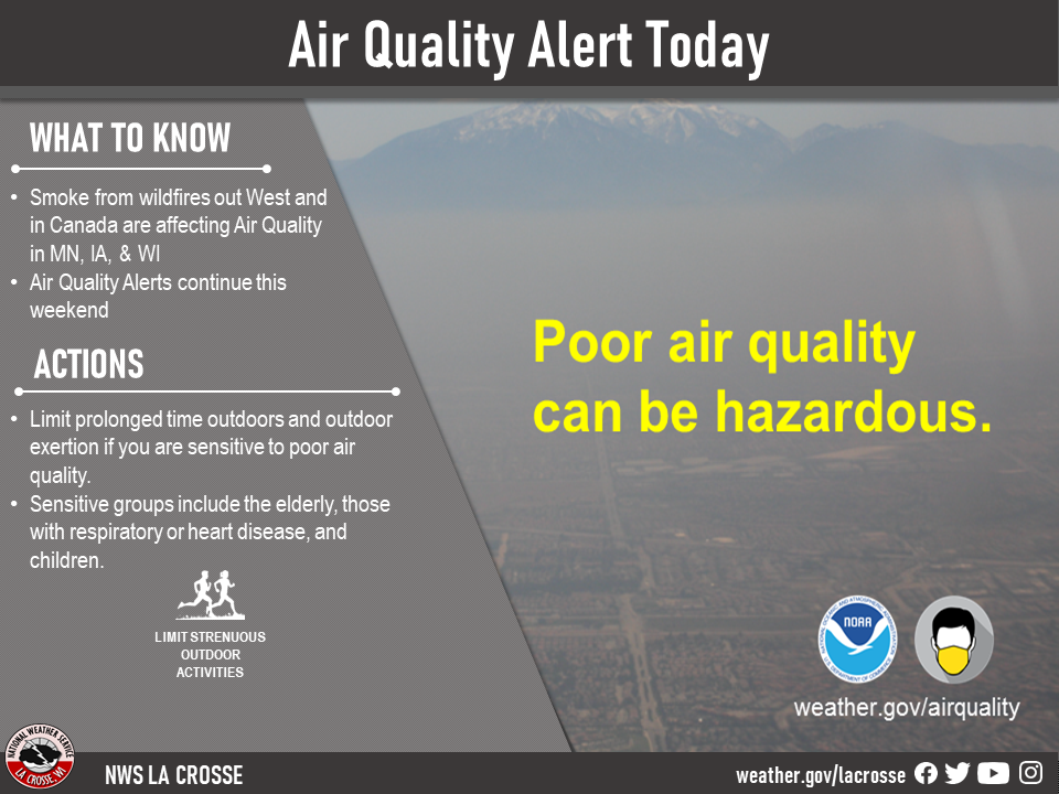
Certain people are more likely to be affected with higher levels of fine particle pollution. Those include people with asthma, chronic obstructive pulmonary disease (COPD), heart disease, or high blood pressure. Children and older adults are also at risk. Anyone performing strenuous outdoor activities for extended periods can be at risk as well.
According to the MN Pollution Control Agency, unhealthy air quality can aggravate heart and cardiovascular disease as well as lung diseases like asthma and COPD. When the air quality is unhealthy, people with these conditions may experience symptoms like chest pain, shortness of breath, wheezing, coughing, or fatigue. If you are experiencing any of these symptoms, use your inhalers as directed and contact your health care provider.

Forecast
 |
 |
 |
|
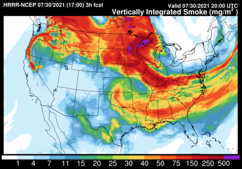
HRRR Vertically Integrated Smoke Valid: 07/30/2021 3:00PM CDT |
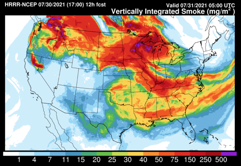
HRRR Vertically Integrated Smoke Valid: 07/31/2021 12:00AM CDT |
HRRR Vertically Integrated Smoke Valid: 07/31/2021 6:00AM CDT |
 |
 |
 |
|
HRRR Near-Surface Smoke Valid: 07/30/2021 5:00PM CDT |
HRRR Near-Surface Smoke Valid: 07/31/2021 12:00AM CDT |
HRRR Near-Surface Smoke Valid: 07/31/2021 6:00AM CDT |
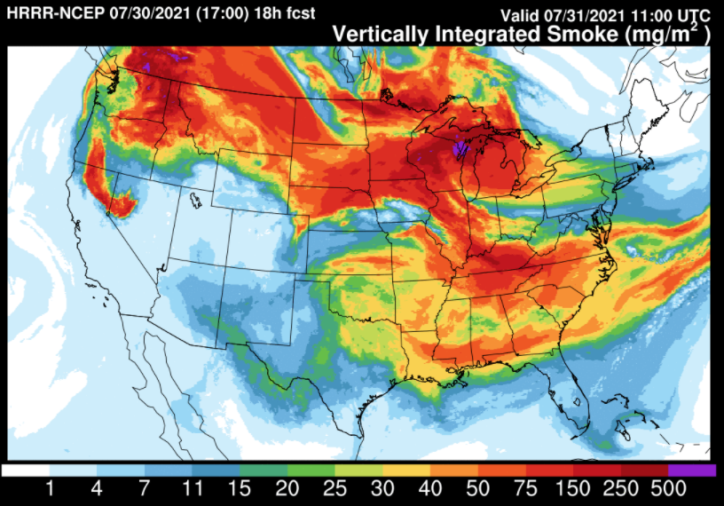
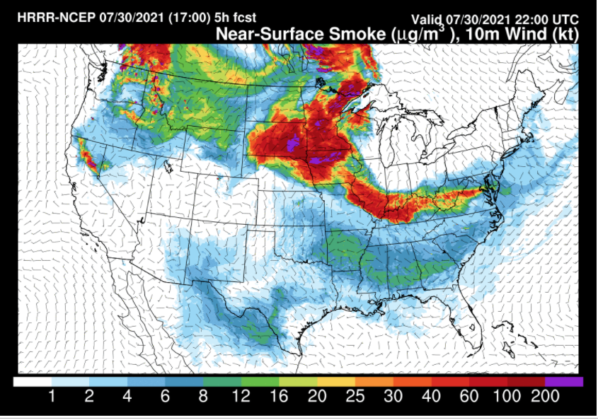
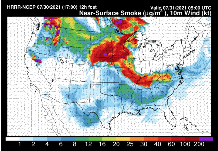
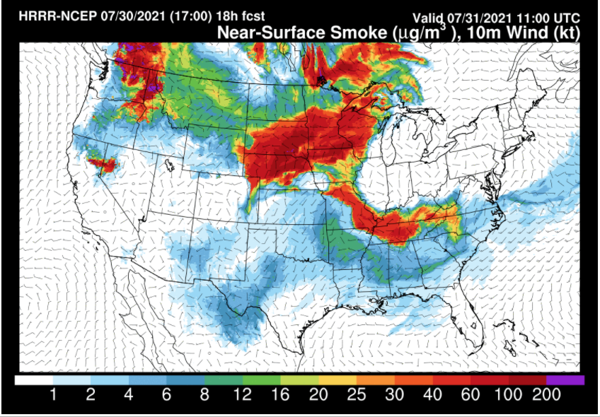
The High-Resolution Rapid Refresh (HRRR) model vertically integrated and near-surface smoke outputs (above) forecasts eastward propagation of the highest smoke concentrations from the Dakotas and central Minnesota into Wisconsin during the weekend. Therefore, air quality alerts in Minnesota, Iowa, and Wisconsin are continuing through the weekend..
MN Pollution control agency air quality alert specifications
WI DNR Air Quality Monitoring map


 Weather Story
 Weather Map
 Local Radar