Overview
|
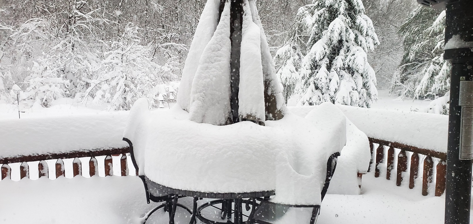
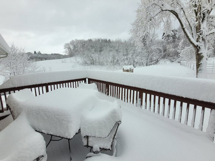
A major weather system moved through the area late in the weekend and into Monday morning after record breaking warmth the week prior. Temperatures were in the 80s Tuesday through Thursday but plummeted into Sunday, with rain changing to snow in the afternoon. Western into central Wisconsin was hit the hardest with over a foot of very wet heavy snow along a north-south band. Some saw snow amounts near 20". Tree damage, some power outages, and numerous auto accidents impacted the area. |
 Radar Loop from 12 pm Sunday April 16 through through Monday morning April 17, 2023 |
Snow

...SNOWFALL REPORTS APRIL 16-17...

LOCATION                     AMOUNT

...IOWA...

...ALLAMAKEE COUNTY...
CHURCHTOWN                   8.0 IN
HARPERS FERRY                5.0 IN
HARPERS FERRY 6.4 SSW        4.5 IN
WAUKON 3E                    4.0 IN
POSTVILLE 5.5 NE             3.7 IN

...CHICKASAW COUNTY...
NEW HAMPTON                  3.0 IN
FREDERICKSBURG 0.3 S         2.5 IN
NEW HAMPTON 0.4 SW           2.5 IN

...CLAYTON COUNTY...
ELKADER                      8.0 IN
MONONA                       8.0 IN
MARQUETTE                    6.0 IN
EDGEWOOD                     5.5 IN
STRAWBERRY POINT             5.0 IN
ELKADER 6SSW                 4.5 IN
ELKADER 6.8WSW               4.5 IN
GUTTENBERG DAM 10            3.0 IN
SAINT OLAF                   2.5 IN

...FAYETTE COUNTY...
WADENA                       6.0 IN
OELWEIN 1E                   3.4 IN
FAYETTE                      2.2 IN
FAYETTE 3N                   2.2 IN

...FLOYD COUNTY...
NASHUA 2SW                   1.0 IN
NORA SPRINGS 2.4SSE            T IN

...WINNESHIEK COUNTY...
DECORAH 8ENE                 7.5 IN
DECORAH 4NNW                 6.5 IN
DECORAH                      6.0 IN
DECORAH 4.9SE                5.1 IN
CALMAR                       5.0 IN

...MINNESOTA...

...DODGE COUNTY...
HAYFIELD 0.3SSE              2.9 IN
MANTORVILLE 1.9ESE           1.5 IN

...FILLMORE COUNTY...
MABEL                        6.0 IN
HARMONY                      5.5 IN
BRATSBERG 1N                 5.0 IN
MABEL                        4.5 IN
CHATFIELD 9ESE               3.9 IN
FILLMORE 2WSW                3.3 IN
WYKOFF 3.1NW                 3.3 IN
SPRING VALLEY 0.2NW          3.0 IN

...HOUSTON COUNTY...
LA CRESCENT                  12.5 IN
LA CRESCENT 2W               12.0 IN
MONEY CREEK                  11.5 IN
MOUND PRAIRIE 2NE            11.0 IN
MOUND PRAIRIE 1NE            11.0 IN
HOKAH                        10.5 IN
NEW HARTFORD 4SSW            10.0 IN
HOUSTON 2WSW                 9.0 IN
SPRING GROVE 5SE             8.0 IN
HOUSTON 5.3 SW               6.4 IN
CALEDONIA 5.4 S              6.0 IN

...MOWER COUNTY...
WALTHAM 2.0 SE               2.5 IN
GRAND MEADOW                 2.1 IN
AUSTIN 2.4 W                 1.0 IN

...OLMSTED COUNTY...
ROCHESTER 3WNW               4.3 IN
ELBA 5SW                     4.0 IN
ROCHESTER 5.6 E              4.0 IN
ROCHESTER 2NNE               3.9 IN
ROCHESTER 2NNW               3.9 IN
ROCHESTER 2NE                3.5 IN
PINE ISLAND 1S               3.5 IN
ROCHESTER 4.7 N              3.4 IN
ROCHESTER 5.7 N              3.0 IN
ROCHESTER 4.2 N              2.5 IN
ROCHESTER 3NW                2.5 IN
PREDMORE 2S                  2.3 IN
ELGIN 2SSW                   2.0 IN
BYRON 0.3 NNE                2.0 IN
STEWARTVILLE 4.3 E           2.0 IN
ROCHESTER INTL AIRPORT       1.8 IN
ROCHESTER 5.5 N              1.5 IN
ROCHESTER 1.5 WSW            1.5 IN

...WABASHA COUNTY...
WABASHA 1W                   6.5 IN
WABASHA 1ENE                 5.5 IN
HAMMOND                      5.5 IN
THEILMAN 1 SSW               5.2 IN
KELLOGG 0.1 N                5.0 IN
LAKE CITY 0.7 SE             3.1 IN

...WINONA COUNTY...
PICKWICK 3NW                 10.5 IN
PICKWICK 1N                  10.0 IN
WINONA                       10.0 IN
DAKOTA                       9.5 IN
WINONA 2ESE                  8.2 IN
LA CRESCENT 4NNW             8.2 IN
WINONA DAM 5A                7.0 IN
STOCKTON                     7.0 IN
WINONA 1.9 ESE               6.5 IN
LA CRESCENT DAM 7            6.5 IN
WILSON 2NNW                  6.0 IN

...WISCONSIN...

...ADAMS COUNTY...
NEKOOSA 8SSE                 3.5 IN
FRIENDSHIP 0.6 W             2.4 IN
OXFORD 4W                    2.0 IN

...BUFFALO COUNTY...
MARSHLAND 3W                 12.0 IN
MONDOVI 12.1 SSE             9.2 IN
ALMA 1SE                     8.0 IN

...CLARK COUNTY...
THORP 10.1 S                 21.3 IN
NEILLSVILLE                  19.0 IN
LOYAL                        18.0 IN
OWEN                         17.0 IN
WILLARD                      15.0 IN
LONGWOOD                     14.0 IN
COLBY                        12.8 IN
THORP 6W                     12.0 IN
CHILI 6N                     7.0 IN

...CRAWFORD COUNTY...
SENECA                       7.0 IN
PRAIRIE DU CHIEN 1NNW        6.5 IN
DE SOTO 1S                   6.5 IN
MOUNT ZION                   6.0 IN
STEUBEN 4SE                  5.8 IN
GAYS MILLS 1NE               5.3 IN
PRAIRIE DU CHIEN 1.4 N       3.2 IN
HARPERS FERRY 2.8 E          3.0 IN
PRAIRIE DU CHIEN 0.6 NE      3.0 IN
WAUZEKA                      3.0 IN

...GRANT COUNTY...
MT HOPE 3NE                  7.0 IN
PATCH GROVE 0.1 NNW          4.5 IN
PLATTEVILLE 3WNW             4.0 IN
PLATTEVILLE  1W              4.0 IN
CUBA CITY                    3.8 IN
SINSINAWA                    3.4 IN
CASSVILLE 7.8 ENE            2.0 IN

...JACKSON COUNTY...
NORTHFIELD 6NNE              22.0 IN
HIXTON                       20.0 IN
BLACK RIVER FALLS 3W         19.5 IN
MELROSE 3.6 W                19.5 IN
MERRILLAN                    18.0 IN
TAYLOR                       18.0 IN
ALMA CENTER 3W               15.5 IN
HATFIELD                     15.0 IN
BLACK RIVER FALLS            15.0 IN
MELROSE                      14.0 IN
PRAY 5W                      12.0 IN

...JUNEAU COUNTY...
NEW LISBON                   11.0 IN
MAUSTON 1E                   6.7 IN

...LA CROSSE COUNTY...
MINDORO                      20.5 IN
BURR OAK                     20.0 IN
WEST SALEM 2E                18.3 IN
WEST SALEM                   17.3 IN
BANGOR                       17.0 IN
NEW AMSTERDAM 4NE            15.7 IN
NEW AMSTERDAM 1ESE           14.5 IN
ONALASKA 1.9 E               14.0 IN
HOLMEN 2N                    14.0 IN
NWS LA CROSSE                13.1 IN
HOLMEN 4ENE                  13.0 IN
BARRE MILLS 3S               13.0 IN
ONALASKA 2SE                 13.0 IN
ONALASKA 2NNW                12.8 IN
HOLMEN 2SSE                  12.8 IN
ONALASKA 1NW                 12.8 IN
ONALASKA 1NNW                12.6 IN
WEST SALEM 2NE               12.5 IN
NEW AMSTERDAM                12.0 IN
ROCKLAND                     12.0 IN
LA CROSSE 5SSE               11.6 IN
LA CROSSE 3SSE               10.0 IN
LA CROSSE AIRPORT            9.5 IN
LA CROSSE 1SSE               9.0 IN

...MONROE COUNTY...
CATARACT                     15.0 IN
CATARACT 3SE                 12.0 IN
ANGELO                       12.0 IN
SPARTA 2S                    11.0 IN
MILLSTON 3SSE                10.8 IN
CASHTON 3NNW                 9.2 IN
WARRENS 3S                   9.0 IN
TOMAH 2N                     8.5 IN
TUNNEL CITY 2SSW             8.0 IN
WARRENS                      8.0 IN
SPARTA                       8.0 IN
WARRENS 4.7WSW               6.8 IN

...RICHLAND COUNTY...
YUBA 2E                      6.0 IN
RICHLAND CENTER 4N           2.5 IN

...TAYLOR COUNTY...
DORCHESTER 2N                11.1 IN
MEDFORD 4N                   9.0 IN
MEDFORD                      8.5 IN
MEDFORD 0.8ENE               8.4 IN

...TREMPEALEAU COUNTY...
ETTRICK 3W                   17.0 IN
ETTRICK 4WNW                 14.5 IN
FRENCHVILLE 3NNW             14.5 IN
ETTRICK                      14.0 IN
BLAIR                        14.0 IN
PIGEON FALLS                 14.0 IN
BEACH CORNERS 1WSW           14.0 IN
GALESVILLE                   13.5 IN
WHITEHALL 3SSW               13.2 IN
STEVENSTOWN 4NW              13.0 IN
CENTERVILLE 2SSE             11.5 IN
TREMPEALEAU                  11.0 IN
DODGE                        9.5 IN
CENTERVILLE                  9.0 IN
INDEPENDENCE 1E              7.8 IN

...VERNON COUNTY...
WESTBY 1S                    10.5 IN
STODDARD 1.5NE               10.1 IN
ROMANCE                      9.5 IN
STODDARD 5NE                 9.0 IN
STODDARD 4.7NNE              9.0 IN
VIROQUA                      8.5 IN
LA FARGE                     8.5 IN
VIROQUA 0.5E                 8.0 IN
VICTORY 3N                   8.0 IN
ONTARIO 3.1E                 5.8 IN
VIOLA                        5.0 IN
GENOA DAM 8                  5.0 IN

OBSERVATIONS ARE COLLECTED FROM A VARIETY OF SOURCES WITH VARYING
EQUIPMENT AND EXPOSURES. WE THANK ALL VOLUNTEER WEATHER OBSERVERS
FOR THEIR DEDICATION. NOT ALL DATA LISTED ARE CONSIDERED OFFICIAL.

$$
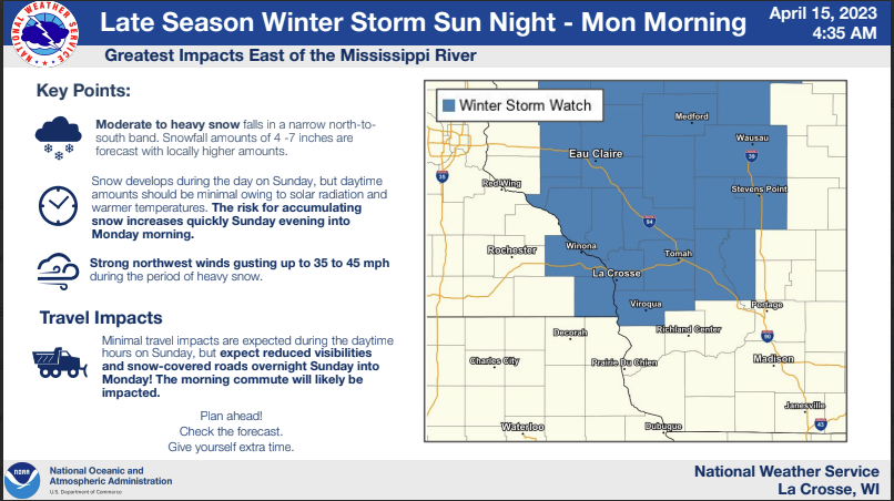
Forecasts
| Issued Saturday Morning | Issued Saturday Afternoon | Issued Sunday Morning | |
 |
 |
 |
|
 |
 |
||
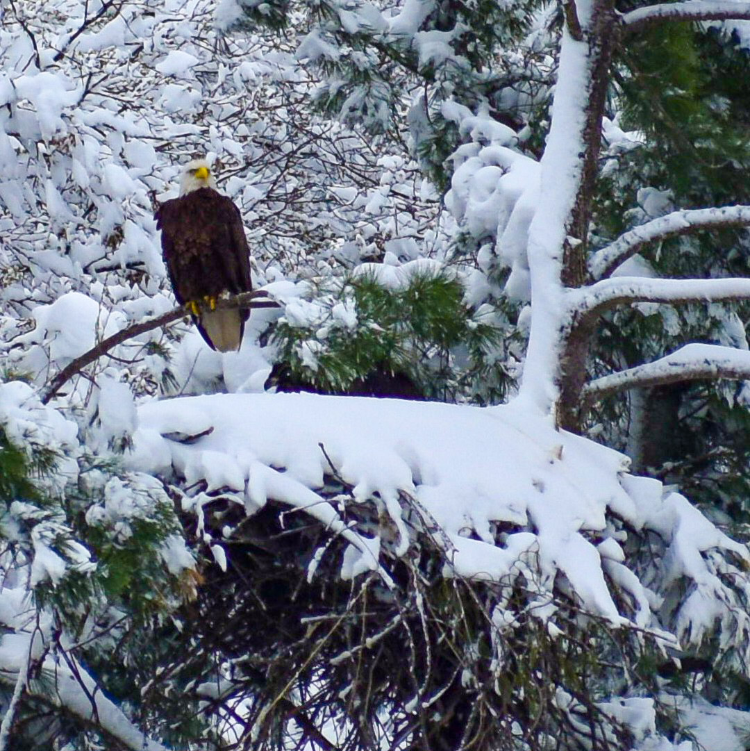
Photos:
 |
 |
 |
 |
| Jack-knifed Semi-trailer near Black River Falls, Wisconsin (WI DOT) |
Snow in Holmen, WI (NWS La Crosse) |
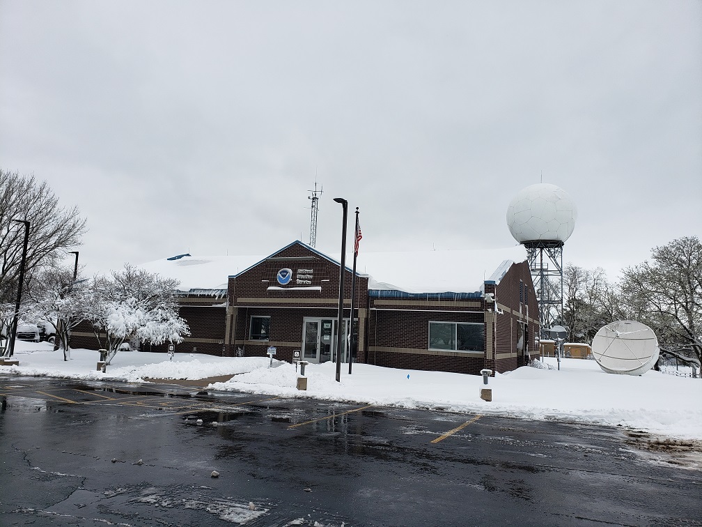
NWS La Crosse Monday April 17, 2023 morning (NWS La Crosse) |
Taylor, WI (David Burnell) |
 |
 |
 |
 |
| Near Stevenstown, WI (Amy Mather) |
Onalaska, WI (Cathy Zapotocny) |
Burr Oak, WI area (Shelly Marie) |
West Salem, WI (Jeff Boyne) |
Radar:
|
|||
| Radar Loop from 12 pm Sunday April 16 through through Monday Morning April 17, 2023 |
 |
Media use of NWS Web News Stories is encouraged! Please acknowledge the NWS as the source of any news information accessed from this site. |
|

