La Crosse, WI
Weather Forecast Office
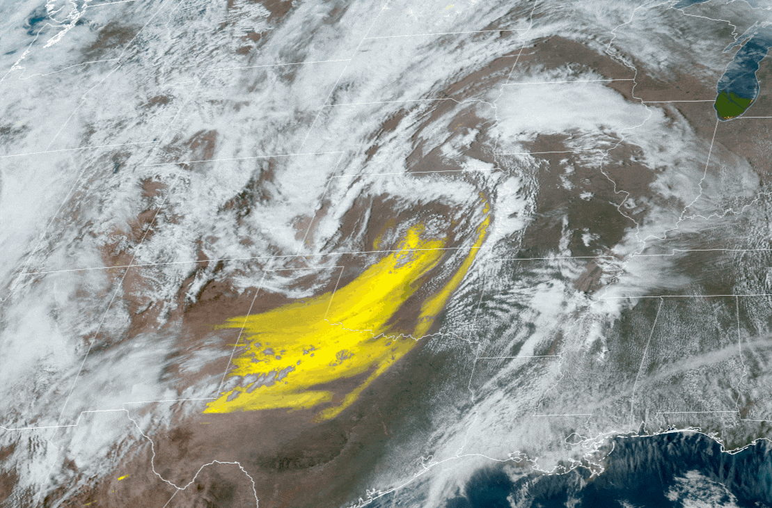
A very "dirty rain" fell later Friday night and early Saturday and quickly became the talk of the town. Why did it occur?
On Friday, a strong area of low pressure developed in Kansas and tracked north toward western Minnesota. Strong southwest winds across Texas and Oklahoma picked up soil and dust and transported it northeast and into the storm. Wildfire smoke added to the plume. The GOES view from space clearly shows the bright yellow dust plume wrapping into the storm Friday afternoon (March 14). All of this airborne dust and debris was then "rained out" of the atmosphere Friday night and early Saturday further north causing widespread "dirty rain" in the local area.
Our Office
Staff
Community Involvement
Station / Location Info
Follow Us On Social Media
Student Opportunities
Additional Information
Storm Summaries
Cooperative Observers
Educational Resources
Science / Research
Weather Phenomenon
Mayfly Tracking
Latest
Temp/Pcpn Summary
Precipitation Reports
Forecast Discussion
Hazardous Weather Outlook
Hourly Weather
Public Information Statement
Local Storm Report
Lightning Plot Archive
River Stages
Water Temp
Observations
Precipitation Plotter
Soil Temps
US Dept of Commerce
National Oceanic and Atmospheric Administration
National Weather Service
La Crosse, WI
N2788 County Road FA
LaCrosse, WI 54601
608-784-7294
Comments? Questions? Please Contact Us.

