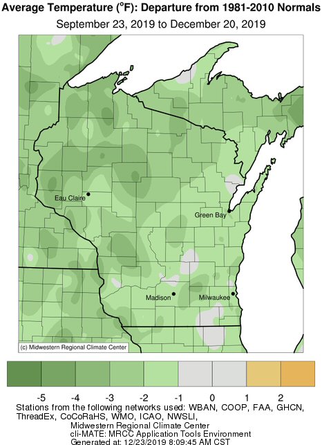
Astronomical Autumn 2019 (September 23 to December 20) was colder and wetter than the long-term average for both La Crosse WI and Rochester MN. La Crosse was 0.8F colder-than-average, 3.56 inches wetter than average (14th wettest), and 1.2 inches below average on snow. Rochester was 3F colder-than-average (15th coldest), 5.27 inches wetter than average (tied with 2009 for 3rd wettest), and 5.3 inches snowier-than-average (17th snowiest).
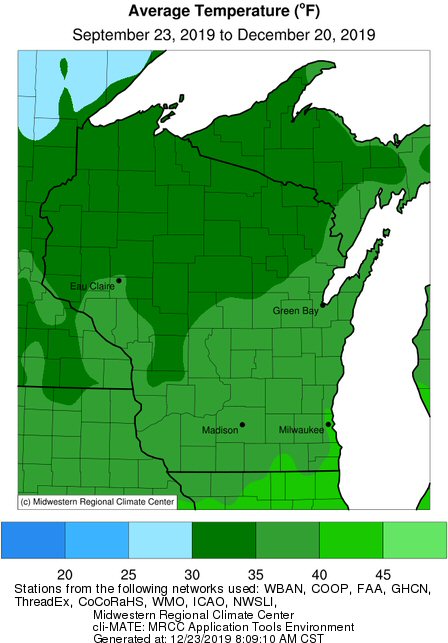
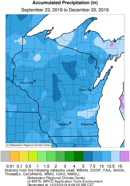
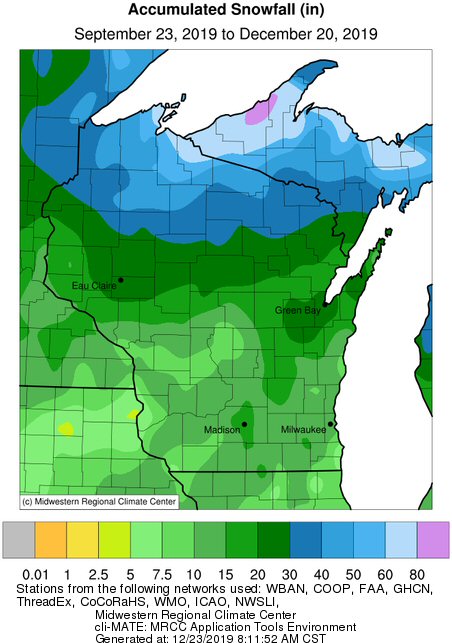
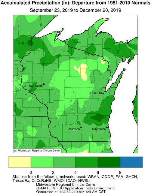
Elsewhere in the Upper Mississippi River Valley, average temperatures ranged from 31.2F in Medford, WI to 39.4F in Boscobel, WI. These temperatures ranged from near normal to 4F below normal. Precipitation ranged from 6.30" near Necedah, Wi to 11.84" near Austin, MN. This ranged from near normal to 6 inches wetter-than-normal. Snowfall ranged from 4.7" at La Crescent Dam 7 to 27.4" at Medford, WI. This ranged from 10" below normal to near 20" above normal.
 |
 |
 |
| Average Temperature | Precipitation | Snowfall |
 |
 |
|
| Average Temperature Departure | Precipitation Departure | Snowfall Departure |
Temperature...
During astronomical autumn, La Crosse Regional Airport had an average temperature of 39.2F. This was 0.8F colder than the 1873-2019 long-term average of 40F.
Precipitation...14th Wettest Autumn
During astronomical autumn, La Crosse Regional Airport received 9.30 inches of precipitation. This was 3.56 inches wetter than the 1873-2019 long-term average of 5.74 inches. This was the 14th wettest autumn and the wettest autumn since 2010 (9.99 inches - 8th wettest). The wettest autumn occurred in 1900 when 14.62 inches fell.
The wettest day occurred on October 21 when 1.61 inches fell.
Snowfall...
During astronomical autumn, the official NWS snow observer near La Crosse Regional Airport received 9.2 inches of snow. This was 1.2 inches below the 1897-2019 long-term average of 10.4 inches.
The snowiest day occurred on November 6 when 4.5 inches fell.
Snow Depth...
During astronomical autumn, the official NWS snow observer near La Crosse Regional Airport had an average snow depth of 0.5 inches. This was 0.2 inches below the 1893-2019 long-term average of 0.7 inches.
Temperature...15th Coldest
During astronomical autumn, Rochester International Airport had an average temperature of 34.3F. This was 3.1F colder than the 1886-2019 long-term average of 37.4F. This was the 15th coldest and the coldest autumn since 1996 (33.8F - tied with 1932 for 11th coldest).
Precipitation...Tied with 2009 for 3rd Wettest
During astronomical autumn, Rochester International Airport received 10.10 inches of precipitation. This was 5.27 inches wetter than the 1886-2019 long-term average of 5.27 inches. This was tied with 2009 for the third wettest autumn. Only 1911 (13.09 inches - wettest) and 2010 (12.98 inches - 2nd wettest) were wetter. Four out of the 10 wettest autumns have occurred since 2007 (2010 - 2nd wettest, 2019 - tied for 3rd wettest, 2009 - tied for 3rd wettest, and 2007 - 10th wettest).
The wettest day occurred on October 1 when 1.48 inches fell.
Snowfall...17th Snowiest
During astronomical autumn, the official NWS snow observer near Rochester International Airport received 17.1 inches of snow. This was 5.3 inches snowier than the 1933-2019 long-term average of 12.4 inches. This was 17th snowiest autumn and the snowiest since 2010 when 39.2 inches of snow fell (snowiest autumn).
The snowiest day occurred on November 26 when 4.4 inches fell.
Snow Depth...
During astronomical autumn, the official NWS snow observer near Rochester International Airport had an average snow depth of 1.1 inches. This was 0.7 inches greater than the 1944-2019 long-term average of 0.3 inches.

