Gaylord, MI
Weather Forecast Office
Local Information
Area Information
Office Webcam
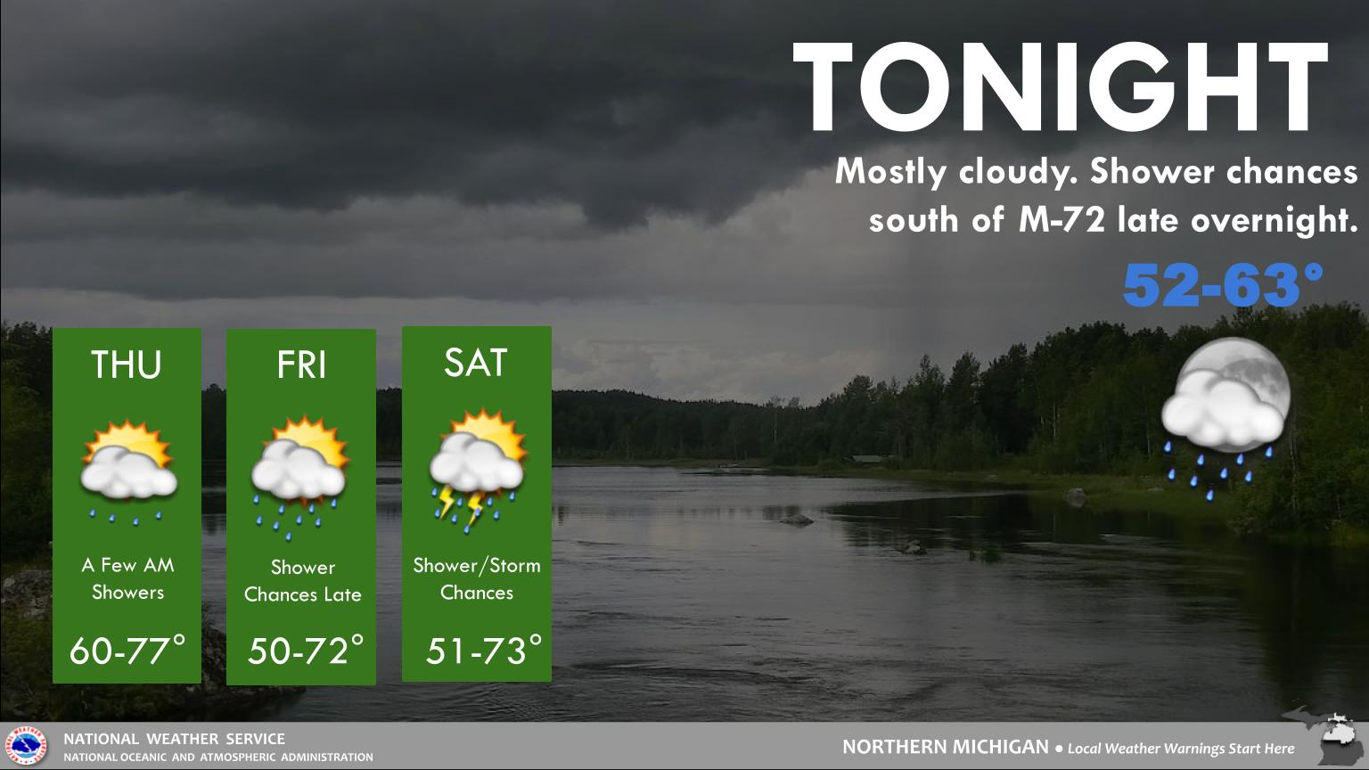
Forecast
Recreational
Great Lakes/Marine
NWS DSS Table
Beach/Surf
Text Products
US Dept of Commerce
National Oceanic and Atmospheric Administration
National Weather Service
Gaylord, MI
8800 Passenheim Road
Gaylord, MI 49735-9454
989-731-3384
Comments? Questions? Please Contact Us.

