Please use the links below to find out more information on current flooding issues and details of any warnings that may be currently issued.
Quick Links:
Latest Information
|
||||||||
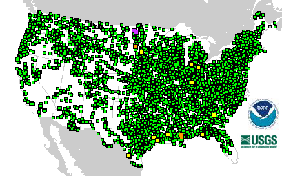
Current River/Streamflow Information
|
|||||
Precipitation Info/Forecasts
|
||||||||
758

FLUS43 KAPX 290138

HWOAPX


Hazardous Weather Outlook

National Weather Service Gaylord MI

938 PM EDT Mon Apr 28 2025


MIZ016>018-020>036-041-042-086>088-095>099-300145-

Emmet-Cheboygan-Presque Isle-Leelanau-Antrim-Otsego-Montmorency-

Alpena-Benzie-Grand Traverse-Kalkaska-Crawford-Oscoda-Alcona-

Manistee-Wexford-Missaukee-Roscommon-Ogemaw-Iosco-Gladwin-Arenac-

Western Chippewa-Central Chippewa-Southeast Chippewa-

Western Mackinac-Eastern Mackinac-

Mackinac Island/Bois Blanc Island-

Beaver Island and surrounding islands-Charlevoix-

938 PM EDT Mon Apr 28 2025


This hazardous weather outlook is for Eastern Upper Michigan and

Northern Lower Michigan.


.DAY ONE...Tonight.


There is a chance for thunderstorms tonight. Severe thunderstorms

are possible. The best chance for severe storms will be over

eastern upper and northwest lower Michigan. Damaging wind gusts

and large hail will be the primary threats. Isolated tornadoes are

also possible.


.DAYS TWO THROUGH SEVEN...Tuesday through Sunday.


There is a chance for thunderstorms Tuesday morning into early

afternoon. An isolated severe storm is possible in northern lower

Michigan, producing damaging winds.


Windy conditions are expected Tuesday.


.SPOTTER INFORMATION STATEMENT...


Spotter activation may be needed tonight.


For more information visit http://weather.gov/gaylord.


$$


LHZ345>349-LMZ323-341-342-344>346-LSZ321-322-300145-

Straits of Mackinac within 5 nm of Mackinac Bridge including

Mackinac Island-St Ignace to False Detour Channel-

5NM East of Mackinac Bridge to Presque Isle Light MI including

Bois Blanc Island-

Presque Isle Light to Sturgeon Pt MI Including Thunder Bay

National Marine Sanctuary-Sturgeon Pt to Alabaster MI-

Grand Traverse Bay south of a line Grand Traverse Light to

Norwood MI-Seul Choix Point to 5NM West of Mackinac Bridge-

Norwood MI to 5NM West of Mackinac Bridge including Little

Traverse Bay-Sleeping Bear Point to Grand Traverse Light MI-

Point Betsie to Sleeping Bear Point MI-

Manistee to Point Betsie MI-

Whitefish Bay (U.S. Portion)/Whitefish Point to Point Iroquois MI-

St. Marys River Point Iroquois to E. Potagannissing Bay-

938 PM EDT Mon Apr 28 2025


This hazardous weather outlook is for the northern Michigan

nearshore waters of Lake Huron, Lake Michigan and Lake Superior.


.DAY ONE...Tonight.


There is a chance for thunderstorms tonight. Severe thunderstorms

are possible. The best chance for severe storms will be over Lake

Michigan and Lake Superior. Damaging wind gusts and large hail

will be the primary threats.


Gale force gusts are likely on Lake Michigan late tonight.


.DAYS TWO THROUGH SEVEN...Tuesday through Sunday.


There is a chance for thunderstorms Tuesday morning into early

afternoon. An isolated severe storm is possible on Lake Huron,

producing damaging winds.


Gale force gusts are likely on Lake Michigan late tonight.


.SPOTTER INFORMATION STATEMENT...


Spotter activation may be needed tonight.


For more information visit http://weather.gov/gaylord.


$$
734

ACUS01 KWNS 290114

SWODY1

SPC AC 290112


Day 1 Convective Outlook

NWS Storm Prediction Center Norman OK

0812 PM CDT Mon Apr 28 2025


Valid 290100Z - 291200Z


...THERE IS A MODERATE RISK OF SEVERE THUNDERSTORMS FOR SOUTHEAST

MN...NORTHERN IA...WESTERN WI...


...THERE IS AN ENHANCED RISK OF SEVERE THUNDERSTORMS FOR NORTHWEST

TX AND SOUTHWEST OK...


...SUMMARY...

Multiple corridors of severe thunderstorms will continue this

evening from the Upper Midwest into the central and southern Plains.

Tornadoes, large hail, and severe gusts all remain possible,

including some strong-tornado potential.


...Upper Midwest...

Convection has generally evolved into a linear mode from northern IA

into southeast MN and western WI, though with occasional embedded

supercells noted. The environment farther south across IA and

downstream of the ongoing storms remains very favorable for

organized convection, with moderate to strong buoyancy and very

favorable low-level and deep-layer shear. Development of more

discrete storms is uncertain, however. There remains potential for a

couple sustained supercells to develop and pose a threat for all

severe hazards, including conditional strong-tornado potential.

Otherwise, the ongoing cluster will continue to pose a threat for

damaging winds, hail, and embedded tornadoes as it moves eastward

through the evening.


Farther west, a couple small supercells may continue in the vicinity

of the cold front this evening near the IA/MN border region, before

weakening later tonight.


...Northeast KS into northwest MO and vicinity...

A cluster of supercells is ongoing across northeast KS this evening,

with earlier reports of large to very large hail. Given the ongoing

clustering of storms, some upscale growth will be possible with time

this evening, with a threat of damaging wind and hail. Increasing

low-level flow with time and eastward extent will also support a

tornado threat with any supercells that can persist through the

evening.


...Southern Plains into southern KS/MO...

Widely scattered supercells have developed from northwest TX into

southwest OK, within a strongly unstable and favorably sheared

environment. These cells will continue to pose a threat of large to

very large hail and localized severe gusts through the evening.

There will also be a window of opportunity this evening for an

increasing tornado threat, including localized strong-tornado

potential, as a strengthening nocturnal low-level jet substantially

increases effective SRH. See MCD 592 for more information in this

area.


Additional storm development and eventual evolution of one or more

clusters will be possible later tonight from north TX into OK,

south-central/southeast KS, and possibly southern MO, due to the

increasing low-level jet and eventual approach of a cold front from

the north. The late-night convection could pose a continued threat

for hail and damaging winds, and possibly a tornado for any storms

that can remain surface based.


..Dean.. 04/29/2025


$$
790

ACUS02 KWNS 290553

SWODY2

SPC AC 290552


Day 2 Convective Outlook

NWS Storm Prediction Center Norman OK

1252 AM CDT Tue Apr 29 2025


Valid 301200Z - 011200Z


...THERE IS A SLIGHT RISK OF SEVERE THUNDERSTORMS NORTH-CENTRAL

TEXAS...SOUTHEASTERN OKLAHOMA...WESTERN/CENTRAL ARKANSAS...


...SUMMARY...

Scattered severe thunderstorms are possible on Wednesday, centered

on central Texas to eastern Oklahoma and western Arkansas. Large

hail, damaging wind, and a few tornadoes will be possible with

thunderstorm activity.


...Synopsis...

A shortwave trough is expected to move eastward across the Southern

Plains on Wednesday, with multiple rounds of thunderstorm activity

possible across portions of Texas and Oklahoma. At the start of the

period Wednesday morning, convection should be ongoing across

western Oklahoma into northern Texas near the surface low. This

activity will continue to track eastward through the period and

intensify through the afternoon/evening, as the surface low moves

north and eastward. Additional thunderstorm development is expected

along the southern fringe near the dryline in north-central Texas.


A warm front extending across portions of Missouri, southern

Indiana, southern Illinois into northern Kentucky may be the focus

of strong to severe thunderstorm development Wednesday afternoon.


...Southern Plains into the Lower Mississippi Valley...

The aforementioned thunderstorm activity early in the period

Wednesday morning is expected to intensify through the afternoon, as

daytime heating and increasing moisture leads to destabilization

downstream in the warm sector. By the afternoon, the dryline across

central Texas will be the focus of new development as upper level

forcing overspreads the region. With multiple rounds of convection

expected across the Texas Panhandle into western Oklahoma and north

Texas in the D1 period, there is some uncertainty on where all the

mesoscale features will be as this occurs. Nonetheless, it appears

that ahead of the dryline the environment will be characterized by

steep lapse rates, modest MLCAPE, and strong deep layer shear. This

will support potential for a few supercells initially capable of

very large hail. Should the mode remain favorable, the tornado risk

will increase through the afternoon as the low-level jet strengthens

and low-level curvature of hodographs increases. A more favorable

corridor for tornadoes may exist near the Red River across

southeastern Oklahoma/northern Texas. Upscale growth will promote

potential for damaging wind, especially across eastern Oklahoma into

western Arkansas. However, shear will also support potential for

line embedded circulations.


Additional thunderstorms may re-develop further west across the

Texas Panhandle Wednesday afternoon, with potential for large hail.

At this time, it is uncertain how much recovery can happen from

multiple rounds of convection late D1 into D2 across this region.


...Lower MO/OH Valleys...

Along the warm front from southern Indiana into southern Illinois

and northern Kentucky, thunderstorm development is possible

Wednesday afternoon. Forcing remains weaker across this region, with

the shortwave back in the southern Plains. However, profiles would

be supportive of a supercell or two in this region, given the plume

of steep low to mid-level lapse rates, buoyancy, and sufficient

shear. These would be capable of hail, severe wind, and potentially

a tornado. For now, some uncertainty on coverage keeps probabilities

low.


..Thornton/Bentley.. 04/29/2025


$$
416

NWUS53 KAPX 290538

LSRAPX


Preliminary Local Storm Report

National Weather Service Gaylord MI

138 AM EDT Tue Apr 29 2025


..TIME...   ...EVENT...      ...CITY LOCATION...     ...LAT.LON...

..DATE...   ....MAG....      ..COUNTY LOCATION..ST.. ...SOURCE....

            ..REMARKS..


0120 AM     Non-Tstm Wnd Gst 1 SE Greilickville      44.79N 85.63W

04/29/2025  M39 MPH          LMZ323             MI   Mesonet


            Mesonet station XELM Elmwood Township

            Marina.


&&


$$


JZ
290

FXUS63 KAPX 290348

AFDAPX


Area Forecast Discussion

National Weather Service Gaylord MI

1148 PM EDT Mon Apr 28 2025


.KEY MESSAGES...


- Widespread thunderstorms tonight and Tuesday morning with chances

for scattered severe storms


- Rain chances re-emerge on Thursday, lingering into Friday.


- Cooler Friday into Saturday.


- Period of warm and mostly dry conditions possible in the extended

  range (~May 5 and beyond).


&&


.UPDATE...

Issued at 931 PM EDT Mon Apr 28 2025


General idea remains unchanged, with upstream convection

expected to work east into the area overnight. Uncertainty on

overall storm organization and coverage remains significant as

waning instability intercepts still excellent deep layer shear.

Moisture advection is increasing rather significantly, at least

supporting some maintenance of upstream activity as it heads

east. SPC still highlights eastern upper and northwest lower as

having the greatest potential of severe storms tonight...with

winds and hail being the primary severe weather concerns. Will

simply continue to monitor and see how things unfold over the

next several hours.


&&


.SHORT TERM /THROUGH TUESDAY/...

Issued at 320 PM EDT Mon Apr 28 2025


Forecast Synopsis: Current satellite and radar depict areas of

thunderstorm activity over the western Upper peninsula and western Lk

Superior this afternoon. This is draping some high clouds over

northern MI, however ample sunshine is still reaching the surface in

most spots. Temperatures are quickly rising into the high 60s and

low 70s across northern MI. Critical fire weather conditions due to

frequently gusty southerly winds persisting dry air near the

surface. These conditions will persist through the late afternoon

hours as mixing heights rise to around 4 kft and mix out any

moisture that tries to seep in from the west. NE lower will see

these conditions linger into the evening, however mid and LL

moisture will finally make its way over Lk MI and to NW lower. A

surface cyclone will reach WI and move a warm sector over the state

after midnight. This warm sector will have a LLJ of around 60 to 70

kts at 2-5 kft. During this time, there will be a SW/NE axis of

upper level forcing draped over WI/MN and through Lk Superior. These

features will start to dip SE around midnight, yielding strong shear

(Bulk 0-6km up to 50 or even 60kts) and lift (mid and LL omega) over

northern MI. Around 500 to 1200 j/kg of elevated instability will

exist on top of this, and in some spots (near Manistee and Wexford

Co.) a few hundred SFC/ML instability exists. Dry air aloft (600 mb

and above) will be present throughout the night, leading to

healthy mid level lapse rates of +7 C/km.


Putting this all together, an initial round of isolated thunder

storms are possible over eastern upper and NW lower this

evening and tonight (before midnight). A line of storms will

likely sprout over central WI and the U.P. orientated from SW-

NE. This will move across northern MI, reaching the western

coast of Lk Huron by sunrise Tuesday. Chances remain favorable

for a handful of these storms to produce damaging winds and some

large hail. There is a non-zero chance for a tornado or two

with the very favorable shear environment while cloud bases

temporarily dip.


The front will move through Tuesday mid morning, which could result

in more thunderstorm activity for NE lower as this is where the best

environment will remain tomorrow morning.


Winds will be breezy overnight, however there is low confidence for

widespread strong gusts as mixing heights will be capped (most

instability remains elevated). Winds turn west Tuesday and

strengthen and become frequently gusty.


Forecast Confidence and Concerns:  A chaotic environment, such as

what is forecasted tonight, results in a few uncertainties. Lets

start with the more certain thoughts. There will be thunderstorm

activity across northern MI tonight, resulting in lightning, wetting

rains and gusty outflow winds. The cool lakes will temporarily

hurt storm development, however background forcing and favorable

mid and LL environments should keep activity alive. The

coverage and strength are what could change as storms move over

land. If a line of storms becomes more defined, it will become

parallel with mid level flow as it reaches the shores of NW

lower and have what it needs to sustain its definition as it

crosses the penisula. This could result in more widespread

damaging winds. CAMs don`t reflect this scenario, however it

depends heavily on how convection starts over WI and the western

U.P.. Better chances exist for convection remaining more

scattered but aligned in the form of a line with damaging winds

and large hail remaining an isolated threat with a handful of

storms.


&&


.LONG TERM /TUESDAY NIGHT THROUGH MONDAY/...

Issued at 320 PM EDT Mon Apr 28 2025


Pattern Synopsis and Forecast:


High pressure builds in briefly on Wednesday with seasonable

temperatures and lighter winds. Next chance for precipitation will

be Thursday into portions of Friday due to a low pressure system

tracking up from the S Plains-MS Valley vicinity into southern

portions of MI. There are still discrepancies on the exact track of

this low pressure system, for instance CMC shoves it a little

farther east, along with subsequent GEPS ENS, but the GFS/GEFS &

ECMWF/EPS keep the low/precip shield farther NW. Something to fine

tune in the coming days but the best potential for wetting rains may

reside across the southeastern half of northern MI. Much cooler

Friday into the first half of this weekend after this system, and

additional upper level system swings on through (showers will linger

on Friday due to an upper level system adding lift). Cannot

completely rule out a few snowflakes if the cold air times perfectly

with some lingering moisture. Dry this weekend, with warming

temperatures Sunday into early next week as heights build aloft. A

warm and dry period looks increasingly likely in the extended (~May

5 and beyond) as an omega/rex block, or some combination of the two,

forms over the CONUS with the high pressure centered near northern

MI.


&&


.AVIATION /06Z TAFS THROUGH 06Z WEDNESDAY/...

Issued at 1145 PM EDT Mon Apr 28 2025


Still expecting upstream showers and thunderstorms to move west

to east across the area early this morning. Uncertainty

remains, both with regards to overall coverage and intensity of

these storms. If storms remain organized, a few may contain very

gusty winds and some hail. Shower threat continues into today,

with again perhaps a few embedded thunderstorms. Gradual

improvement expected from west to east this afternoon. Strong

low level jet will continue to produce widespread low level

wind shear early this morning, this despite maintenance of

gusty south to southwest surface winds. Wind shear ends later

this morning, with surface winds become northwest and remaining

gusty as we head through the day. Skies clear and winds decrease

this evening.


&&


.APX WATCHES/WARNINGS/ADVISORIES...

MI...None.

MARINE...Small Craft Advisory until 11 PM EDT Tuesday for LHZ345>349.

     Gale Warning until 11 AM EDT Tuesday for LMZ323-341-342-

     344>346.

     Small Craft Advisory until 11 PM EDT Tuesday for LSZ321-322.


&&


$$


UPDATE...MSB

SHORT TERM...ELD

LONG TERM...JLD

AVIATION...MSB
785

ACUS11 KWNS 290551

SWOMCD

SPC MCD 290550

MOZ000-ARZ000-OKZ000-KSZ000-TXZ000-290745-


Mesoscale Discussion 0597

NWS Storm Prediction Center Norman OK

1250 AM CDT Tue Apr 29 2025


Areas affected...far southern Kansas...much of northern

Oklahoma...and small portions of the Texas Panhandle and southwest

Missouri


Concerning...Severe potential...Watch possible


Valid 290550Z - 290745Z


Probability of Watch Issuance...60 percent


SUMMARY...Storms are forecast to increase in coverage along or

possibly just ahead of the cold front as it pushes south from Kansas

into Oklahoma and surrounding states. Locally damaging gusts and

sporadic large hail will be possible.


DISCUSSION...A cold front currently stretches from the OK Panhandle

across south-central KS and into northwest MO, with elevated

convection already forming in the HUT to P28 corridor. South of the

front, a moist and unstable air mass remains in places with MLCAPE

to 2000 J/kg.


Winds aloft will remain nearly parallel to the cold front, and even

the low-level jet will veer with time. As such, any initial cellular

activity (producing hail) may tend to merge into an MCS. Such an MCS

would move eastward with the mean wind, possibly producing damaging

winds across northern OK and vicinity.


..Jewell/Mosier.. 04/29/2025


...Please see www.spc.noaa.gov for graphic product...


ATTN...WFO...SGF...TSA...ICT...OUN...DDC...AMA...


LAT...LON   37129404 36699426 36459465 35939569 35749742 35509882

            35479990 35620023 36020035 36380019 36859971 37139910

            37519811 37829734 37979590 37899471 37589409 37129404


MOST PROBABLE PEAK TORNADO INTENSITY...85-115 MPH

MOST PROBABLE PEAK WIND GUST...65-80 MPH

MOST PROBABLE PEAK HAIL SIZE...1.50-2.50 IN