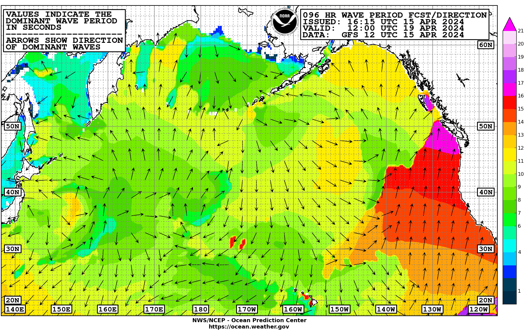
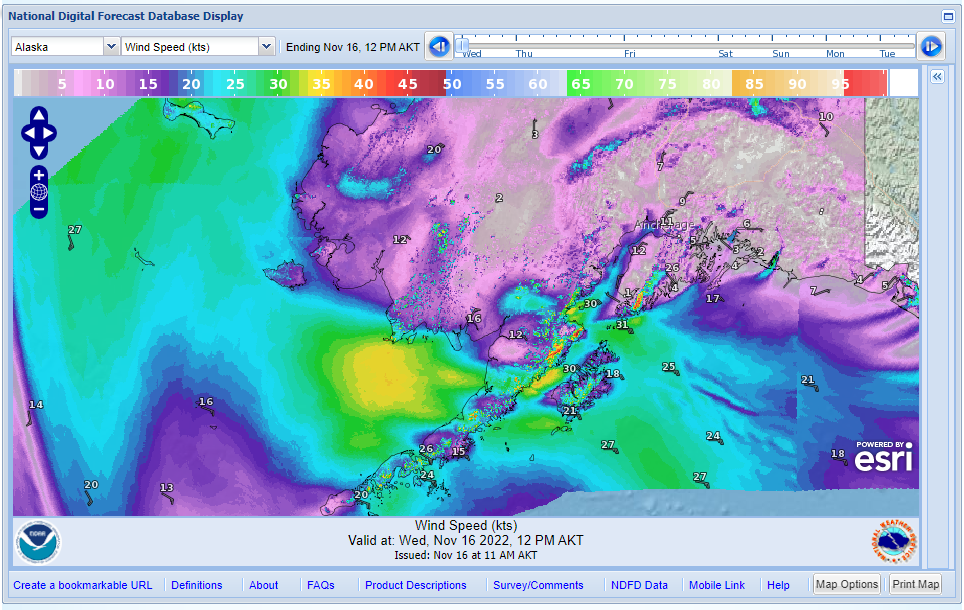
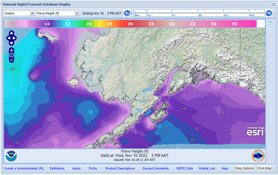
Digital Forecast Database - Pan & Zoom to your area of interest and step through the wind forecast in 3hr timesteps or the wave height forecast in 6hr timesteps.
Note: The latest version of each weather chart is available here. This list is not in the order of transmission.
For a complete list of marine fax images and schedules, go here:
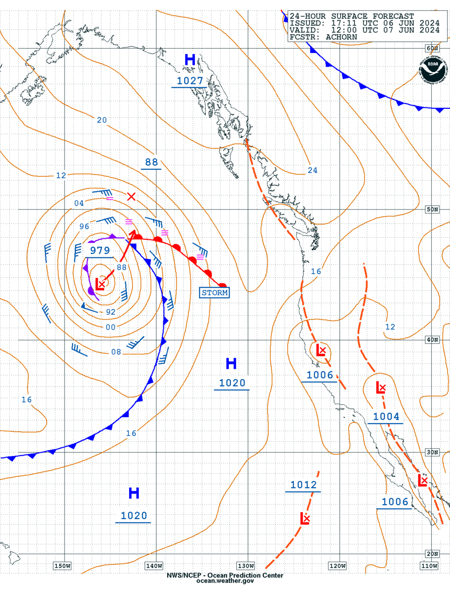
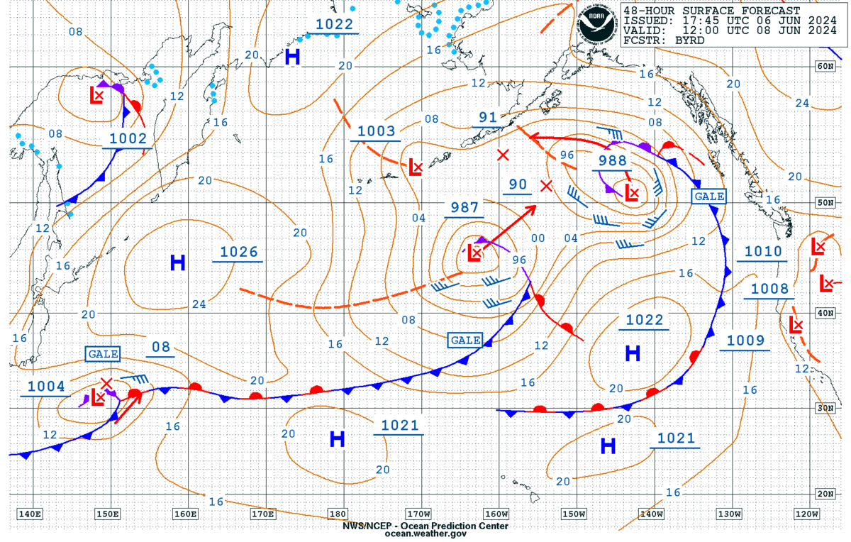
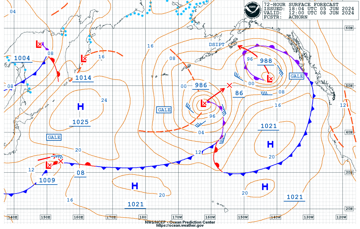
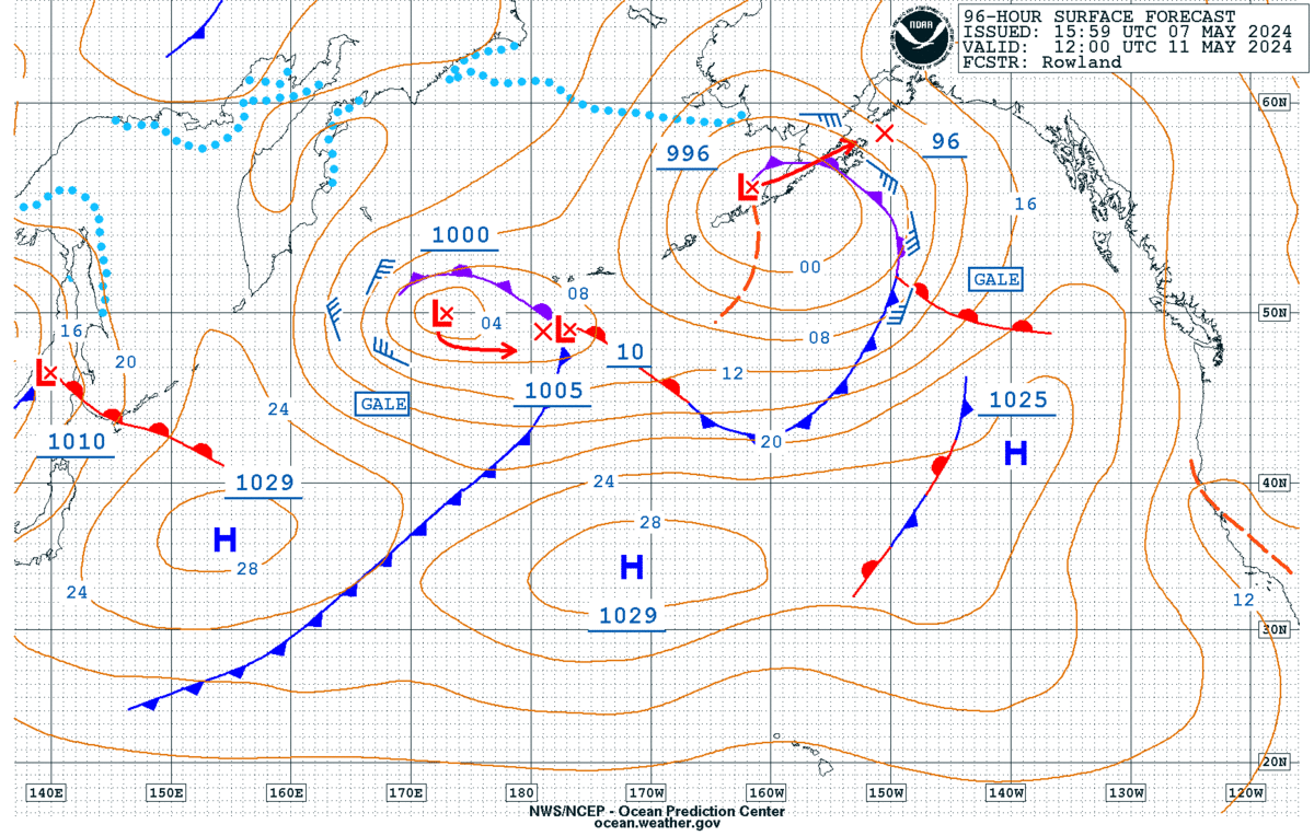
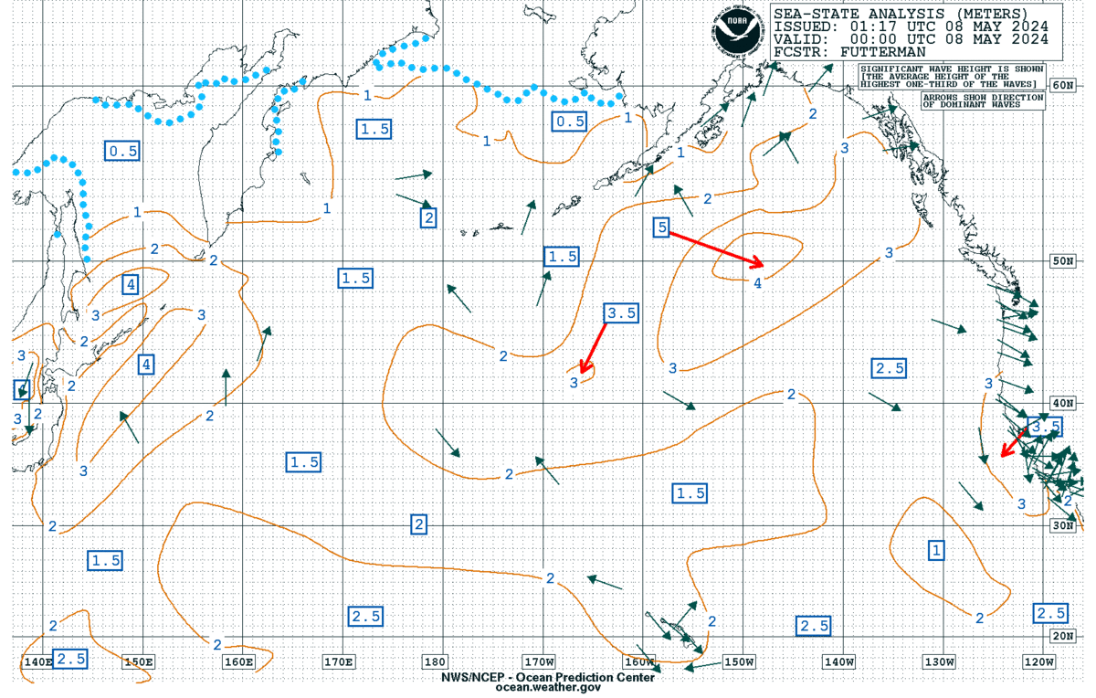
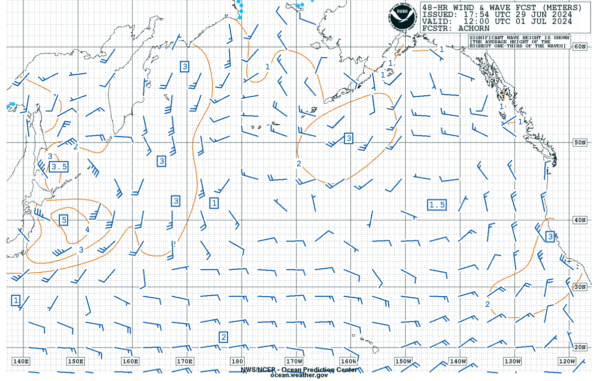
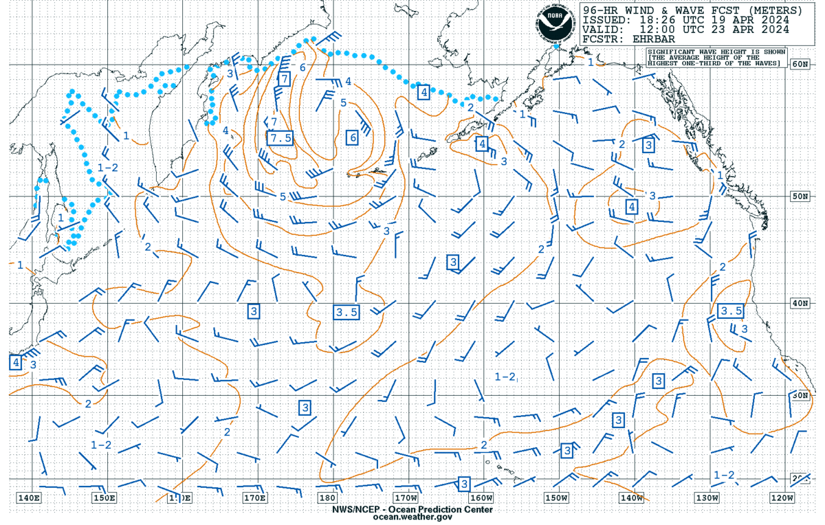
Marine Radiofax Charts
General Radiofax Information
Marine Text Products - Great for low-bandwidth
NDBC Buoy Map | Dial-A-Buoy
Surface Analysis and Forecast (black & white)
Marine & Safe Boating Safety!
WRN Marine Ambassador program