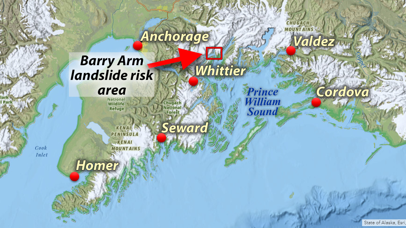
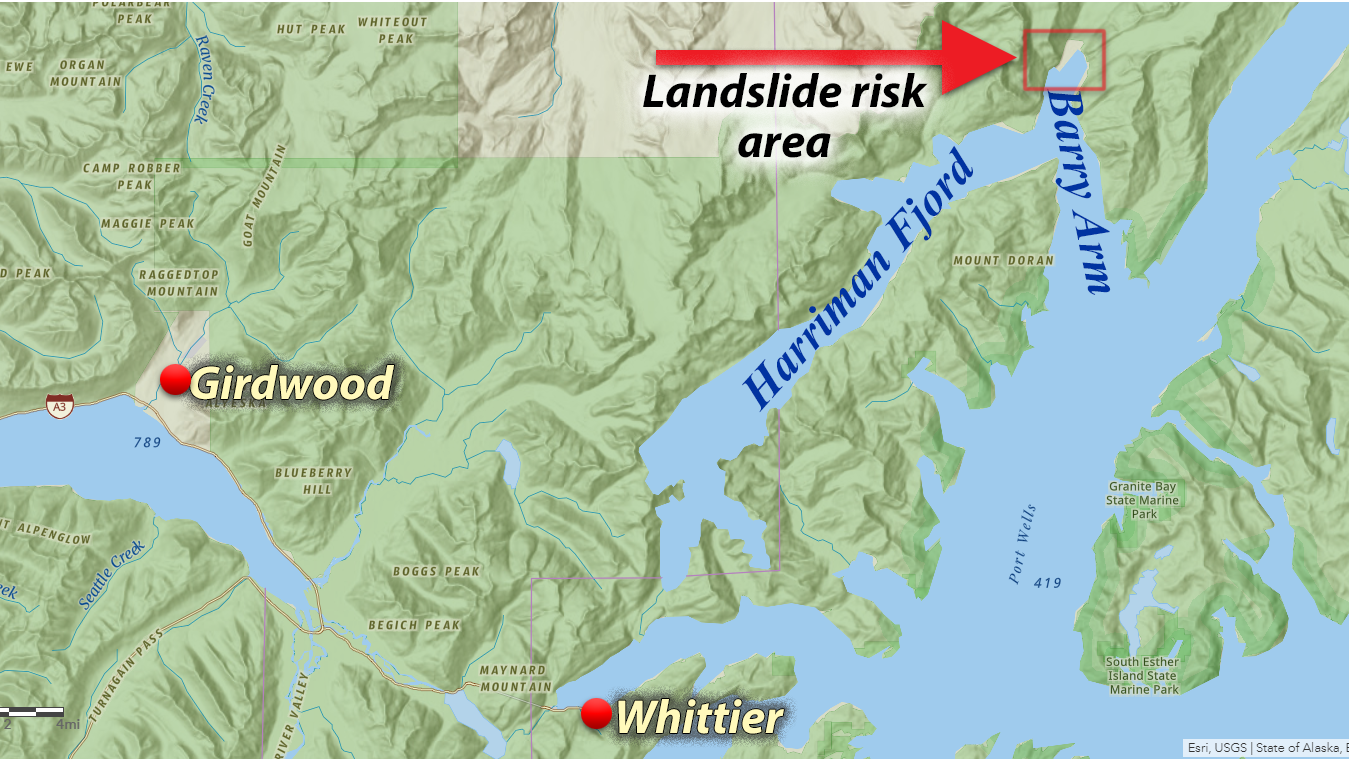
Prince William Sound has a long history with tsunamis, perhaps most memorably during the 1964 9.2M earthquake. Tsunami science has discovered that many local tsunamis are generated by landslides, which can be caused by a large earthquake, or potential other factors that increase the risk on an already unstable slope. Landslide-generated tsunamis are a concern in steep areas, such as the glacial fjords of Prince William Sound, including the most recent discovery of a weak slope along Barry Arm.

The National Weather Service is responsible for keeping everyone in Prince William Sound safe, including recreational users, commercial fishermen, and residents. Landslide-generated tsunamis are especially difficulty to monitor and warn for, so people using Prince William Sound need to be aware of this risk and take action at the first sign of any danger, even if a warning has not been sent out yet.

For more information about the science behind this potential landslide, please visit this webpage created by our partners at the Alaska Division of Geological and Geophysical Surveys.
Frequently Asked Questions​
Q: Is Whittier at risk for a Tsunami?
A: Yes.
The risk of an earthquake-driven wave or a local landslide creating a tsunami is a well-known risk for the city of Whittier. A landslide in Barry Arm is one way a tsunami could occur in Whittier or elsewhere in Prince William Sound.
Q: Is the danger real? / When will the landslide occur?
A: At this time the National Tsunami Warning Center has no indication that a landslide is imminent, but landslides can happen at any time, and the community needs to remain vigilant. The National Tsunami Warning Center will continue to work with our local, state, and federal partners to develop reliable, sustainable information that will give us critical awareness whenever we need it.
Q: How will I know if there’s a tsunami? How will I get a warning?
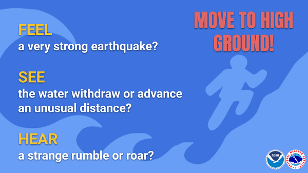
A: Your natural warning signs may be your first warning. If you feel the ground shake, if you hear a loud roaring sound, if you see the water behaving strangely, stop what you’re doing and move to high ground immediately. Do not wait for a warning message or siren.

Other ways to receive a tsunami alert message include a NOAA weather radio, marine VHF, the Whittier tsunami siren, and Wireless Emergency Alerts as well as other 3rd party services on your wireless device. DO NOT rely on any single service to alert you.
Q: How will the National Tsunami Warning Center know if there is a tsunami?
A: The National Tsunami Warning Center is working with our local, state, and federal partners to develop monitoring technology and communication networks to detect dangerous changes in Barry Arm and share that information with anyone who needs it as quickly as possible.
Even with reliable information in place, natural warning signs may be your first warning. When a long or strong earthquake occurs, an unusual sea-level change is noticed, and in this case- especially unusual noises from the hillside or the water - people should not wait for a warning or siren. Seconds matter. Stop what you’re doing. Move to higher ground.
Q: How much time will Whitter have to respond?
A: Whittier and any community in Prince William Sound are always at increased risks for landslides. When a landslide occurs that could produce a tsunami, the natural warning signs are your best alert. When a long or strong earthquake occurs, an unusual sea-level change is noticed, and in this case- especially unusual noises from the hillside or the water - people should not wait for a warning or siren. Seconds matter. Stop what you’re doing. Move to higher ground.
Q: If I’m in the Whittier harbor and there’s a tsunami warning, should I return to the dock or head out to sea?
A: If you’re in the Whittier harbor, you will not have enough time to reach deep water. Dock or beach your vessel and head to high ground immediately.
Q: How are you keeping Whittier and Prince William Sound safe?
A: Whittier and Cordova are Tsunami Ready communities. Being “Tsunami Ready” means the cities like Whittier and Cordova work with the National Tsunami Warning Center, the Anchorage Weather Forecast Office, and the State of Alaska to understand their Tsunami risk, educate their citizens, and prepare. Tsunami Ready communities have alerting tools such as tsunami sirens and have established evacuation routes to keep people safe.
Q: Is there anything I can do right now to be prepared?
The National Weather Service and National Tsunami Warning Center urge those who live in and visit Whittier to review their tsunami risk and evacuation plans and routes so you know what to do when a tsunami warning is issued or natural warning signs are seen or heard. More tips including how to get alerts, how to make an evacuation kit, and how to make and practice a family emergency plan can be found at the NWS tsunami preparedness site.
Q: What other places are at risk from local landslide tsunamis in Prince William Sound?
A: Prince William Sound is full of glacial fjords- long, narrow inlets with steep sides or cliffs. Any of these fjords could produce a landslide of varying sizes in the future. Large landslides could produce local tsunamis. Because of this, it’s important for residents and visitors to use their instincts and natural warning signs to stay safe: if you feel the ground shake, if you hear a loud roaring sound, if you see the water behaving strangely, stop what you’re doing and move to high ground immediately. Do not wait for a warning message or siren.
Q: Where can I learn more about landslides?
A: The United States Geologic Survey is the national science resource for landslide information. Learn more here: https://www.usgs.gov/natural-hazards/landslide-hazards/science