.png)
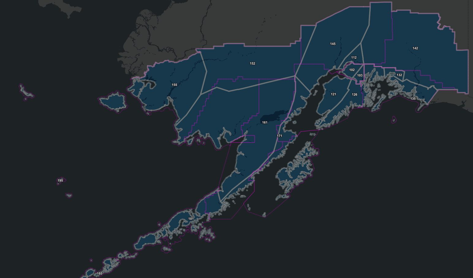
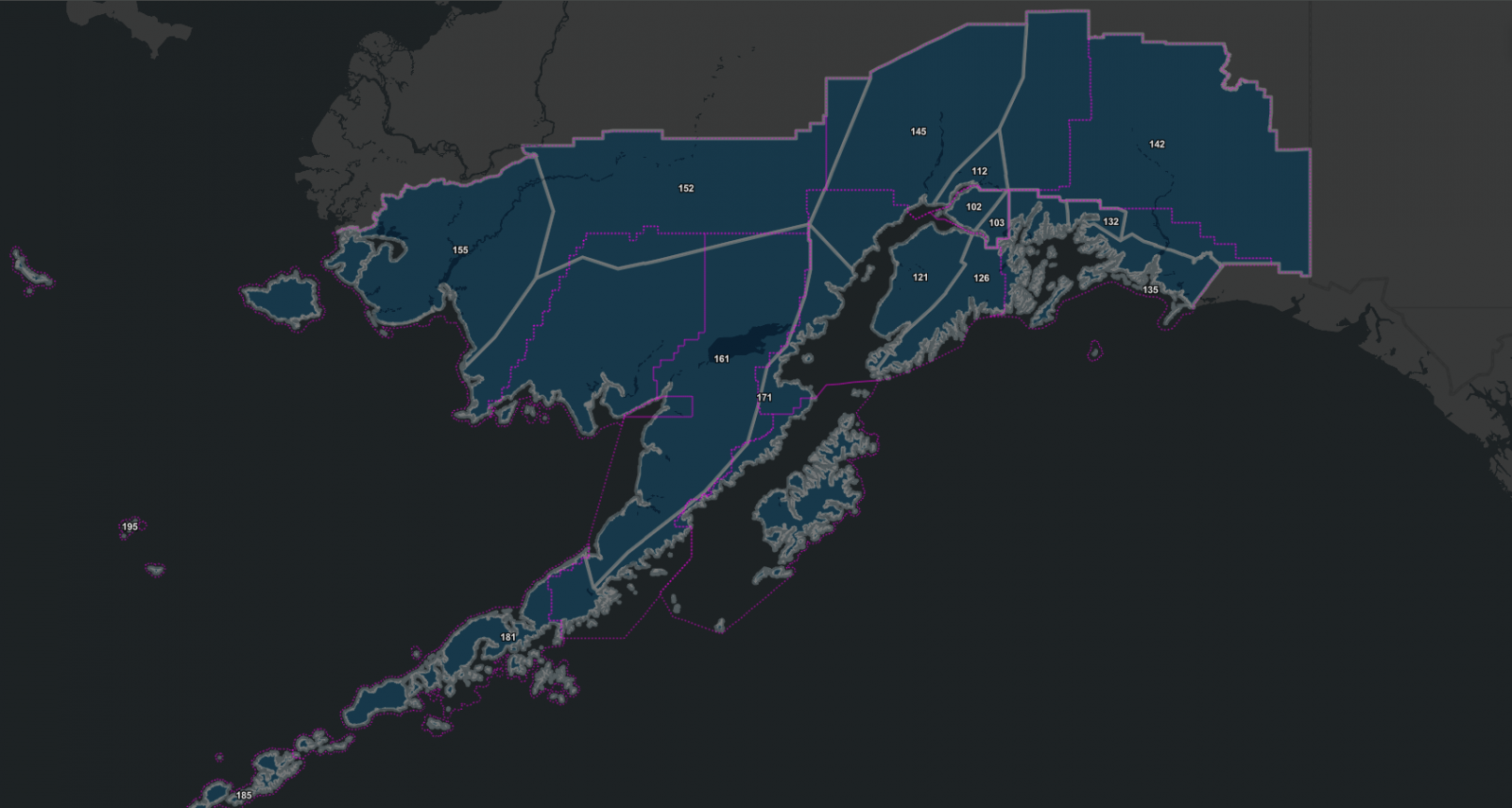
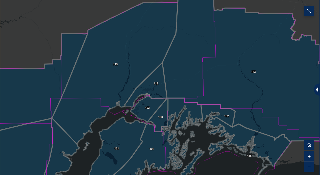
The National Weather Service (NWS) issues messages for geographical areas that Weather Forecast Offices (WFOs) pre-determine, called forecast zones. For land-based forecast zones, these are referred to as “public forecast zones.” In the past, NWS WFO Anchorage has hosted 17 public forecast zones that grouped numerous microclimates together, combined alerting needs, and crossed Borough and Census Boundaries. This led to a blending of forecast needs and impacts, and to overalerting of regions to impacts not realized in some local communities.
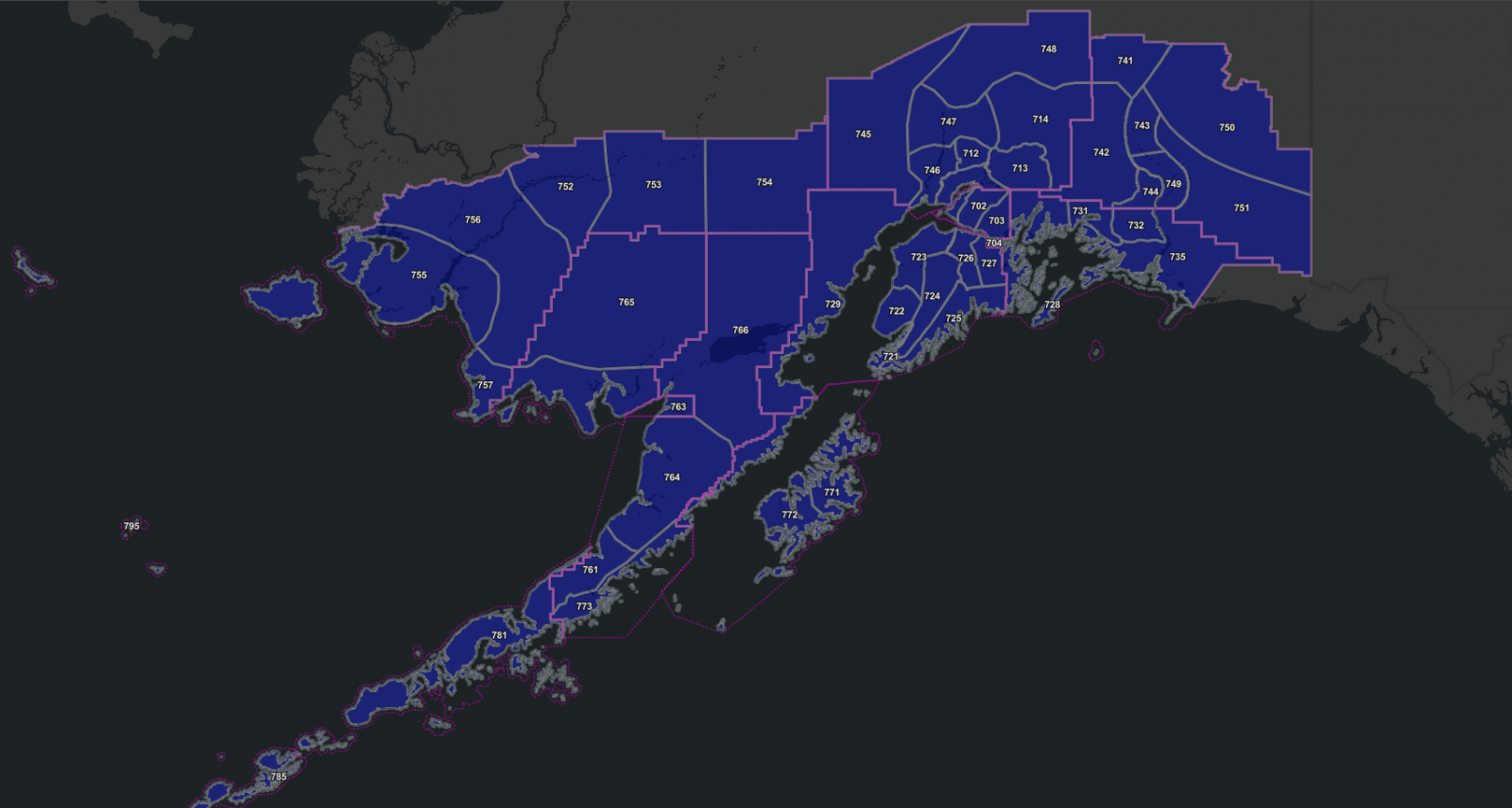
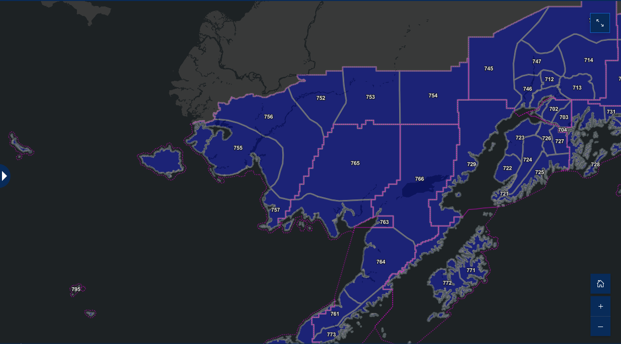
In an effort to redefine our public forecast zones, and be more in-tune with regional and local forecast needs, our forecast office worked closely with local community leadership and incorporated climatology and alert needs in the implementation of our new public forecast areas. With this March’s forecast zone upgrade, NWS WFO Anchorage will host 51 forecast zones, more than double the number of zones previously forecast for. We believe this will provide a vast improvement to those who live across Southern Alaska.
Due to the scope of these changes, all forecast zone names and numbers in Southern Alaska will change. For the complete list of anticipated changes to forecast zone names and numbers, please refer to the Service Change Notice (SCN linked below). Zone change implementation occurred March 19, 2025.
For higher bandwidth users, please visit the StoryMap to visualize the planned zone changes.
The updated Service Change Notice can be found here, updated shapefiles can be found here.
To view the related press release, click here.
NWS partners and users should take the appropriate action to ensure systems recognize the new UGCs and new zone alignments and names. In addition, NOAA Weather Radio All Hazards (NWR) listeners using receivers equipped with Specific Area Message Encoding (SAME) will need to add new SAME location codes to their receivers prior to March 19, 2025.
The NWS issues forecasts, watches, and warnings for public, fire and marine weather by zones. Local effects such as elevation or proximity to large bodies of water can cause highly variable weather across zones.
One of the ways the National Weather Service disseminates information is by broadcasting official watches, warnings, forecasts, and other hazard information 24 hours a day, 7 days a week via the NOAA Weather Radio All Hazards (NWR). This message alerting system functions based on areas defined by borough, census area, municipality, county and parish boundaries.
In hopes of providing quality public support, NWS Alaska Region has been working on a multi-year, multi-phase effort to align forecast zone boundaries with borough, municipality, and census area boundaries. This effort will facilitate the reduction of over-alerting by systems that define geographic areas in terms of cities, boroughs, municipalities, and census areas. With the implementation of these forecast zone changes by WFO Anchorage in March 2025, there will be no overlap between forecast zones and county equivalents in Alaska.
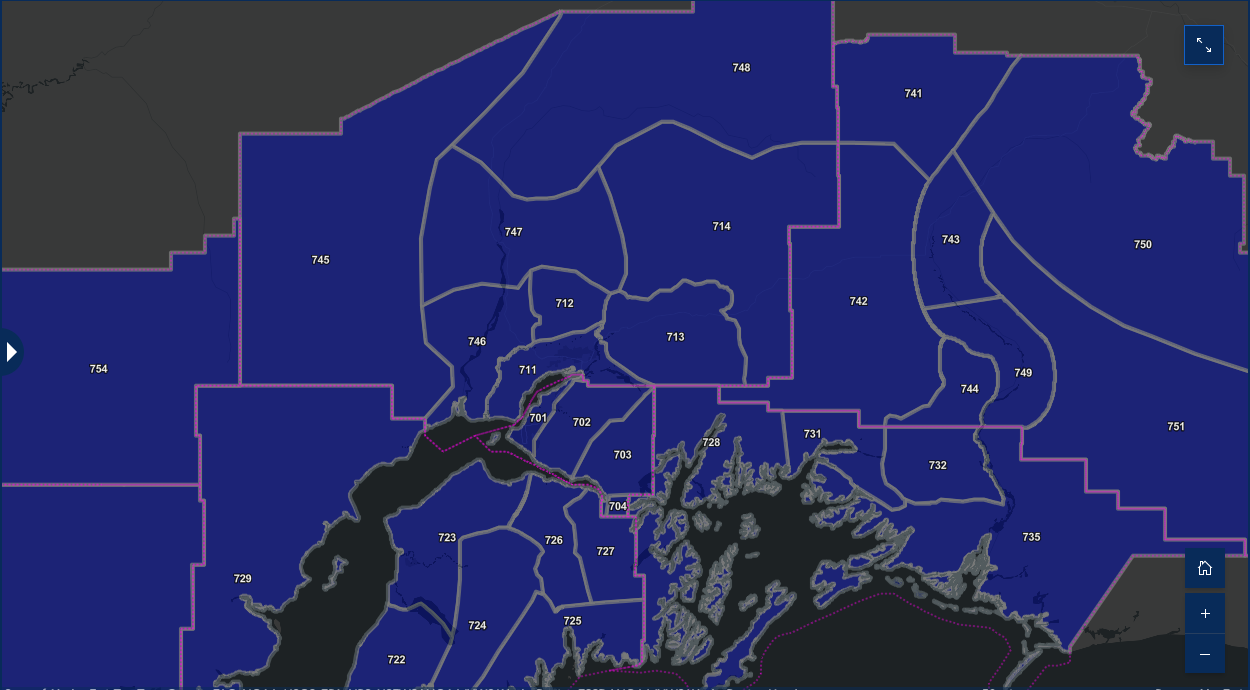
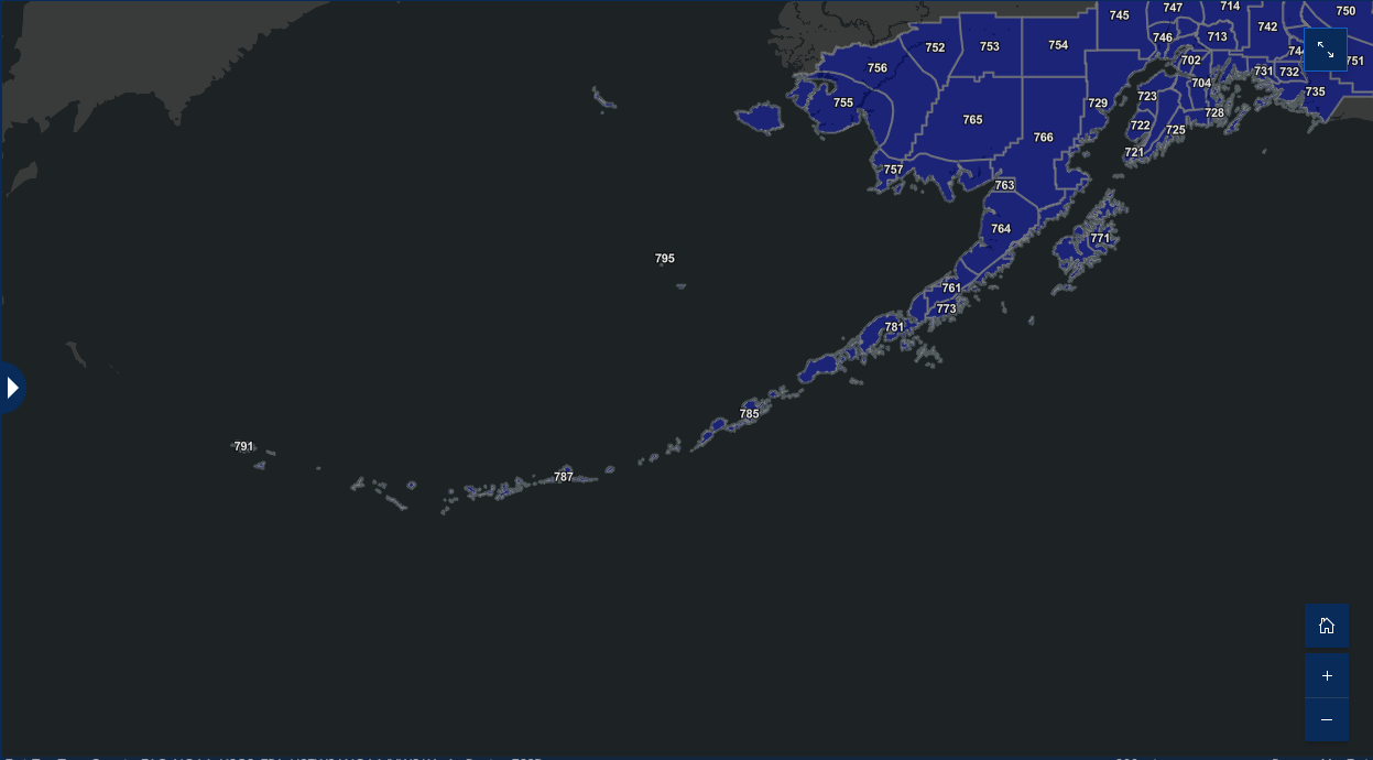
Southcentral Alaska Domain
----------------------------------
AKZ701: Anchorage / Eagle River (lower elevations)
AKZ702: Anchorage Hillside / Upper Eagle River
AKZ703: Turnagain Arm
AKZ704: Portage
AKZ711: Lower Matanuska Valley
AKZ712: Hatcher Pass
AKZ713: Sutton/Upper Matanuska Valley
AKZ714: Eureka / Tahneta Pass
AKZ721: Southern Kachemak Bay
AKZ722: Southwest Kenai Peninsula
AKZ723: Northwest Kenai Peninsula
AKZ724: Skilak Lake / Eastern Sterling Highway
AKZ725: Southern Kenai Mountains / Seward
AKZ726: Interior Kenai Peninsula
AKZ727: Turnagain Pass
AKZ728: West Prince William Sound and Whittier
AKZ729: Tyonek
AKZ731: Valdez
AKZ732: Thompson Pass
AKZ735: Cordova
AKZ741: Northern Copper Valley
AKZ742: Western Copper Valley
AKZ743: Central Copper Valley
AKZ744: Ernestine
AKZ745: Western Susitna Valley
AKZ746: Southern Susitna Valley
AKZ747: Central Susitna Valley
AKZ748: Northern Susitna Valley
AKZ749: Southern Copper Valley
AKZ750: Tok Cutoff
AKZ751: McCarthy
AKZ771: Kodiak Island Northeast
AKZ772: Kodiak Island Southwest
AKZ773: Chignik
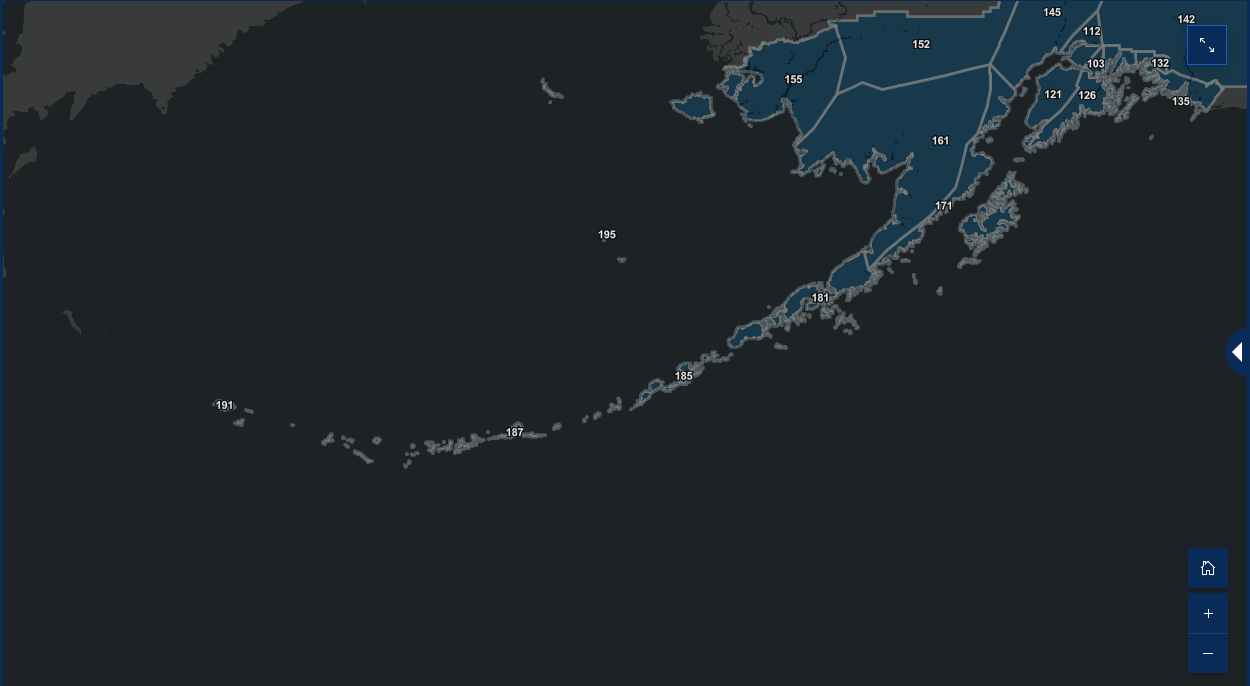
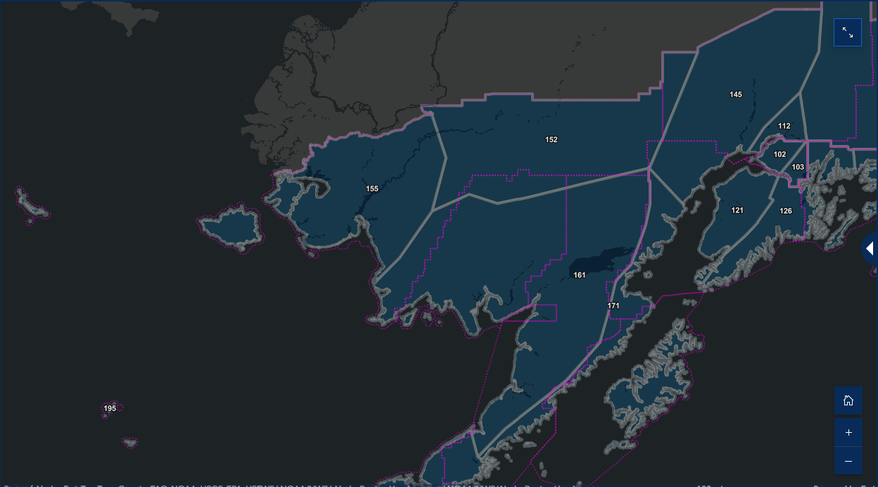
Southwest Alaska Domain
----------------------------------
AKZ752: Kuskokwim Valley West
AKZ753: Kuskokwim Valley East
AKZ754: Lime Village
AKZ755: Kuskokwim Delta Coast and Nunivak Island
AKZ756: Inland Kuskokwim Delta
AKZ757: Western Capes
AKZ763: Bristol Bay Borough (Naknek and King Salmon)
AKZ764: Northern Bristol Bay Coast
AKZ765: Inland Bristol Bay
AKZ766: Lake Iliamna / Nila Vena / Nanvarpak
AKZ761: Central Alaska Peninsula
AKZ762: Northern Alaska Peninsula
AKZ781: Alaska Peninsula
AKZ785: Eastern Aleutians
AKZ787: Central Aleutians
AKZ791: Western Aleutians
AKZ795: Pribilof Islands
Thank you for viewing

