Anchorage, AK
Weather Forecast Office
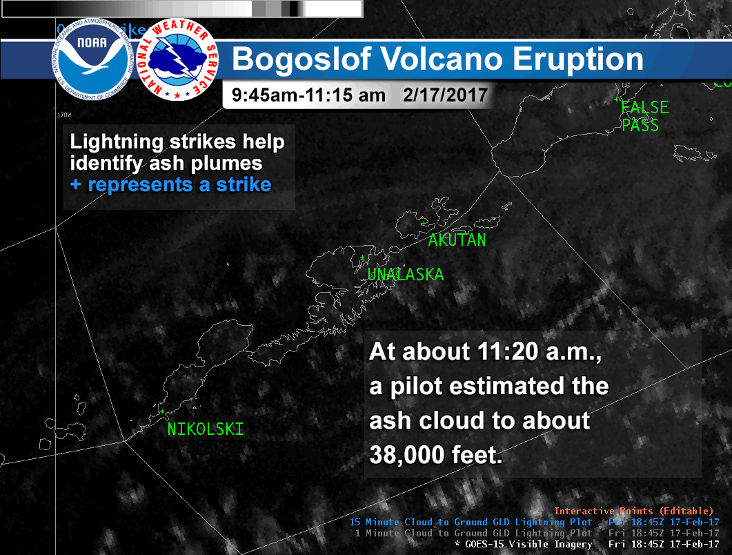
February 17, 2017--
Bogoslof volcano erupted this morning with an ash cloud estimated by pilots to about 38,000 feet.
The ash cloud was identified quickly with satellite and lightning data by meteorologists at the Alaska Aviation Weather Unit, Center Weather Service Unit and Volcanic Ash Advisory Center along with volcanologists at the Alaska Volcano Observatory.
Early detection of eruptions occurring in remote locations like Bogoslof volcano gives advance warning to aviators to steer clear of destructive ash clouds.
Follow our partner Alaska Volcano Observatory on facebook and @Alaska_AVO on twitter for more on Bogoslof's ongoing period of unrest in the Aleutians.
US Dept of Commerce
National Oceanic and Atmospheric Administration
National Weather Service
Anchorage, AK
6930 Sand Lake Road
Anchorage, AK 99502
907-266-5105
Comments? Questions? Please Contact Us.

