| 2022 Weather Highlights | The Year in Pictures | Memorable Events | Hydrology & Drought Status | Fire Weather | Records & Extremes | Monthly Review | Severe Weather |

|
Monthly Review of Weather Events Across New Mexico in 2022
|
|
|
January 2022 was fairly active with a couple rounds of winter weather and strong winds. The first system was already moving through the region on New Year's Day with widespread snow across the north and west. Strong winds returned on the 5th and 8th with gusts of 50 to 60 mph common over the high terrain. Moderate to heavy snow returned with a winter storm from the 25th to the 27th. Parts of northern NM picked up 3 to 7" of snowfall. Overall precipitation was near normal within central NM and below normal across far western and eastern NM. Temperatures were above normal across the western half of the state and below normal across the eastern half.
|
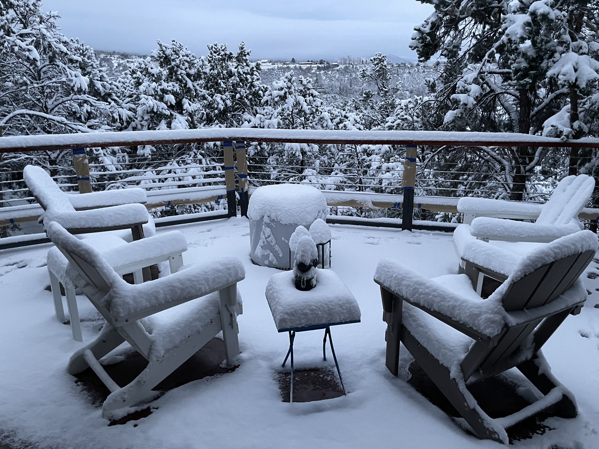
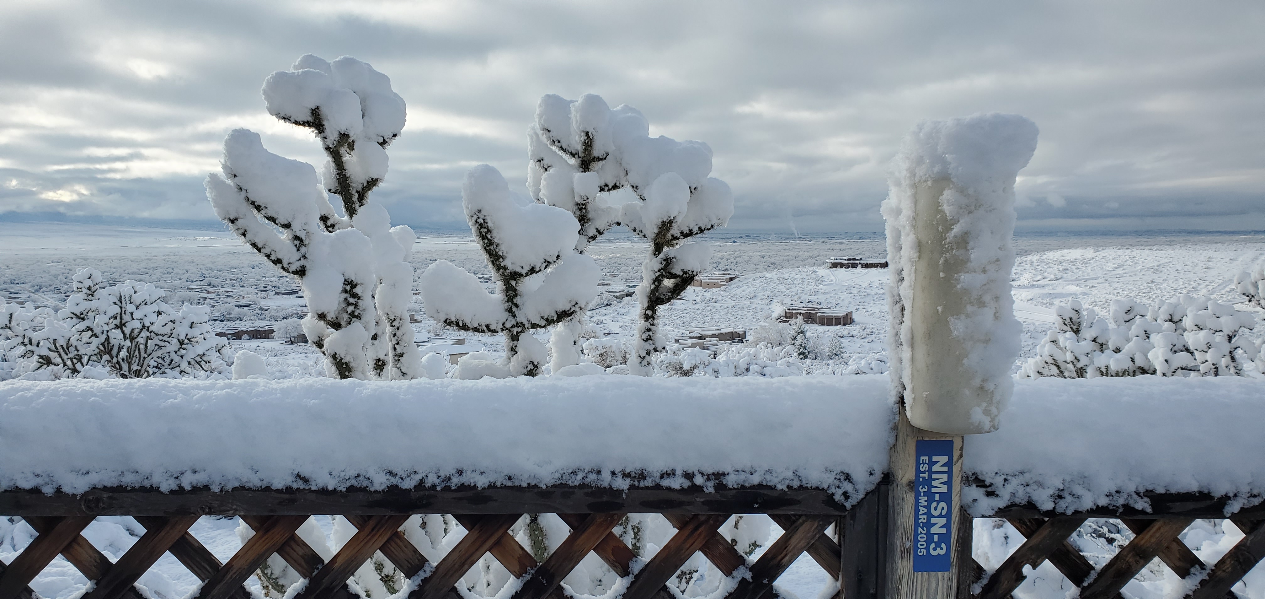
Pendaries, NM | January 27, 2022 |
| February 2022 | |
|
Albuquerque, NM Big-I | February 2, 2022 |
February 2022 was more active than January with several storm systems pushing through NM. A major snowstorm slammed the region from the 1st to the 3rd with much of the northern high terrain picking up 10 to 20" of snow. The combination of snow and bitterly cold temperatures moving into the Albuquerque metro area during rush hour resulted in massive traffic snarls with numerous accidents and extremely long commuting times. Wind chill temperatures in the wake of this storm fell to between -25 and -35° across much of eastern NM. High winds then spread across the state around the 15th with gusts of 60 to 75 mph over parts of central and eastern NM. Another snowstorm impacted parts of the area at the end of February with amounts in the 5 to 10" range. Temperatures were below normal across the entire region. Precipitation was near normal within parts of northern and central NM and below normal elsewhere. |
|
March 2022 quickly transitioned from winter to spring with only a couple winter weather events early in the month followed by widespread strong winds for the second half. Heavy snow impacted the northern mountains on the 10th and 11th with another 10 to 20" in many areas. A large avalanche occurred around Taos Ski Valley. High winds across eastern NM on the 22nd and again on the 29th produced wind gusts of 50 to 60 mph are significant blowing dust. Temperatures were below normal once again for a second month across the entire area. Precipitation was near to above normal along the central mountain chain and below normal across the east and west. Drought conditions started to deteriorate across the east in this pattern by the end of March. |
Rio Rancho, NM | March 23, 2022 |
|
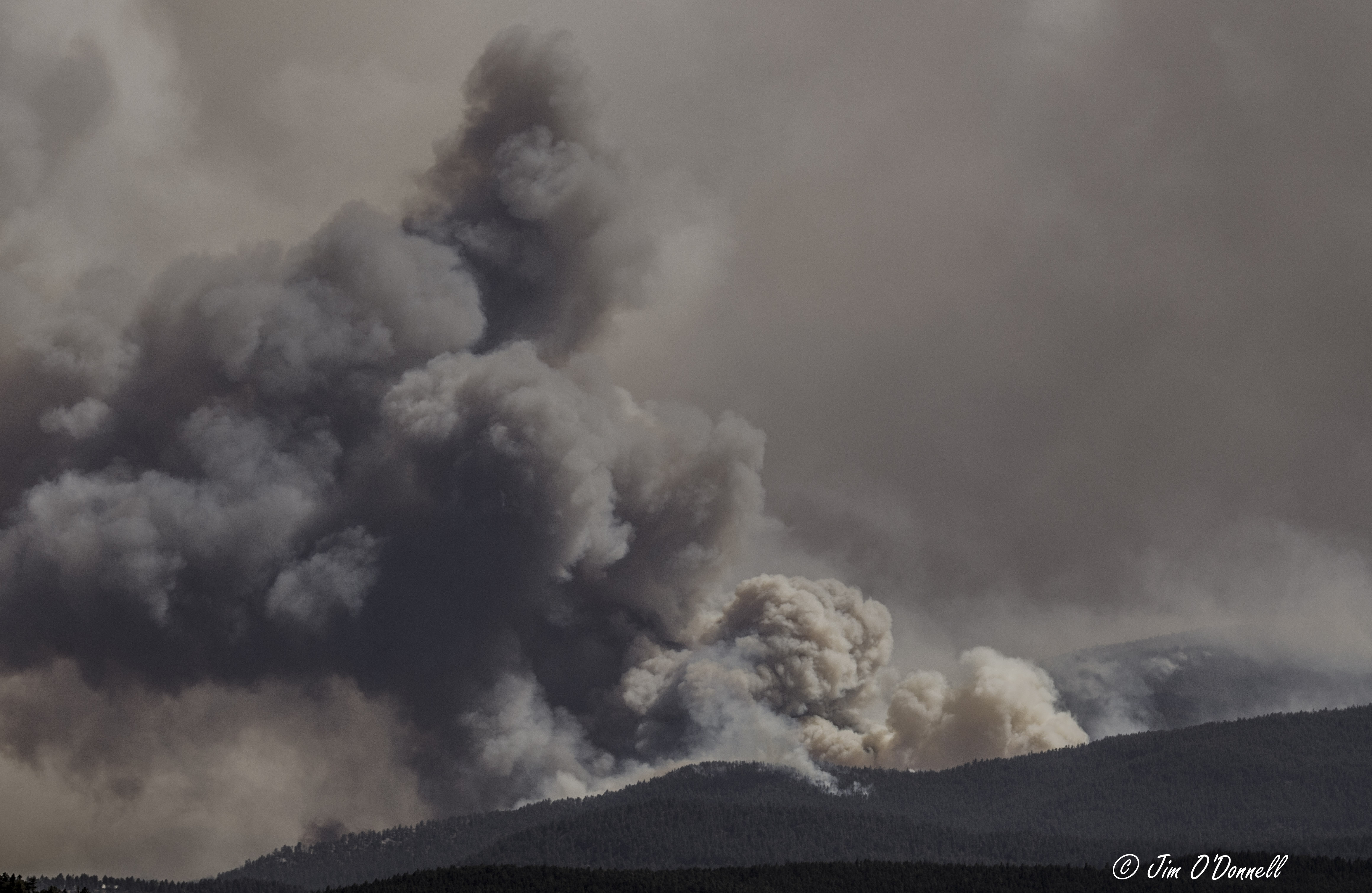
Hermits Peak - Calf Canyon Fire | April 29, 2022 |
April 2022 was the beginning of a tragic spring for NM as exceptionally dry conditions combined with above normal temperatures and frequent bouts of high winds. Wind gusts of 50 to 70 mph were reported on several days during the month, including the 5th, 10th, 12th, 13th, 15th, 19th, 20th, 22nd, and 29th. Significant blowing dust accompanied several of these windstorms. Numerous wildfires erupted across the state, including the Big Hole Fire near Belen, the McBride and Nogal Canyon fires near Ruidoso, the Cooks Peak Fire near Cimarron, the Cerro Pelado Fire near Jemez Springs, and the historic Hermits Peak - Calf Canyon Fire in the Sangre de Cristo Mountains. Thick wildfire smoke across the area deteriorated air quality for extensive stretch of the spring. Only two hail reports were received for the entire month with one thunderstorm wind gust to 60 mph. Drought conditions expanded dramatically across NM as most areas recorded zero precipitation for the entire month. |
|
May 2022 followed on the heels of April with exceptionally dry conditions and above normal temperatures. High winds continued to fan wildfires across the state with gusts of 55 to 65 mph common on several days, including the 2nd, 7th, 8th, 9th, 10th, 11th, 20th, 28th, 29th, and 30th. The Cerro Pelado Fire grew to around 45,000 acres, the Cooks Peak Fire near 60,000 acres, and a new state record was established with the Hermits Peak - Calf Canyon Fire growing to a devastating 315,000+ acres. A brief period of severe weather impacted eastern NM on the 23rd and 24th with mostly penny to quarter size hail. Extreme to exceptional drought conditions spread to nearly 50% of the state while the rest of the state was in moderate to severe drought. |
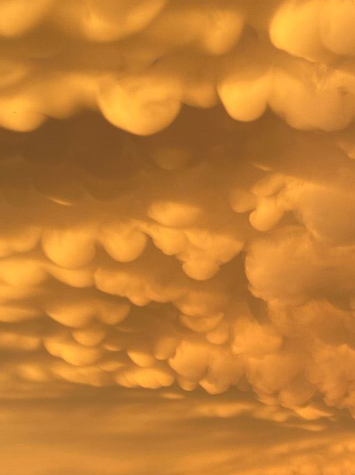
Mammatus Clouds - Portales, NM | May 10, 2022 |
|
Flash Flood Damage - Roswell, NM | June 26, 2022 |
June 2022 started out very dry with above normal temperatures just like April and May. Winds began to settle down over the region as temperatures soared into the 90s and 100s. The Hermits Peak - Calf Canyon Fire grew to an unprecedented 341,000+ acres. Roswell reported a scorching high temperature of 111° on the 11th and Tucumcari reached 112°. Severe weather was more common in June with numerous reports of large hail and damaging winds across eastern NM on the 2nd, 3rd, 7th, 8th, 12th, 13th, and 16th. A tornado was even spotted in rural eastern Mora County on the 7th. Drought conditions in early June expanded across the region with almost 50% of the state in the worst category of exceptional drought. Dramatic changes began around the 16th as a major tap of moisture surged northward into the state. Widespread rainfall amounts of 2 to 4" occurred within central and eastern NM with locally up to 6" in the Sacramento Mountains. The exceptionally early start to the monsoon season wreaked havoc on recent wildfire burn scars with flash flooding forcing ash, mud, rocks, and debris down scorched hill sides of the Hermits Peak - Calf Canyon Fire. Many areas saw early season flash flooding, including Dixon, Los Lunas, San Fidel, Cubero, and Roswell. |
|
July 2022 was very active with daily rounds of showers and thunderstorms producing locally heavy rainfall. Precipitation was near to above normal across the northern and western high terrain. Temperatures were above normal statewide. Flash flooding impacted wildfire burn scars almost every day with significant impacts to roads and drainages, especially on the Hermits Peak - Calf Canyon and McBride burn scars. A flash flood on the 21st near Gallinas claimed several lives as flood waters washed away a residence. A few strong thunderstorms also impacted the region with small hail and wind gusts of 50 to 60 mph. Drought conditions improved through the month with many areas pulling out of extreme drought within central and western NM. Heavy rainfall across the region also helped with containment efforts on wildfires. |
Gallinas Creek (above Las Vegas) | July 29, 2022 |
|
Pecos River (above Roswell) | August 21, 2022 |
August 2022 remained very active with showers and thunderstorms producing locally heavy rainfall every day. Significant flash flooding impacted several communities, especially over the Hermits Peak - Calf Canyon and McBride burn scars. Temperatures were actually below normal in many locations with well above normal precipitation across the southern and eastern portions of the state. Drought conditions continued to improve through August with a few areas across northern and western NM finally seeing removal of drought for the first time in nearly 10 months. |
|
September 2022 was quieter as the coverage of showers and thunderstorms decreased. A couple flash flood events impacted the McBride burn scar near Ruidoso with mostly minor flooding reports elsewhere across the state. The heaviest rainfall occurred along the Continental Divide where around 1 to 3" fell during the month. A couple strong thunderstorms also occurred with some localized strong winds. A landspout tornado was even reported near Crownpoint on the 22nd. Temperatures were above normal or the month, especially across northern NM. Drought conditions improved mainly across northern and western NM while severe to extreme drought persisted across eastern NM. |
Ruidoso, NM | September 12, 2022 |
|
Albuquerque Bosque Trail | October 27, 2022 |
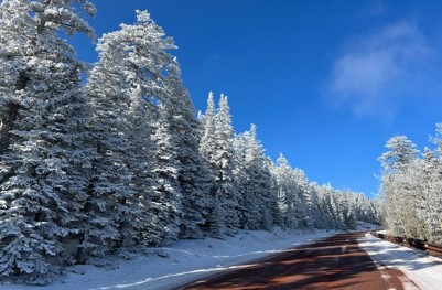
October 2022 was very active once again with a wide variety of weather impacting the region. Funnel clouds were spotted early in the month near Edgewood, Belen, and Navajo. A couple long duration rainfall events occurred during the second half of the month with many areas reporting record rainfall totals. Several locations saw monthly totals in excess of 4" with locally higher amounts over 6" in the southern and central high terrain. A high wind event impacted the state on the 23rd with gusts of 50 to 60 mph. The first bouts with winter weather moved across the area on the 24th and the 28th when parts of northern and western NM picked up a couple inches of snow. Weather conditions over the summer and fall seasons produced gorgeous fall foliage across NM. Several folks noted brilliant displays from several different tree species.
|
|
November 2022 was mostly dry and cold. Much of the state was between 3 and 5° below normal. There were several high wind events during the month with widespread gusts of 50 to 60 mph on several days. The strongest winds impacted high terrain areas where gusts of 70+ mph were reported on a couple days. Snow fell over parts of northern NM on the 13th-14th. The most significant winter storm of the season impacted the region over the Thanksgiving holiday with rain, snow, and strong winds. Some locations across southeast NM picked up between 2 and 8" of snow. |
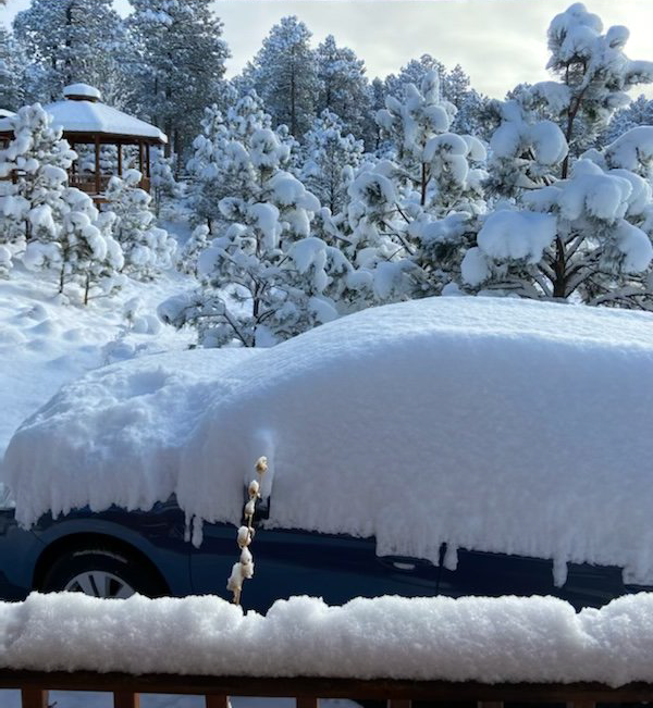
Glorieta, NM | November 4, 2022 |
|
|
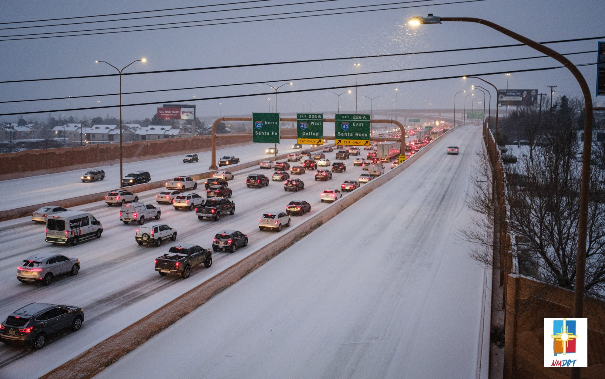
December 2022 started out warmer than normal with a period of soaking rainfall across southern and central parts of NM. A storm system around the middle of December finally brought some more snow to the high terrain with more strong winds across eastern NM. An arctic airmass spilled into the region before Christmas with extremely cold wind chills, especially across eastern NM. A typically active weather pattern returned between Christmas and New Year's with mountain snow, valley rain, and more strong winds. |
| (Return to the main page) |


.jpg)
.png)
.jpg)
.jpeg)