NWS All NOAA
Salt Lake City, UT
Weather Forecast Office
Last Map Update: Mon, Aug 3, 2026 at 3:08:40 am MDT


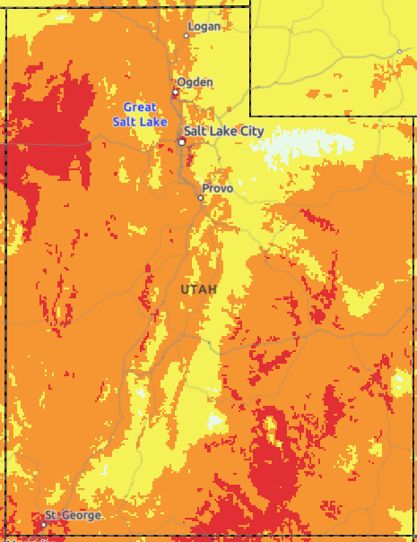 HeatRisk
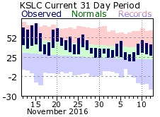 Monthly Climate Data