Severe thunderstorms will be possible from the central Plains to the Mid-Atlantic and Northeast on Monday. Hazardous heat will linger across the southern U.S. and build across the West through mid-week. Hot and dry conditions will fuel fire weather concerns for Interior Alaska and the Four Corners region through Monday. Read More >
| Manhattan Tornado | Chapman Tornado | Soldier Tornado | June 11th Homepage |
The night of June 11th, 2008, two long lived supercell thunderstorms produced tornadoes across Northeast Kansas. The communities of Chapman, Manhattan, and Soldier were hit hardest by the tornadoes, with extensive damage occuring along the paths of the storms as they made their way across the area. The links above will lead to pages about each specific city and the damage along the tornadoes path for that area. Below are a few other items that summarize the event across the area:
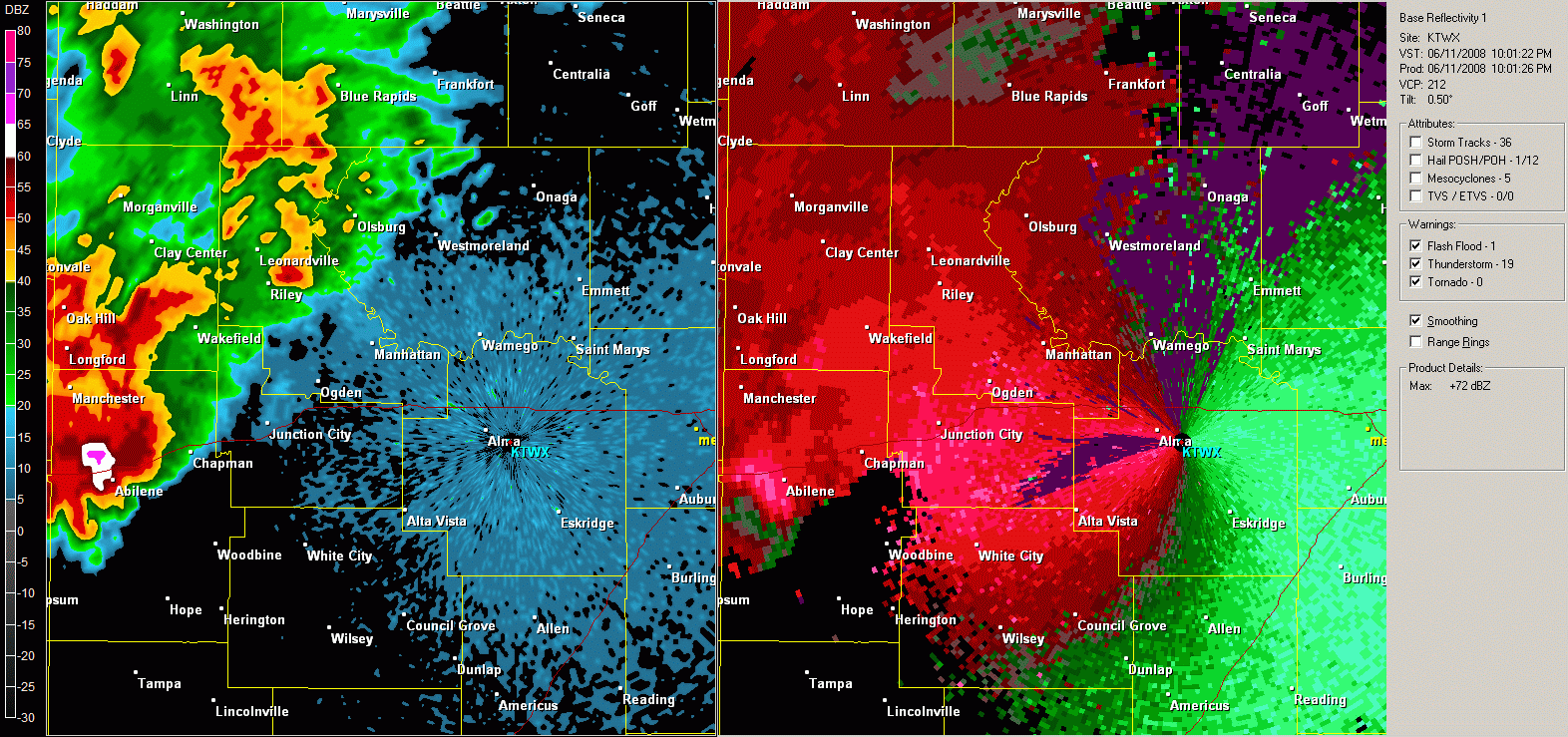
Below is a split radar image, depicting both radar reflectivity (left) and velocity (right). On the velocity product, green indicates motion towards the radar, while the reds indicate motion away from the radar. Look for the tight 'couplet' of red and green that develops just west of Chapman, then moves northeast through Manhattan. The storm reorganizes, and the couplet redevelops in Pottawatomie county and moves northeast until dissipating near Wetmore. Look for the hook feature in the reflectivity associated with the couplet. Also notice the burst of white after the storm moves through Chapman - likely due to debris in the storm after the tornado hit the city.