
Excessive rainfall continues to produce life-threatening, locally catastrophic flash flooding along the central Gulf Coast. Isolated to scattered dry thunderstorms may cause lightning-ignited fires and erratic behavior due to gusty winds across parts Oregon, California, and the Great Basin into the weekend. Read More >
Topeka, KS
Weather Forecast Office
| Manhattan Tornado | Chapman Tornado | Soldier Tornado | June 11th Homepage |
.jpg)
Below are a few damage photos taken by the survey team in Chapman.
(Click images for a larger view)
 |
 |
|
|
|
 |
 |
|
|
|
 |
 |
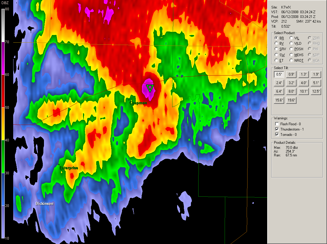
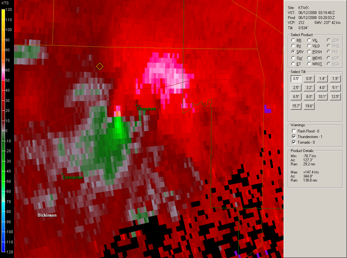
The following is a brief Doppler Radar review from KTWX (the Topeka NWS Radar) of the parent supercell thunderstorm that produced the Chapman tornado. The images on the left show the reflectivity and Storm Relative Motion (SRM) before the tornado moved through Chapman, and the images on the right are the same radar images a couple of minutes after the tornado moved through Chapman. Note the high (purple) reflectivities in the 'hook' after the tornado moved through Chapman. This is debris that the radar was able to detect, a few thousand feet in the air.
 |
 |
 |
 |
Below is a picture taken by Scott Blair. The photo was taken from near I-70 at mile marker 290. The tornado is seen as a large stovepipe in the center of the image and was roughly 3 miles WSW of his location.

US Dept of Commerce
National Oceanic and Atmospheric Administration
National Weather Service
Topeka, KS
1116 NE Strait Avenue
Topeka, KS 66616-1667
785-234-2592
Comments? Questions? Please Contact Us.

