
A frontal boundary extending from the western High Plains to the Southeast will focus additional showers and thunderstorms this weekend. Some of these storms may become severe, alongside frequent lightning, and isolated instances of flash flooding. Meanwhile dry conditions will continue for the Great Basin where fire weather concerns linger. For the mid-Atlantic and Northeast, seasonable weather. Read More >
NWS Topeka Fire Weather Information
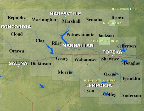
Click on the Map Below for a Fire Weather Planning Forecast by County
If the below links do not work, please access our backup page.
Products We Issue:
Observations and Data:
Other Helpful Links:
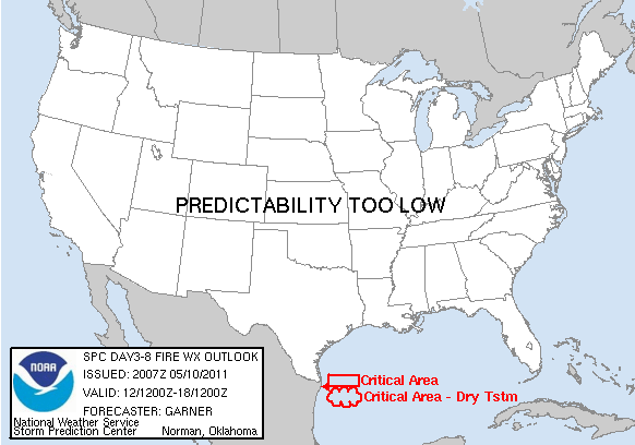
| SPC Fire Outlook Today | SPC Fire Outlook Tomorrow | SPC Fire Outlook Day 3-8 |
 |
 |
 |
| 1 Hour Fuel | 10 Hour Fuels | 100 Hour Fuels |
 |
 |
 |
| Drought Monitor | Palmer Index | Drought Outlook |
 |
 |
 |

