
A dangerous, record heat wave continues across portions of the West through Tuesday. High rip current risk and dangerous surf continue through the weekend. There are flash flooding concerns through the weekend for portions of the Southeast and Southwest. Read More >
A tornado outbreak occurred during the afternoon and evening hours of the May 20, 2013, and was the last day of a three-day stretch of significant severe weather from May 18-20, 2013. This event also produced the most deadly and devastating tornado of the year for Oklahoma and the the United States.
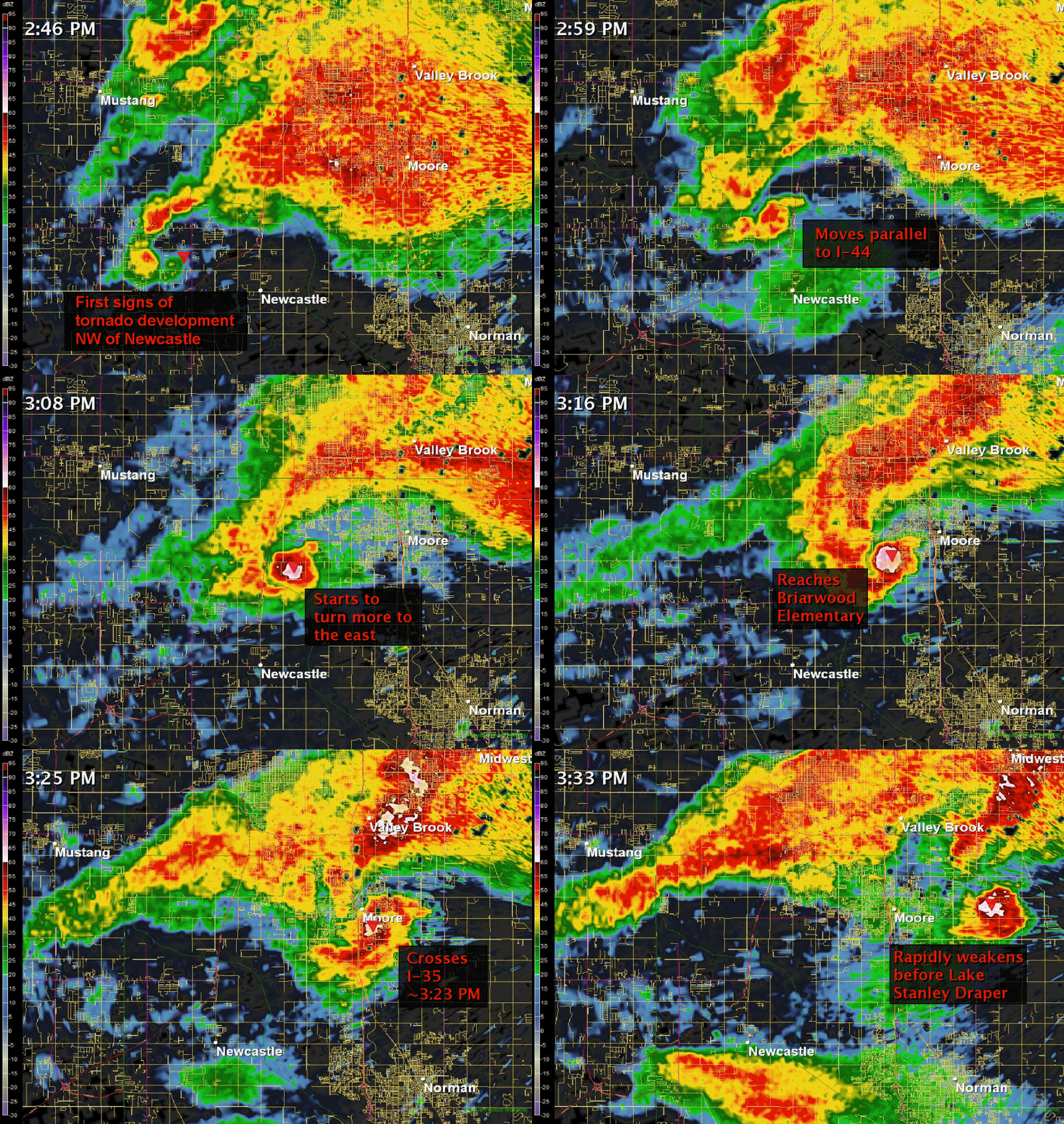
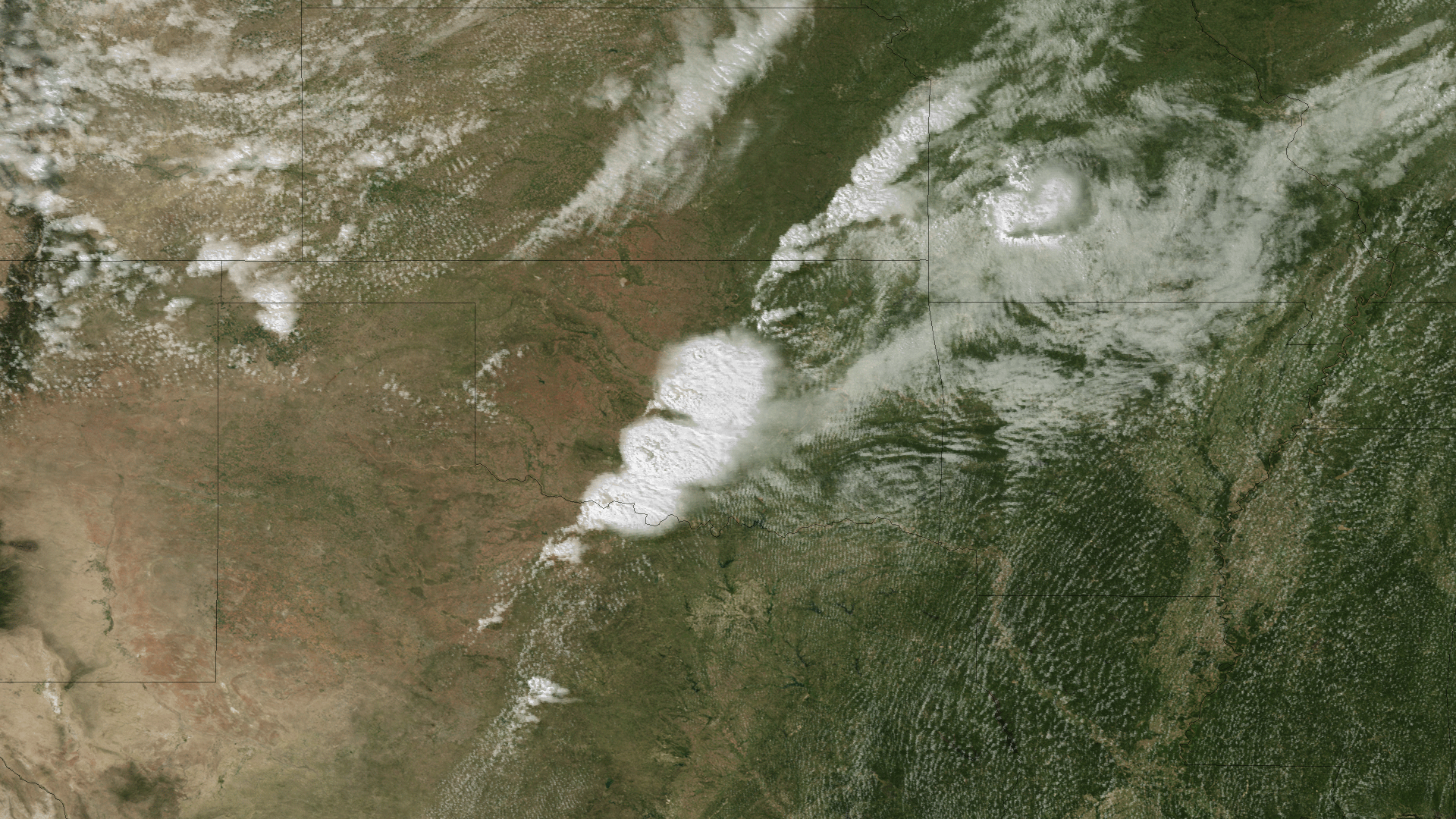
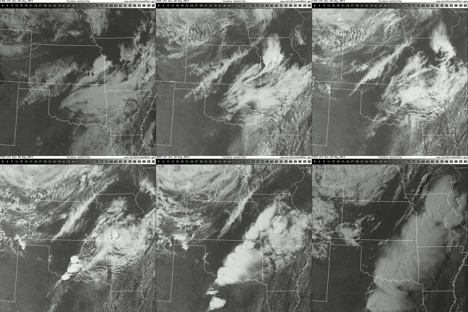
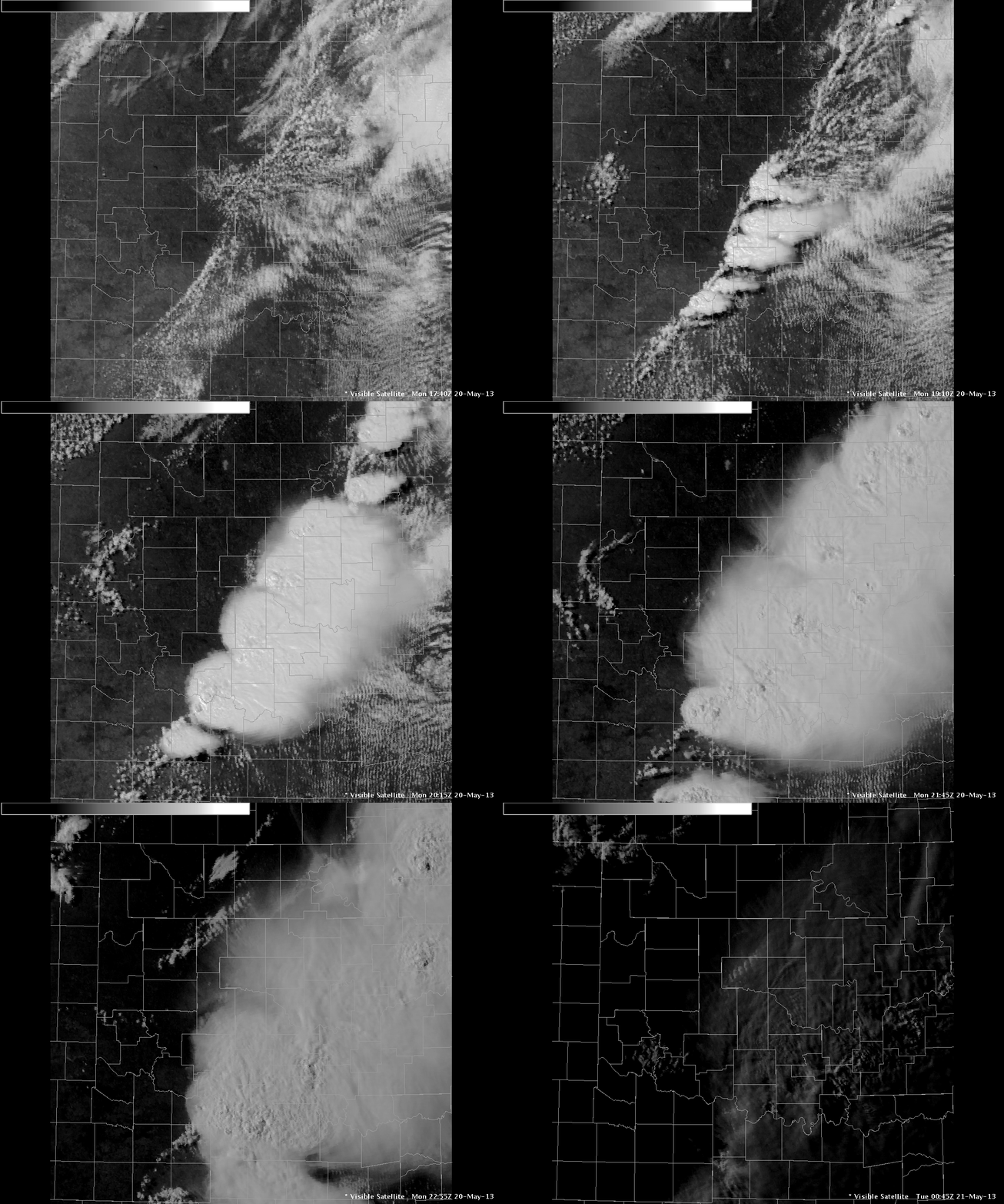
Several supercell thunderstorms developed during early afternoon of May 20th along a dryline in central Oklahoma. One of these storms developed near Chickasha and rapidly intensified, producing a tornado which touched down at 2:56 PM CDT on the west side of Newcastle. The tornado became violent within minutes, then tracked east-northeastward across the city of Moore and parts of south Oklahoma City for about 40 minutes before finally dissipating near Lake Stanley Draper. The tornado caused catastrophic damage in these areas, and was given a maximum rating of EF-5. The tornado claimed 24 lives, injured scores of people, and caused billions of dollars in damage.
Several other tornadoes also occurred in Stephens and Lincoln Counties during the afternoon of May 20. In addition to the tornadoes, large hail and damaging winds caused damage in many areas.
 |
|
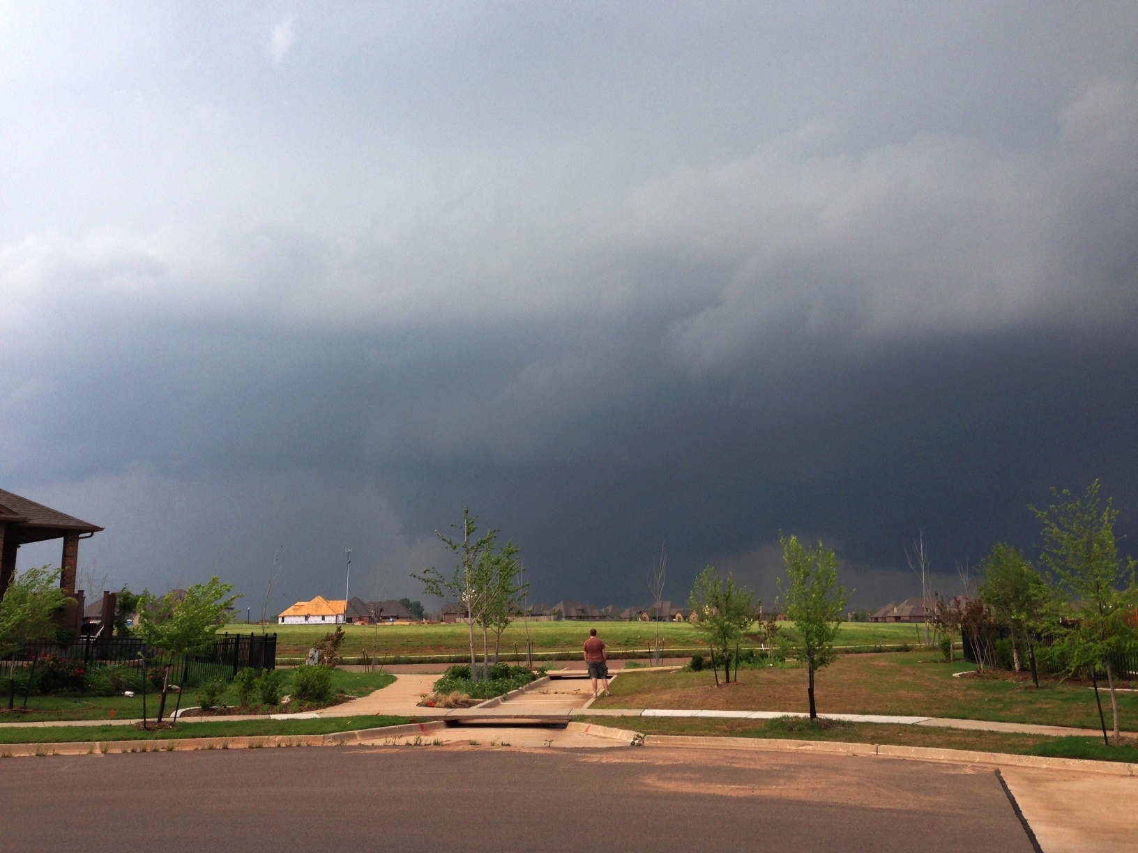
| This photo was taken around 3:00 pm CDT on May 20, 2013 from Carrington Lane in the Carrington Place addition in northwest Norman, which is located between 36th Ave NW and 48th Ave NW, and south of Franklin Road. The view is looking northwest towards the corner of Franklin Road and 48th Ave NW. This photo was provided courtesy of Jenny Hamar. |
| Year | Total |
| 2019 | 25 |
| 2013 | 15 |
| 1977 | 14 |
| 2001 | 12 |
| 1957 | 11 |
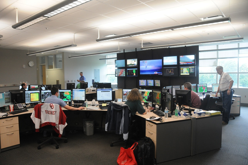
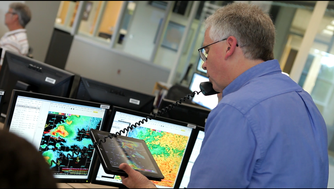
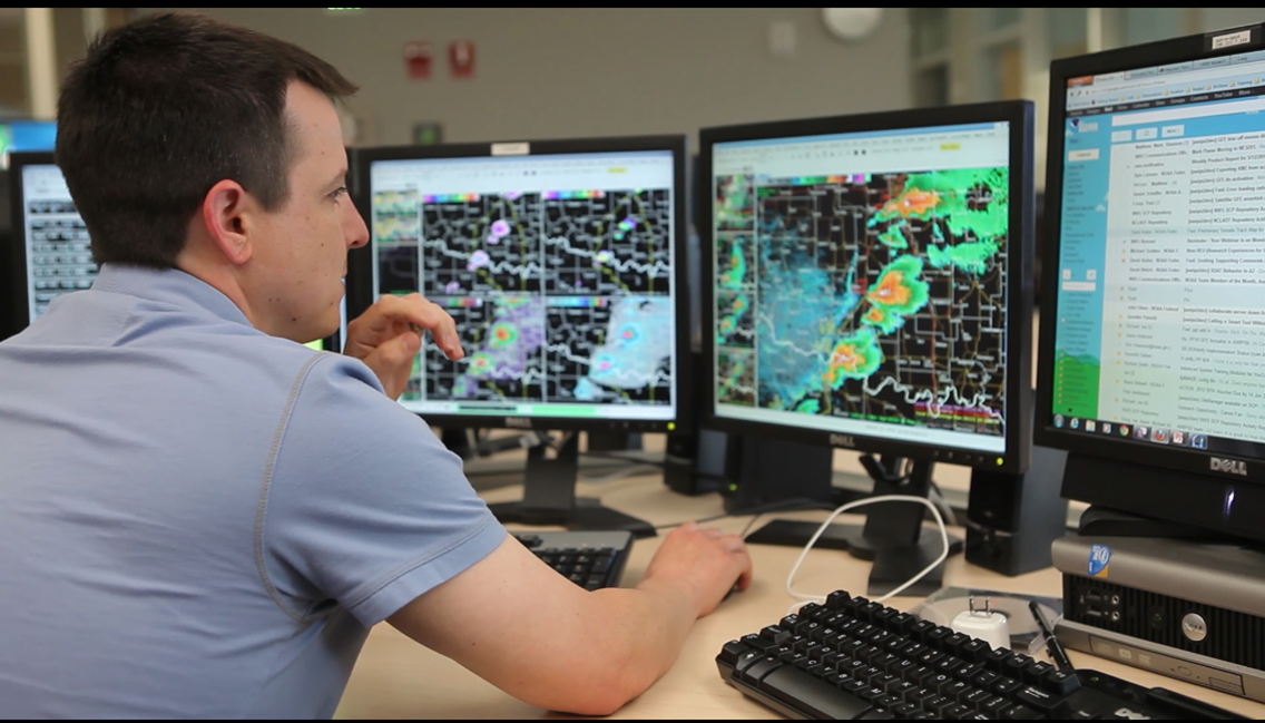
Immediately after the Moore EF-5 event, the city of Moore and Cleveland county emergency management officials quickly set up an Incident Command (IC) Post in the parking lot of the Warren Theater. The NWS office was in immediate contact with the Moore IC using the 800 mHZ radio providing continuious weather updates and forecasts. The following day (Tuesday May 21st), the NWS office provided a forecaster on site at the Moore IC, which was then moved to the Fire Station on SW 19th. The Moore IC was staffed with a NWS meteorologist from Tuesday - Saturday, providing on site weather support to the Incident Commanders and First Responders. The following meteorolgists took turns serving the IC, Lead Forecaster Scott Curl, General Forecaster Bruce Thoren, and Lead Forecaster Michael Scotten. These meteorologists were the liaison between the meteorologists at the forecast office and the IC. They staffed the IC for 12 hour shifts from 7am to 7pm. Here are some of the photos they collected during there time at the Command Post.
Checkout the Incident Command Structure here, courtesy of FEMA.
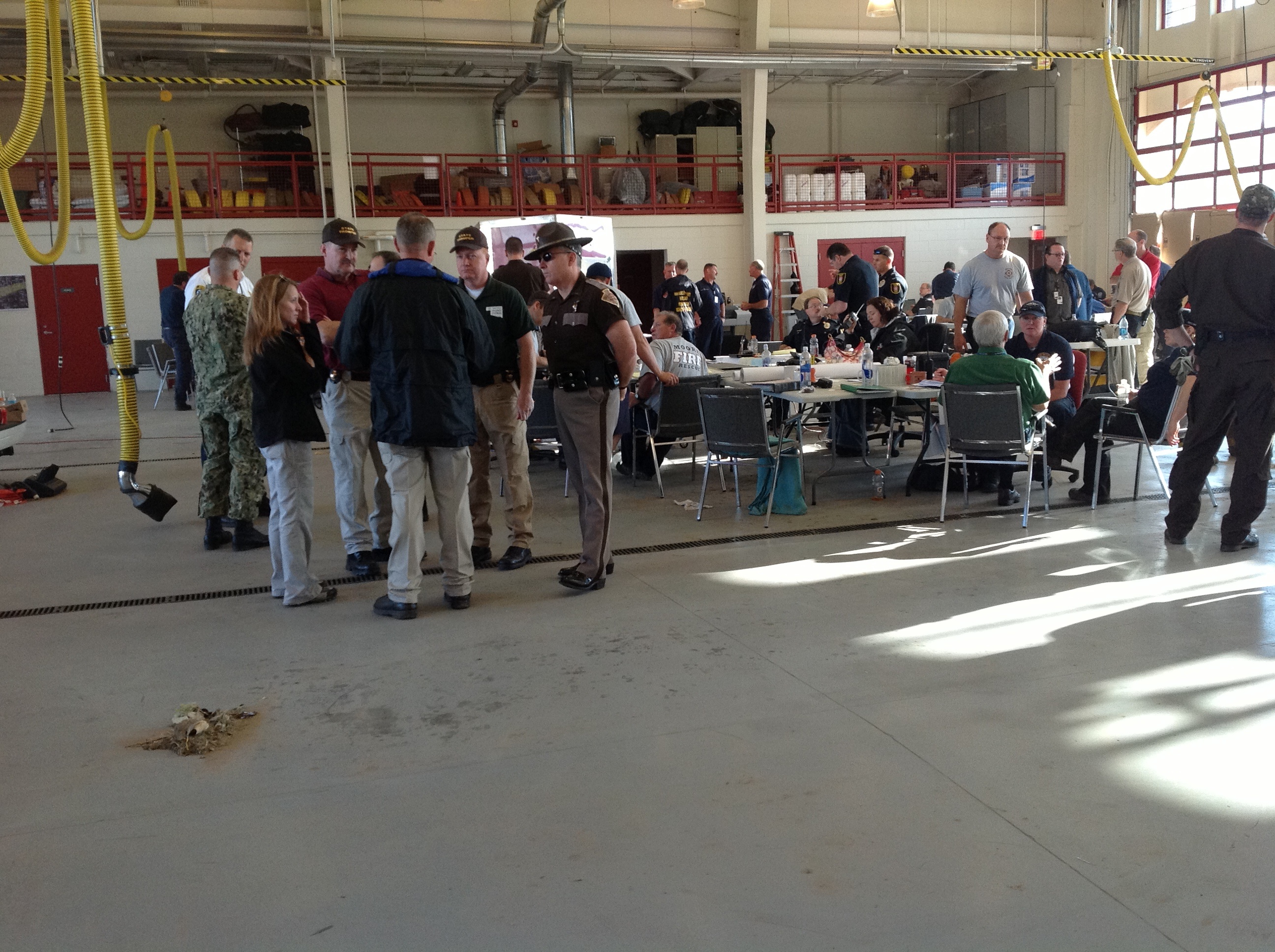

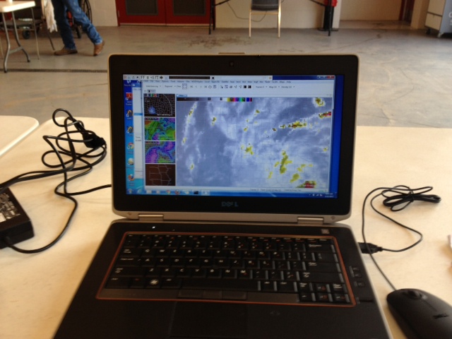
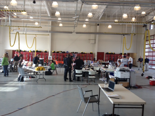
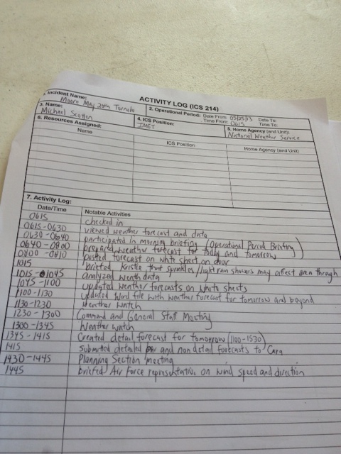
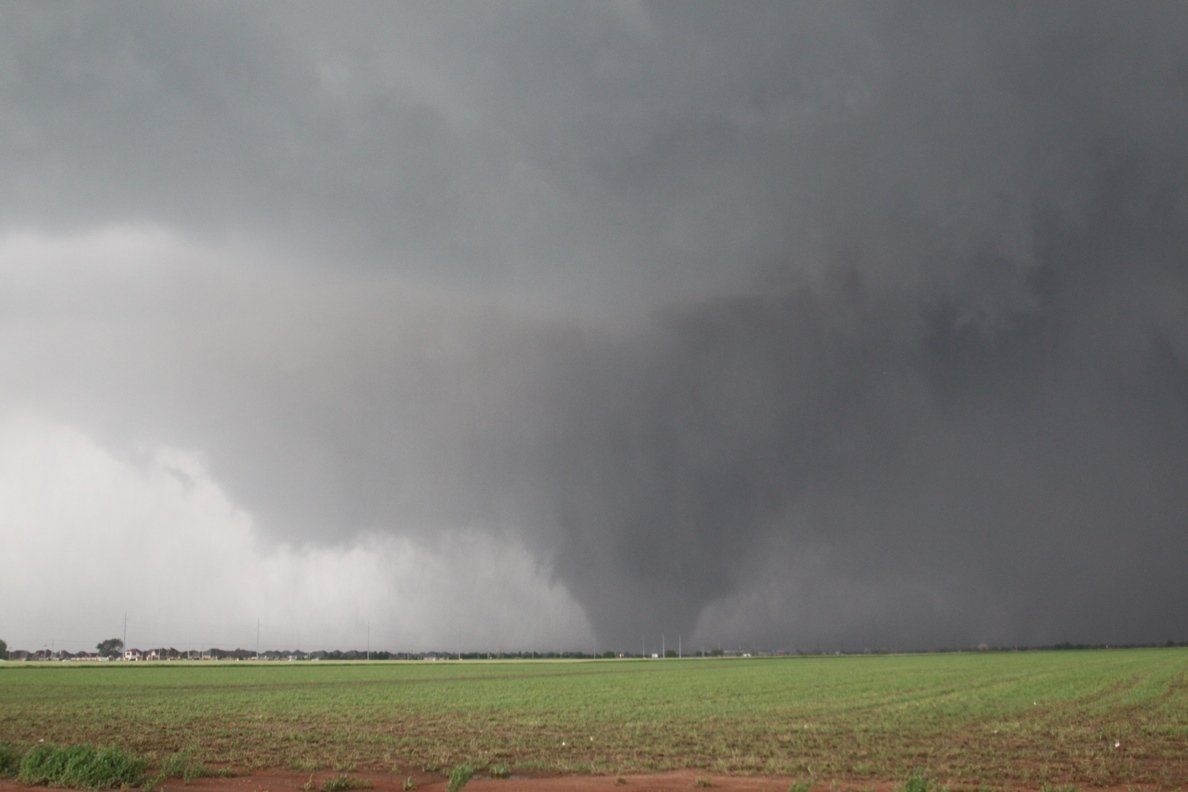
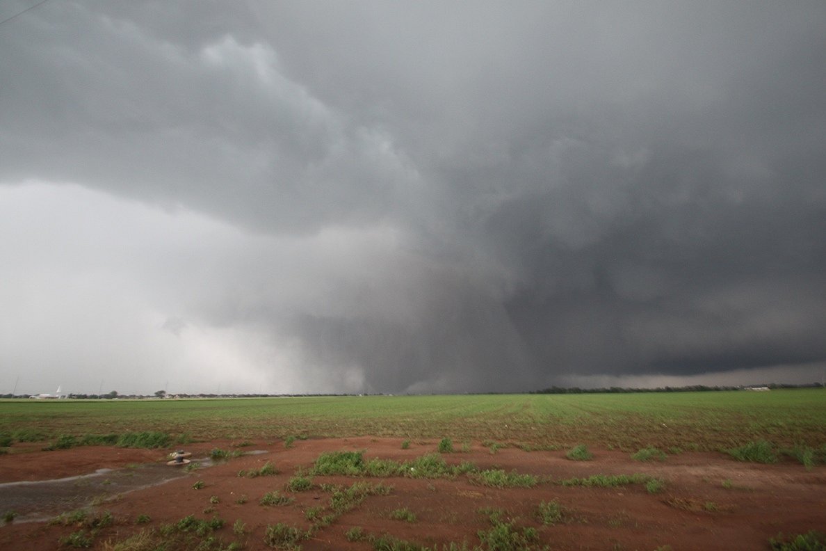
Photo of the May 20, 2013 Newcastle-South OKC-Moore EF-5 Tornado was provided courtesy of Gabe Garfield.
Below are images with the preliminary damage path of the Newcastle-South OKC-Moore EF-5 Tornado. Contours delineate the extent of EF-0 (light blue), EF-1 (green), EF-2 (yellow), EF-3 (orange), and EF-4 (red), and EF-5 (magenta) damage from the survey.
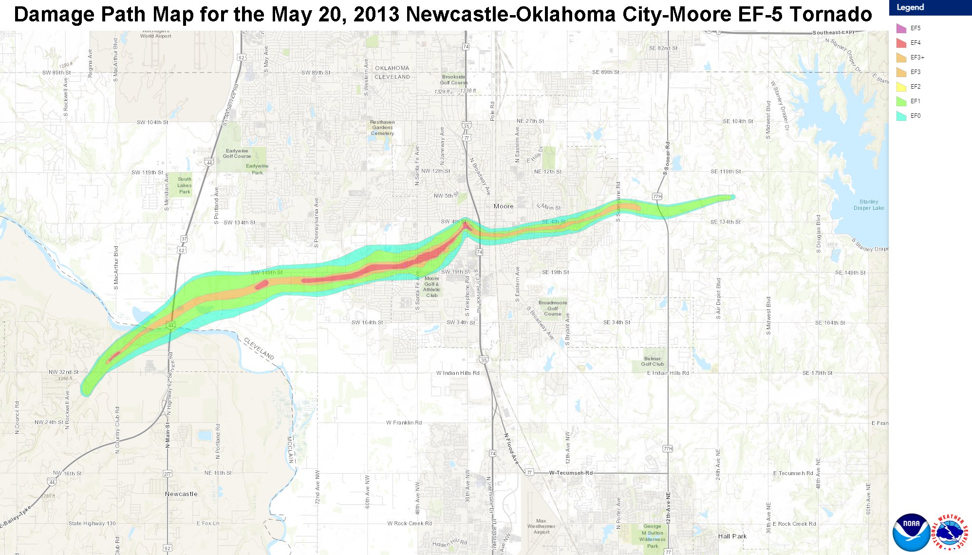
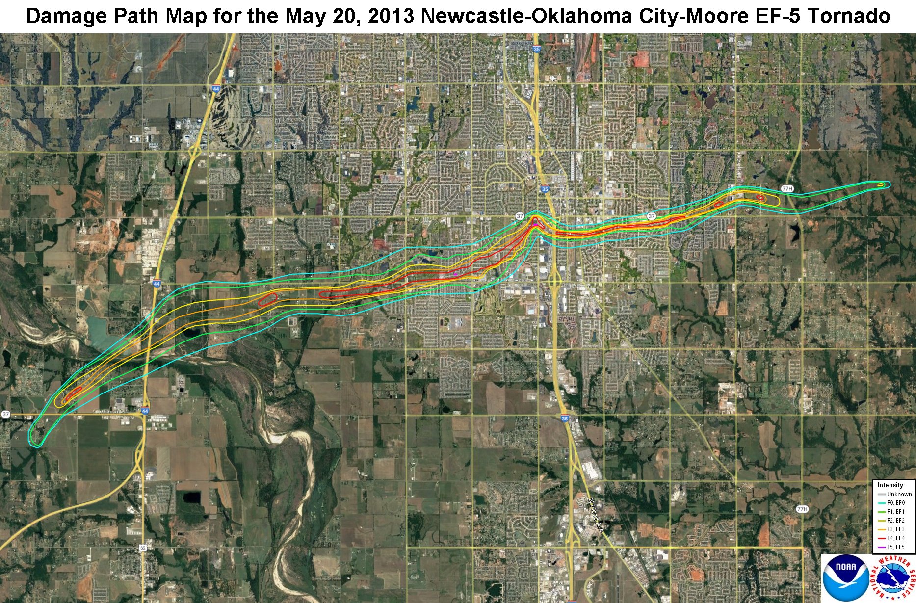
A tornado outbreak occurred during the afternoon and evening hours of the May 20, 2013. Several tornadoes occurred from central Oklahoma down through south central Oklahoma near the Red River. The strongest tornado touched down near Newcastle and traveled through Moore and south Oklahoma City. This tornado caused catastrophic damage in these areas, with a maximum rating of EF-5. The tornado claimed 24 lives and caused billions of dollars in damage. In addition to the tornadoes, large hail and damaging winds cause damage in many areas.
The violent Newcastle-South OKC-Moore tornado was first observed at 1:56 PM CST (2:56 PM CDT) developing about one-half mile south of Oklahoma State Highway 37 in northwest Newcastle to the east of Rockwell Avenue. EF-4 damage was observed soon after the tornado crossed State Highway 37. The tornado continued to expand in size as it approached the Canadian River and moved into Cleveland County.
The tornado then moved into Cleveland County at 2:04 PM CST from McClain County as it moved northeast across the Canadian River near U.S. Interstate Highway 44. The tornado then turned more east and then east-northeast after crossing I-44. Violent EF-4 damage was again observed as it began to move into progressively higher density residential areas approaching May Avenue.
The center of the large tornado path passed near SW 149th Street and Western Avenue. After crossing Western Avenue, numerous buildings were destroyed and horses killed at Orr Family Farm. Two storage tanks estimated to weigh approximately 10 tons were lifted from Orr Family Farm and landed about one-half mile east.
Moving east, the tornado destroyed much of Briarwood Elementary School, where the NWS storm survey team rated damage as EF-5. Despite the destruction of this elementary school during school hours, no fatalities occurred at the school. As the tornado continued to move east and east-northeast, it moved through much more densely populated suburban neighborhoods of southwest Oklahoma City and Moore where violent destruction was widespread.
The width of EF-4 and greater damage was up to 250 yards wide as the tornado moved through neighborhoods east of Western Avenue. The first two fatalities occurred in a house in the neighborhood just east of Briarwood Elementary, with another fatality in a house as the tornado approached Santa Fe Avenue.
After crossing Santa Fe Avenue, the tornado moved through more suburban neighborhoods and toward Plaza Towers Elementary School. Damage to the school was extensive and seven children were killed when a wall collapsed at the school. Nine other people were killed in eight different neighborhood homes within one-quarter mile of Plaza Towers Elementary, most occurring just south of the school.
The tornado turned northeast as it approached Telephone Road, made a loop near the intersection of Telephone Road and 4th Street, then moved southeast crossing the interstate. Three people were killed when a convenience store along Telephone Road was destroyed. Crossing Telephone Road, the tornado inflicted significant damage to the Moore Medical Center, a post office and numerous businesses along Telephone Road and U.S. Interstate Highway 35.
Although the tornado was more narrow after crossing I-35, it continued to produce EF-4 damage in neighborhoods east of the interstate as it curved east and then again east-northeast. One fatality occurred at a business just east of the interstate, and one final fatality occurred in a home between Eastern Avenue and Bryant Avenue. Consistent EF-4 damage continued until the tornado passed SE 4th Street just east of Bryant Avenue.
Moving east from Bryant Avenue, the tornado continued to produce EF-2 damage with isolated EF-4 damage noted. The density of housing also decreased east of Bryant as the tornado moved east and east-northeast before dissipating at 2:35 PM CST east of Air Depot Blvd. between SE 119th Street and SE 134th Street in southeast Oklahoma City. Overall, over 300 homes experienced EF-4/EF-5 damage along the tornado path.


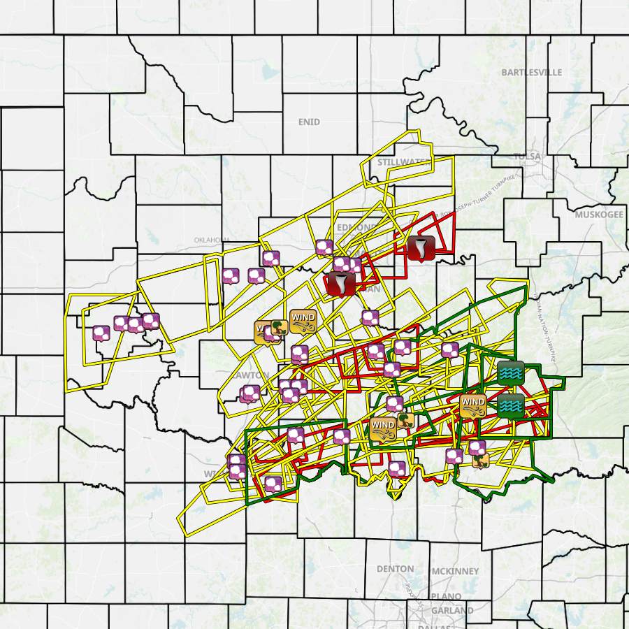
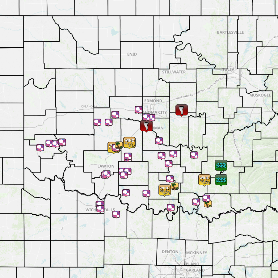
Surveys conducted by crews in the NWS Norman and NWS Tulsa forecast areas revealed that 15 tornadoes occurred during the afternoon and evening of May 20, 2013. A total of 5 tornadoes occurred in the NWS Norman forecast area in McClain, Cleveland, Lincoln, Stephens, and Coal Counties in central and southern Oklahoma. A total of 10 tornadoes occurred in the NWS Tulsa forecast area in Osage, Washington, Rogers, Ottawa, Adair, and Le Flore Counties in eastern Oklahoma.
| # | Date | Time (CST) |
Path Length (miles) |
Path Width (yards) |
F-Scale | Killed | Injured | County | Path |
|---|---|---|---|---|---|---|---|---|---|
| 1 | 05/20/2013 | 1356-1435 | 14 | 1900 | EF5 | 24 | 212 | McClain/ Cleveland | Newcastle (3 NW US-277/SH-130) - 3 WNW Stanley Draper Lake Dam |
| 2 | 05/20/2013 | 1358-1401 | 1 | 30 | EF0 | 0 | 0 | Stephens | 7 SSE Marlow |
| 3 | 05/20/2013 | 1407-1422 | 4 | 200 | EF1 | 0 | 0 | Stephens | 4 SSE Marlow - 4 W Bray |
| 4 | 05/20/2013 | 1451-1505 | 6.5 | 500 | EF1 | 0 | 0 | Osage/ Washington | 4.5 S Avant - 5.3 W Vera |
| 5 | 05/20/2013 | 1521-1530 | 4.5 | 400 | EF1 | 0 | 0 | Washington | 3 SSE - 5 E Ramona |
| 6 | 05/20/2013 | 1533-1547 | 6 | 500 | EF1 | 0 | 0 | Washington/ Rogers | 5.6 ENE Ramona - 3.9 NNW Talala |
| 7 | 05/20/2013 | 1540-1542 | 1.2 | 100 | EF0 | 0 | 0 | Lincoln | 6 NE Meeker - 3.1 SSE Sparks |
| 8 | 05/20/2013 | 1725-1740 | 10 | 800 | EF2 | 0 | 0 | Ottawa | 3.6 SW Ottawa - 3.9 ENE Wyandotte |
| 9 | 05/20/2013 | 1732-1743 | 9 | 600 | EF1 | 0 | 0 | Ottawa/ Newton MO | 2.4 WNW Wyandotte - 1 SSW Seneca MO |
| 10 | 05/20/2013 | 1732-1734 | 2 | 150 | EF1 | 0 | 0 | Adair | 2 SE Proctor - 1.9 WNW Christie |
| 11 | 05/20/2013 | 1735-1737 | 2.5 | 300 | EF1 | 0 | 0 | Adair | 1.7 WSW - 1.3 N Christie |
| 12 | 05/20/2013 | 1740-1747 | 8 | 500 | EF1 | 0 | 0 | Adair/ Washington AR | 1.2 NE Addielee OK - 2.2 NNW Cincinnati AR |
| 13 | 05/20/2013 | 1749-1757 | 6 | 250 | EF1 | 0 | 0 | Coal | 4 WSW - 2 E Lehigh |
| 14 | 05/20/2013 | 1933-1934 | 0.7 | 260 | EF0 | 0 | 0 | Le Flore | 2.1 S - 1.8 SSE Milton |
| 15 | 05/20/2013 | 1944-1955 | 8.5 | 500 | EF1 | 0 | 0 | Le Flore | 0.7 ENE Neff - 1.8 S Rock Island |
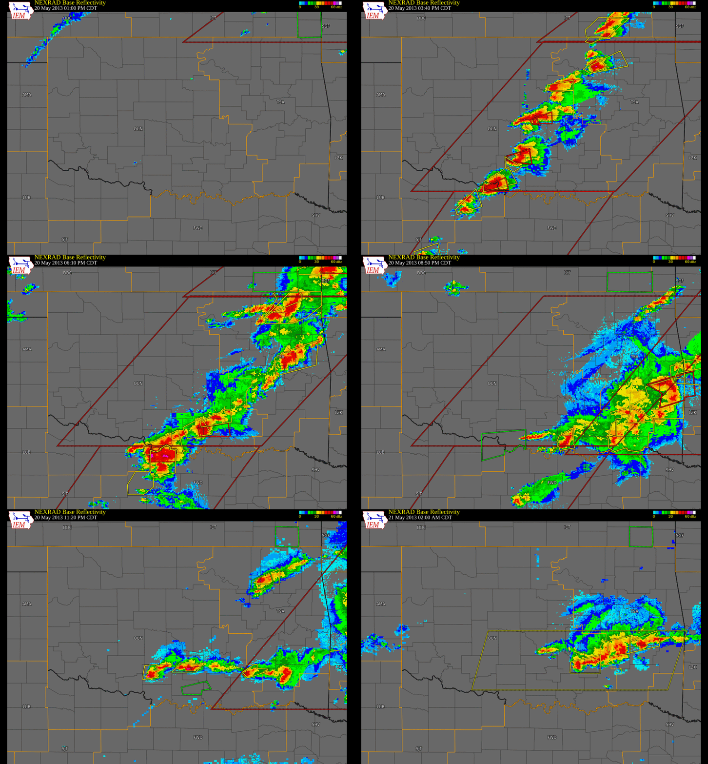
PRELIMINARY LOCAL STORM REPORT...CORRECTED
NATIONAL WEATHER SERVICE NORMAN OK
858 PM CDT WED MAY 22 2013

..TIME...   ...EVENT...      ...CITY LOCATION...     ...LAT.LON...
..DATE...   ....MAG....      ..COUNTY LOCATION..ST.. ...SOURCE....
            ..REMARKS..

0154 PM     HAIL             6 N MARLOW              34.73N 97.96W
05/20/2013  E1.75 INCH       GRADY              OK   PUBLIC

0156 PM     HAIL             1 S RUSH SPRINGS        34.76N 97.96W
05/20/2013  E1.00 INCH       GRADY              OK   EMERGENCY MNGR

0202 PM     HAIL             6 W DUNCAN              34.52N 98.07W
05/20/2013  E1.00 INCH       STEPHENS           OK   AMATEUR RADIO

0215 PM     HAIL             1 W SHEPPARD AFB        33.98N 98.52W
05/20/2013  E1.25 INCH       WICHITA            TX   TRAINED SPOTTER

0220 PM     HAIL             SHEPPARD AFB            33.98N 98.50W
05/20/2013  E1.75 INCH       WICHITA            TX   TRAINED SPOTTER

0227 PM     HAIL             YUKON                   35.51N 97.75W
05/20/2013  E3.25 INCH       CANADIAN           OK   NEWSPAPER

0228 PM     HAIL             WILL ROGERS AIRPORT     35.39N 97.60W
05/20/2013  E1.00 INCH       OKLAHOMA           OK   NWS EMPLOYEE

0256 PM     TORNADO          NEWCASTLE               35.25N 97.60W
05/20/2013                   MCCLAIN            OK   BROADCAST MEDIA

            LIFTED AROUND 336 PM. ESTIMATED PATH LENGTH OF 20 MILES
            THRU NEWCASTLE, MOORE, AND SOUTH OKC. PRELIMINARY DAMAGE
            RATING OF AT LEAST EF4.

0306 PM     HAIL             3 NNW MOORE             35.38N 97.50W
05/20/2013  E2.50 INCH       OKLAHOMA           OK   TRAINED SPOTTER

0412 PM     HAIL             WILL ROGERS AIRPORT     35.39N 97.60W
05/20/2013  M2.00 INCH       OKLAHOMA           OK   OFFICIAL NWS OBS

0415 PM     HAIL             WAURIKA                 34.17N 98.00W
05/20/2013  E1.00 INCH       JEFFERSON          OK   PUBLIC

0430 PM     TORNADO          1 W MEEKER              35.50N 96.91W
05/20/2013                   LINCOLN            OK   BROADCAST MEDIA

            REPORTED BY KWTV

0436 PM     HAIL             WHITEBEAD               34.77N 97.30W
05/20/2013  E1.75 INCH       GARVIN             OK   AMATEUR RADIO

0440 PM     HAIL             WICHITA FALLS           33.91N 98.50W
05/20/2013  E1.75 INCH       WICHITA            TX   PUBLIC

0445 PM     HAIL             CORNISH                 34.16N 97.60W
05/20/2013  E2.50 INCH       JEFFERSON          OK   PUBLIC

0452 PM     HAIL             6 W STRATFORD           34.80N 97.07W
05/20/2013  E1.75 INCH       GARVIN             OK   PUBLIC

0453 PM     HAIL             WICHITA FALLS           33.91N 98.50W
05/20/2013  E1.75 INCH       WICHITA            TX   PUBLIC

            5 MILES WEST OF FISHER RD

0543 PM     HAIL             2 SSE TURNER FALLS      34.40N 97.14W
05/20/2013  E1.00 INCH       MURRAY             OK   EMERGENCY MNGR

0545 PM     TSTM WND DMG     GENE AUTRY              34.28N 97.04W
05/20/2013                   CARTER             OK   EMERGENCY MNGR

            EM REPORTS ROOF BLOWN OFF OF OLD GENE AUTRY GYM.

0630 PM     HAIL             HENRIETTA               33.82N 98.19W
05/20/2013  E1.00 INCH       CLAY               TX   AMATEUR RADIO

0639 PM     TSTM WND GST     2 WNW WAPANUCKA         34.38N 96.46W
05/20/2013  M80.00 MPH       JOHNSTON           OK   TRAINED SPOTTER

            SPOTTER REPORTED TREE BRANCHES DOWN IN AREA

0800 PM     TSTM WND DMG     1 W DURANT              33.99N 96.39W
05/20/2013                   BRYAN              OK   EMERGENCY MNGR

            EMERGENCY MANAGEMENT REPORTS TREES DOWN AND POWER LINE
            DOWN IN WESTERN DURANT.

0805 PM     TSTM WND GST     7 WNW ARDMORE           34.21N 97.24W
05/20/2013  M62.00 MPH       CARTER             OK   MESONET

0824 PM     HAIL             MARIETTA                33.93N 97.12W
05/20/2013  E1.00 INCH       LOVE               OK   EMERGENCY MNGR

0909 PM     HAIL             4 S LITTLE CITY         34.02N 96.62W
05/20/2013  E2.75 INCH       MARSHALL           OK   PUBLIC

0958 PM     HAIL             7 NNW DURANT            34.08N 96.42W
05/20/2013  E1.00 INCH       BRYAN              OK   EMERGENCY MNGR

            AT INTERSECTION OF SH-22 AND ALBERT PIKE ROAD

1025 PM     HAIL             GERONIMO                34.48N 98.38W
05/20/2013  E1.75 INCH       COMANCHE           OK   FIRE DEPT/RESCUE

1025 PM     HAIL             2 SW GERONIMO           34.46N 98.41W
05/20/2013  E1.25 INCH       COMANCHE           OK   TRAINED SPOTTER

1126 PM     HAIL             DUNCAN                  34.52N 97.97W
05/20/2013  E1.25 INCH       STEPHENS           OK   LAW ENFORCEMENT

            AT STEPHENS COUNTY FAIRGROUNDS

1127 PM     HAIL             WYNNEWOOD               34.64N 97.16W
05/20/2013  E1.00 INCH       GARVIN             OK   PUBLIC

            PUBLIC REPORTED HAIL COVERING GROUND...DIMES TO QUARTERS.


1134 PM     HAIL             EMPIRE CITY             34.46N 98.04W
05/20/2013  E1.75 INCH       STEPHENS           OK   BROADCAST MEDIA

            FROM KSWO

1226 AM     HAIL             ADA                     34.78N 96.66W
05/21/2013  E1.00 INCH       PONTOTOC           OK   BROADCAST MEDIA

1230 AM     HAIL             ADA                     34.78N 96.66W
05/21/2013  E1.25 INCH       PONTOTOC           OK   PUBLIC

0400 AM     HAIL             1 E PURCELL             35.01N 97.35W
05/21/2013  E1.00 INCH       MCCLAIN            OK   NWS EMPLOYEE

0517 AM     TSTM WND GST     2 W CYRIL               34.90N 98.24W
05/21/2013  M77.00 MPH       CADDO              OK   AMATEUR RADIO

0520 AM     TSTM WND DMG     CYRIL                   34.90N 98.20W
05/21/2013                   CADDO              OK   EMERGENCY MNGR

            TREE DAMAGE AND POWERLINES DOWN.

0525 AM     HAIL             CYRIL                   34.90N 98.20W
05/21/2013  M1.00 INCH       CADDO              OK   AMATEUR RADIO

0526 AM     TSTM WND DMG     CEMENT                  34.94N 98.14W
05/21/2013                   CADDO              OK   AMATEUR RADIO

            ROOF OFF OF BUILDING BY HIGHWAY 277...BLOCKING ROADWAY.

0546 AM     HAIL             NINNEKAH                34.95N 97.92W
05/21/2013  E1.75 INCH       GRADY              OK   TRAINED SPOTTER

0549 AM     TSTM WND DMG     CEMENT                  34.94N 98.14W
05/21/2013                   CADDO              OK   AMATEUR RADIO

            TREES AND POWER LINES DOWN

0550 AM     TSTM WND GST     2 NNW NINNEKAH          34.98N 97.93W
05/21/2013  M60.00 MPH       GRADY              OK   MESONET

0953 AM     HAIL             REED                    34.90N 99.68W
05/21/2013  E1.00 INCH       GREER              OK   EMERGENCY MNGR

1000 AM     HAIL             6 N MANGUM              34.97N 99.50W
05/21/2013  E1.75 INCH       GREER              OK   EMERGENCY MNGR

1016 AM     HAIL             1 S LONE WOLF           34.98N 99.25W
05/21/2013  E1.75 INCH       KIOWA              OK   AMATEUR RADIO

1017 AM     HAIL             GRANITE                 34.96N 99.38W
05/21/2013  E1.25 INCH       GREER              OK   PUBLIC

1019 AM     HAIL             LONE WOLF               34.99N 99.25W
05/21/2013  E1.75 INCH       KIOWA              OK   AMATEUR RADIO

1114 AM     HAIL             EAKLY                   35.31N 98.56W
05/21/2013  E1.75 INCH       CADDO              OK   AMATEUR RADIO

1120 AM     HAIL             BINGER                  35.31N 98.34W
05/21/2013  E1.75 INCH       CADDO              OK   AMATEUR RADIO

1140 AM     HAIL             2 E NILES               35.43N 98.21W
05/21/2013  E1.50 INCH       CANADIAN           OK   PUBLIC

0208 PM     FLASH FLOOD      ATOKA                   34.38N 96.13W
05/21/2013                   ATOKA              OK   PUBLIC

            900 BLK OF W 6TH STREET AND 700 BLK OF E 6TH STREET
            CLOSED DUE TO FLOODING. VIA PUBLIC WORKS

0225 PM     FLASH FLOOD      7 NE COALGATE           34.61N 96.13W
05/21/2013                   COAL               OK   EMERGENCY MNGR

            WATER OVER ROADWAY HWY 37 AT KEEL CREEK BRIDGE


&&

$$

JPIKE
|


 |
 |
| From Indian Hills Road looking North - Photos courtesy of Gabriel Garfield | |
 |
|
| This photo was taken around 3:00 pm CDT on May 20, 2013 from Carrington Lane in the Carrington Place addition in northwest Norman, which is located between 36th Ave NW and 48th Ave NW, and south of Franklin Road. The view is looking northwest towards the corner of Franklin Road and 48th Ave NW. This photo was provided courtesy of Jenny Hamar. | |
 |
 |
 |
 |
 |
 |
 |
 |
 |
 |
 |
 |
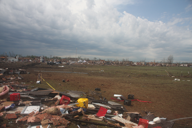
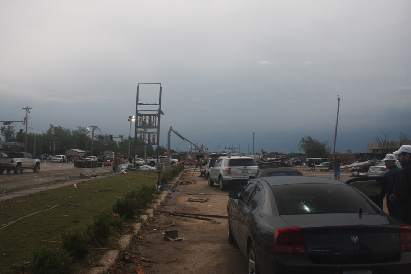
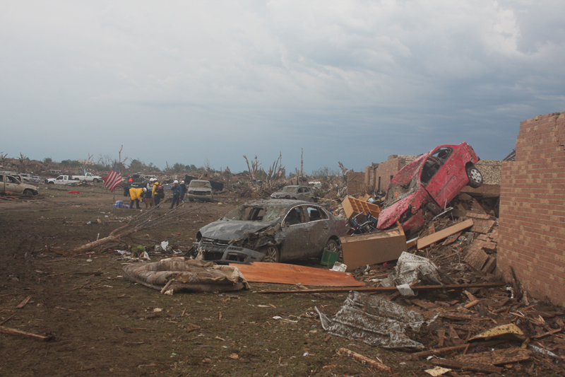
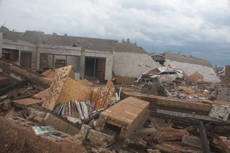
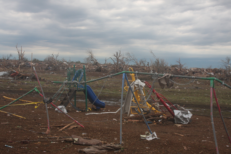
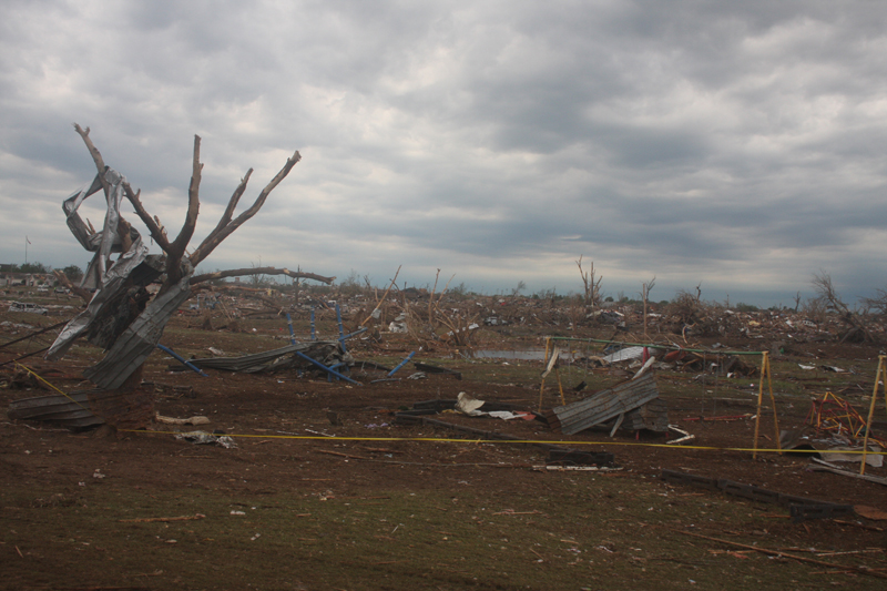
The following photos show damage produced by the May 20, 2013 EF-5 tornado. These photos were taken by NWS meteorologist Doug Speheger during a damage survey of the Moore, OK area on May 21, 2013.
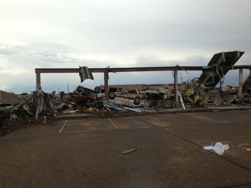 Looking N at professional building at SW6/Classen |
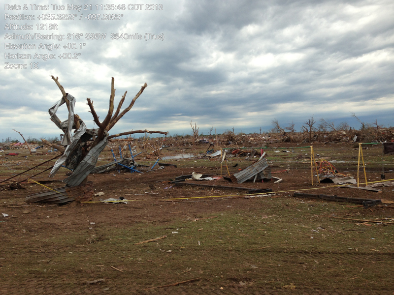 Looking SW at Plaza Towers Elementary |
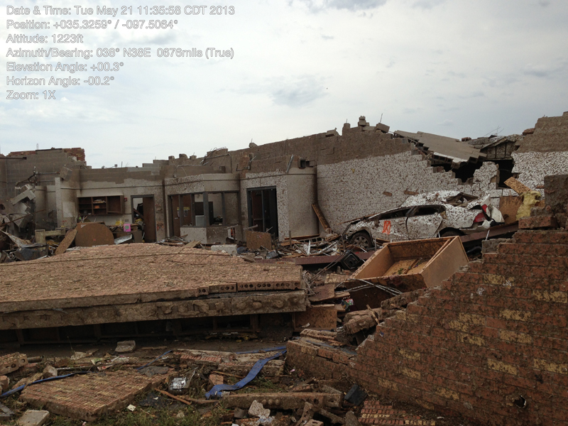 Looking at damage at Plaza Towers Elementary |
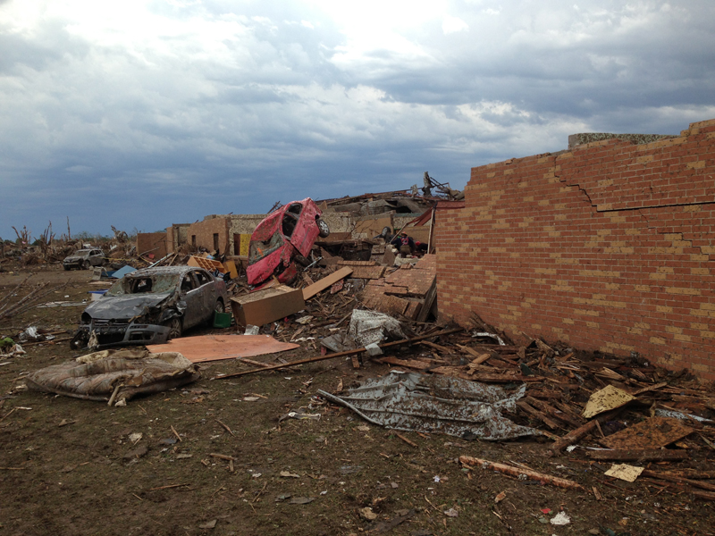 Looking SE at Plaza Towers Elementary |
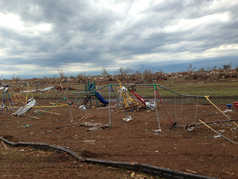 Looking SW at Plaza Towers Elementary |
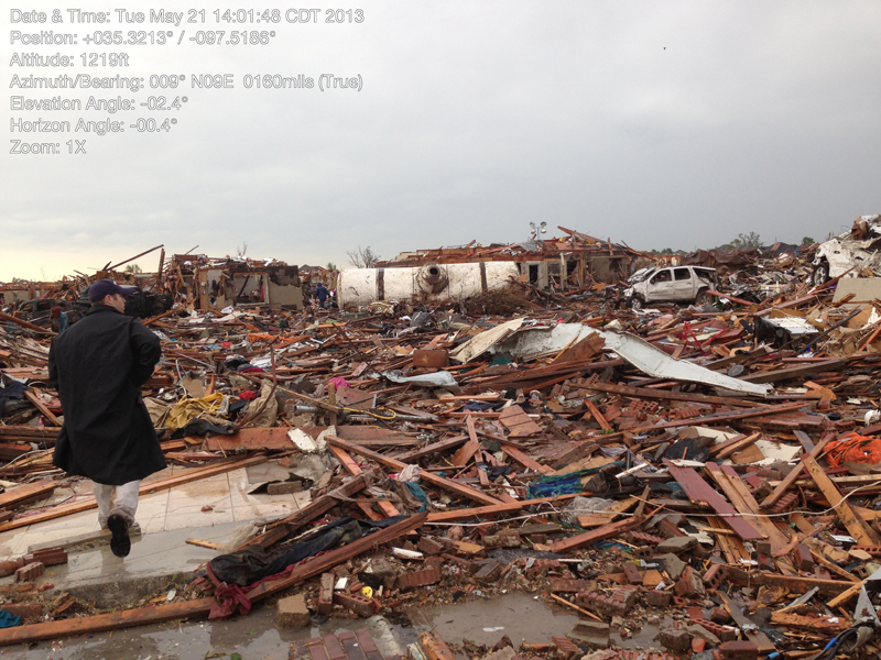 View of tornado damage |
 View of tornado damage |
 View of tornado damage |
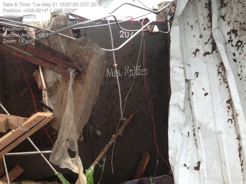 View of Briarwood Elementary School |
 View of Briarwood Elementary School |
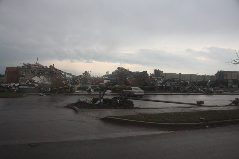 Looking SSW at Tinker Federal Credit Union & Warren Theatre |
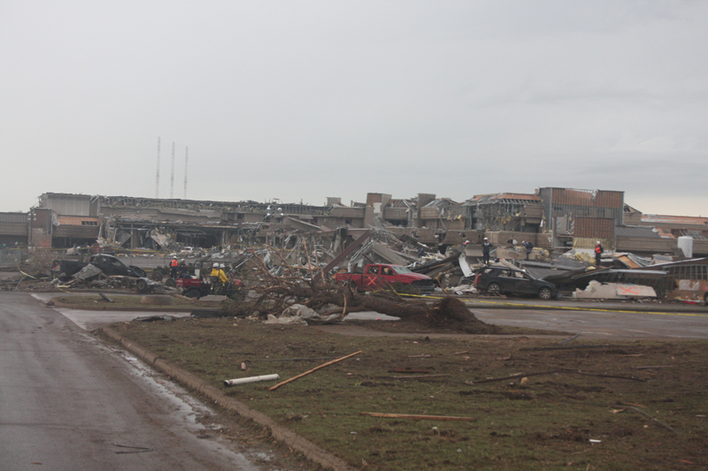 Looking ENE at background: Moore Medical Center |
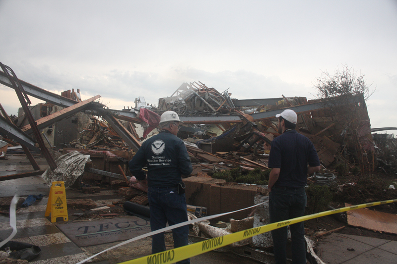 Looking SW at Tinker Federal Credit Union |
 Looking S at west side of Tinker Federal Credit Union |
 Looking S at west side of Tinker Federal Credit Union |
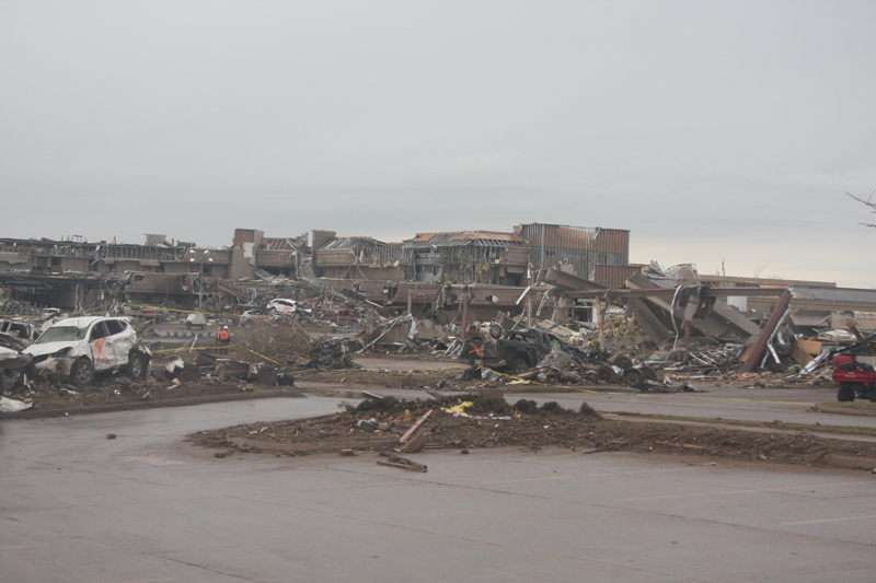 Looking NW at background: Moore Medical Center |
 Looking SE at west side of Tinker Federal Credit Union |
 Looking NW at background: Moore Medical Center |
 Looking S at west side of Tinker Federal Credit Union |
 Looking SE at west side of Tinker Federal Credit Union |
 View of tornado damage |
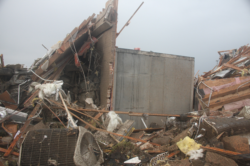 Looking at Tinker Federal Credit Union |
 Looking NW at west side of TFCU; Moore Medical Center |
 View of tornado damage |
 Looking SSE at AMF Moore Lanes |
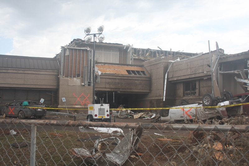 Looking NW at Moore Medical Center |
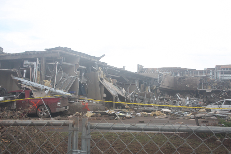 Looking NNW at Moore Medical Center |
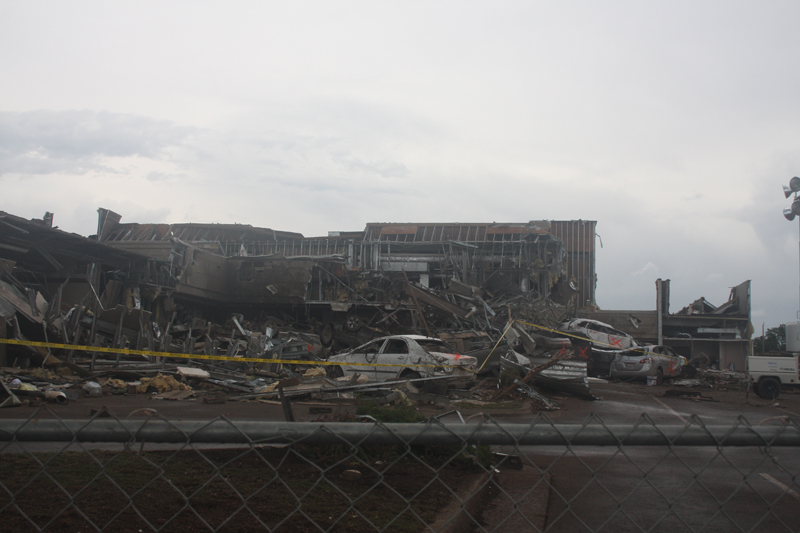 Looking N at Moore Medical Center |
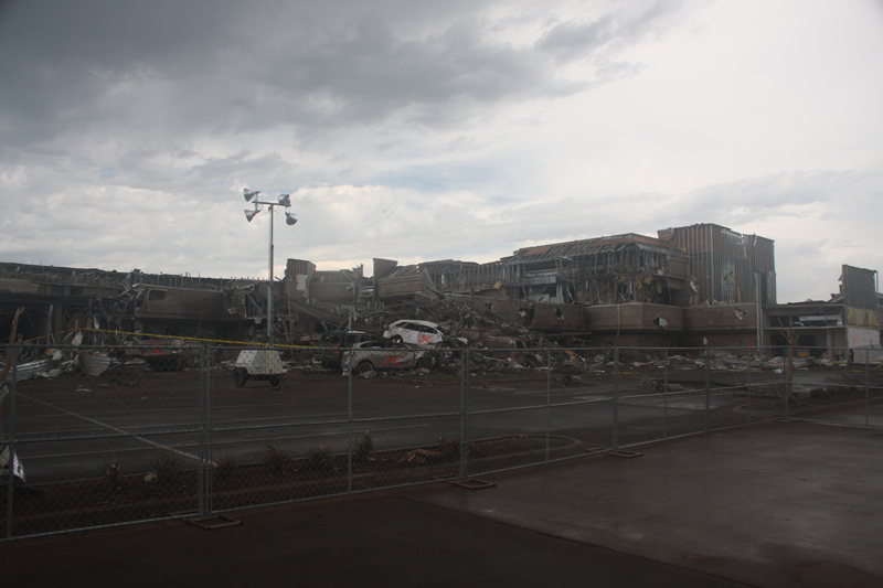 Looking NW at Moore Medical Center |
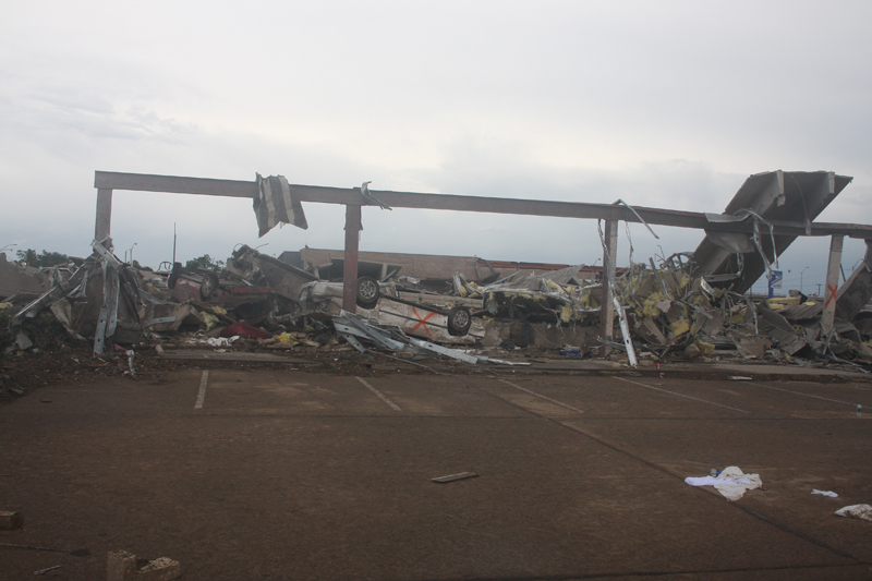 Looking NW at professional building at SW6/Classen |
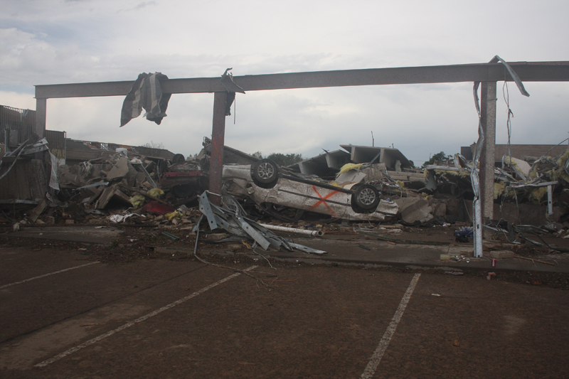 Looking NW at professional building at SW6/Classen |
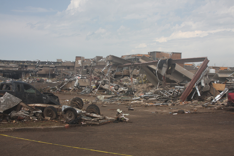 Looking NW at professional building at SW6/Classen |
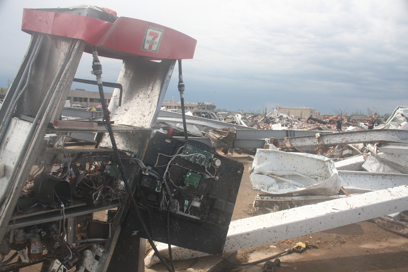 Looking SE at 7-11 at SW4/Telephone |
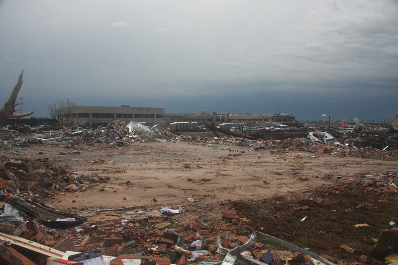 Looking SE at 7-11 at SW4/Telephone |
 Looking S at 7-11 at SW4/Telephone |
 Looking W at 7-11 at SW4/Telephone |
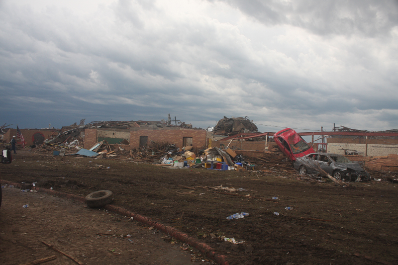 Looking SE at Plaza Towers Elementary |
 Looking ESE at Plaza Towers Elementary |
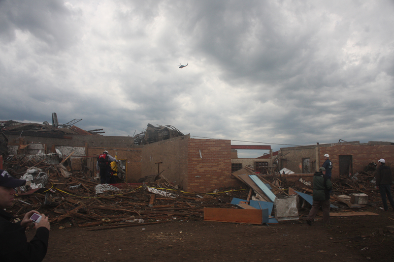 Looking SSW at Plaza Towers Elementary |
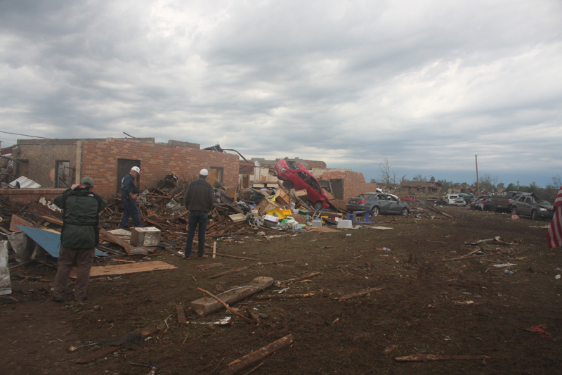 Looking SW at Plaza Towers Elementary |
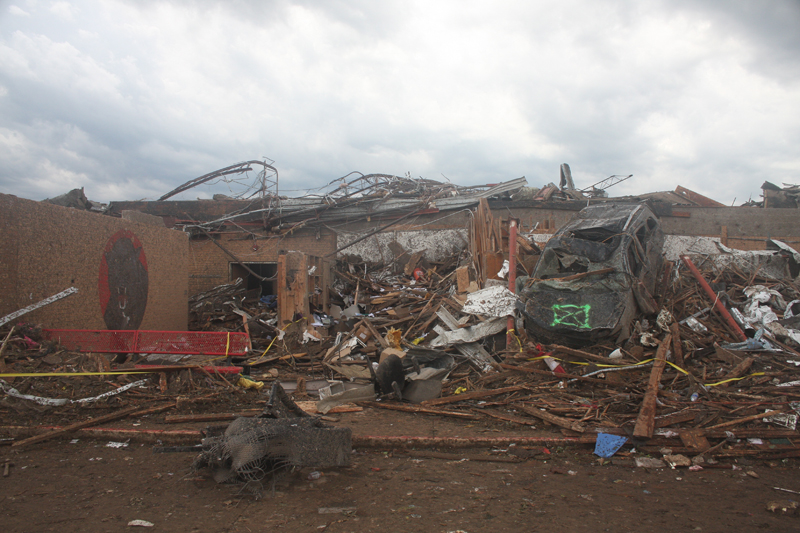 Looking S at Plaza Towers Elementary |
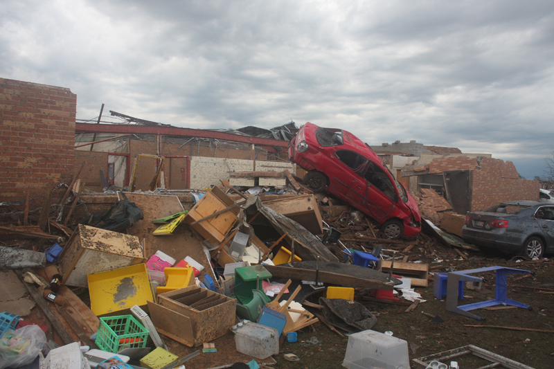 Looking SW at Plaza Towers Elementary |
 Looking SE at Plaza Towers Elementary |
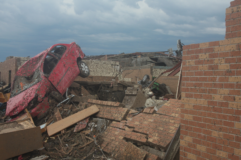 Looking SE at Plaza Towers Elementary |
 Looking ESE at Plaza Towers Elementary |
 Looking at Plaza Towers Elementary |
 Looking WSW at Plaza Towers Elementary |
 Looking WSW at Plaza Towers Elementary |
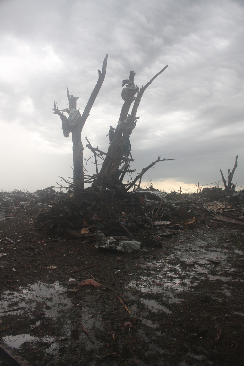 View of tornado damage |
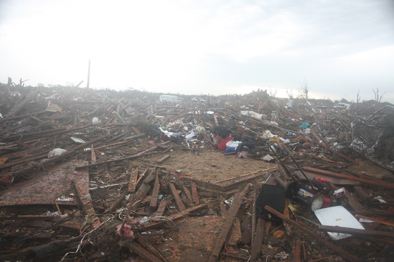 View of tornado damage |
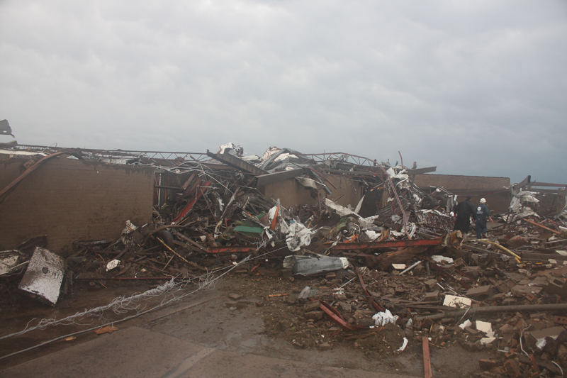 View of damage at Briarwood Elementary School |
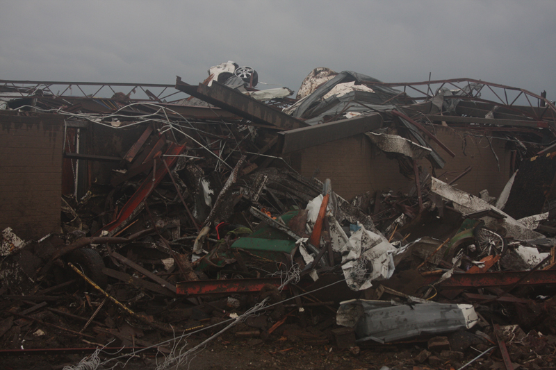 View of damage at Briarwood Elementary School |
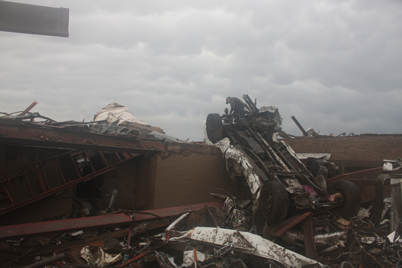 View of damage at Briarwood Elementary School |
 View of damage at Briarwood Elementary School |
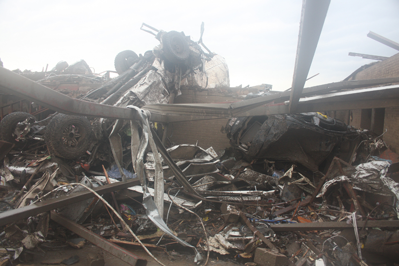 View of damage at Briarwood Elementary School |
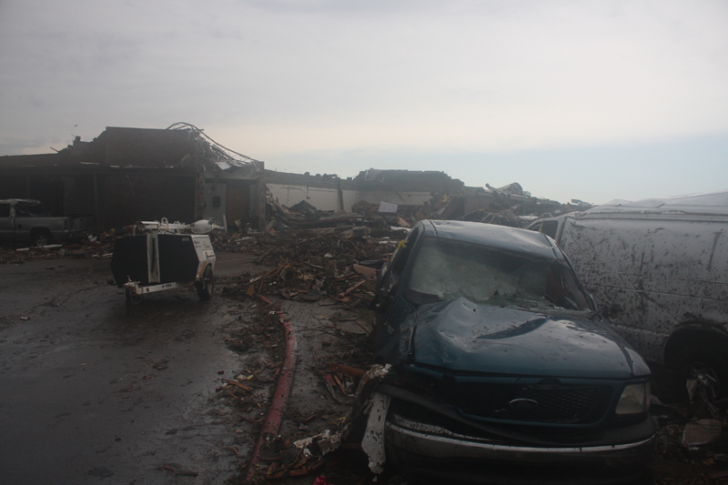 View of damage at Briarwood Elementary School |
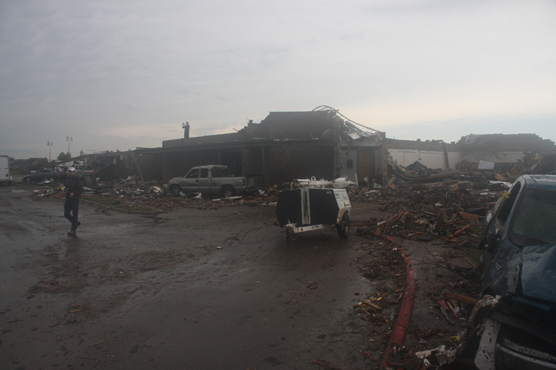 View of damage at Briarwood Elementary School |
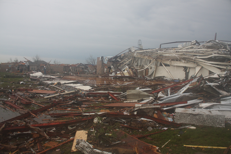 View of damage at Briarwood Elementary School |
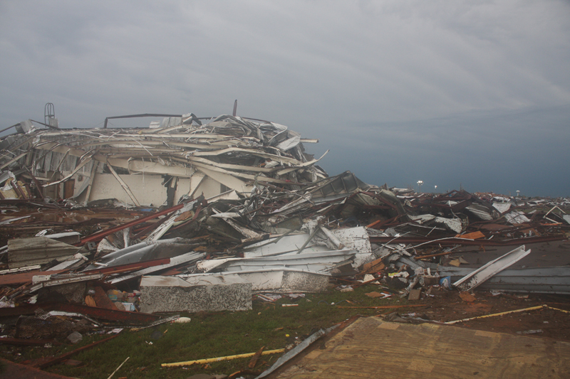 View of damage at Briarwood Elementary School |
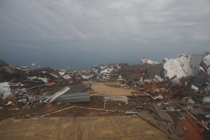 View of damage at Briarwood Elementary School |
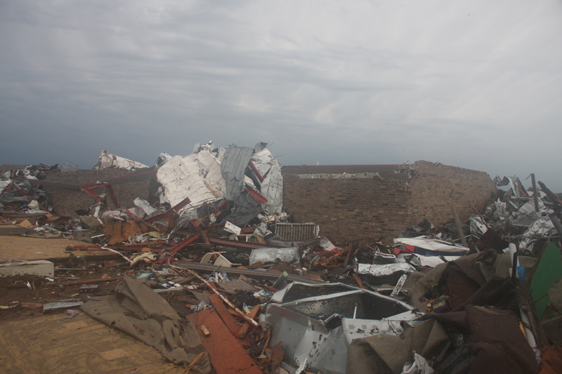 View of damage at Briarwood Elementary School |
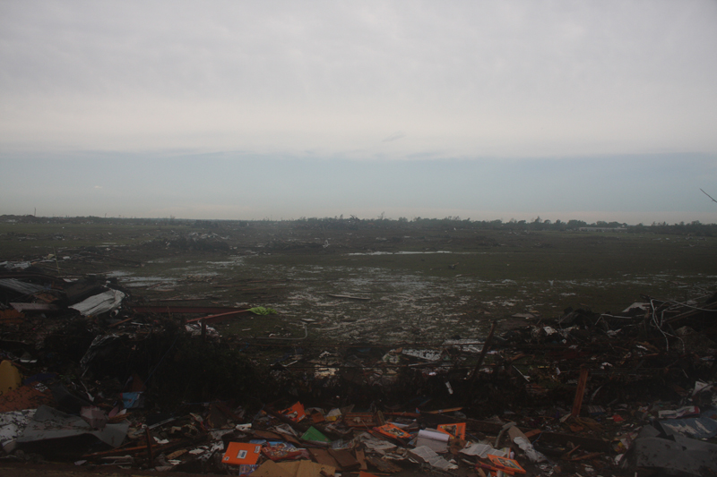 View of damage at Briarwood Elementary School |
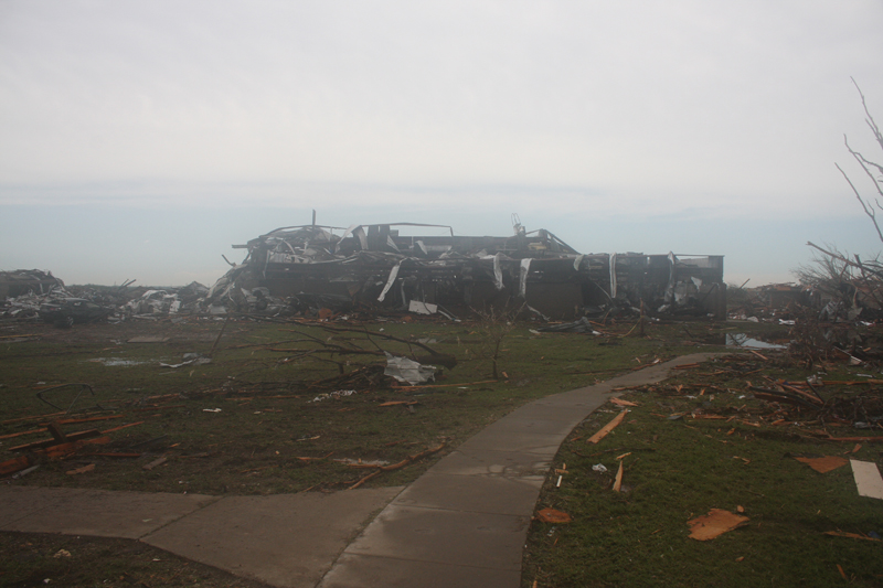 View of damage at Briarwood Elementary School |
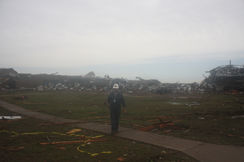 View of damage at Briarwood Elementary School |
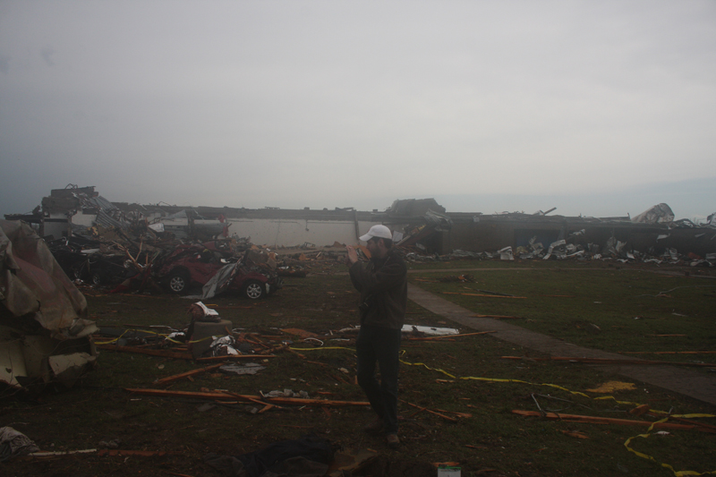 View of damage at Briarwood Elementary School |
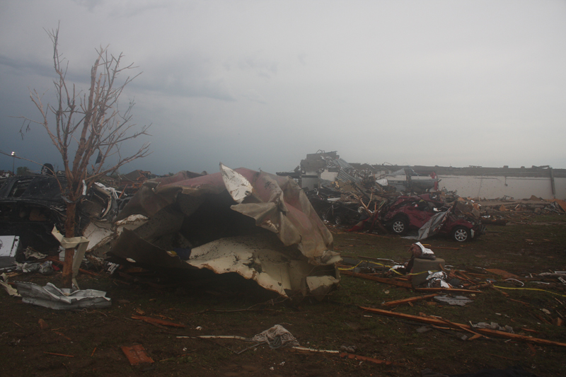 View of damage at Briarwood Elementary School |
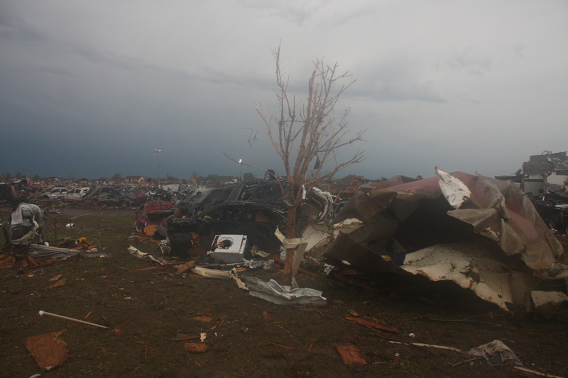 View of damage at Briarwood Elementary School |
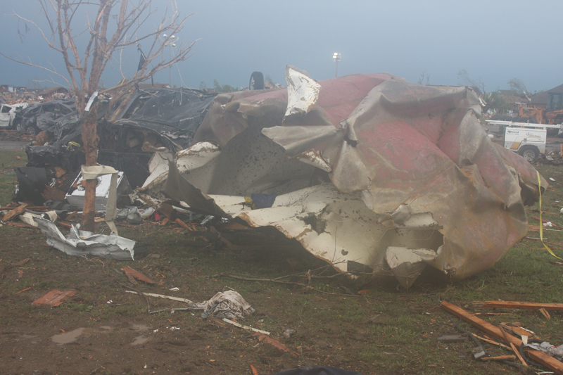 View of damage at Briarwood Elementary School |
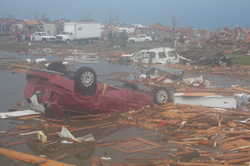 View of damage at Briarwood Elementary School |
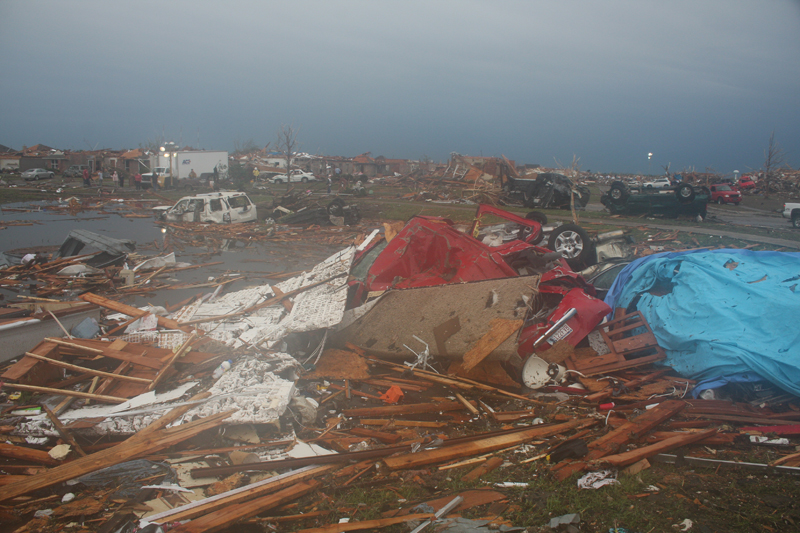 View of damage at Briarwood Elementary School |
 View of damage at Briarwood Elementary School |
 View of damage at Briarwood Elementary School |
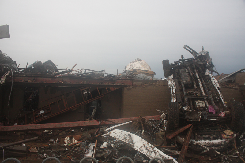 View of damage at Briarwood Elementary School |
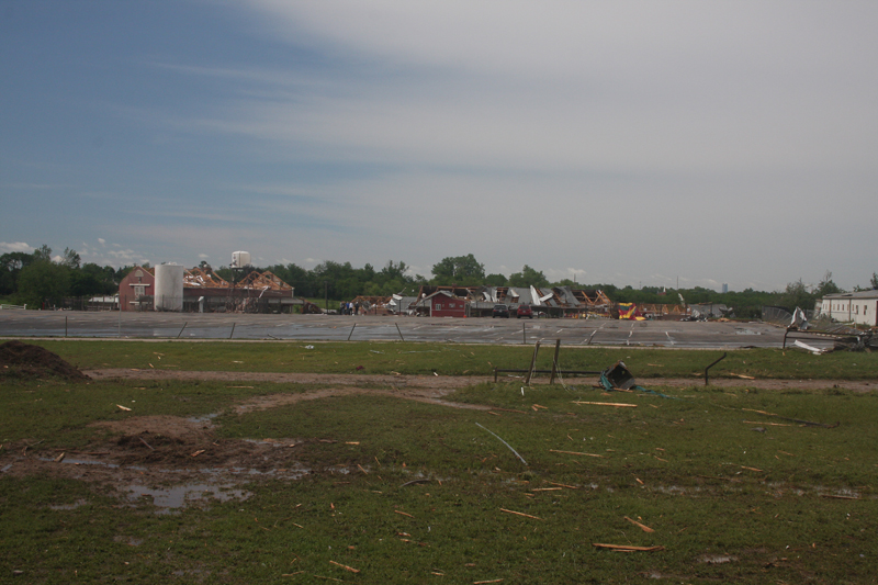 View of damage at Orr Family Farm |
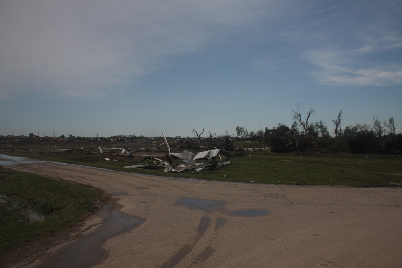 View of damage at Orr Family Farm |
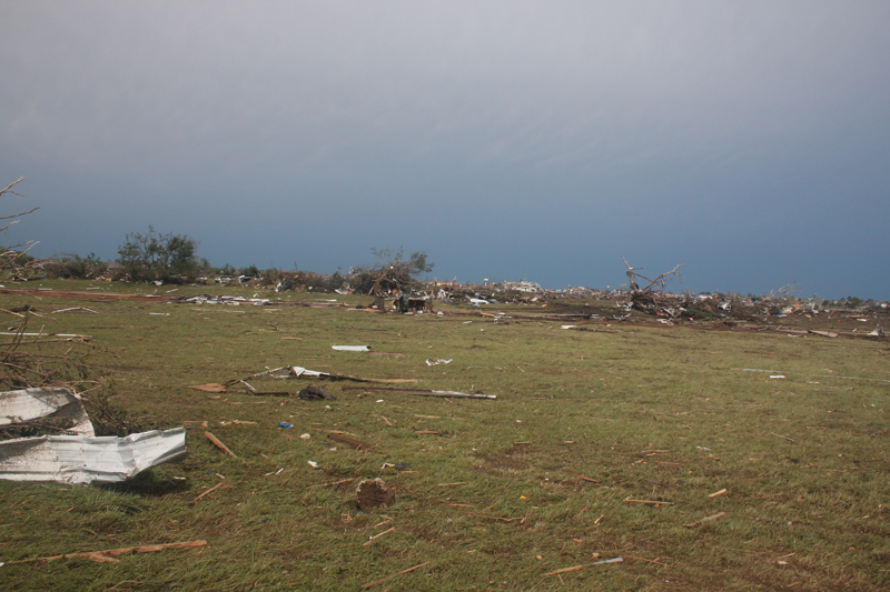 View of damage at Orr Family Farm> |
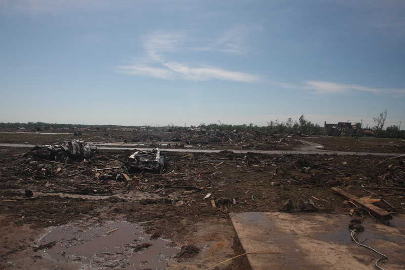 View of damage at Orr Family Farm |
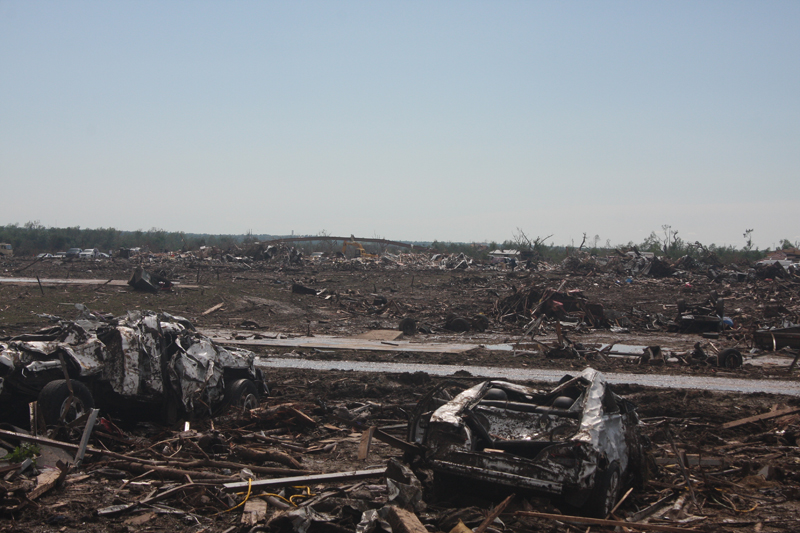 View of damage at Orr Family Farm |
 View of damage at Orr Family Farm |
 View of damage at Orr Family Farm |
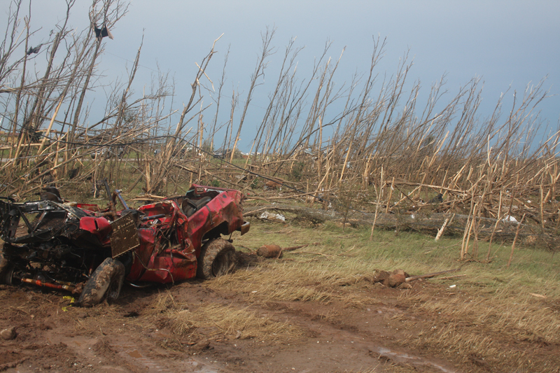 View of tornado damage |
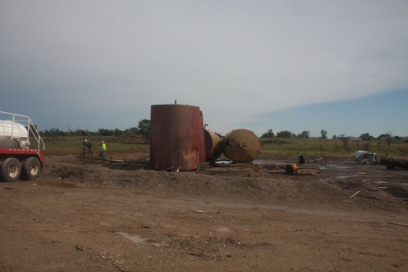 View of tornado damage |
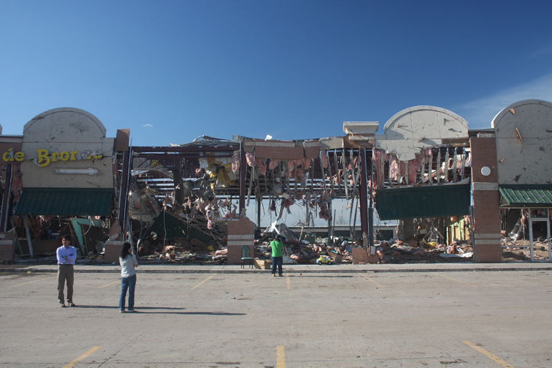 View of tornado damage |