Norman, OK
Weather Forecast Office
NWS Norman NWPS Lake Monitor Page
| NORTHWESTERN AND NORTH CENTRAL OKLAHOMA | ||
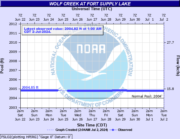 FSLO2 - Fort Supply Lake |
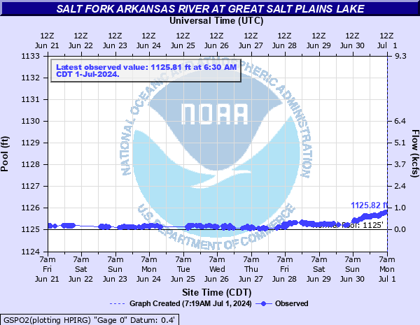 GSPO2 - Great Salt Plains Lake |
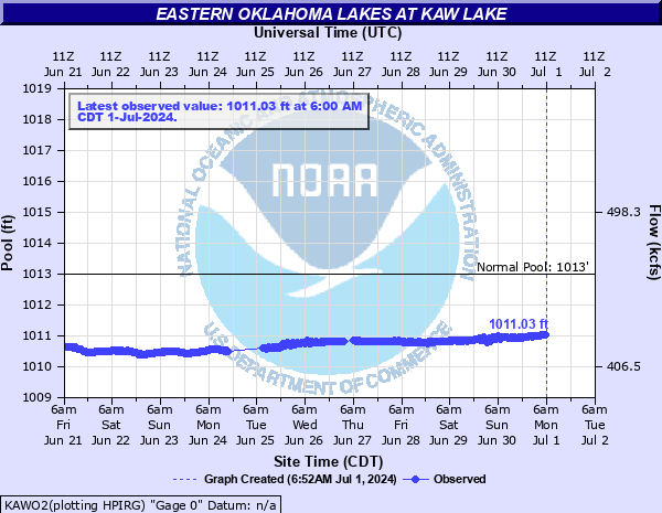 KAWO2 - Kaw Lake |
| SOUTHWESTERN AND WEST CENTRAL OKLAHOMA | ||
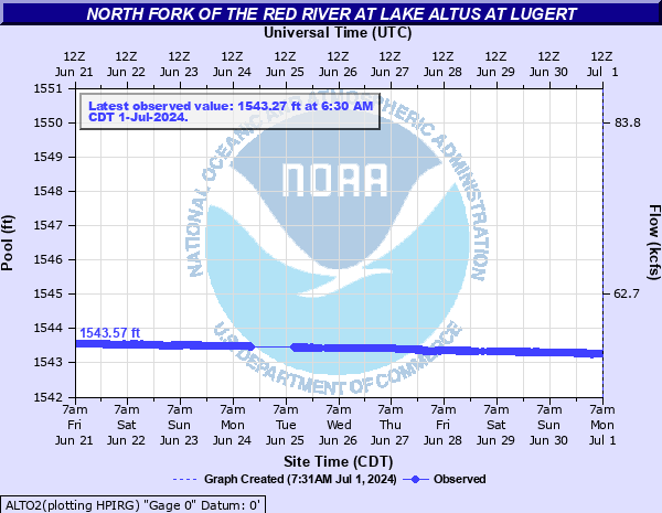 ALTO2 - Lake Altus at Lugert |
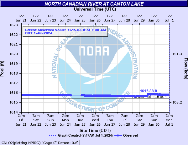 CNLO2 - Canton Lake |
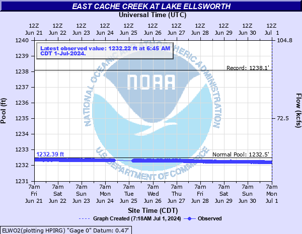 ELWO2 - Lake Ellsworth |
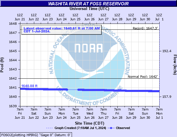 FOSO2 - Foss Lake |
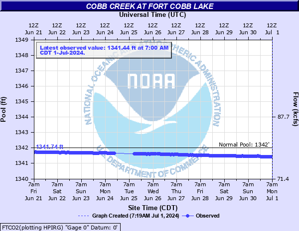 FTCO2 - Fort Cobb Lake |
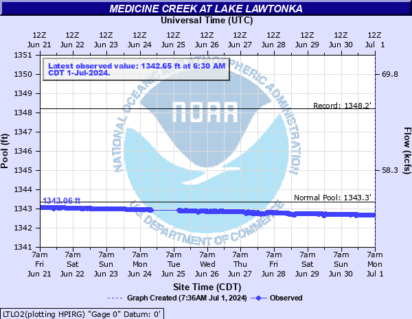 LTLO2 - Lake Lawtonka |
| LAKES IN THE WICHITA MOUNTAINS WILDLIFE REFUGE | ||
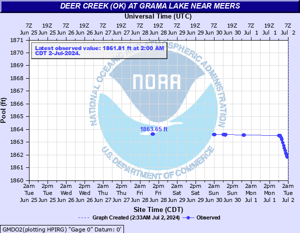 GMDO2 - Deer Creek at Grama Lake near Meers, OK |
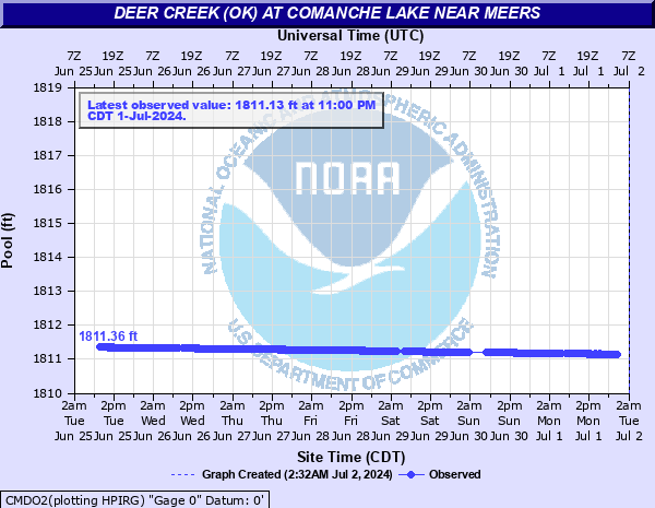 CMDO2 - Deer Creek at Comanche Lake near Meers, OK |
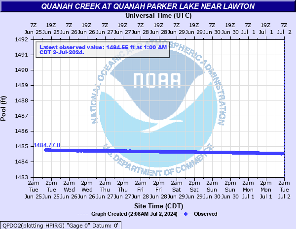 QPDO2 - Quanah Creek at Quanah Parker Lake near Lawton, OK |
| CENTRAL OKLAHOMA | ||
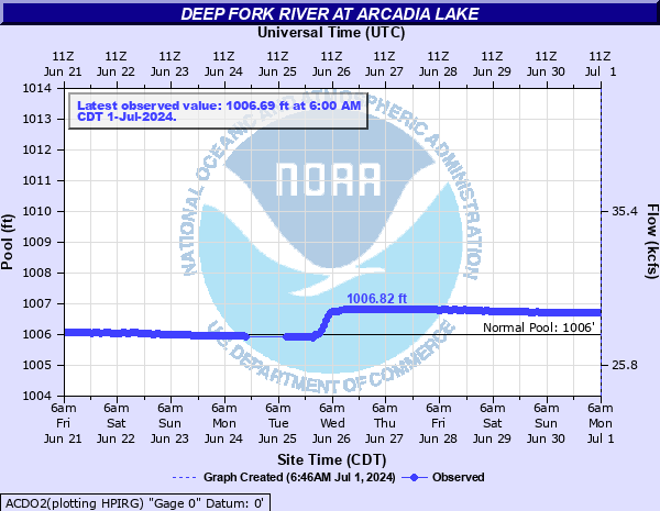 ACDO2 - Arcadia Lake |
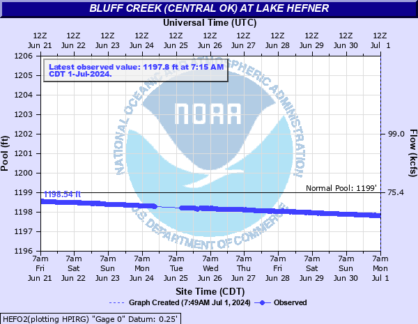 HEFO2 - Lake Hefner |
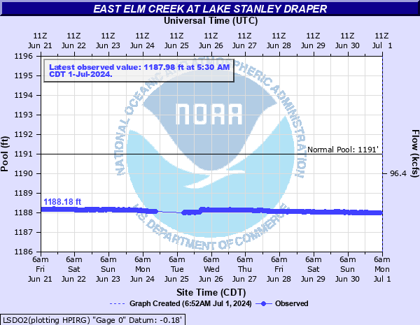 LSDO2 - Lake Stanley Draper |
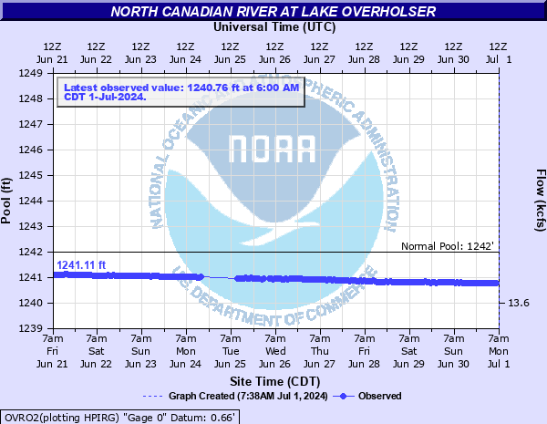 OVRO2 - Lake Overholser |
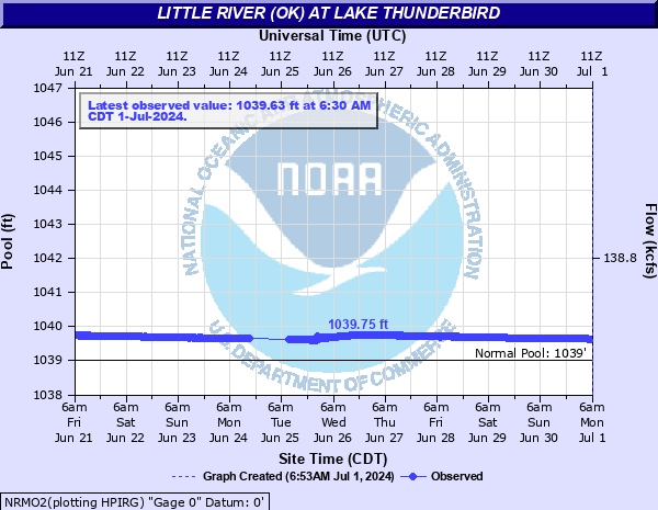 NRMO2 - Lake Thunderbird |
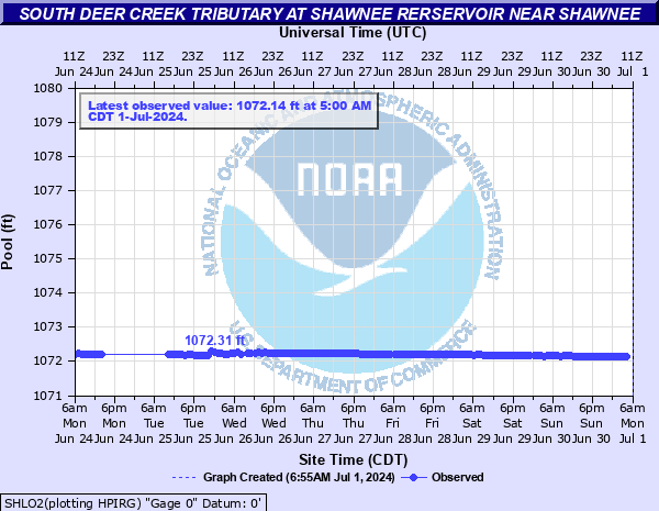 SHLO2 - Shawnee Lake |
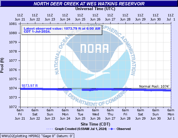 WWLO2 - Wes Watkins Lake |
||
| SOUTH CENTRAL AND SOUTHEASTERN OKLAHOMA | ||
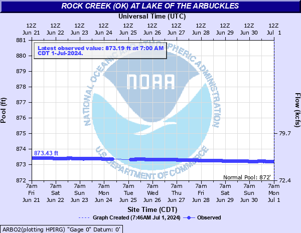 ARBO2 - Lake of the Arbuckles |
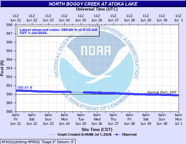 ATKO2 - Atoka Lake |
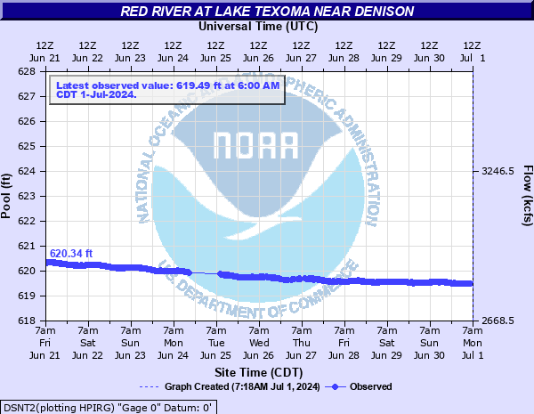 DSNT2 - Lake Texoma |
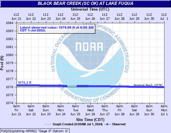 FUQO2 - Lake Fuqua |
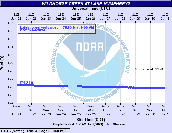 LHUO2 - Lake Humphreys |
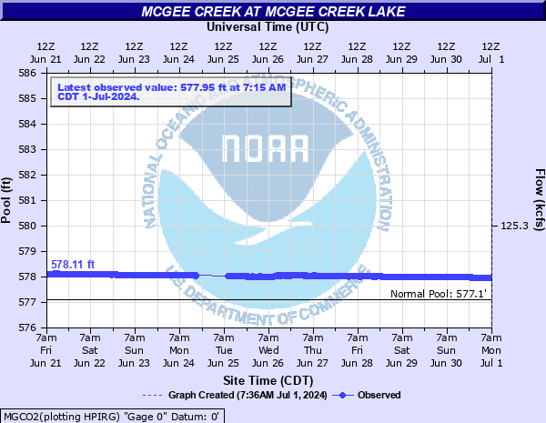 MGCO2 - McGee Creek Lake |
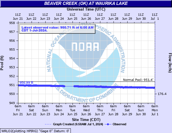 WRLO2 - Waurika Lake |
||
| WESTERN NORTH TEXAS | ||
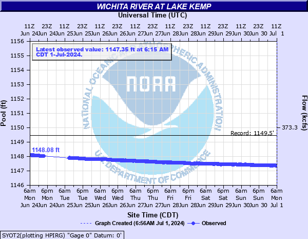 SYOT2 - Lake Kemp |
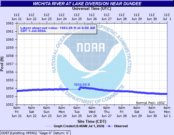 DDET2 - Lake Diversion |
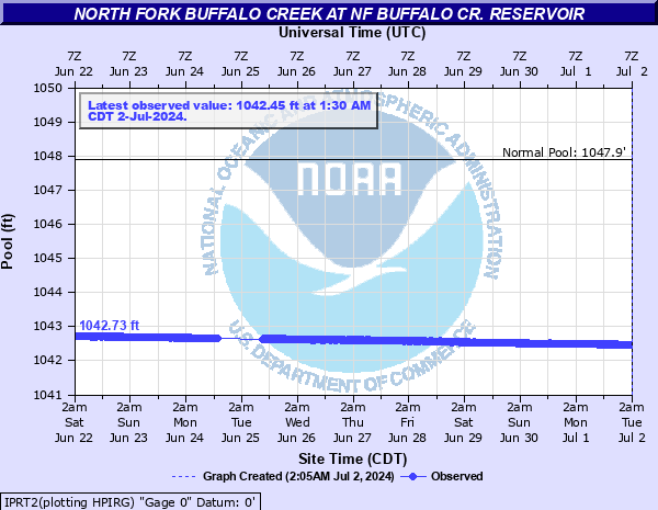 IPRT2 - North Buffalo Creek Reservoir |
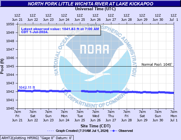 ARHT2 - Lake Kickapoo |
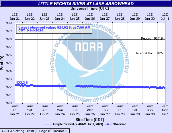 ARRT2 - Lake Arrowhead |
 SMKT2 - Millers Creek Reservoir |
Current Hazards
Local
Nationwide
Local Storm Reports
Current Conditions
More Observations
Surface Maps
Upper Air Maps
Rivers and Lakes
Satellite Imagery
Forecasts
Air Quality
Forecast Discussion
Fire Weather
Winter Weather
Aviation Weather
Submit a Spot Forecast
Graphical Forecasts
Warnings and Other Products
Flash Flood Warnings
Non Precipitation Warnings
Severe Thunderstorm Warnings
Winter Weather Warnings
Tornado Warnings
Flood Warnings
Special Weather Statements
Climate and Past Weather
Daily Weather History
Significant Weather Events
Local Climate Data
Tornado Database
Averages and Records
Storm Data
US Dept of Commerce
National Oceanic and Atmospheric Administration
National Weather Service
Norman, OK
National Weather Center
120 David L. Boren Blvd. Suite 2400
Norman, OK 73072
(405) 325-3816
Comments? Questions? Please Contact Us.

