|
Current Conditions and Seven Day Forecast |
|
| Current Conditions | Forecast | Severe Weather | Hydrology/Rivers | Winter Weather | Fire Weather | Safety |
|

 |
 |
| Eastern Nebraska and Western Iowa River Flood Outlook | 90 Day Chance of River Flooding |
 |
|
||||||||
 |
 |
 |
 |
| Today |
Tomorrow |
Day 3 |
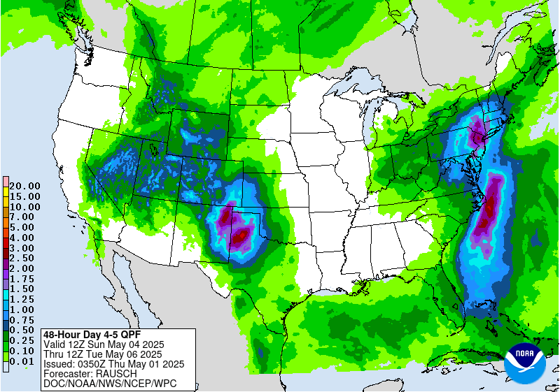
Days 4-5 |
 |
 |
 |
| Excessive Rainfall Outlook Today |
Excessive Rainfall Outlook Tomorrow |
Excessive Rainfall Outlook Day 3 |
 |
 |
 |
| Past Rainfall | Snow Cover and Water Content | Soil Moisture |
 |
 |
| Current Drought Conditions - Click for more Information | Drought Outlook - Click for more Information |


