|
Current Conditions and Seven Day Forecast |
|
|
Current Conditions for Kentucky
| KENTUCKY | ||||
 Radar Loop |
 Satellite Image |
|||
 Surface Map |
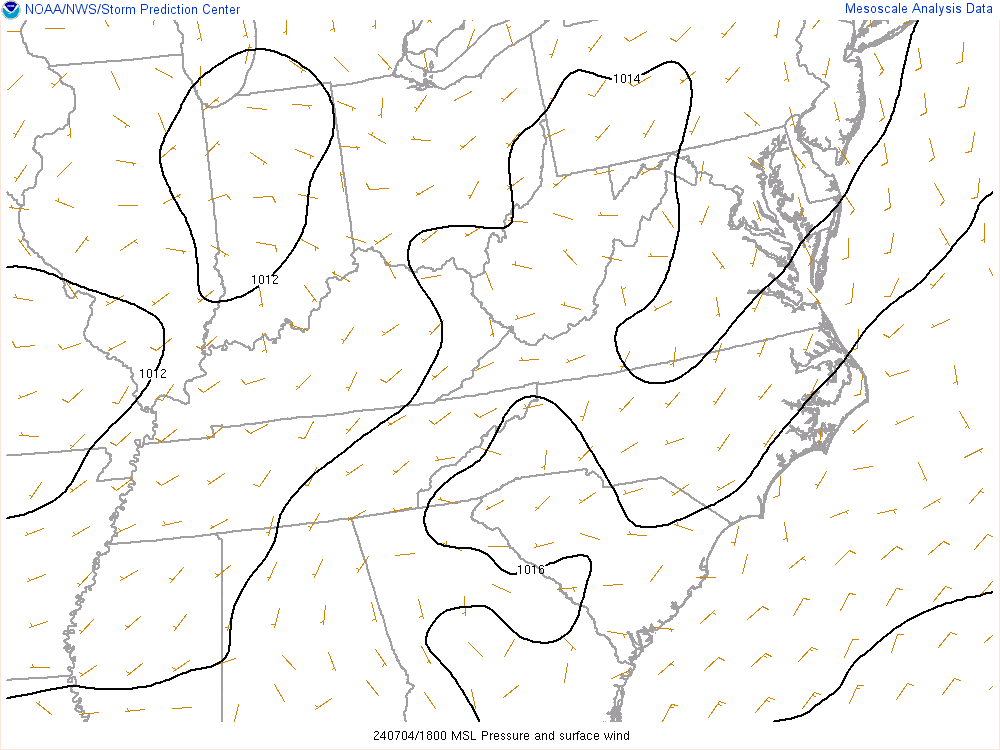 SPC Mesoanalysis Page |
|||
| NWS PADUCAH |
| NWS LOUISVILLE |
| NWS JACKSON |
| NWS WILMINGTON, OH | ||||
 |
The weather story graphic highlights current weather concerns and items of interest across northern KY. Full Description |
|||
| NWS CHARLESTON, WV | ||||
 |
The weather story graphic highlights current weather concerns and items of interest across northwest KY. Full Description |
|||
Kentucky State Forecast Graphics - Update daily around 7 AM, Noon, 5 PM, and 9PM Eastern. Click images to enlarge.
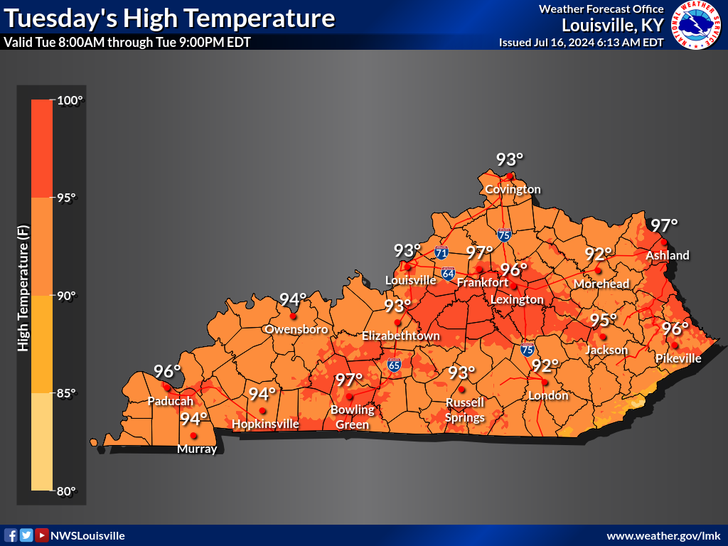
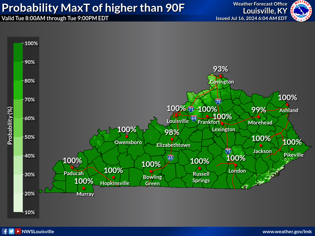
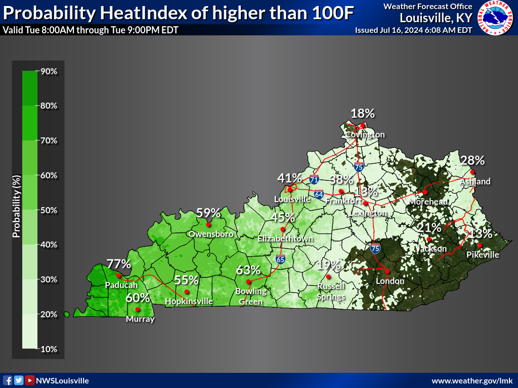
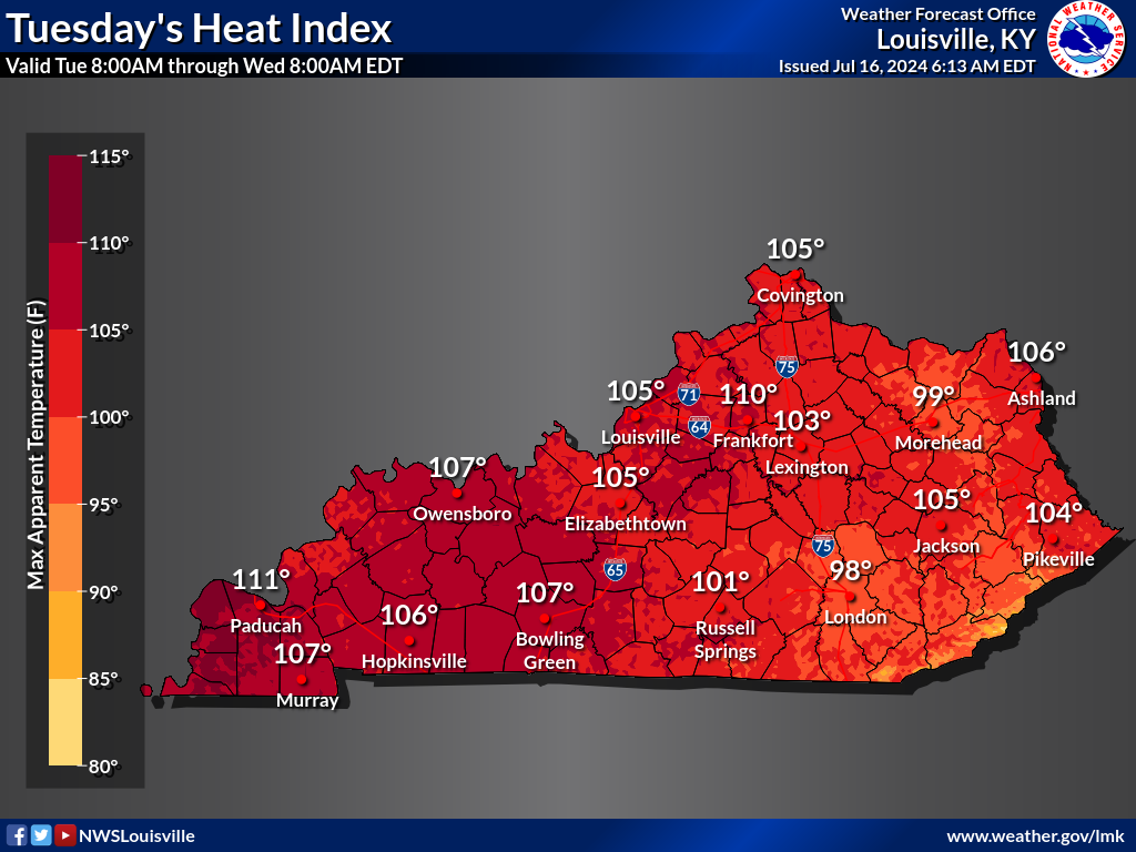
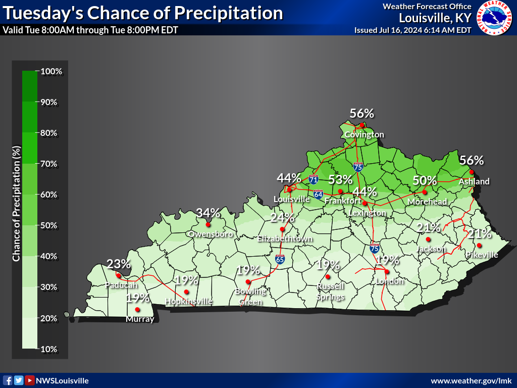
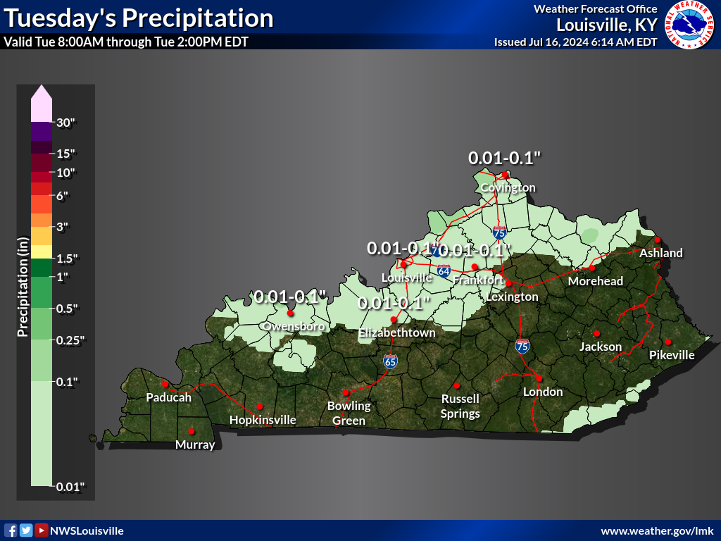
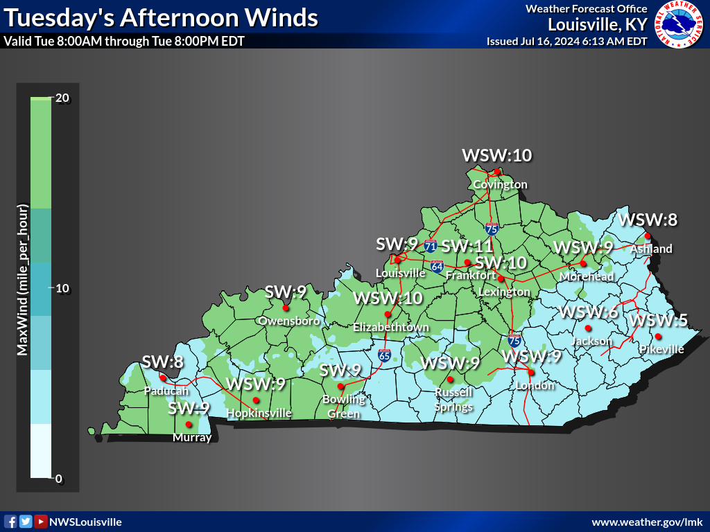
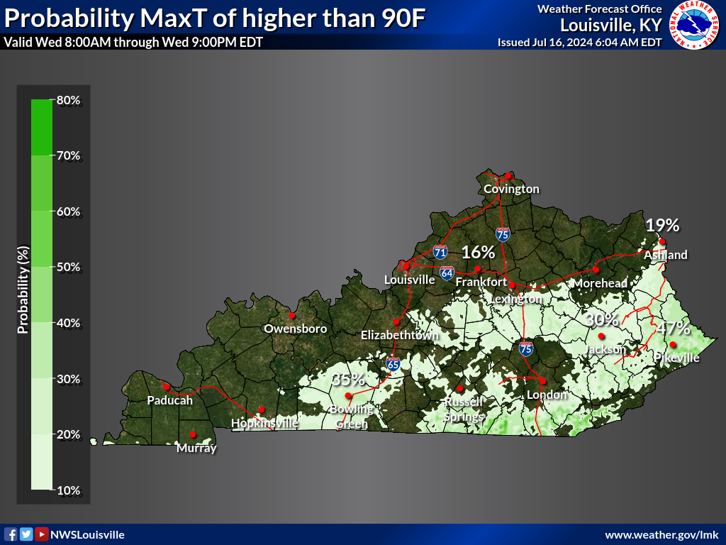
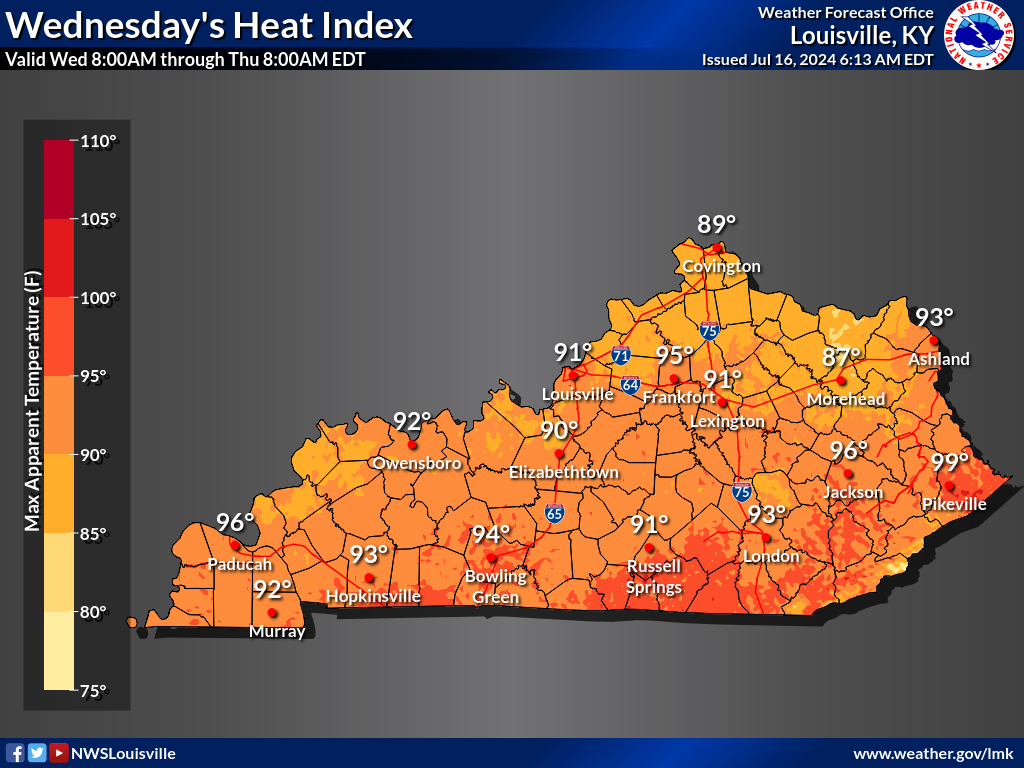
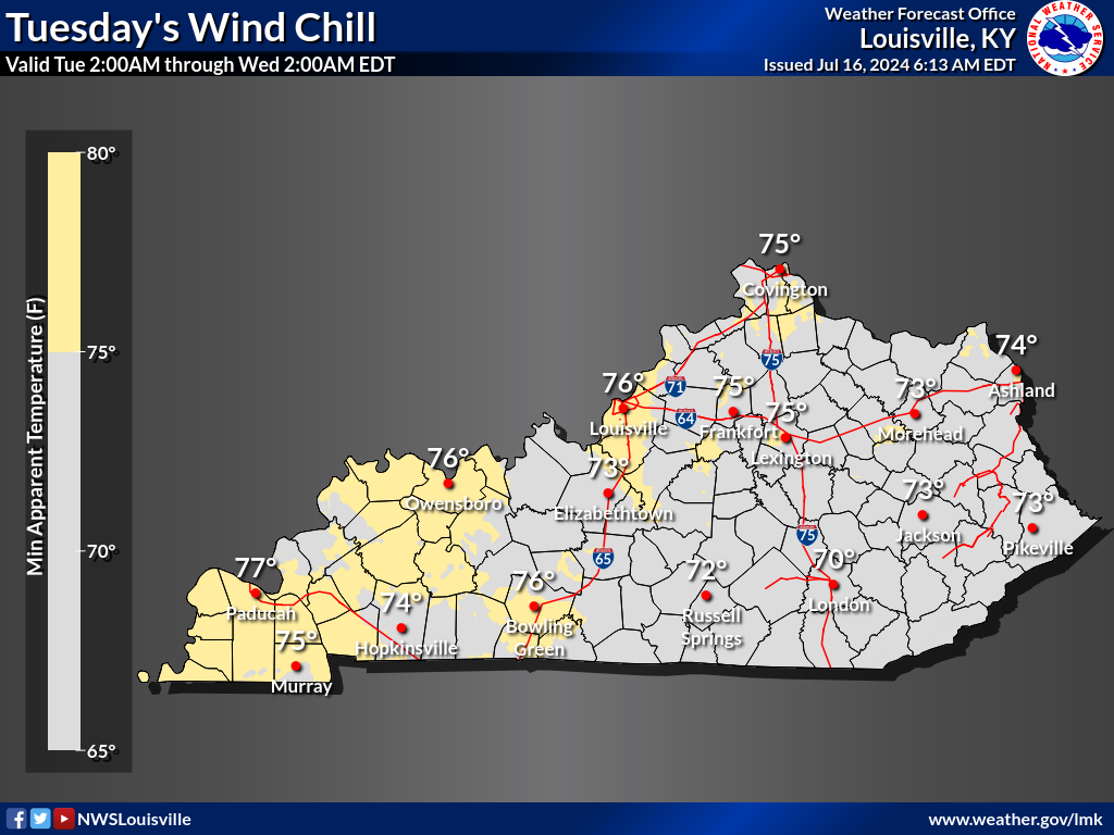
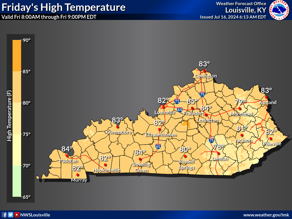
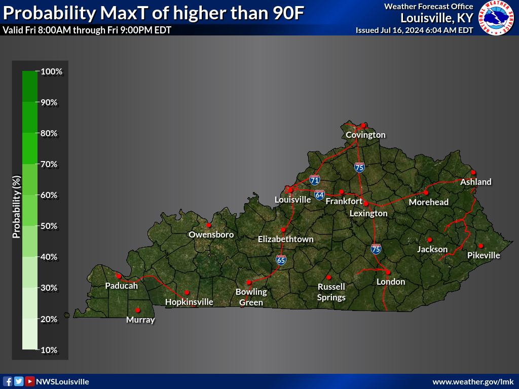
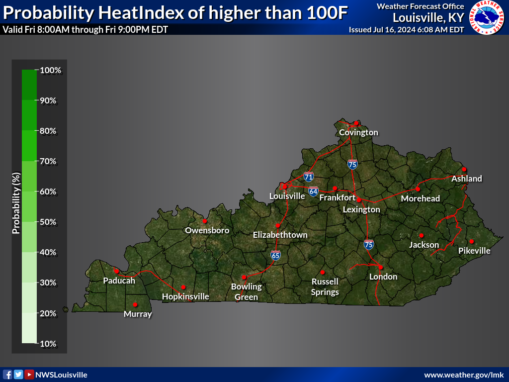
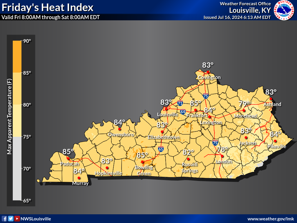
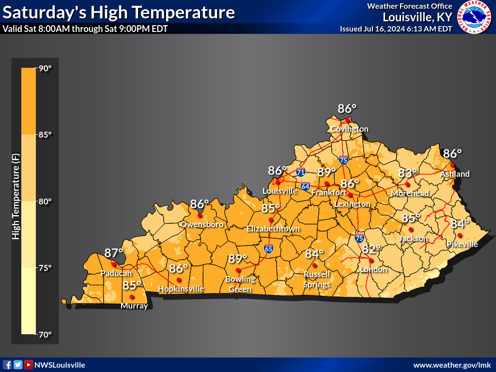
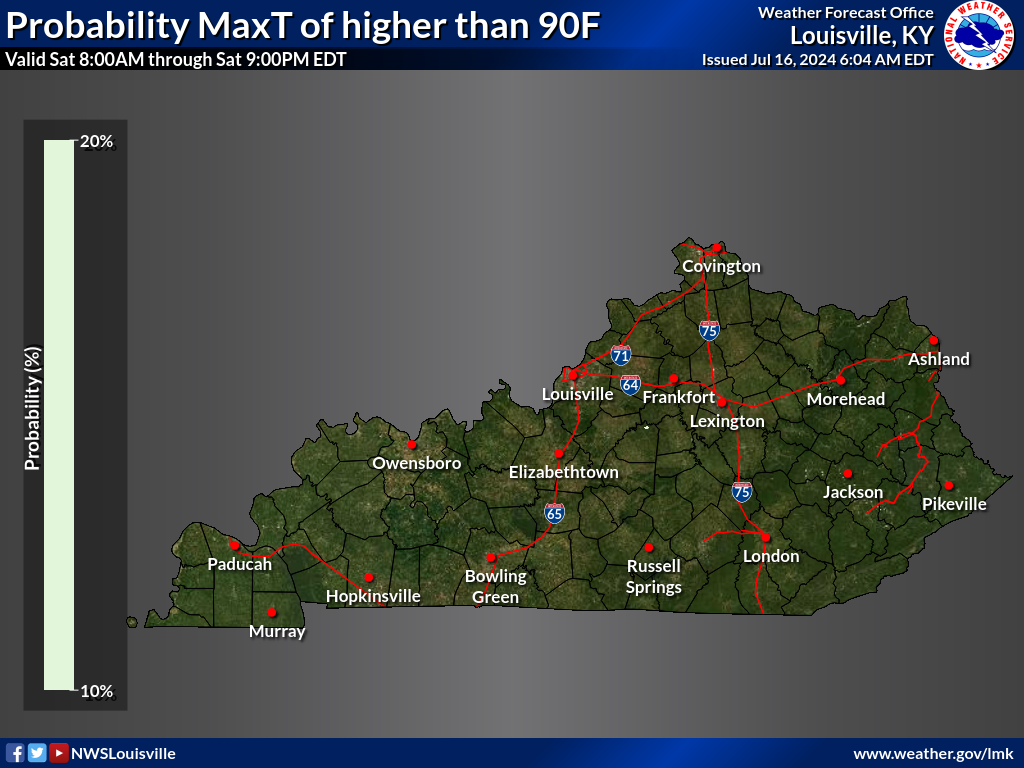
TODAY |
|||
|---|---|---|---|
| High Temperatures | MaxT > 90F | Heat Index > 100F | Heat Index |
 |
 |
 |
 |
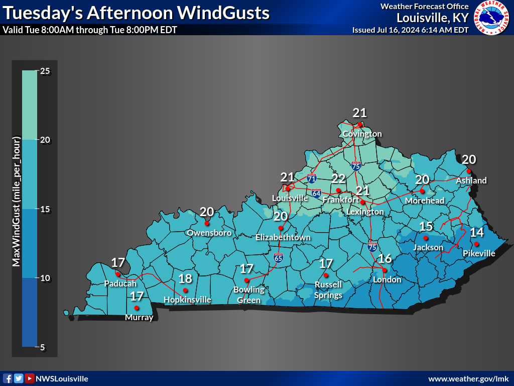
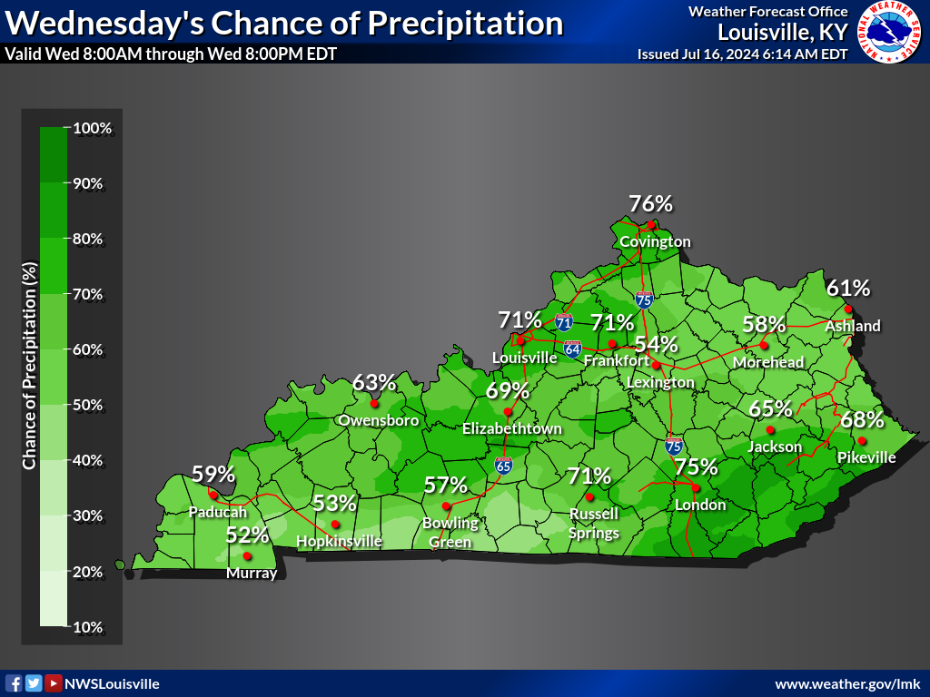
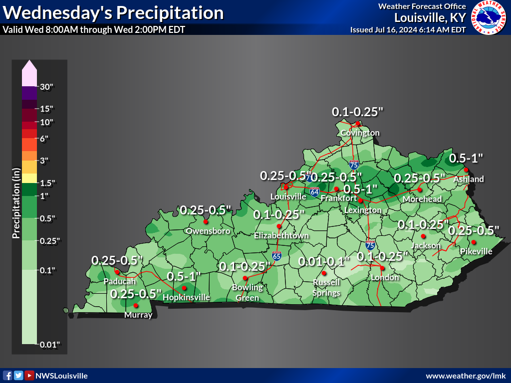
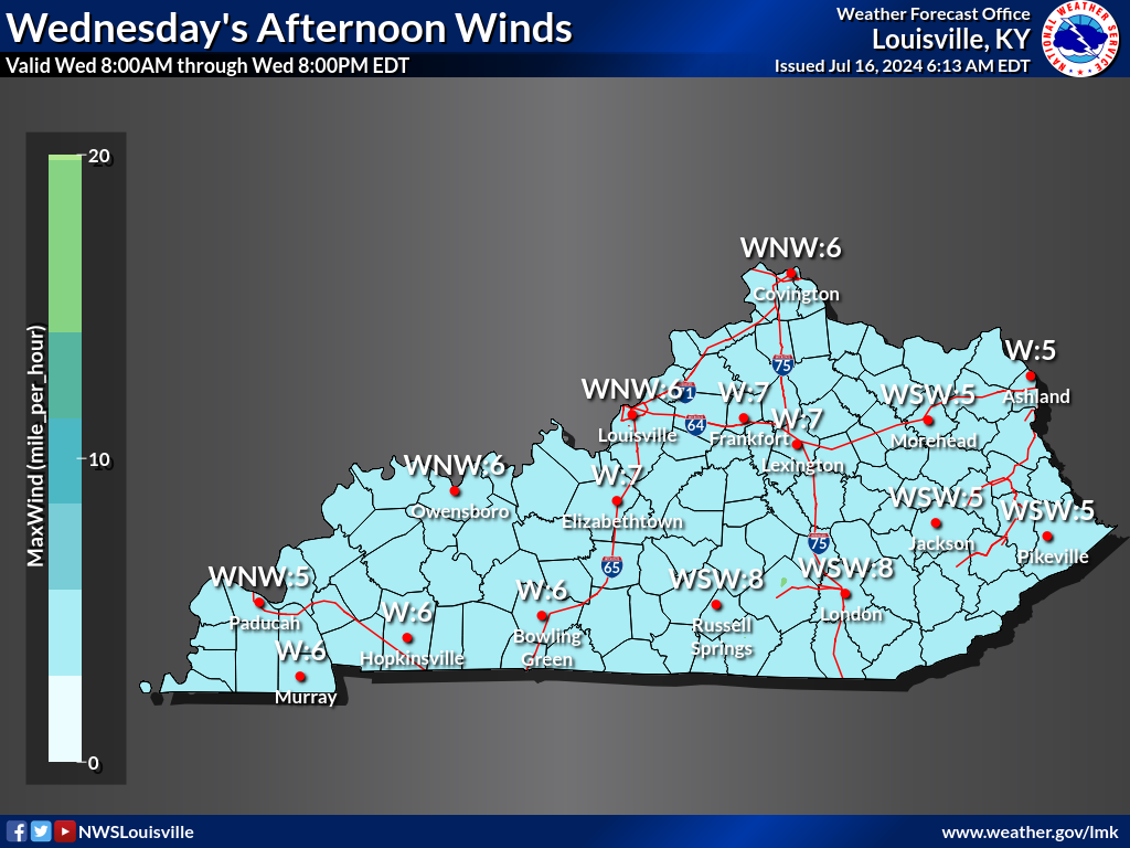
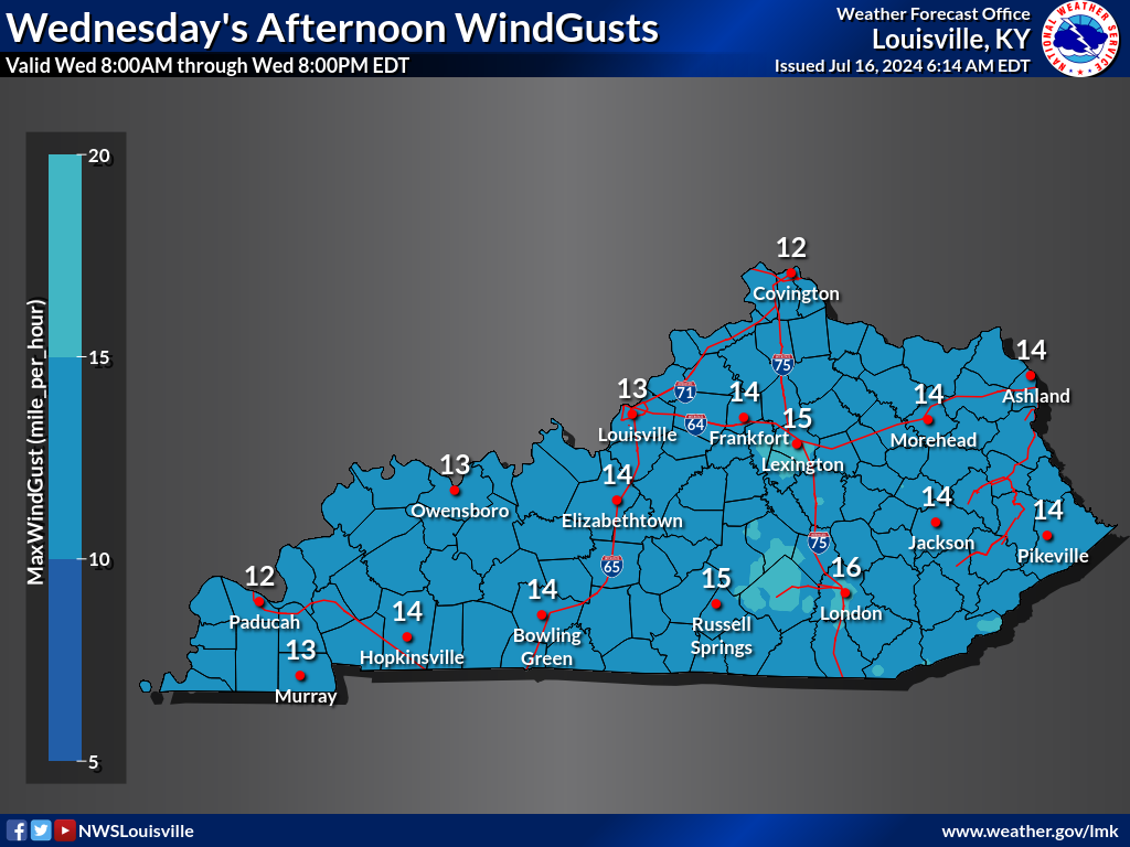
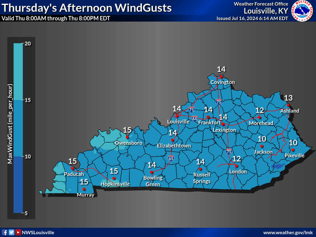
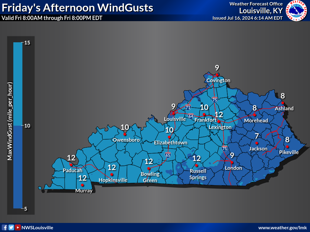
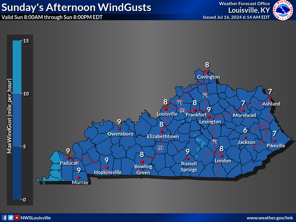
| Probability of Precipitation | Quantitative Precipitation Forecast | Wind and Direction | Gusts |
 |
 |
 |
 |
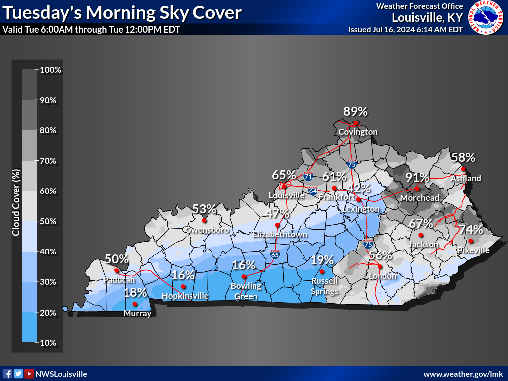
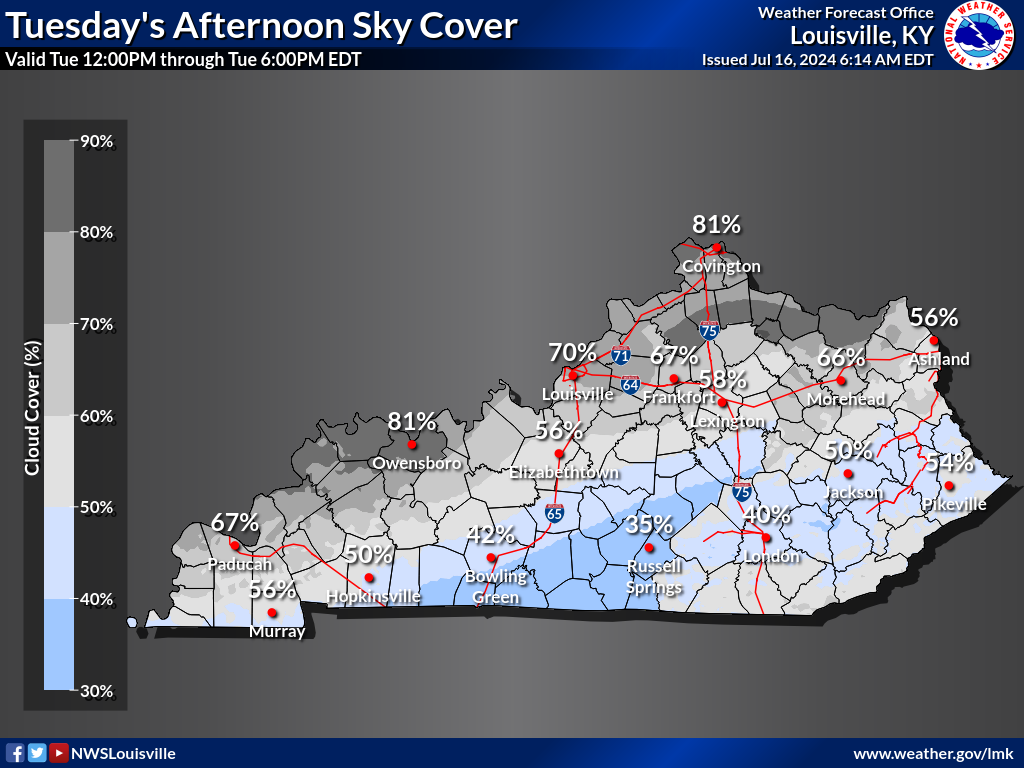
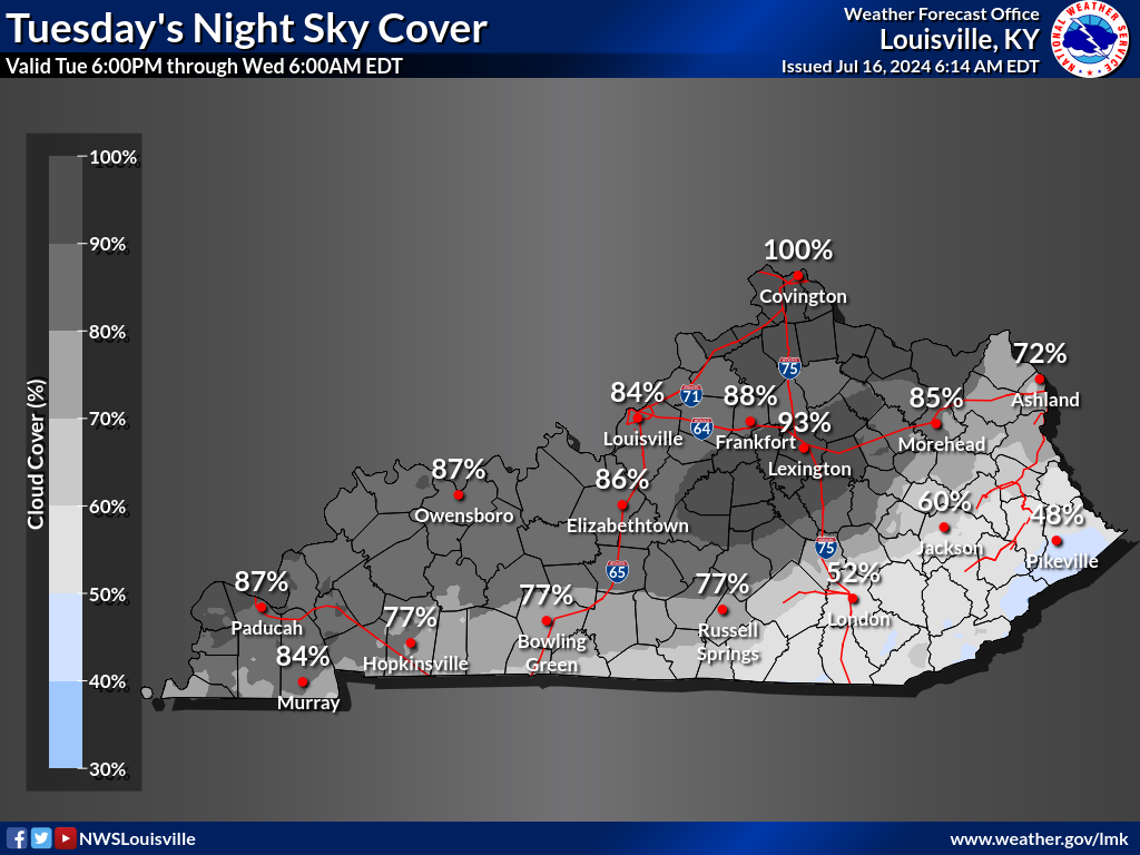
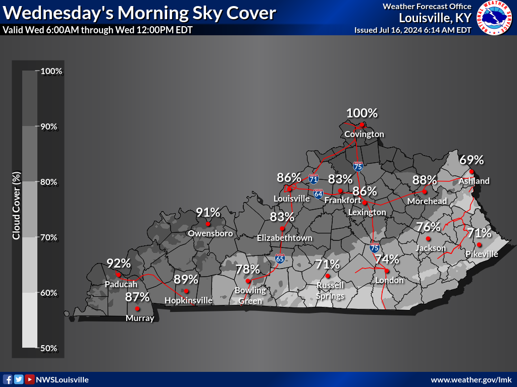
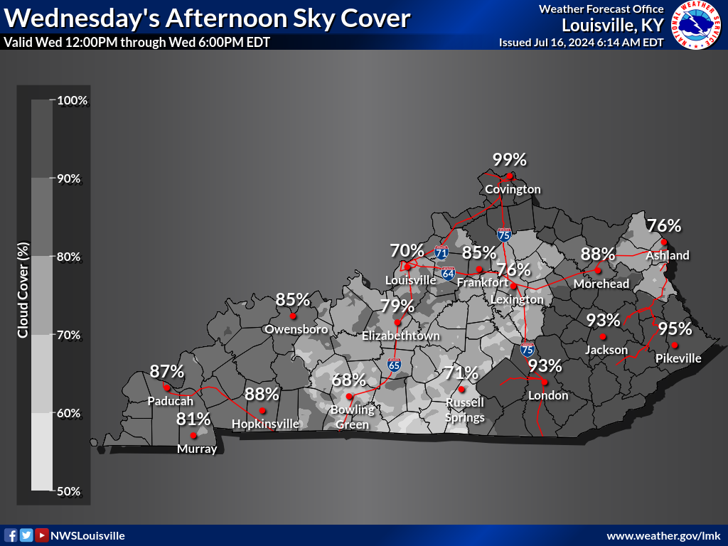
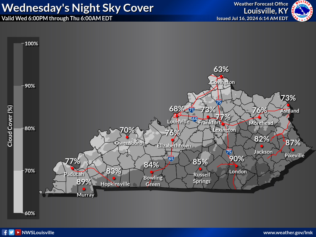
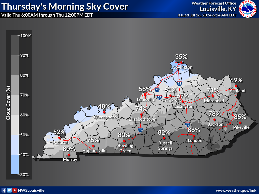
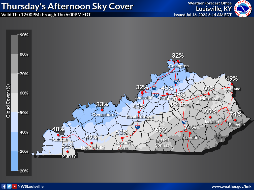
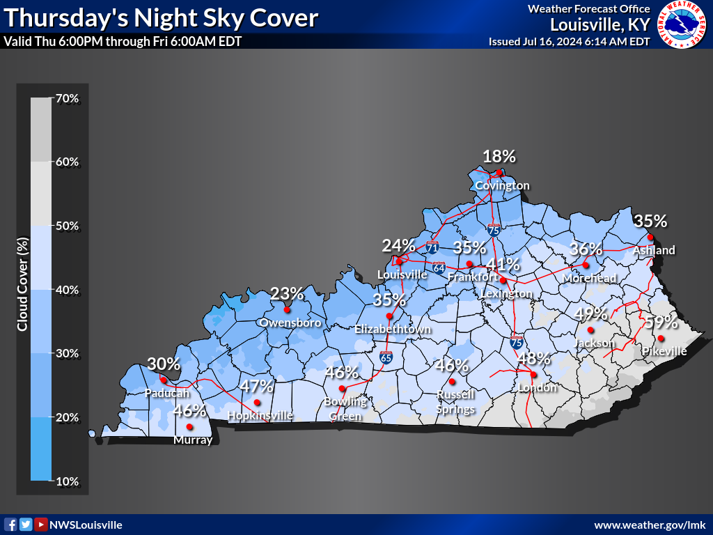
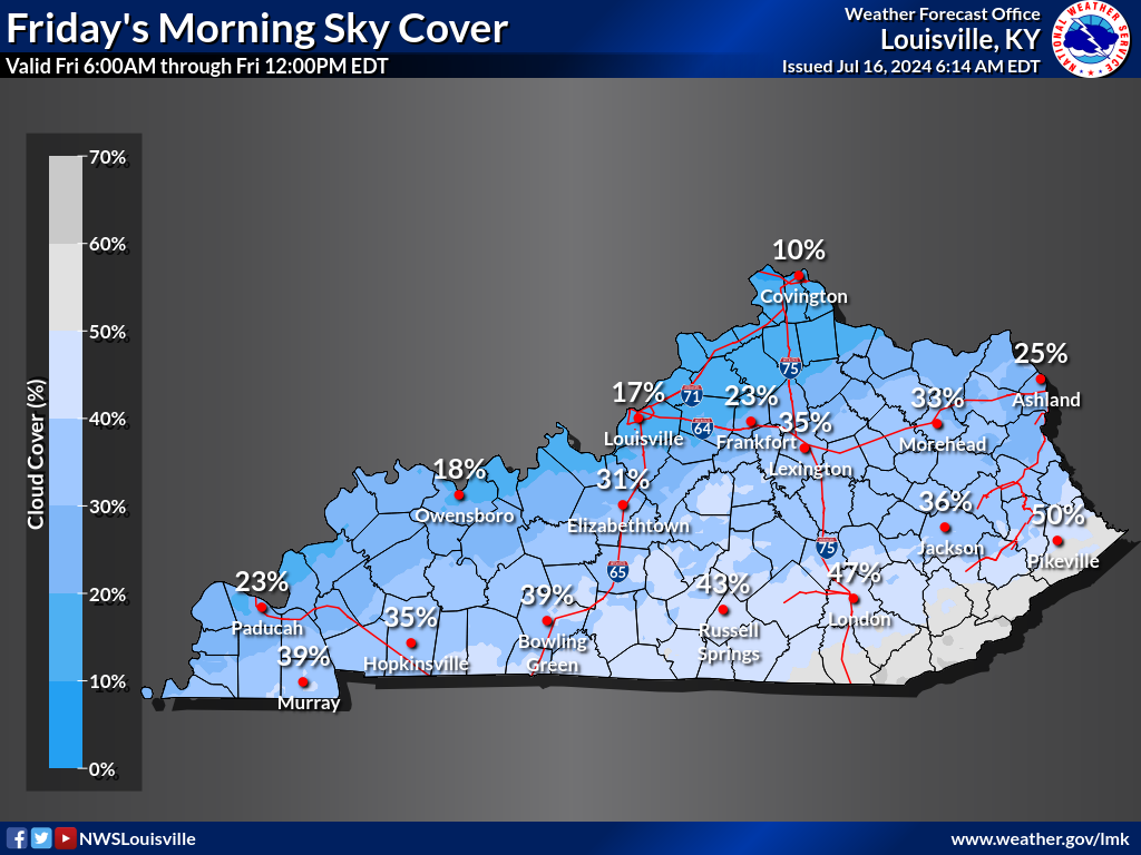
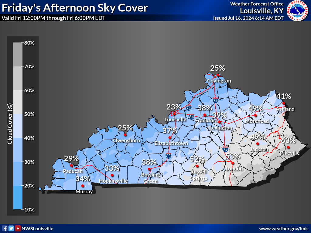
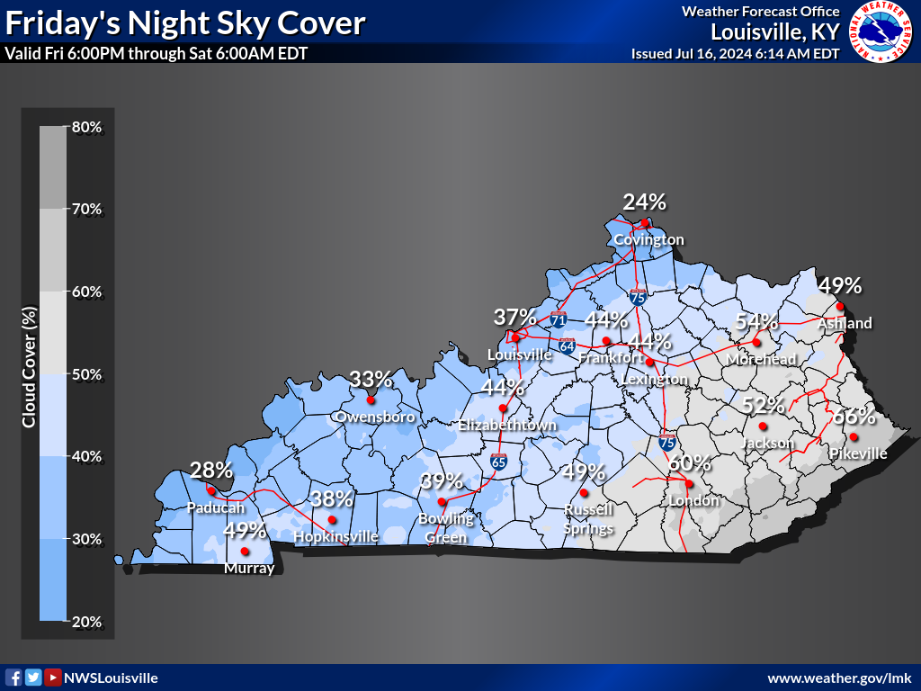
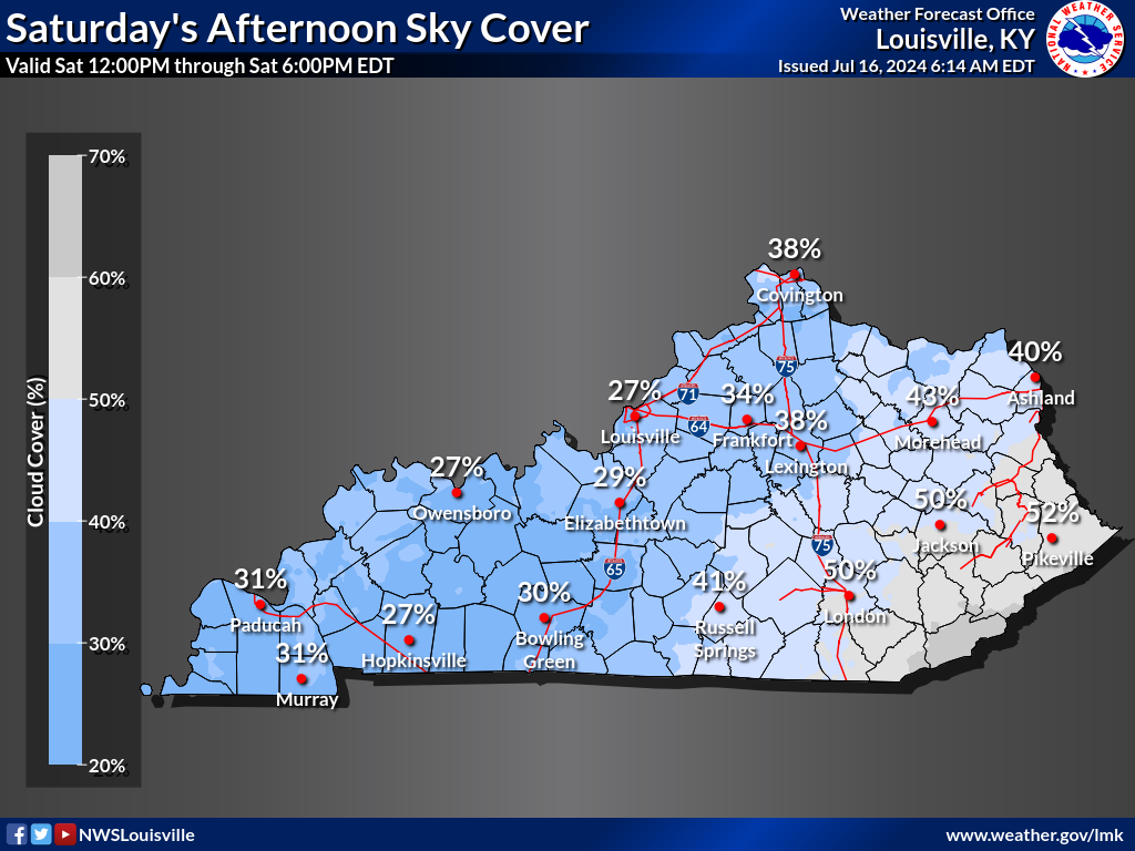
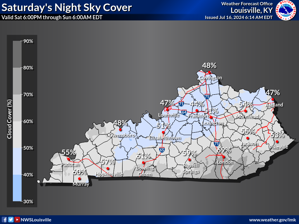
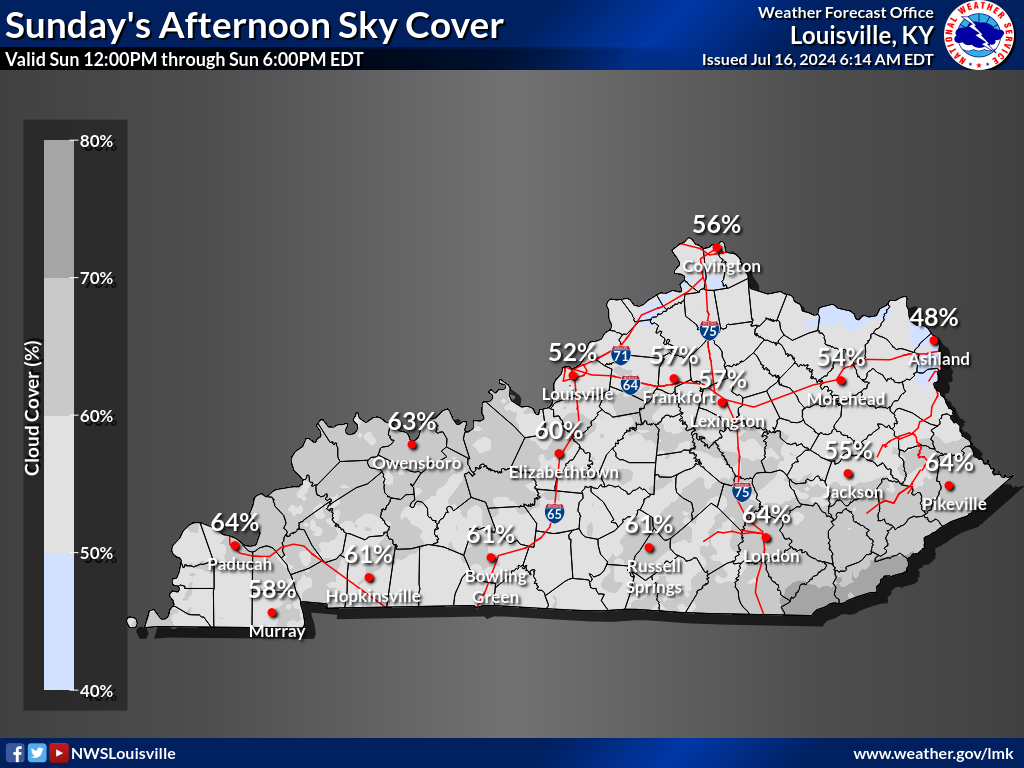
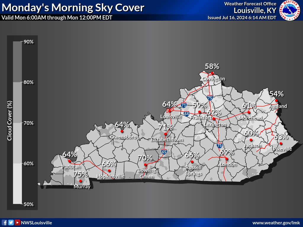
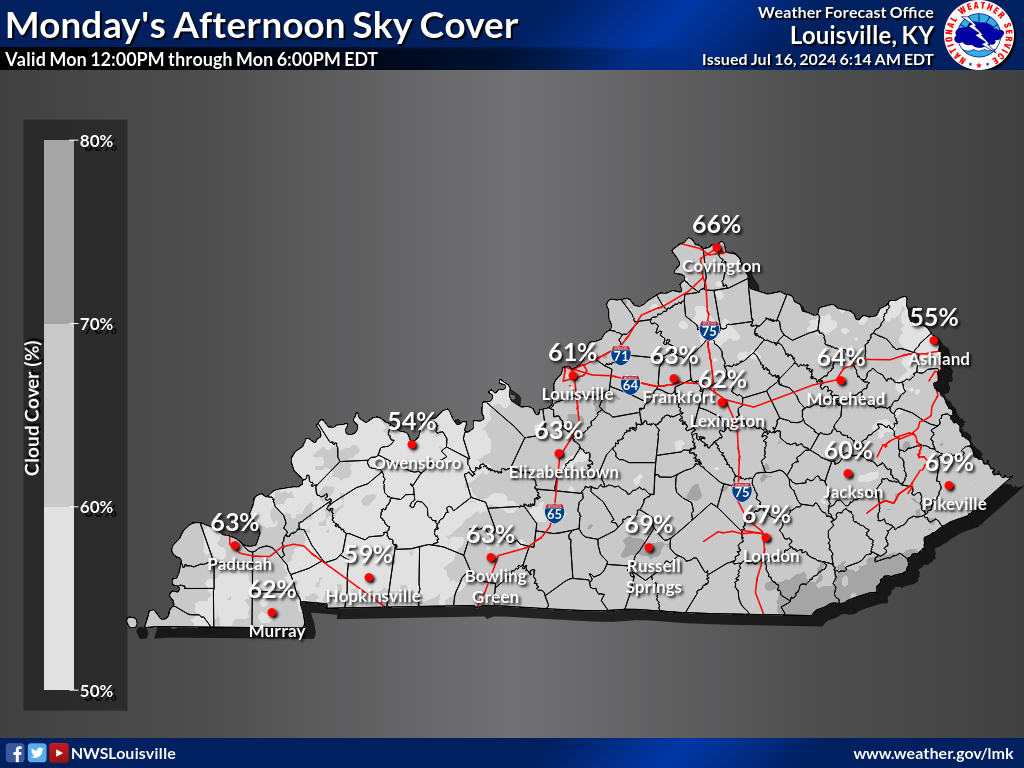
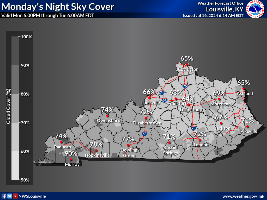
| Sky Cover Morning | Sky Cover Afternoon | Sky Cover Night | |
 |
 |
 |
|
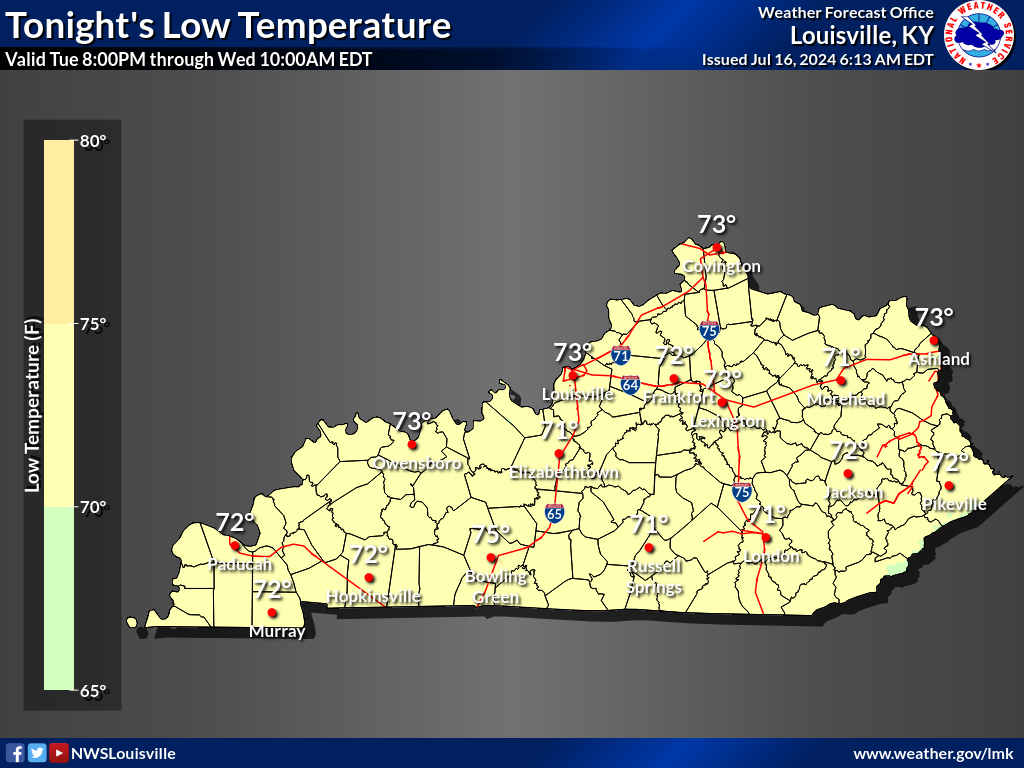
TOMORROW |
|||
|---|---|---|---|
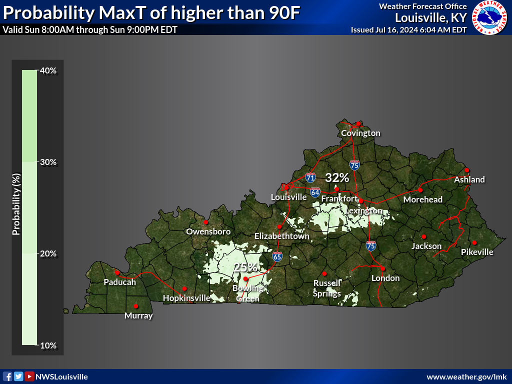
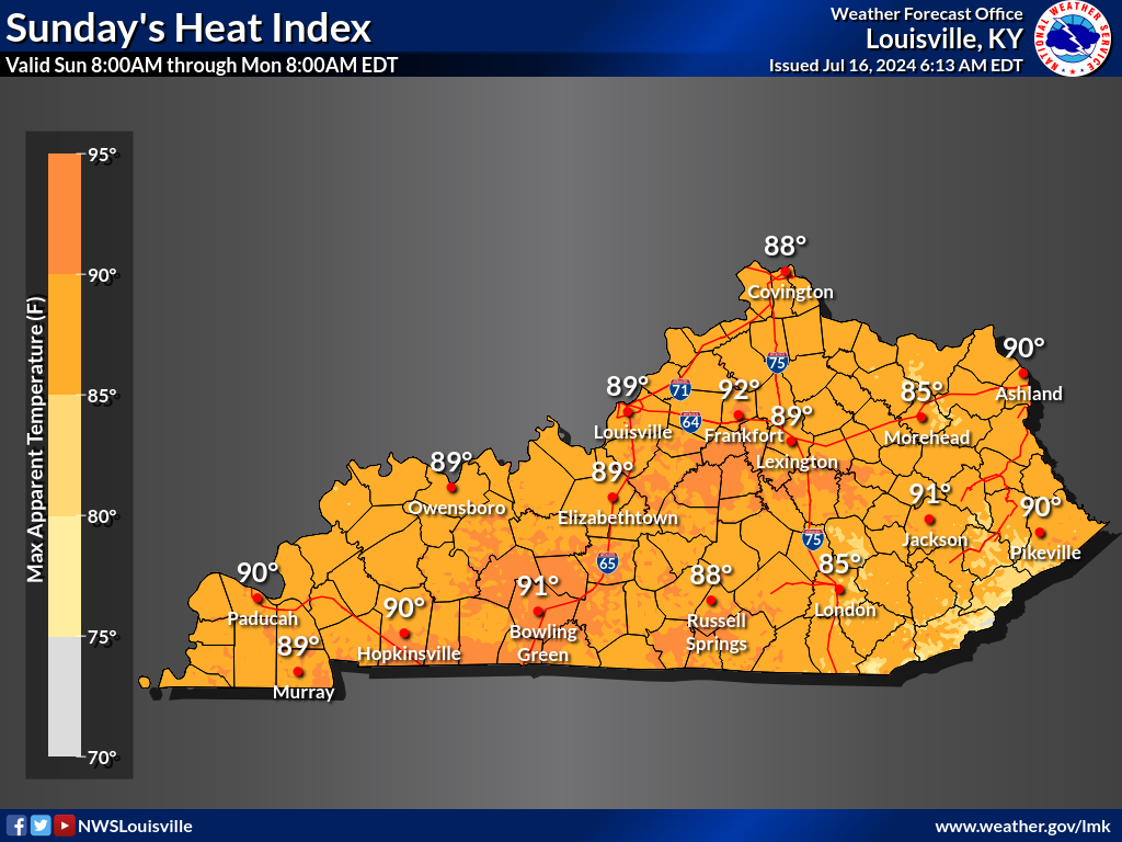
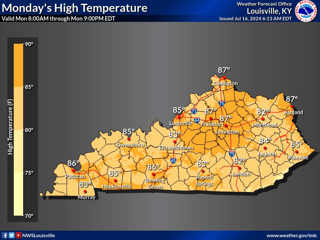
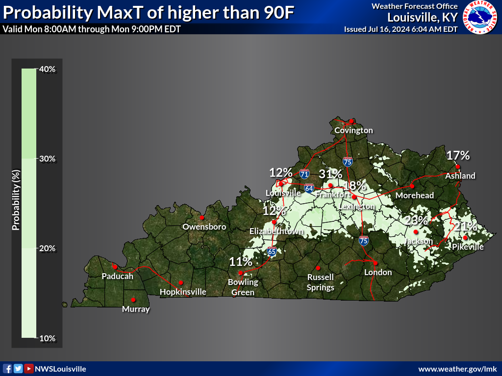
| High Temperatures | MaxT > 90F | Heat Index > 100F | Heat Index |
 |
 |
 |
 |
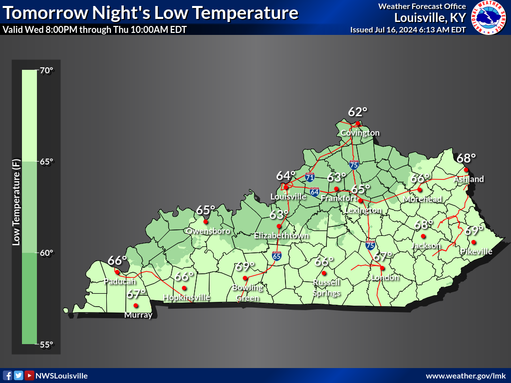
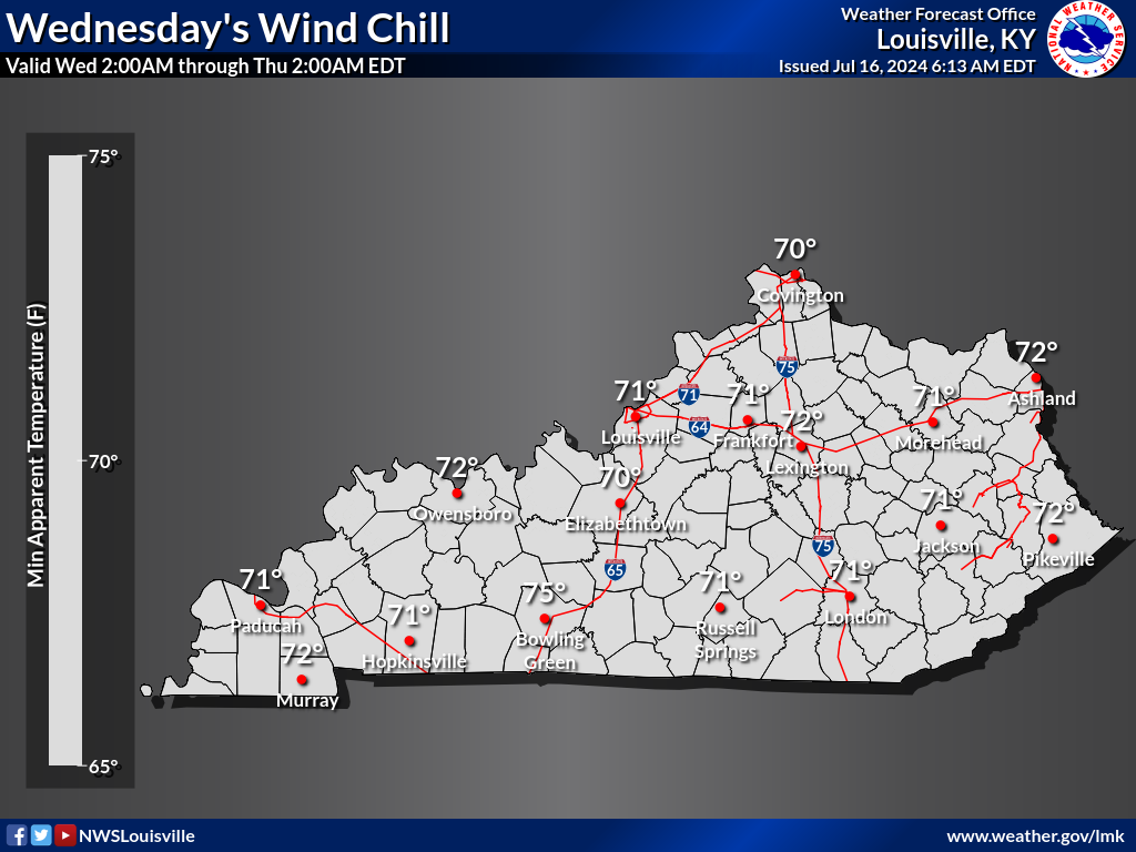
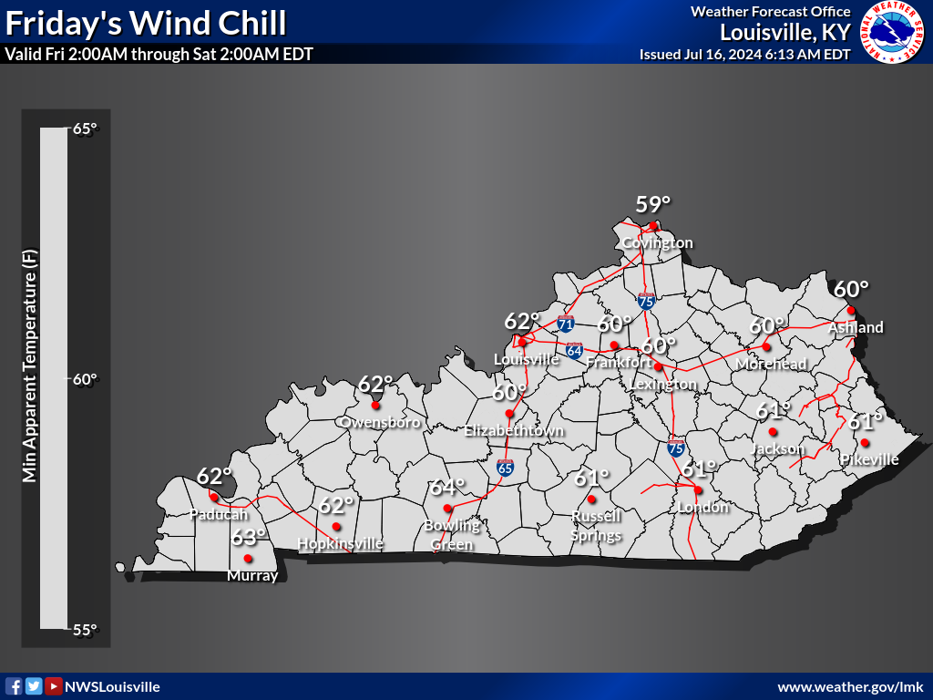
| Low Temperatures | MinT <= 32F | Wind Chill <= 0F | Wind Chill |
 |
 |
 |
 |
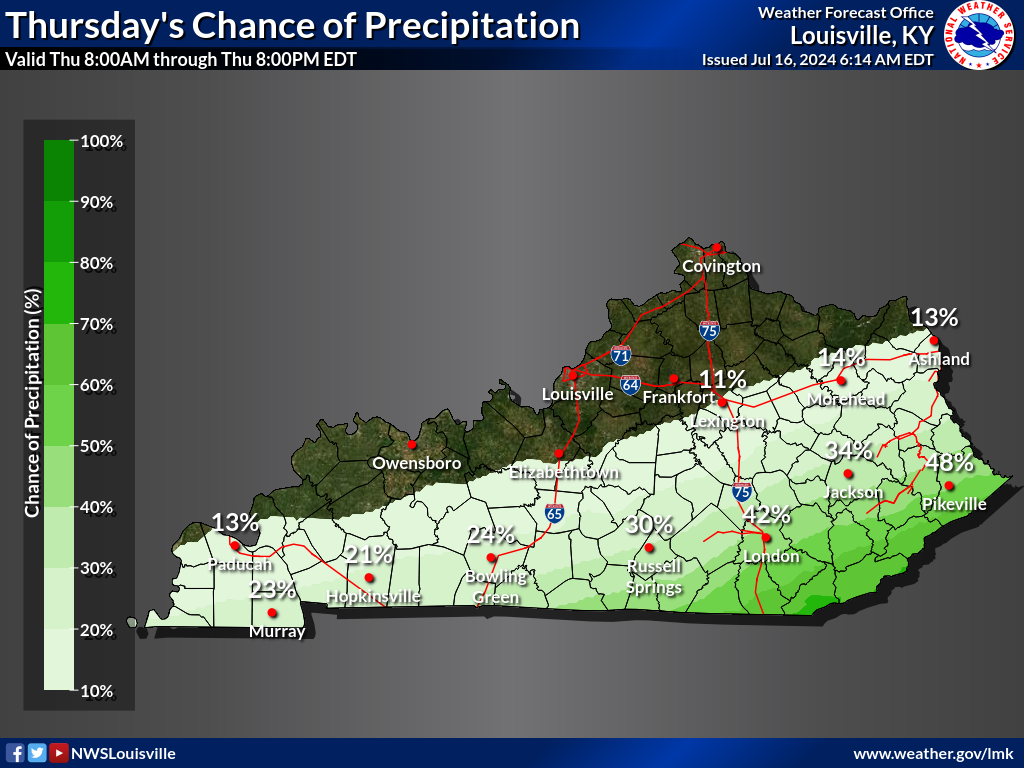
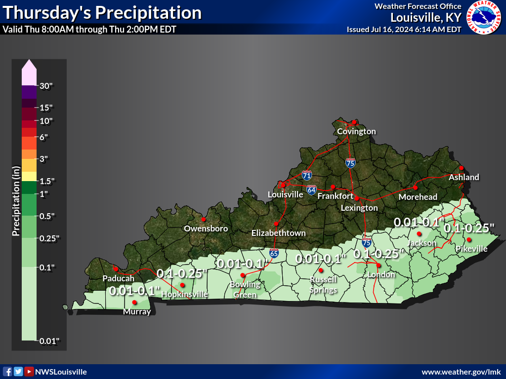
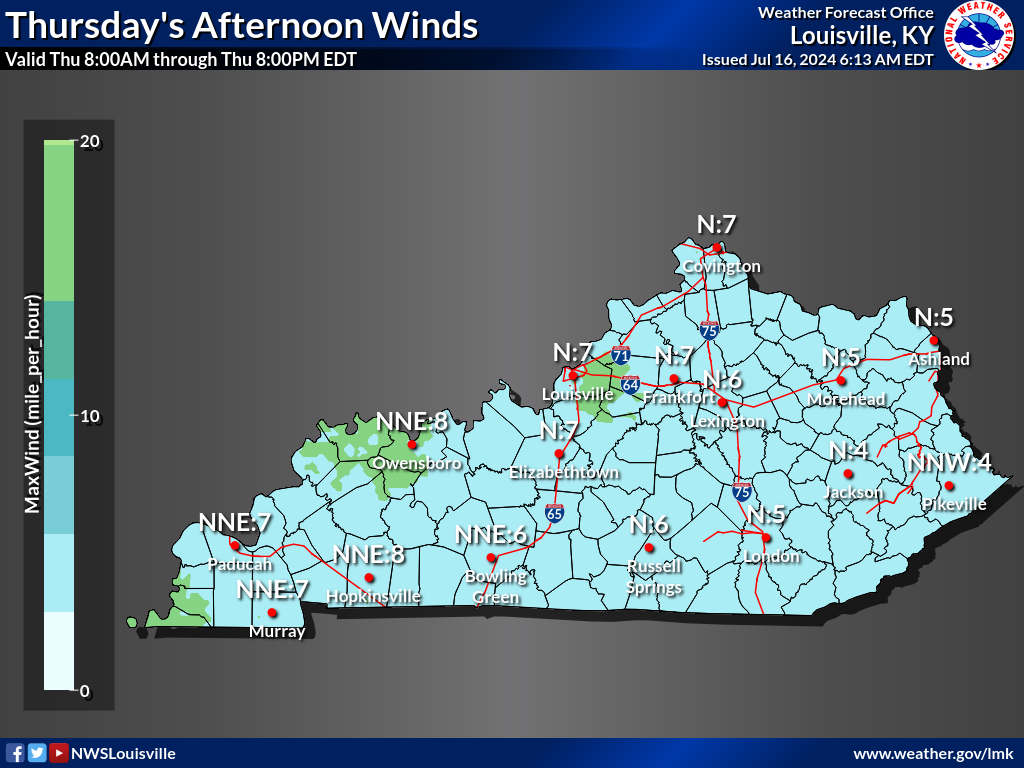
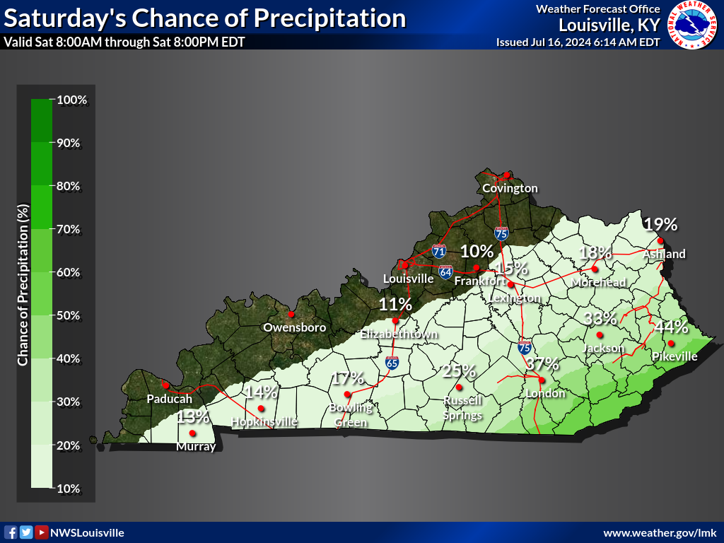
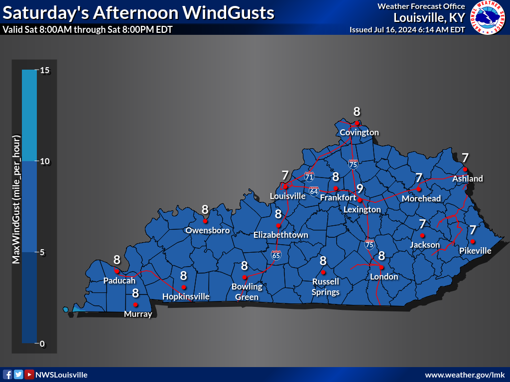
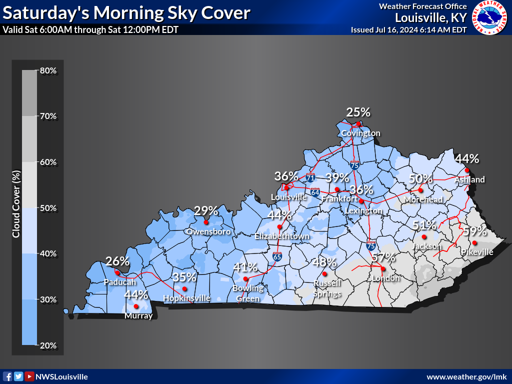
| Probability of Precipitation | Quantitative Precipitation Forecast | Winds | Gusts |
 |
 |
 |
 |
| Sky Cover Morning | Sky Cover Afternoon | Sky Cover Night | |
 |
 |
 |
|
DAY 3 |
|||
|---|---|---|---|
| High Temperatures | MaxT > 90F | Heat Index > 100F | Heat Index |
 |
 |
 |
 |
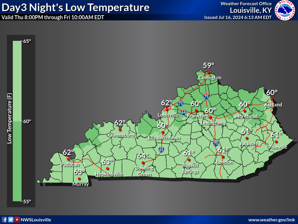
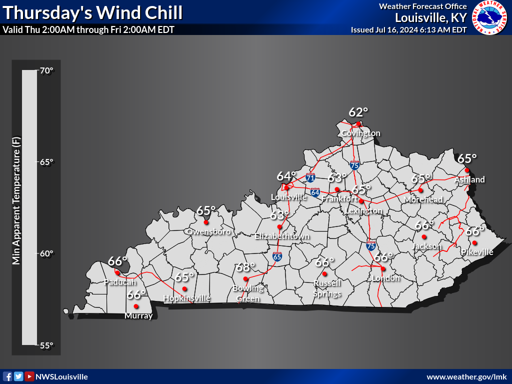
| Low Temperatures | MinT <= 32F | Wind Chill <= 0F | Wind Chill |
 |
 |
 |
 |
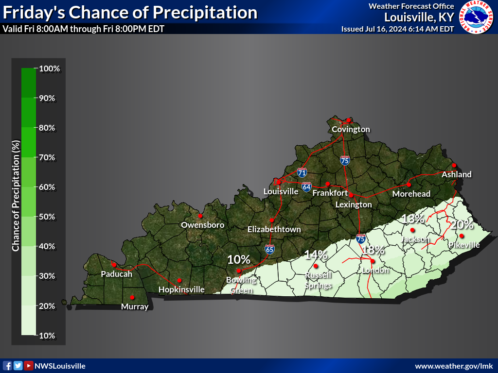
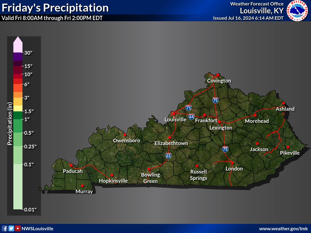
| Probability of Precipitation | Quantitative Precipitation Forecast | Winds | Gusts |
 |
 |
 |
 |
| Sky Cover Morning | Sky Cover Afternoon | Sky Cover Night | |
 |
 |
 |
|
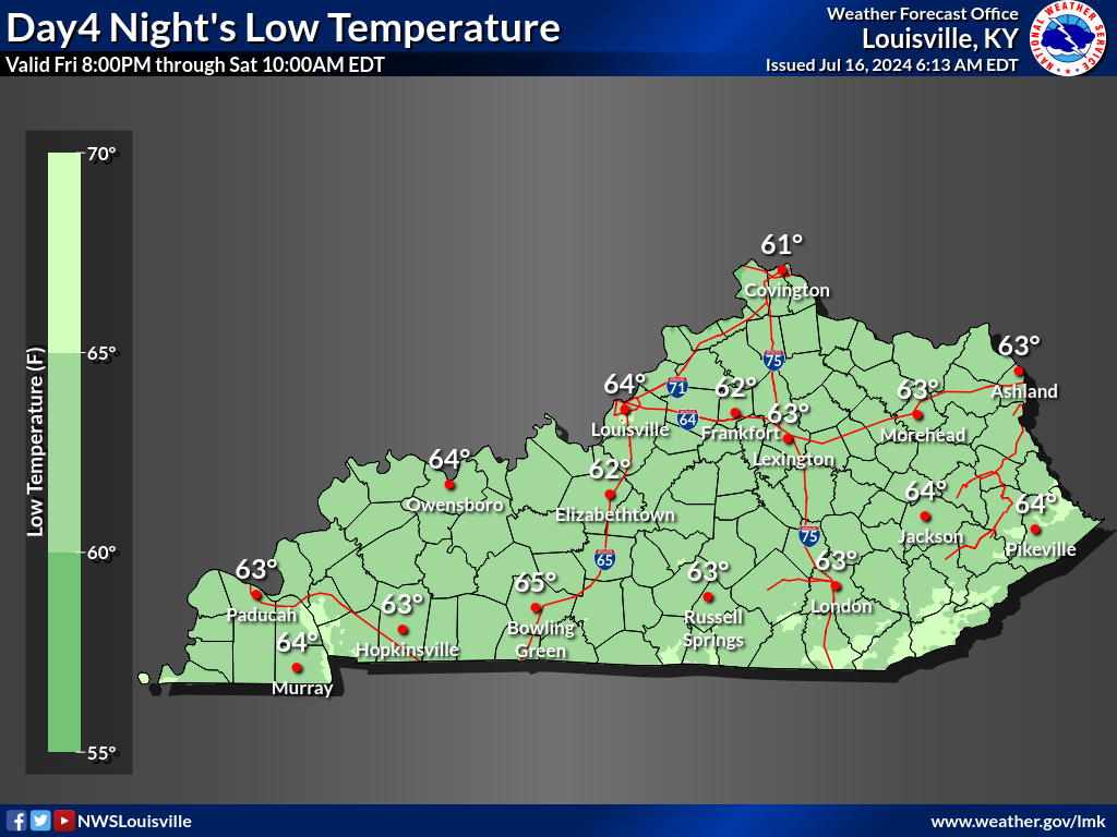
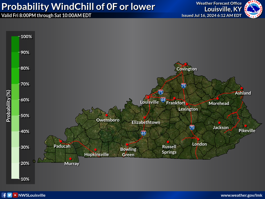
DAY 4 |
|||
|---|---|---|---|
| High Temperatures | MaxT > 90F | Heat Index > 100F | Heat Index |
 |
 |
 |
 |
| Low Temperatures | MinT <= 32F | Wind Chill <= 0F | Wind Chill |
 |
 |
 |
 |
| Probability of Precipitation | Quantitative Precipitation Forecast | Winds | Gusts |
 |
 |
 |
 |
| Sky Cover Morning | Sky Cover Afternoon | Sky Cover Night | |
 |
 |
 |
|
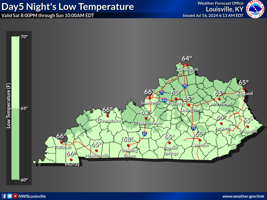
DAY 5 |
|||
|---|---|---|---|
| High Temperatures | MaxT > 90F | Heat Index > 100F | Heat Index |
 |
 |
 |
 |
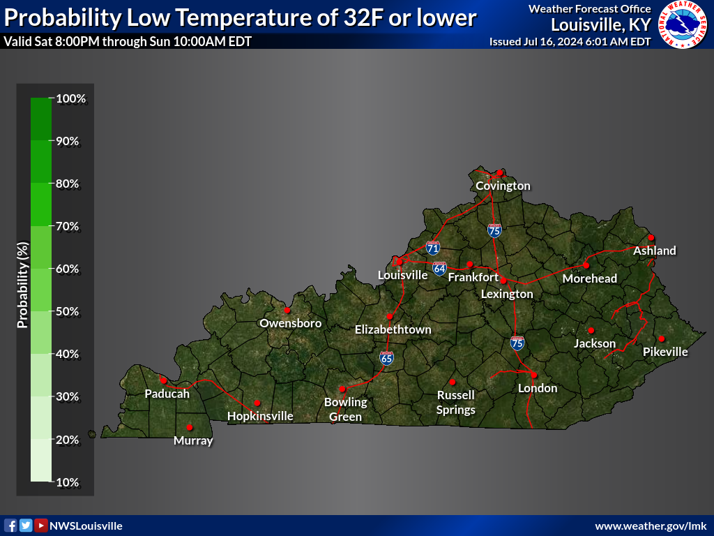
| Low Temperatures | MinT <= 32F | Wind Chill <= 0F | Wind Chill |
 |
 |
 |
 |
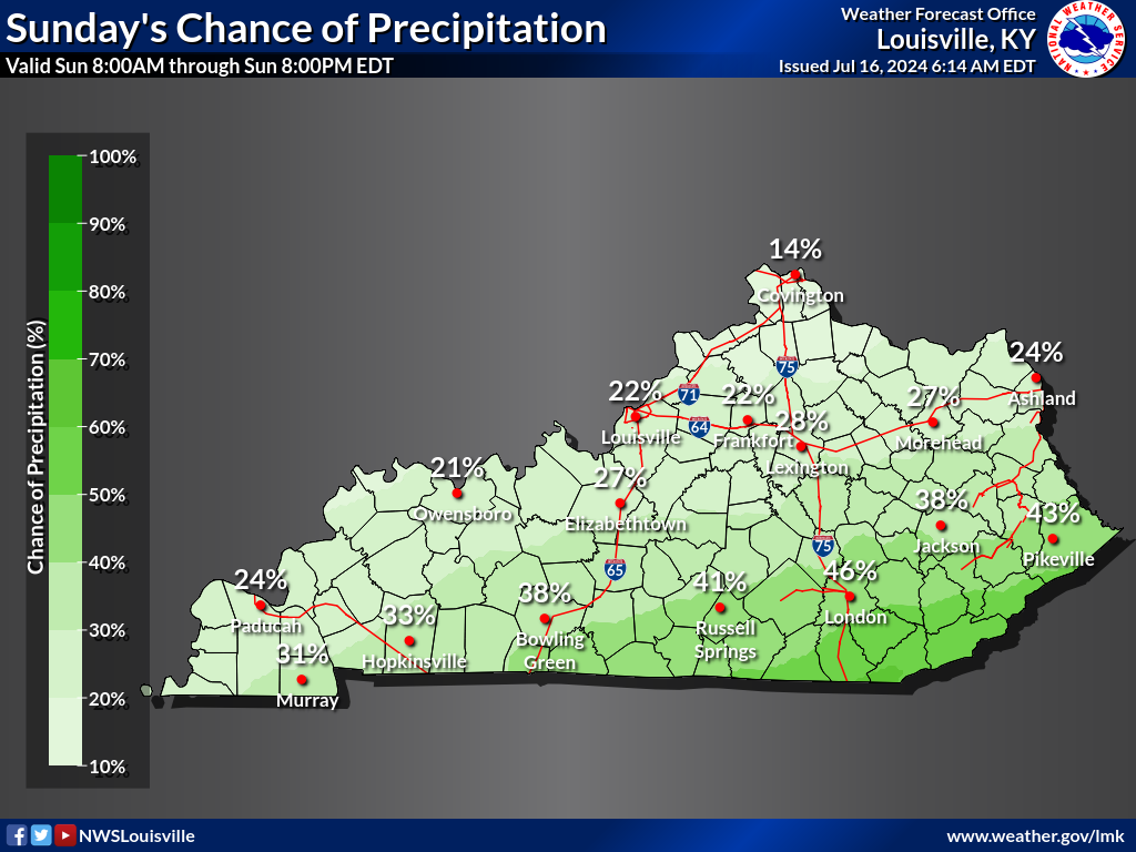
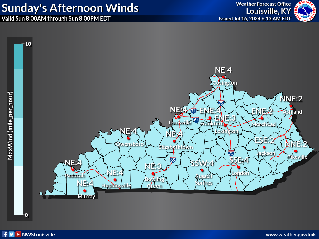
| Probability of Precipitation | Winds | Gusts | |
 |
 |
 |
|
| Sky Cover Morning | Sky Cover Afternoon | Sky Cover Night | |
 |
 |
 |
|
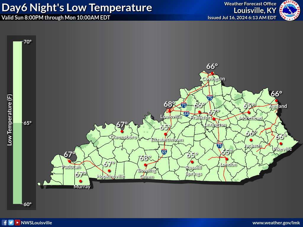
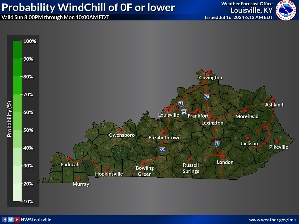
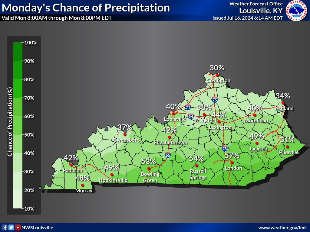
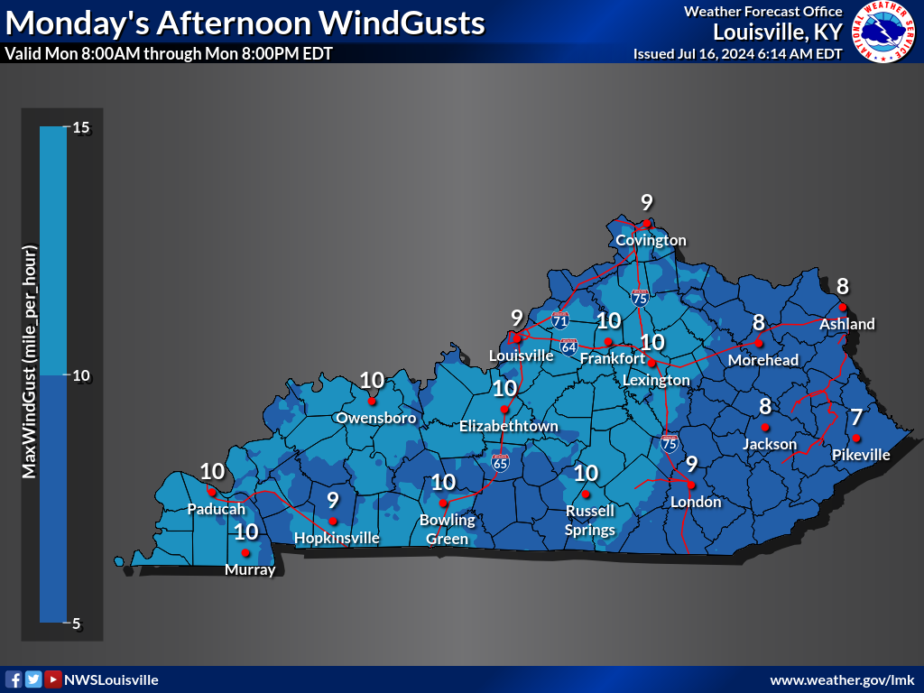
DAY 6 |
|||
|---|---|---|---|
| High Temperatures | MaxT > 90F | Heat Index > 100F | Heat Index |
 |
 |
 |
 |
| Low Temperatures | MinT <= 32F | Wind Chill <= 0F | Wind Chill |
 |
 |
 |
 |
| Probability of Precipitation | Winds | Gusts | |
 |
 |
 |
|
| Sky Cover Morning | Sky Cover Afternoon | Sky Cover Night | |
 |
 |
 |
|
DAY 7 |
|||
|---|---|---|---|
| High Temperatures | MaxT > 90F | Heat Index > 100F | Heat Index |
 |
 |
 |
 |
| Low Temperatures | MinT <= 32F | Wind Chill <= 0F | Wind Chill |
 |
 |
 |
 |
| Probability of Precipitation | Winds | Gusts | |
 |
 |
 |
|
| Sky Cover Morning | Sky Cover Afternoon | Sky Cover Night | |
 |
 |
 |
|
Severe Weather Outlooks - Storm Prediction Center
Day 1 Convective Outlook |
||
|---|---|---|
 |
||
| Tornado | Wind | Hail |
 |
 |
 |
Day 2 Convective Outlook |
||
|---|---|---|
 |
||
| Tornado | Wind | Hail |
 |
 |
 |
Day 3 Convective Outlook |
|
|---|---|
| Categorical | Probabilistic |
 |
 |
Day 4-8 Severe Weather Outlook |
||
|---|---|---|
 |
||
SPC Outlook Info |
||
|---|---|---|
 |
||
Snow and Ice Forecast
| Snow Accumulation | Ice Accumulation |
|---|---|
 |
 |
Additional Kentucky Snow Forecasts
Additional winter weather forecast products - Weather Prediction Center
Day 1 |
|||
|---|---|---|---|
| Prob Snow >= 4" | Prob Snow >= 8" | Prob Snow >= 12" | Prob Ice >= 0.25" |
 |
 |
 |
 |
Day 2 |
|||
|---|---|---|---|
| Prob Snow >= 4" | Prob Snow >= 8" | Prob Snow >= 12" | Prob Ice >= 0.25" |
 |
 |
 |
 |
Day 3 |
|||
|---|---|---|---|
| Prob Snow >= 4" | Prob Snow >= 8" | Prob Snow >= 12" | Prob Ice >= 0.25" |
 |
 |
 |
 |
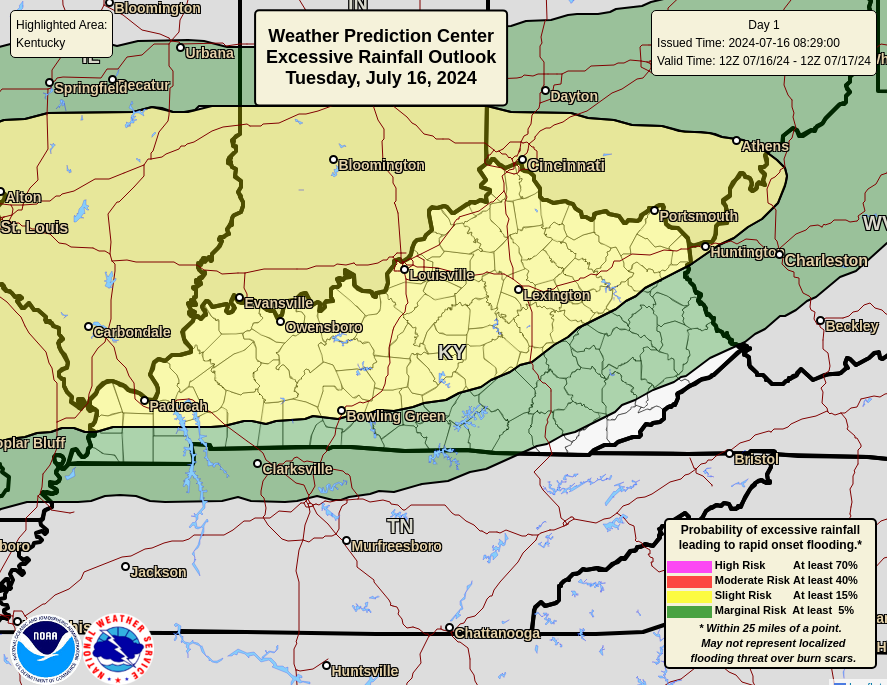
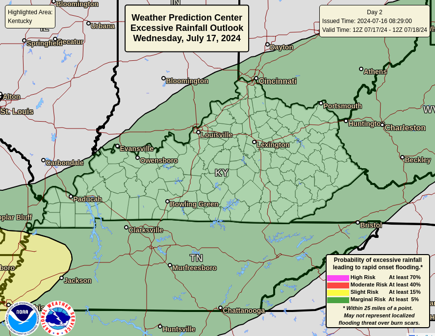
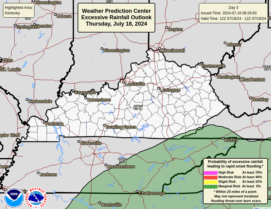
Excessive Rainfall Outlooks - Weather Prediction Center
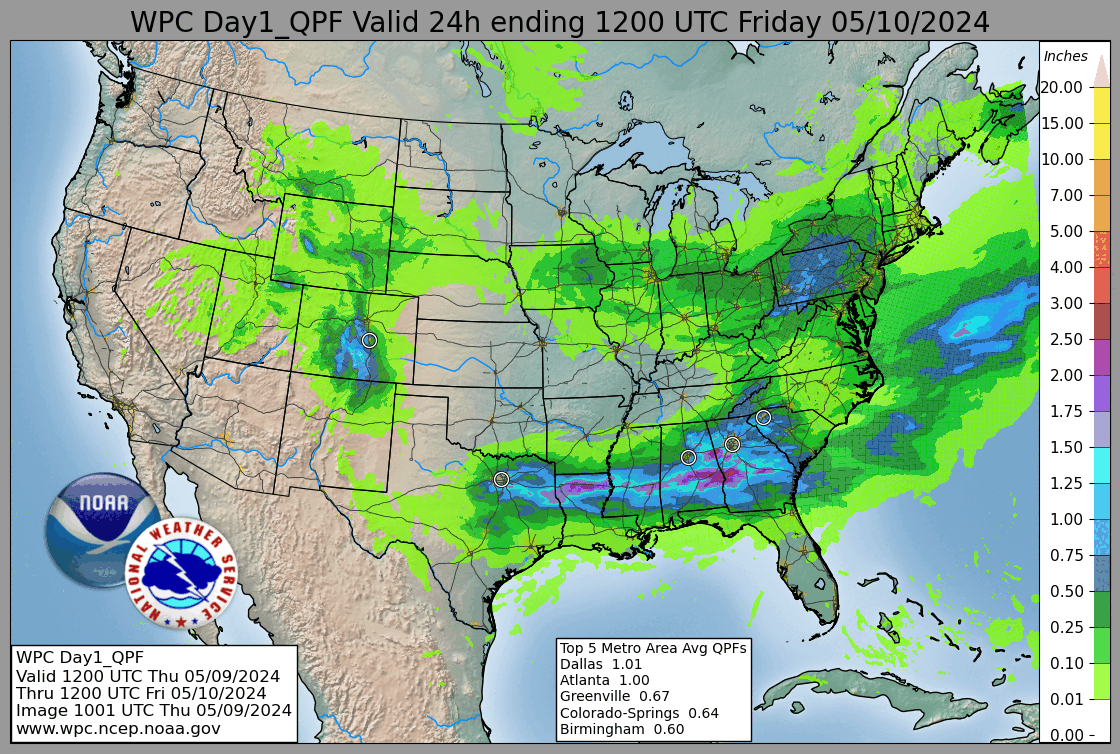
Day 1 |
|
|---|---|
| Excessive Rainfall Outlook | Precipitation Forecast |
 |
 |
Day 2 |
|
|---|---|
| Excessive Rainfall Outlook | Precipitation Forecast |
 |
 |
Day 3 |
|
|---|---|
| Excessive Rainfall Outlook | Precipitation Forecast |
 |
 |
Day 1 -7 |
|
|---|---|
| Loop | Accumulation |
 |
 |
Links
Severe Links
Flood Links
Winter Links


 Weather Story
 Weather Map
 Local Radar
Long Range Outlooks (images may be out of date. If so, please visit the Climate Prediction Center)