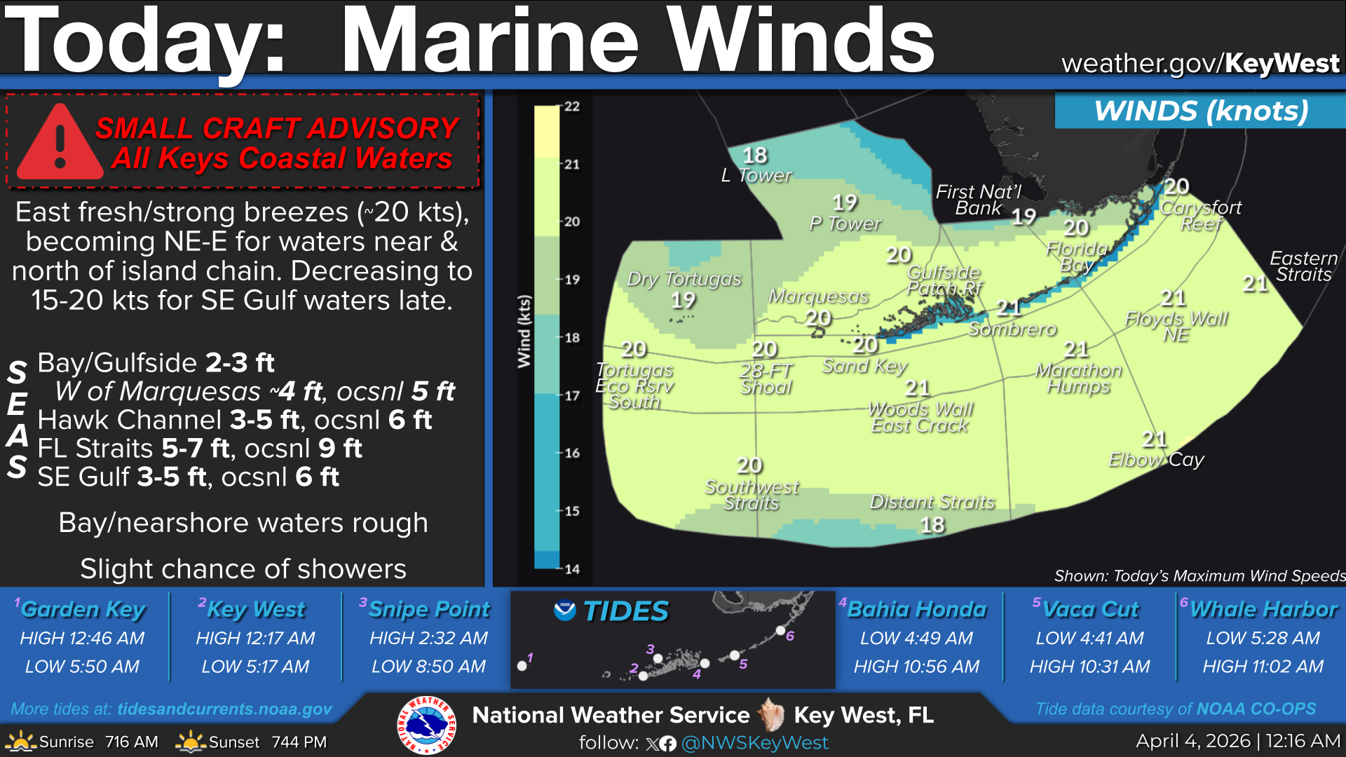
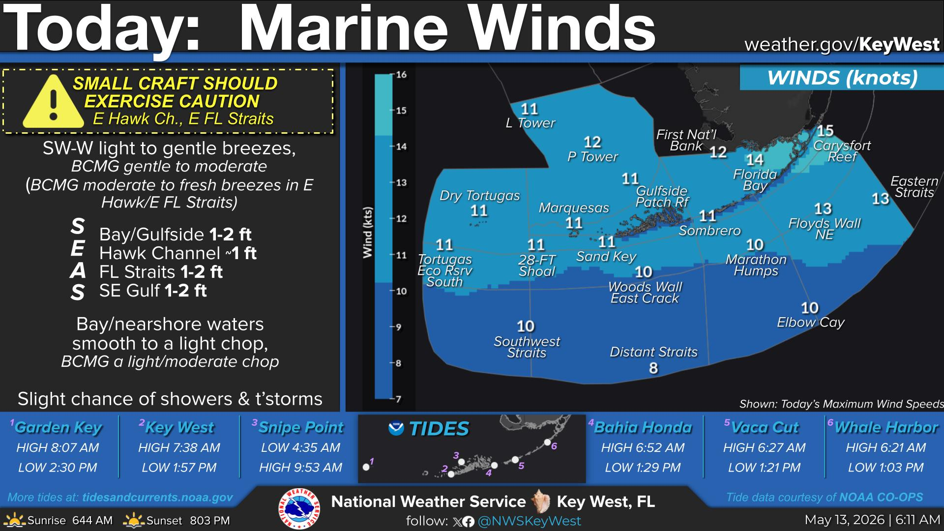
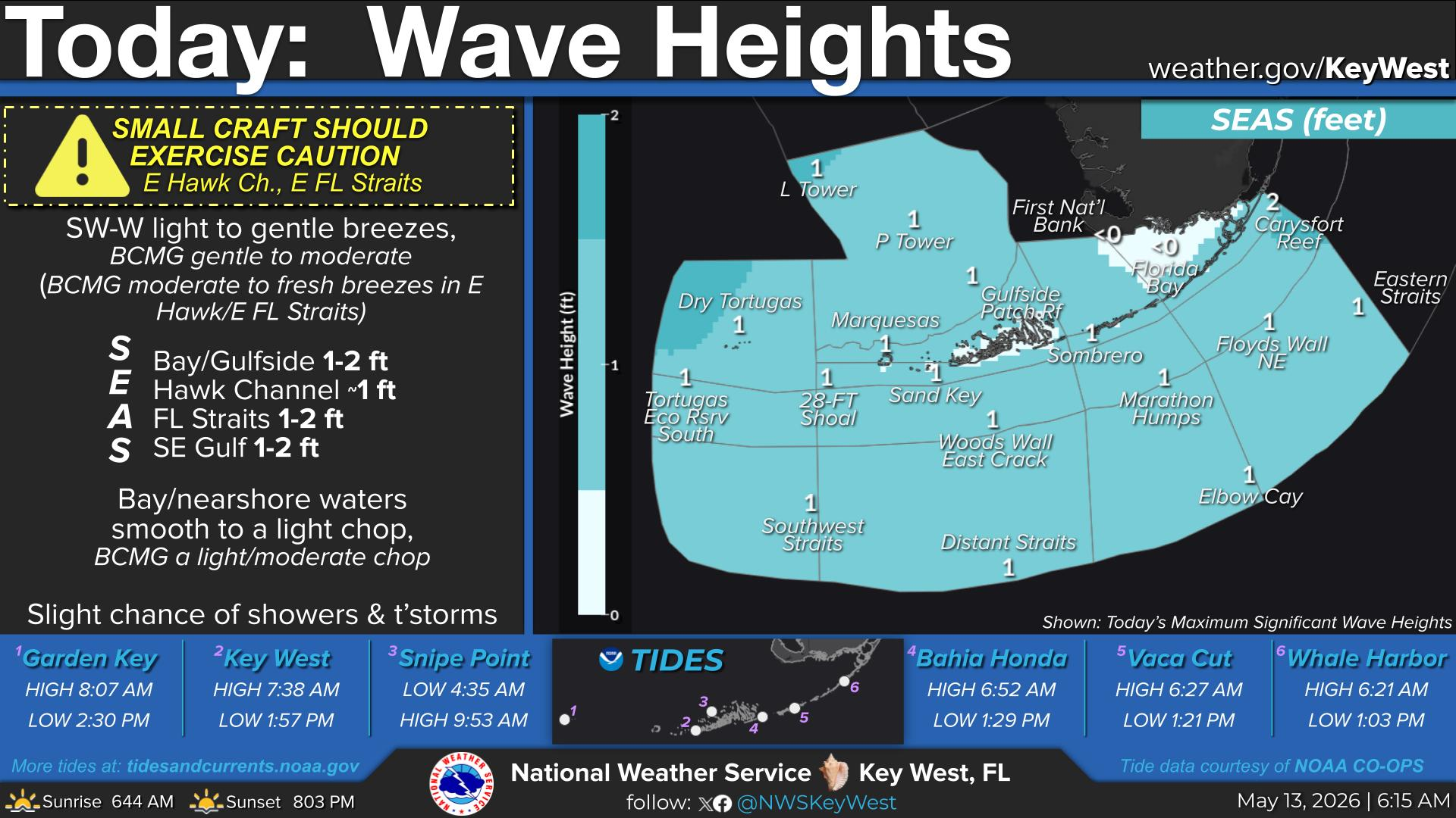
National Weather Service United States Department of Commerce
Click a location below for detailed forecast.

Last Map Update: Sun, Jul 21, 2024 at 9:14:18 pm EDT

TONIGHT...Mostly cloudy. Showers likely with a chance of thunderstorms. Lows near 80. East to southeast winds 10 to 15 mph, becoming southeast to south and decreasing to 5 to 10 mph after midnight. Chance of rain 60 percent.
TONIGHT...East winds near 15 knots, becoming southeast to south and decreasing to near 10 knots after midnight. Bay waters a moderate chop, becoming a light chop. Bay waters rough and winds higher in and around numerous showers and scattered thunderstorms.
TONIGHT...East winds near 15 knots, becoming southeast to south and decreasing to near 10 knots after midnight. Seas 1 to 2 feet. Nearshore waters a moderate chop, becoming a light chop. Winds and seas higher in and around numerous showers and scattered thunderstorms.
TONIGHT...East winds near 15 knots, becoming southeast to south and decreasing to 10 to 15 knots after midnight. Seas 2 to 3 feet, subsiding to around 2 feet. Nearshore waters a moderate chop, becoming a light to moderate chop. Winds and seas higher in and around numerous showers and scattered thunderstorms.
TONIGHT...East to southeast winds near 15 knots, becoming southeast to south and decreasing to 10 to 15 knots after midnight. Seas around 3 feet, subsiding to 2 to 3 feet. Wave Detail: East to southeast 3 feet at 5 seconds. Winds and seas higher in and around numerous showers and scattered thunderstorms.
TONIGHT...East winds 10 to 15 knots, becoming southeast and decreasing to near 10 knots. Seas 2 to 3 feet, subsiding to 1 to 3 feet. Wave Detail: East to southeast 2 feet at 4 seconds. Winds and seas higher in and around numerous showers and scattered thunderstorms.


Text Product Selector (Selected product opens in a new window)