
 |
 |
|
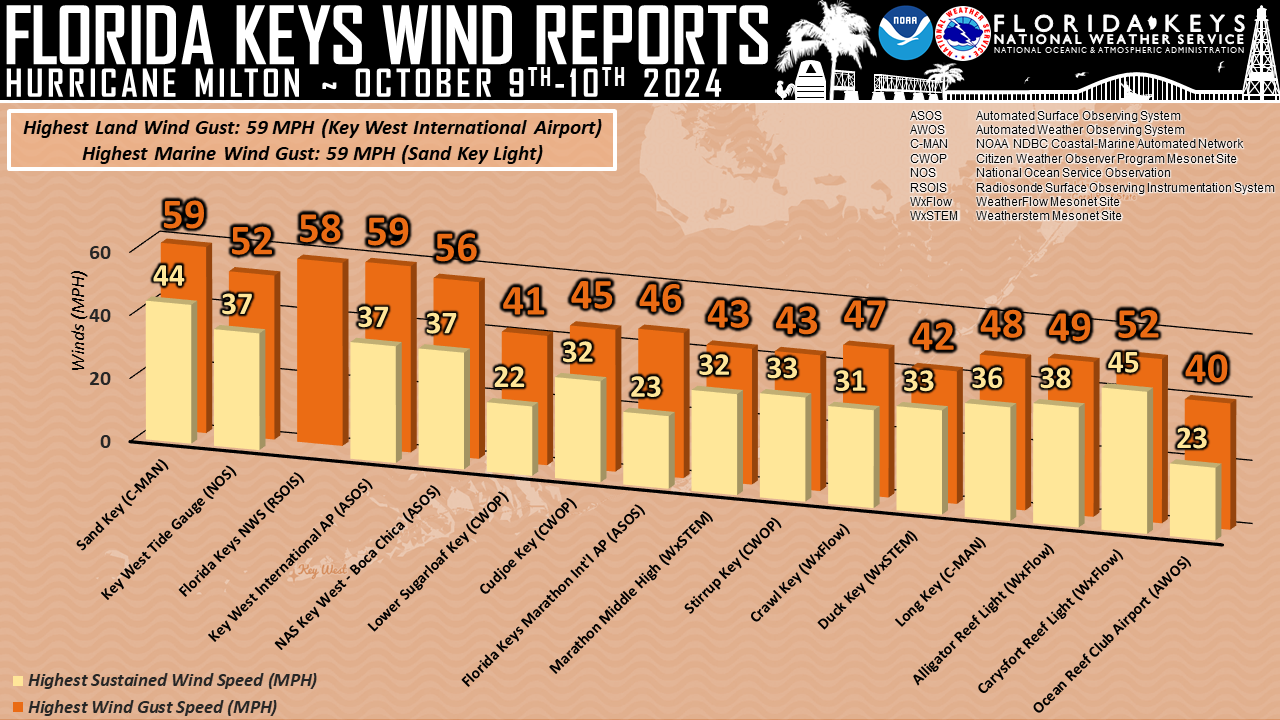
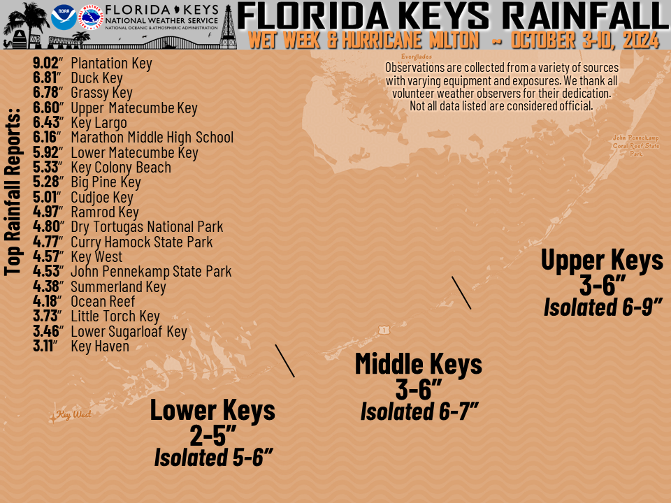
| Wind Reports | Rainfall Reports |
 |
 |
|
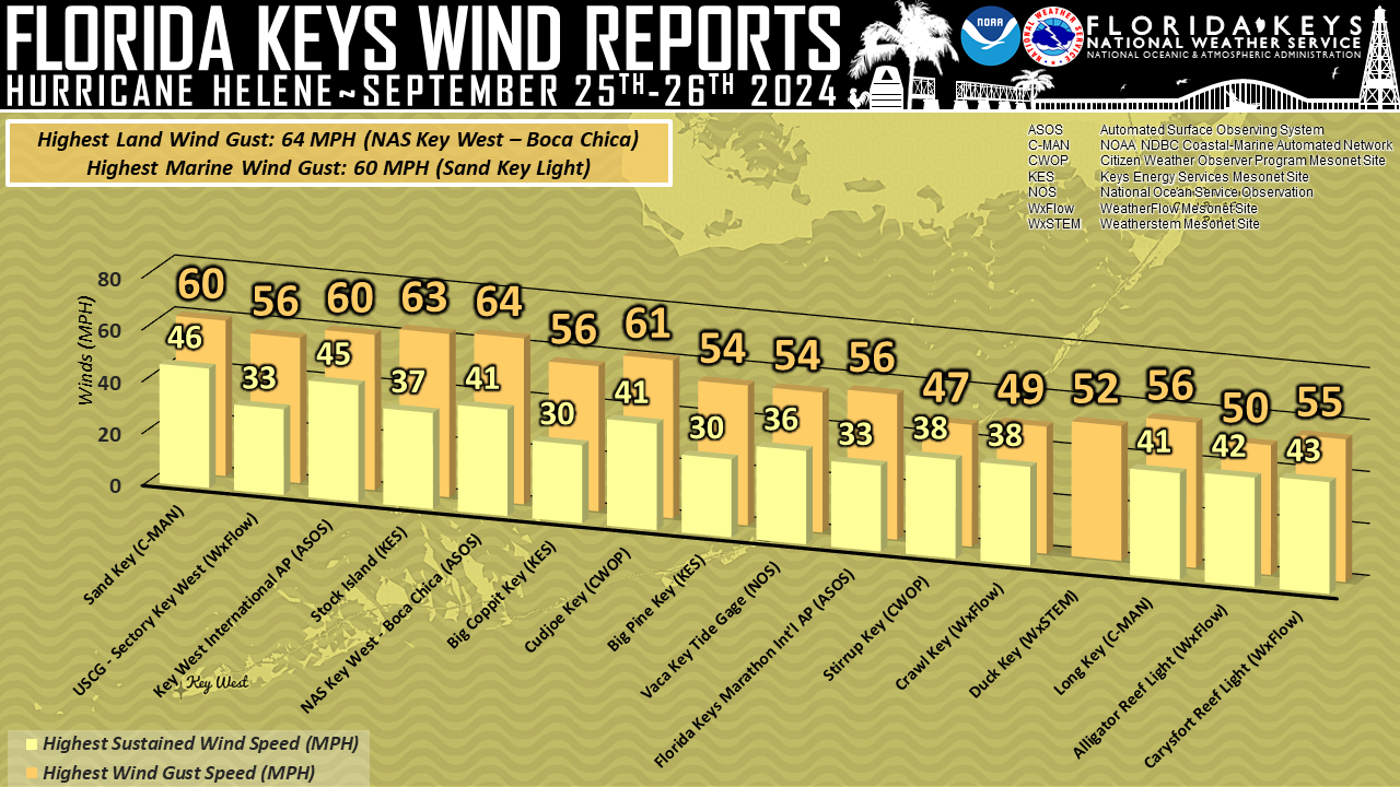
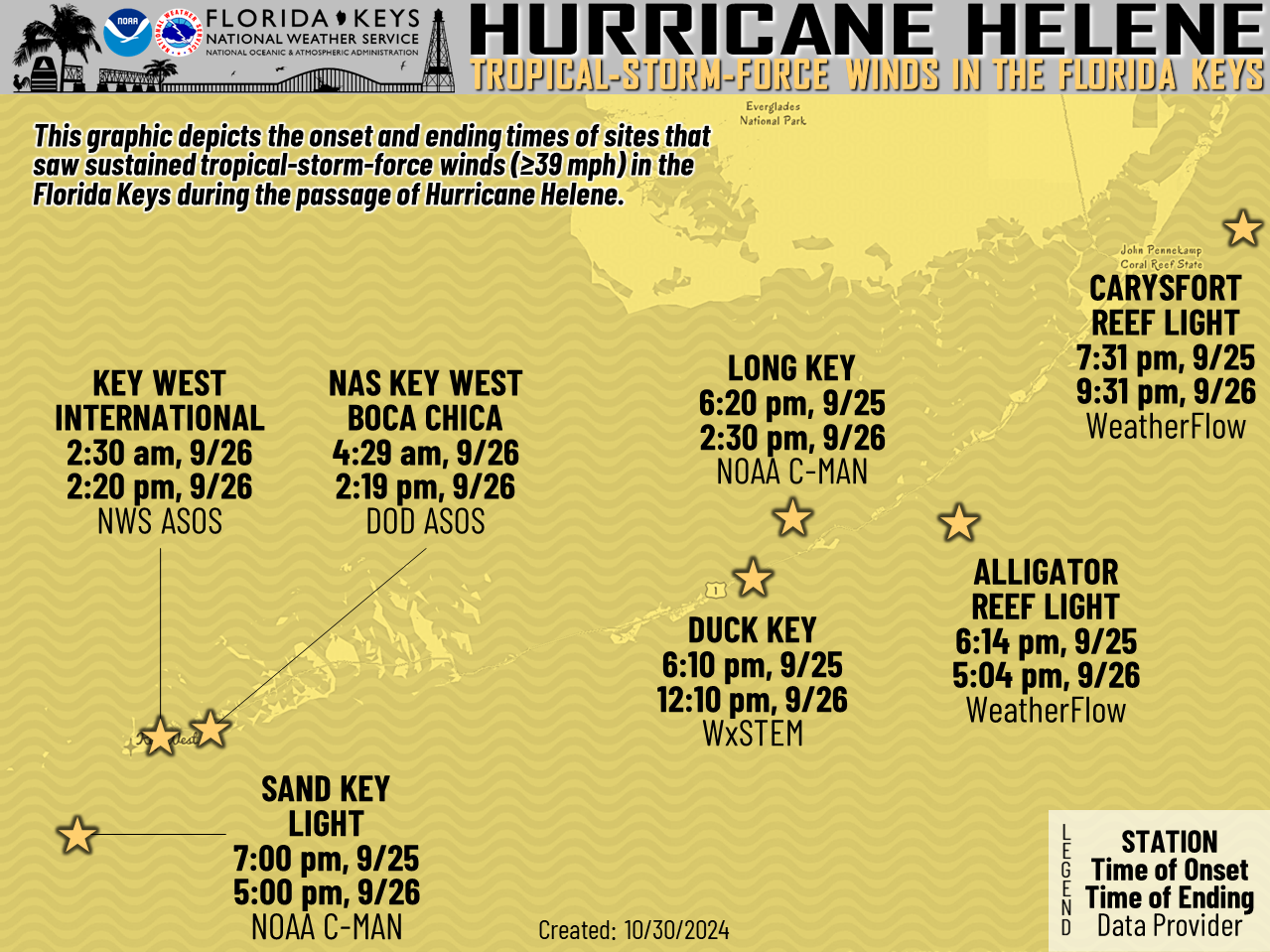
| Wind Reports | Onset and Ending Times of Tropical-Storm-Force Winds |
|
 |
||
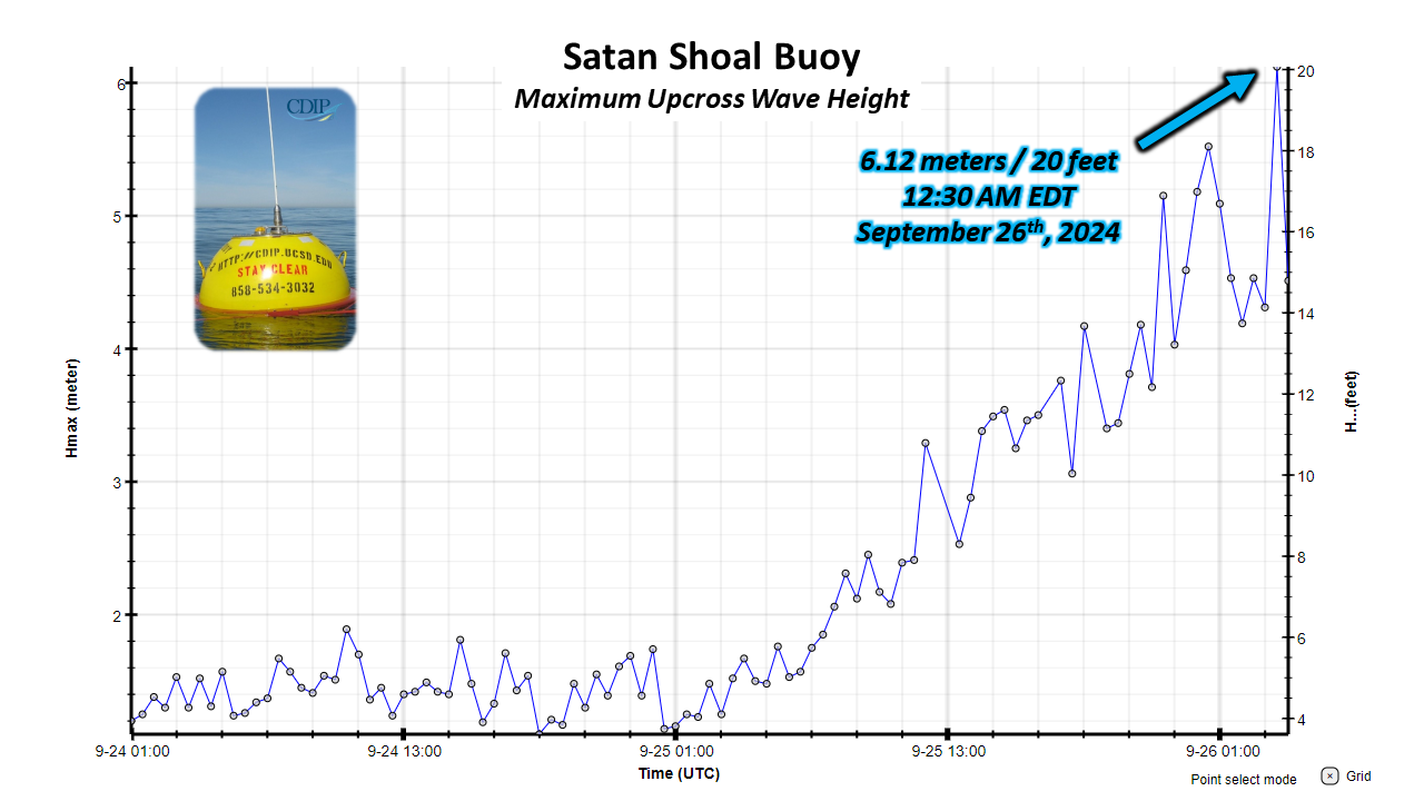
| Satan Shoal CDIP Buoy Maximum Wave Heights | ||
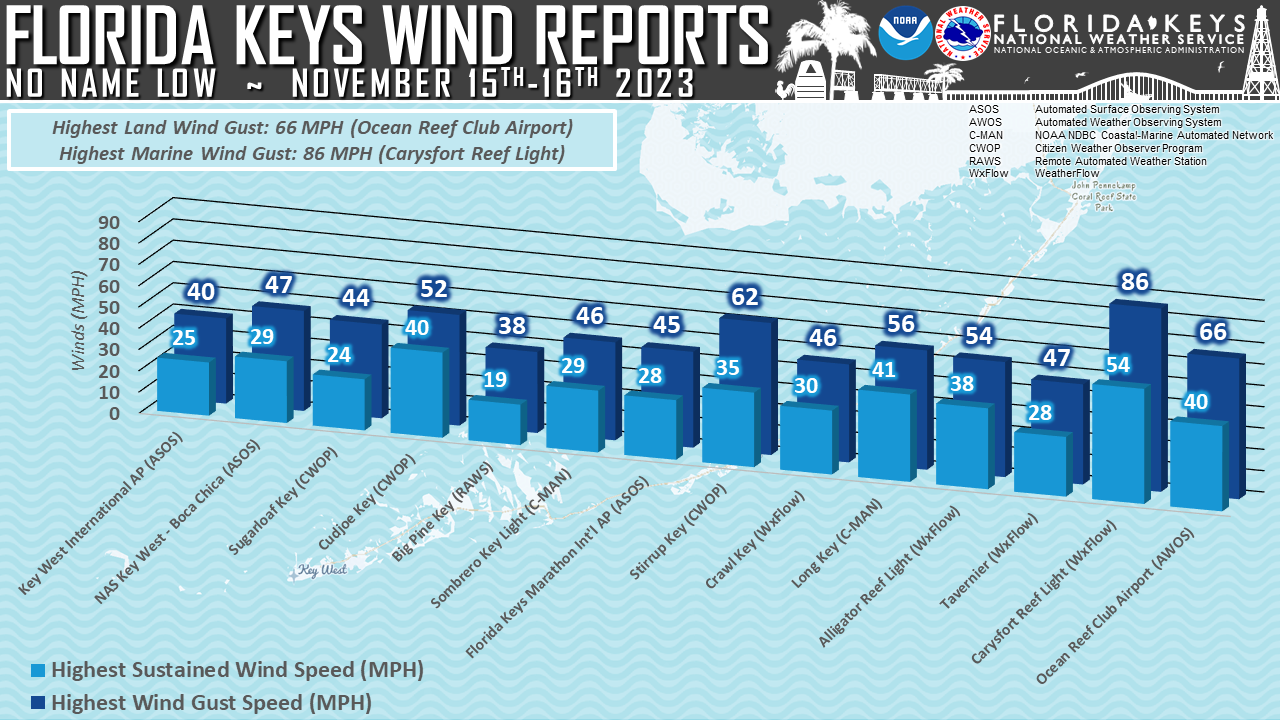 |
| Wind Reports |
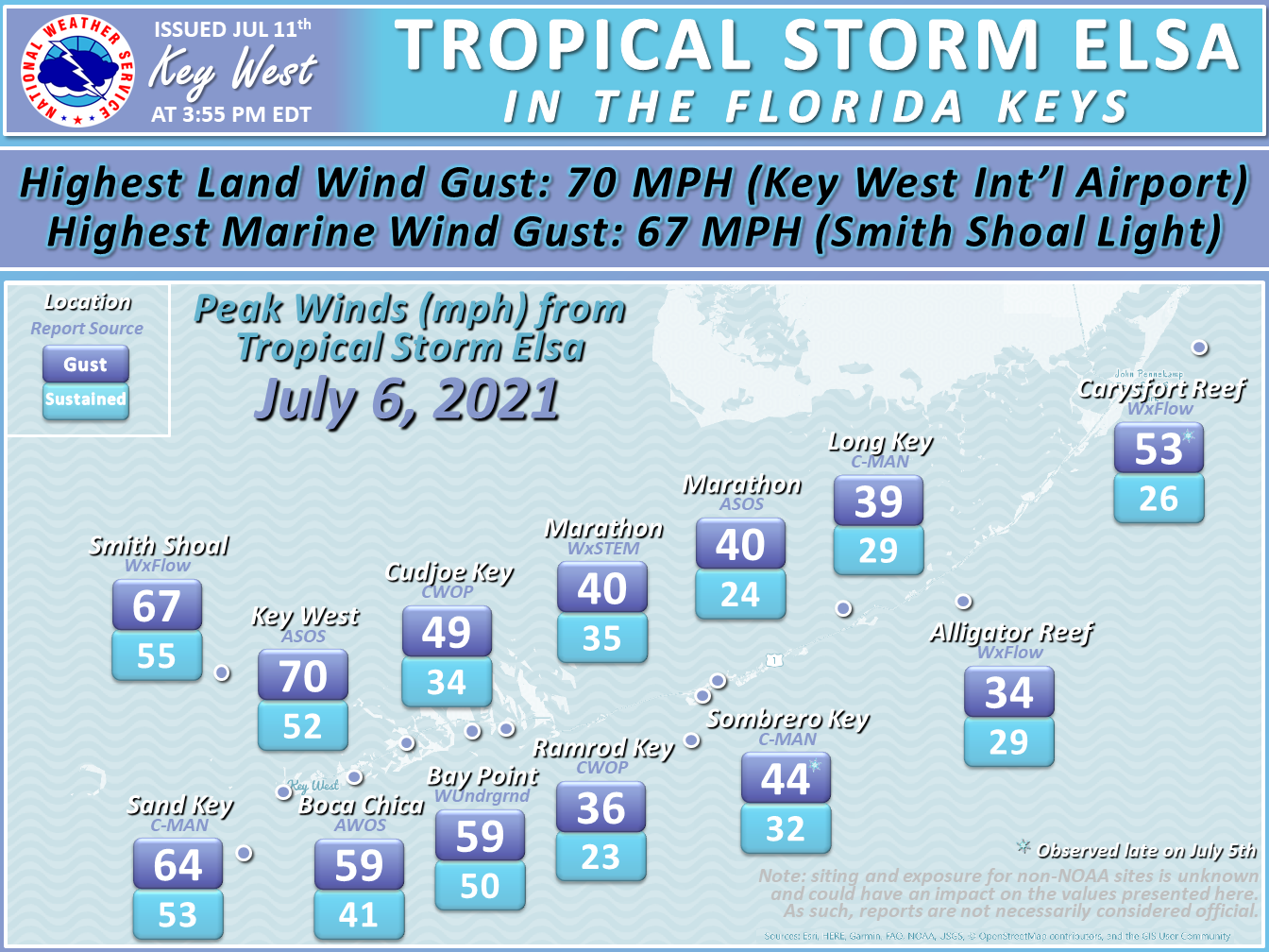 |
| Wind Reports |
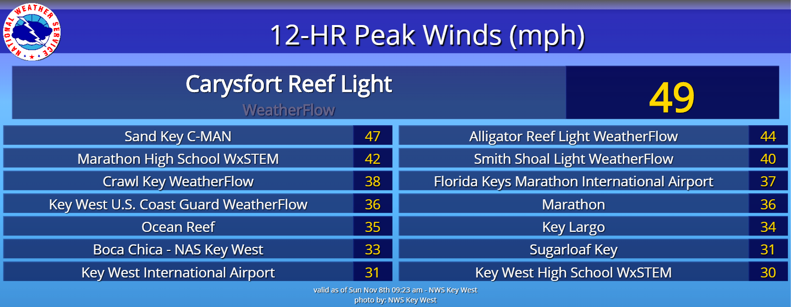 |
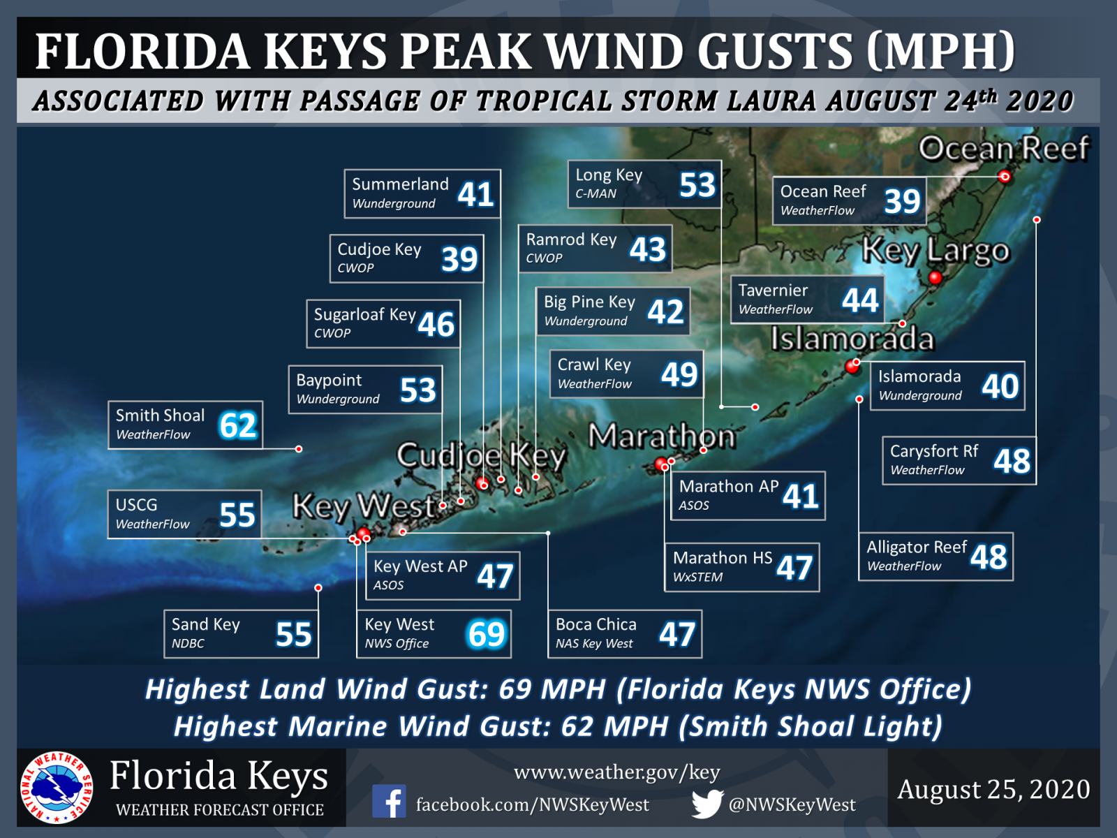
| Wind Gust Reports |
 |
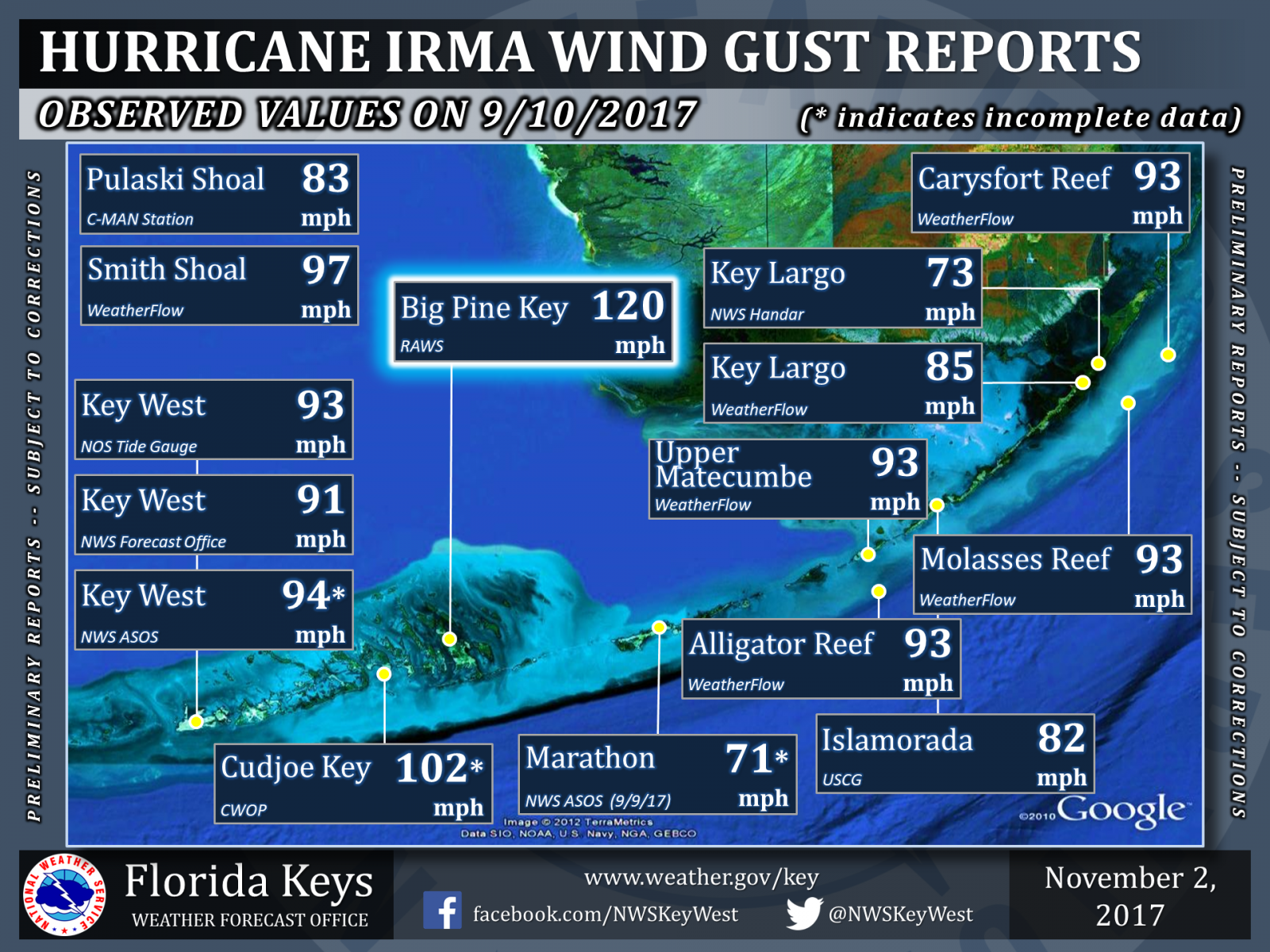
| Wind Gust Reports |
 |
 |
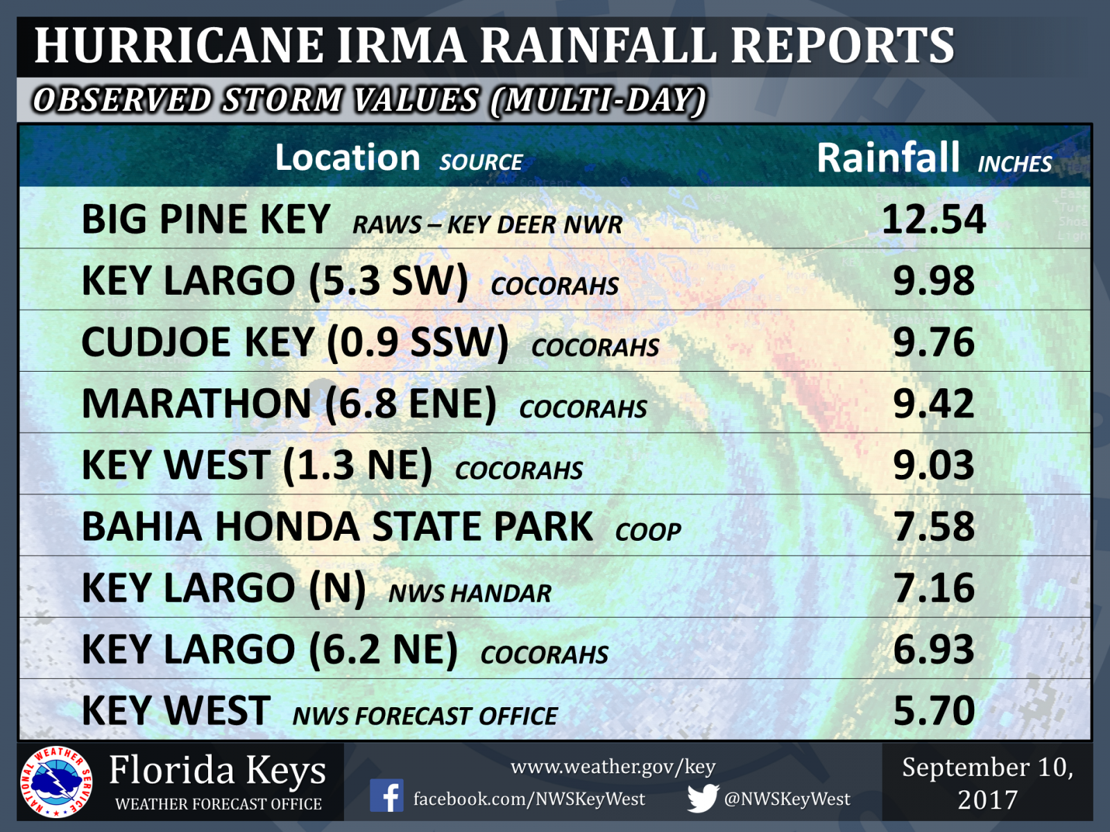 |
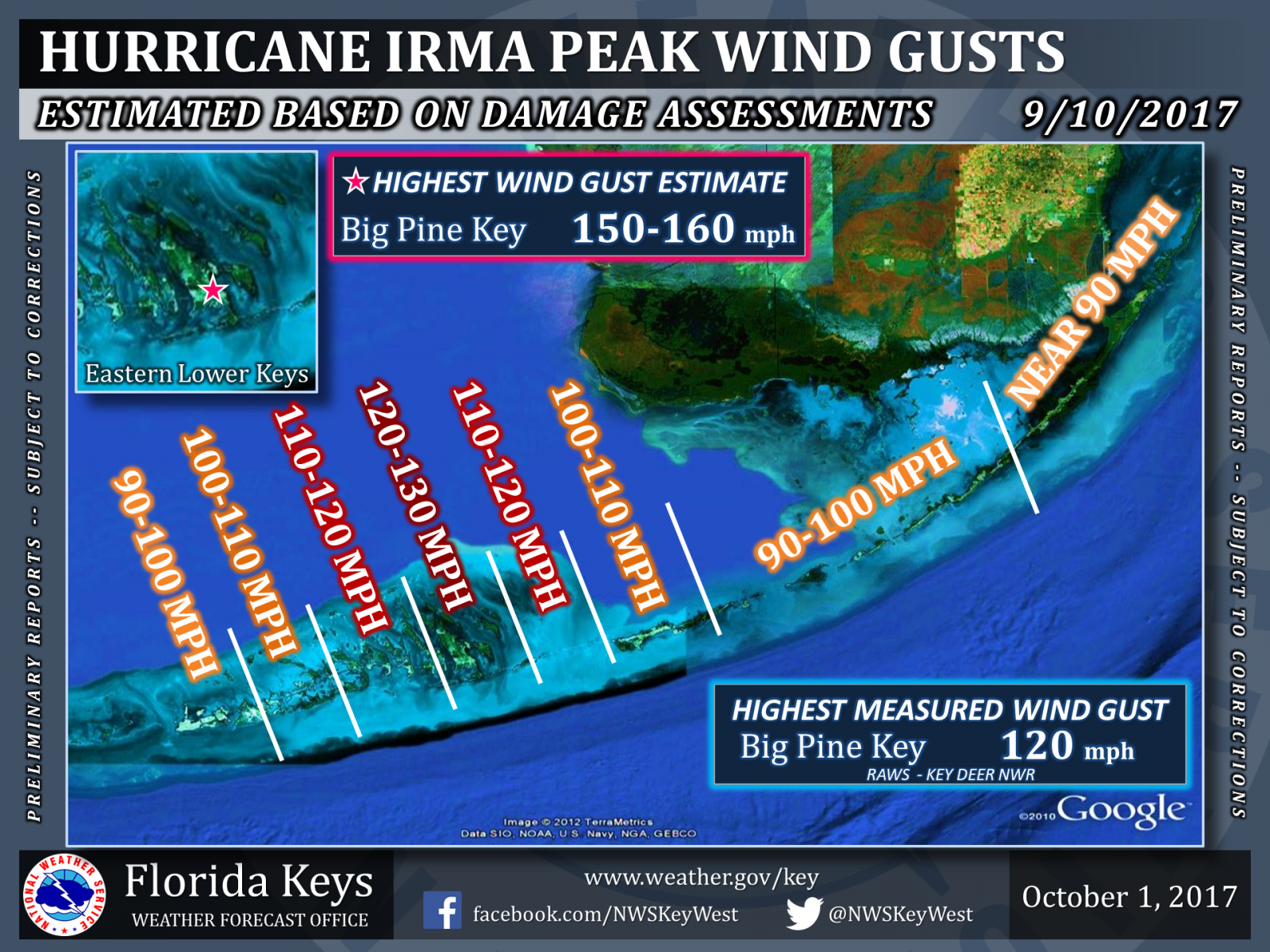
| Peak Wind Gust Estimates | Wind Gust Reports | Rainfall Reports |
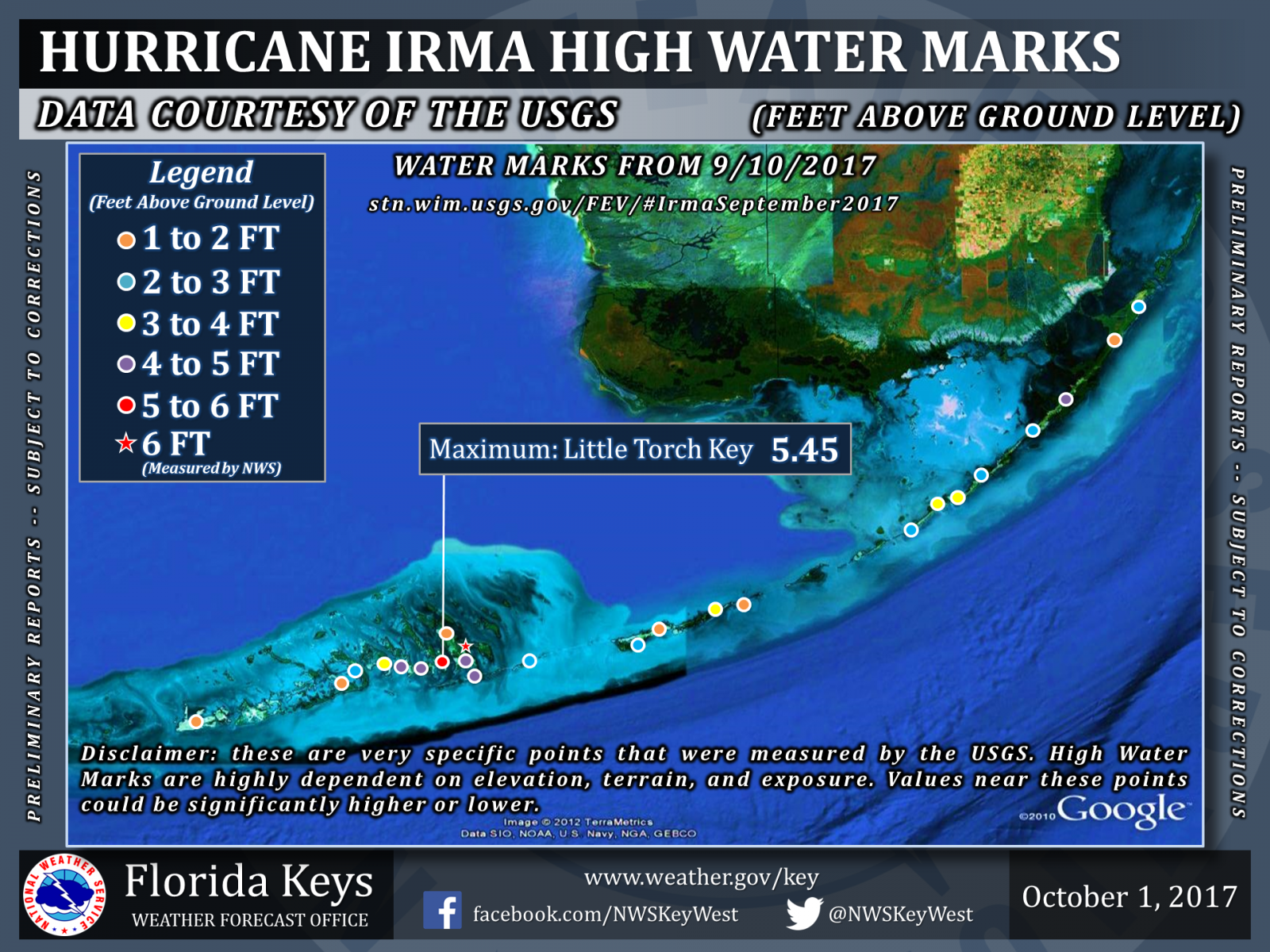 |
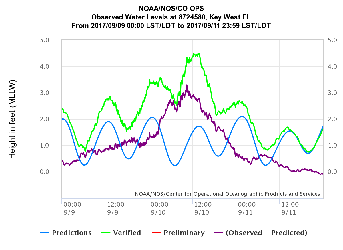 |
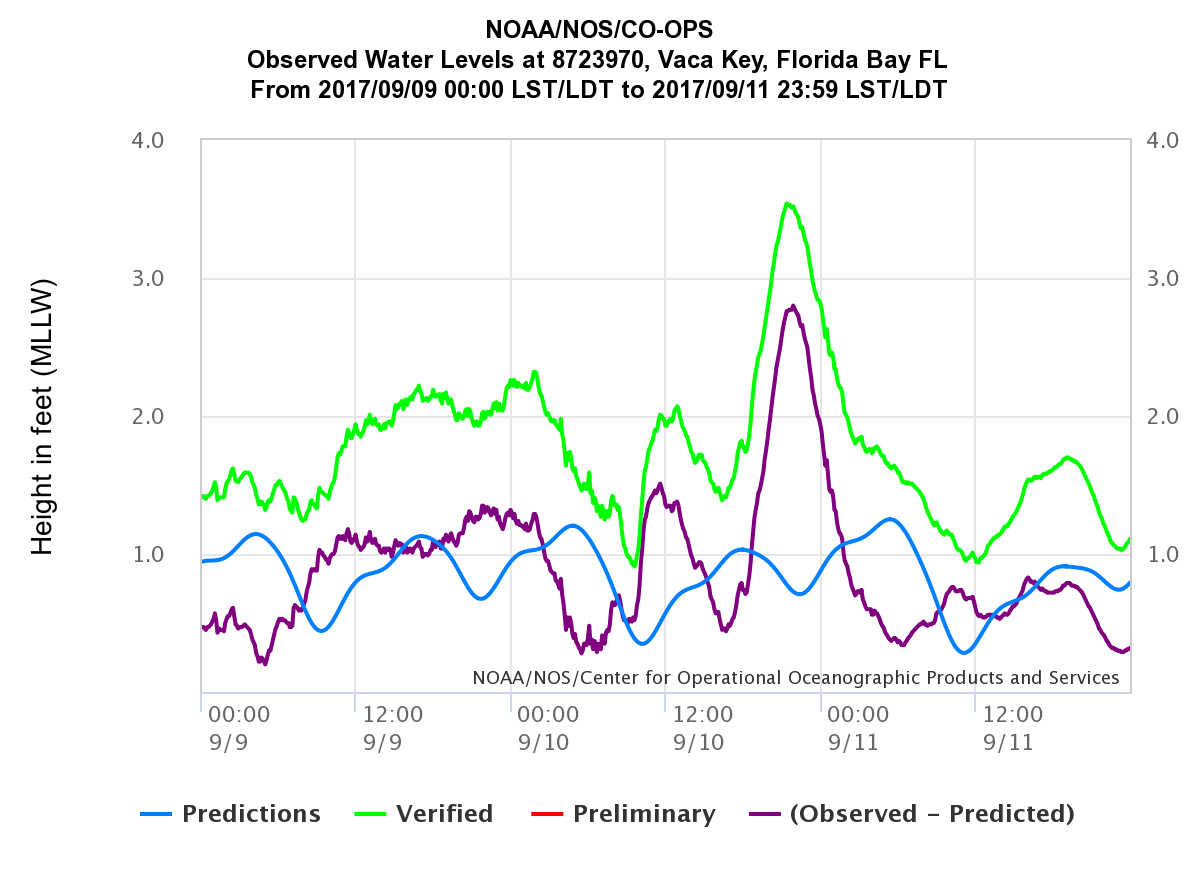 |
| High Water Marks | Key West Tide Gauge | Vaca Key / Marathon Tide Gauge |
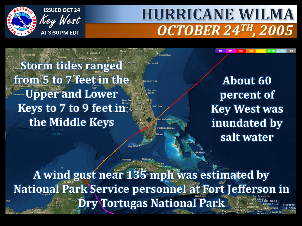 |
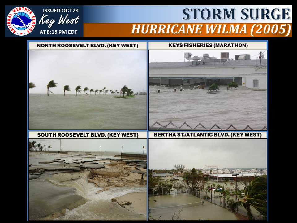 |
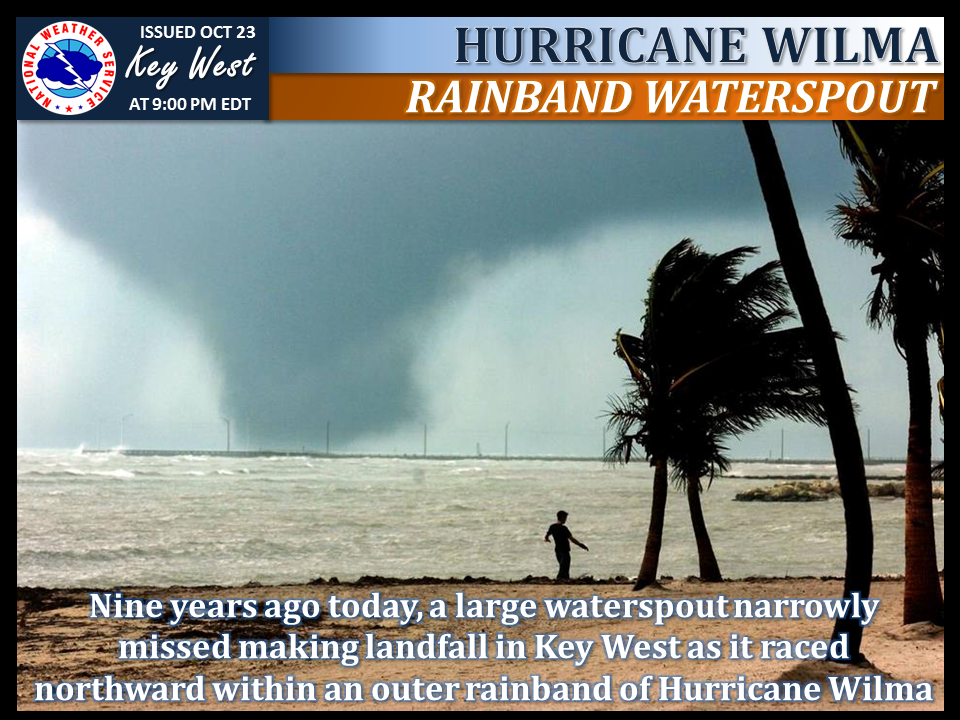 |
| Storm Overview | Storm Surge Photos | 9th Anniversary of Wilma Waterspout |
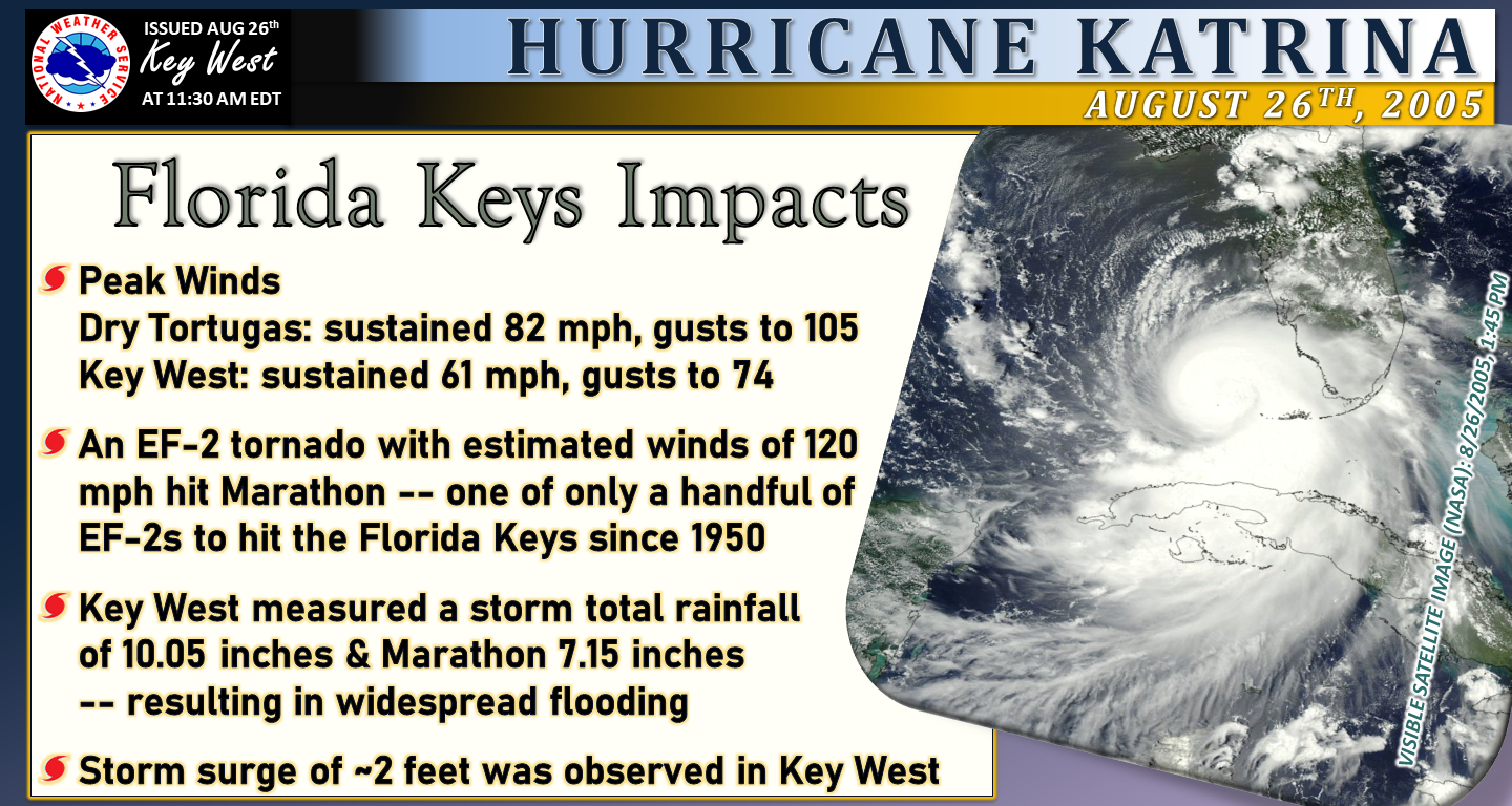 |
| Storm Overview |
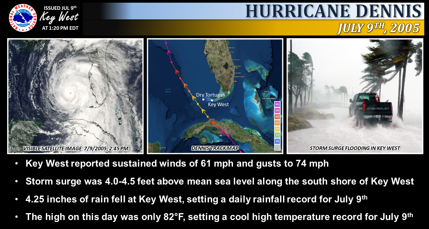 |
| Storm Overview |
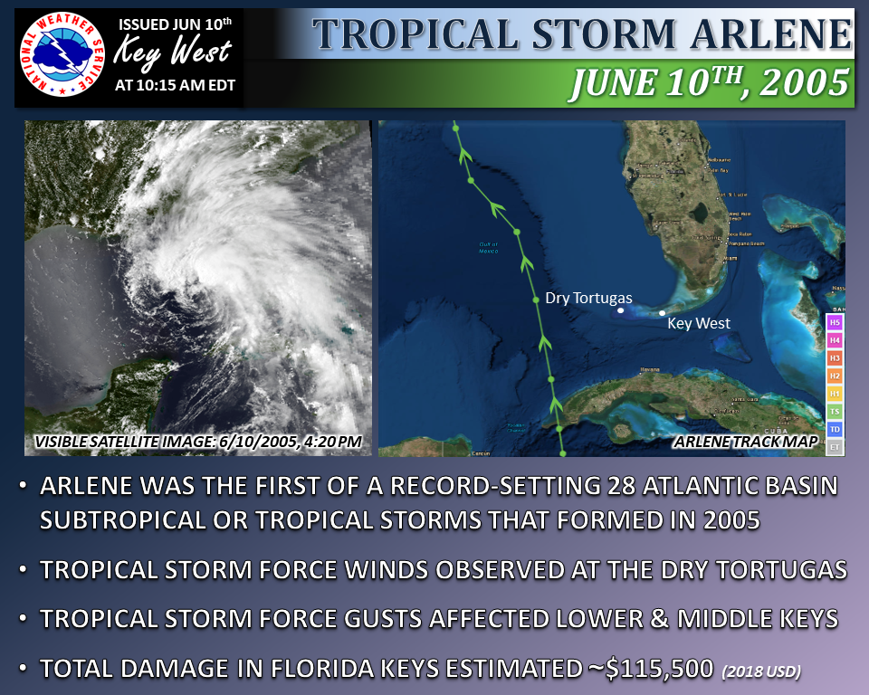 |
| Storm Overview |
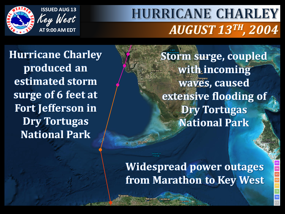 |
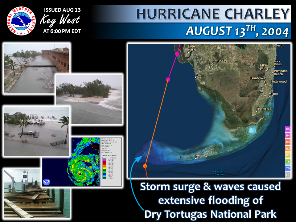 |
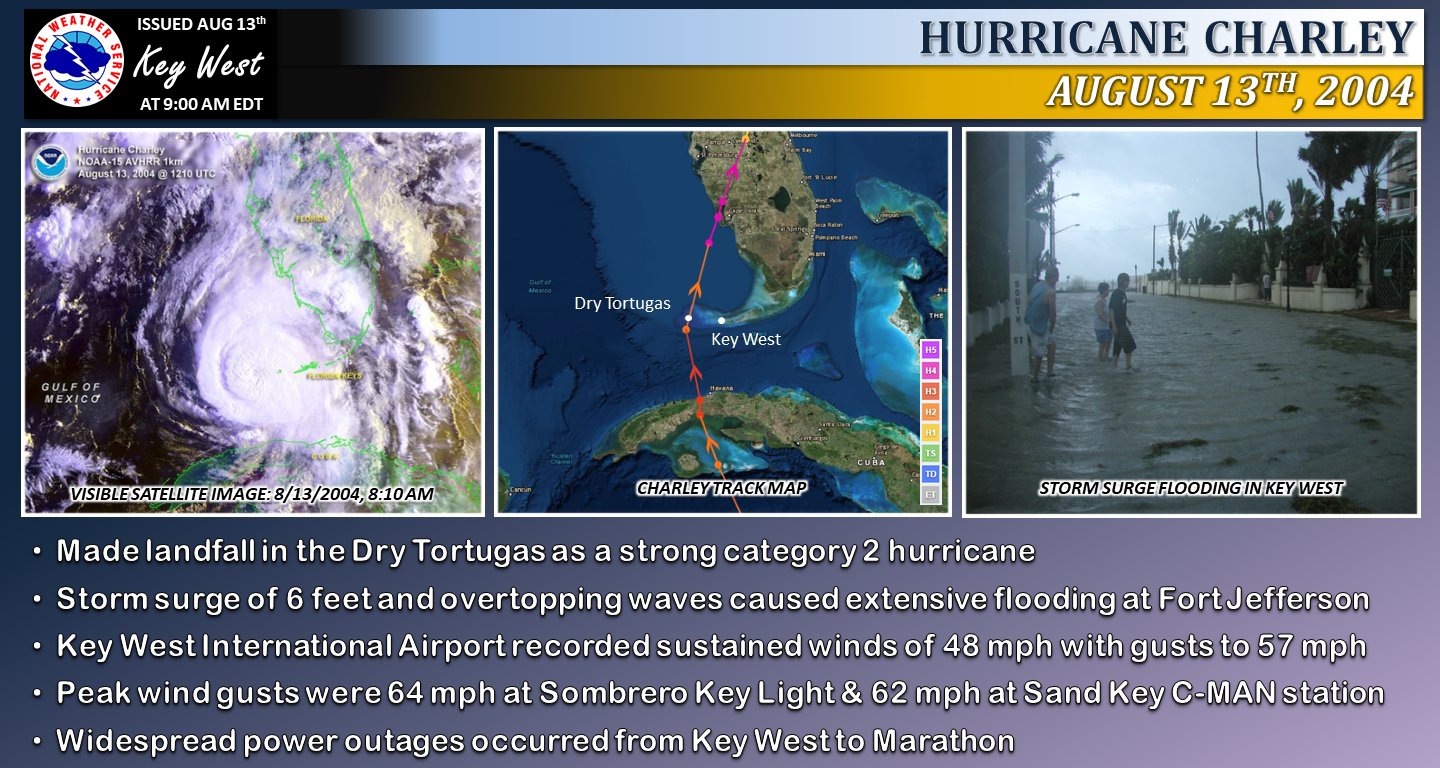 |
| Storm Overview | 8th Anniversary | 20th Anniversary |
 |
| Storm Overview |
 |
| Storm Overview |
 |
| Storm Overview |
 |
| Storm Overview |
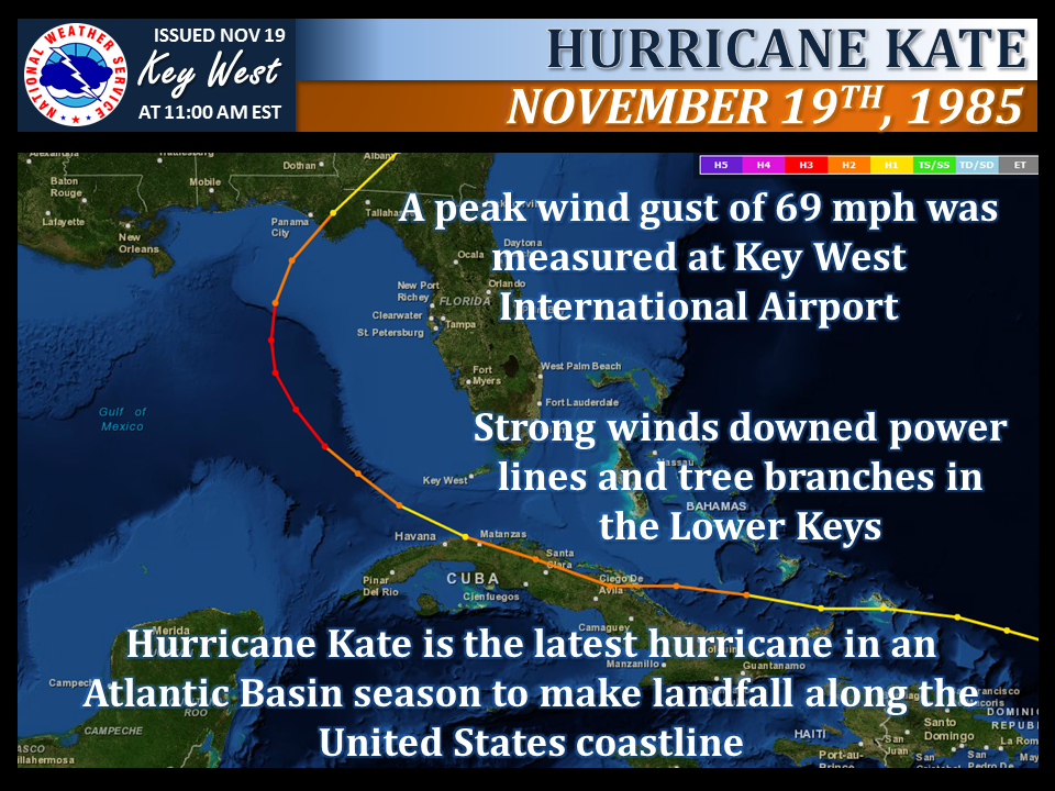 |
| Storm Overview |
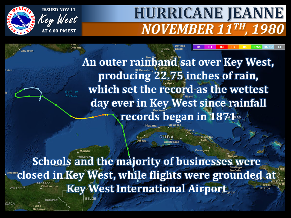 |
| Storm Overview |
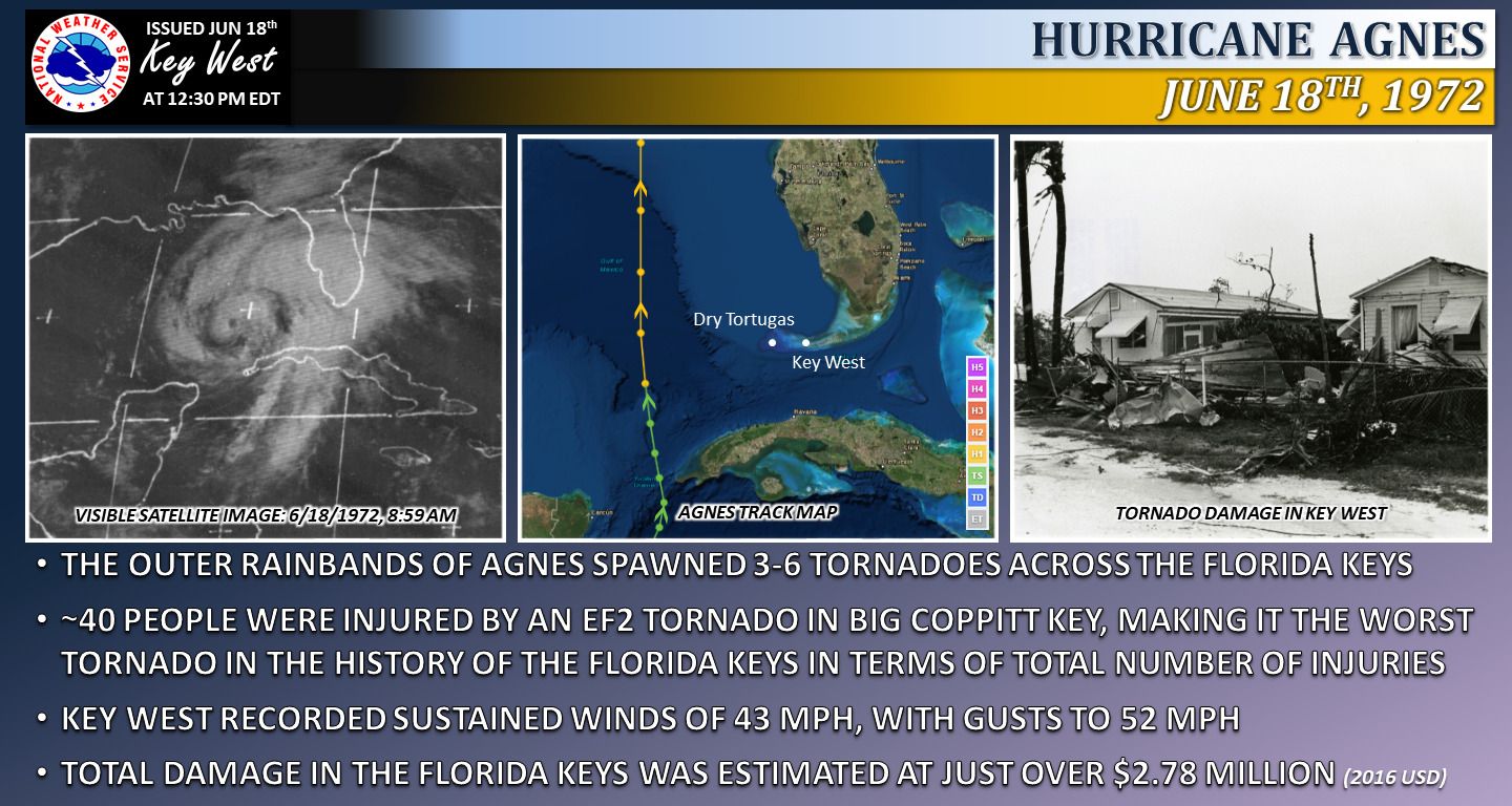 |
| Storm Overview |
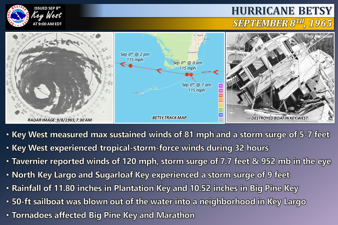 |
| Storm Overview |
 |
| Storm Overview |
 |
| Storm Overview |
 |
| Storm Overview |
 |
| Storm Overview |
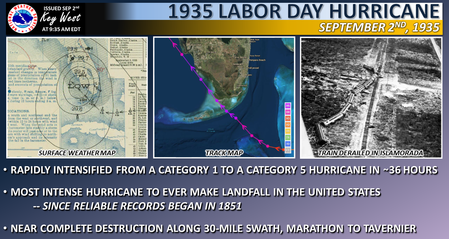 |
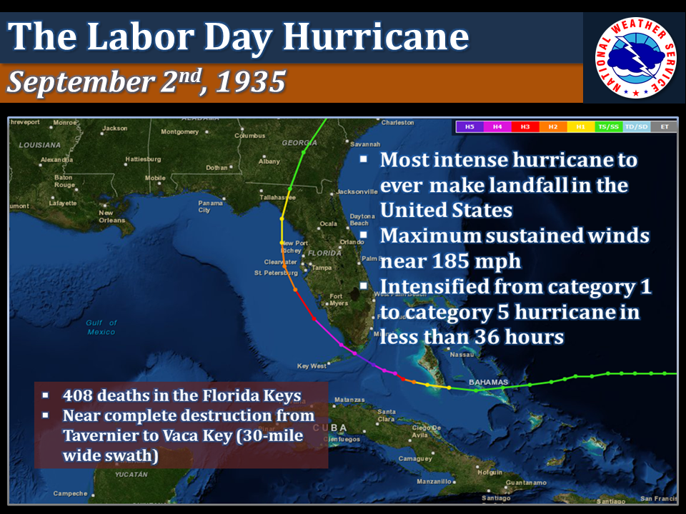 |
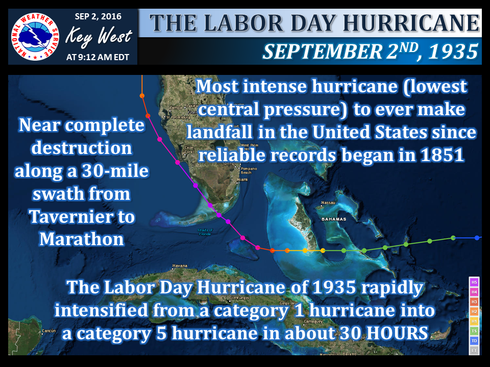 |
| Storm Overview | Storm Overview (2013 Graphic) | Storm Overview (2016 Graphic) |
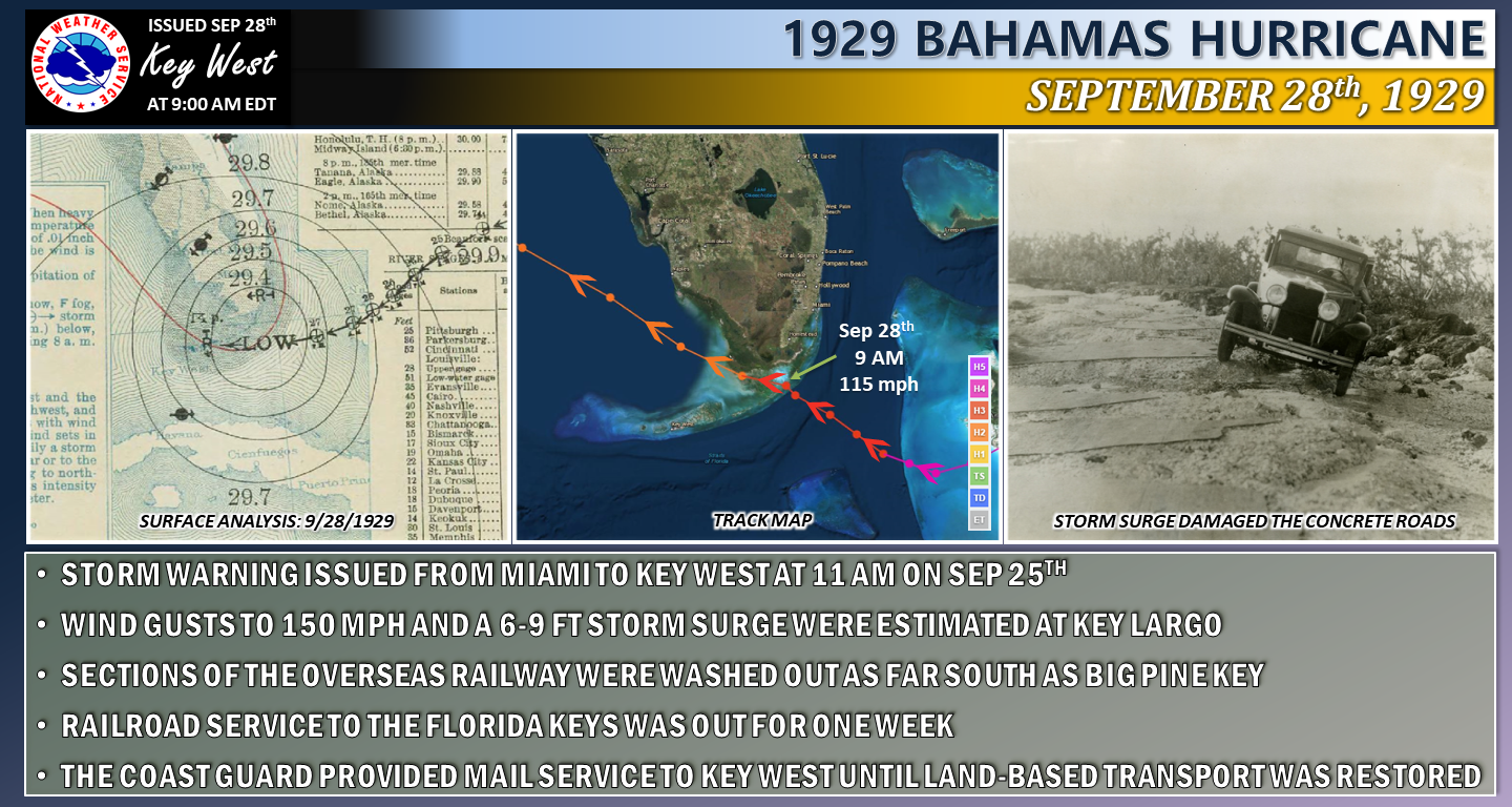 |
| Storm Overview |
 |
| Storm Overview |
 |
| Storm Overview |
 |
| Storm Overview |
 |
| Storm Overview |
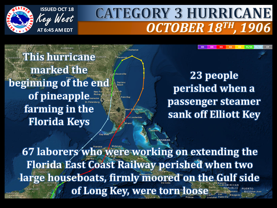 |
| Storm Overview |
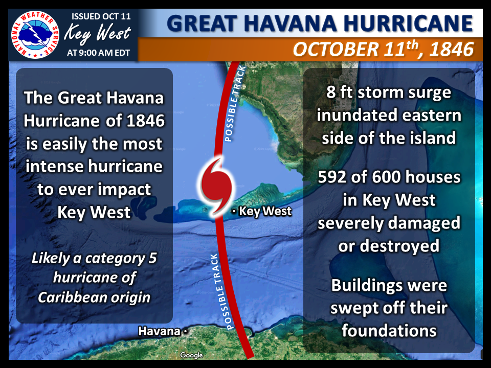 |
| Storm Overview |

| Florida Keys Tropical Cyclone History | |
| Tropical Cyclones Before 1800 | Tropical Cyclones of the 1800s |
| Tropical Cyclones of the 1990s | Tropical Cyclones of the 2000s |
| Strongest Tropical Cyclones (Maximum Sustained Winds) |
| Most Intense Tropical Cyclones (Minimum Central Sea Level Pressure) |
| Florida Keys Tropical Cyclone Climatology |
| Tropical Cyclone by Date Calendar |