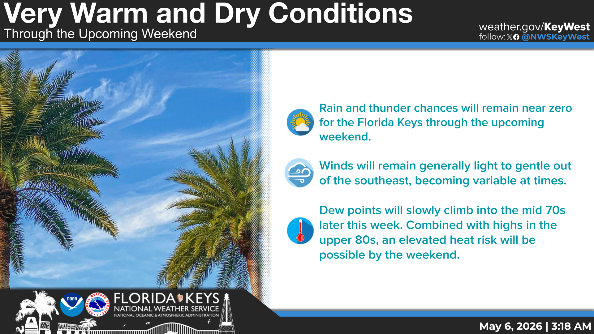
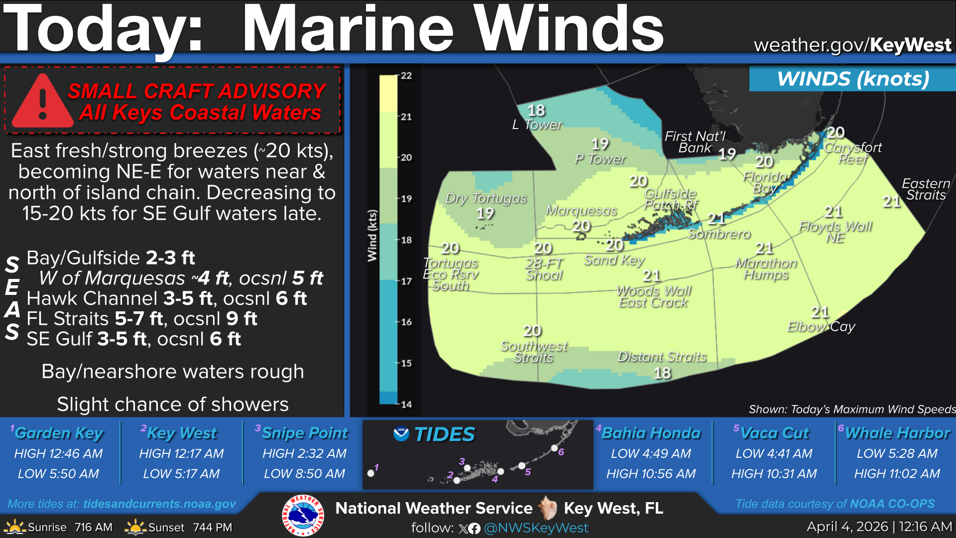
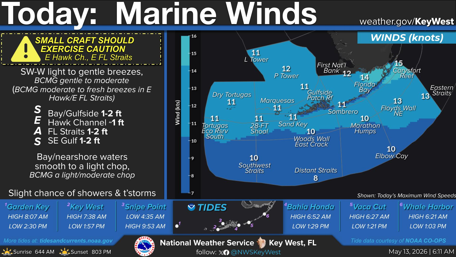
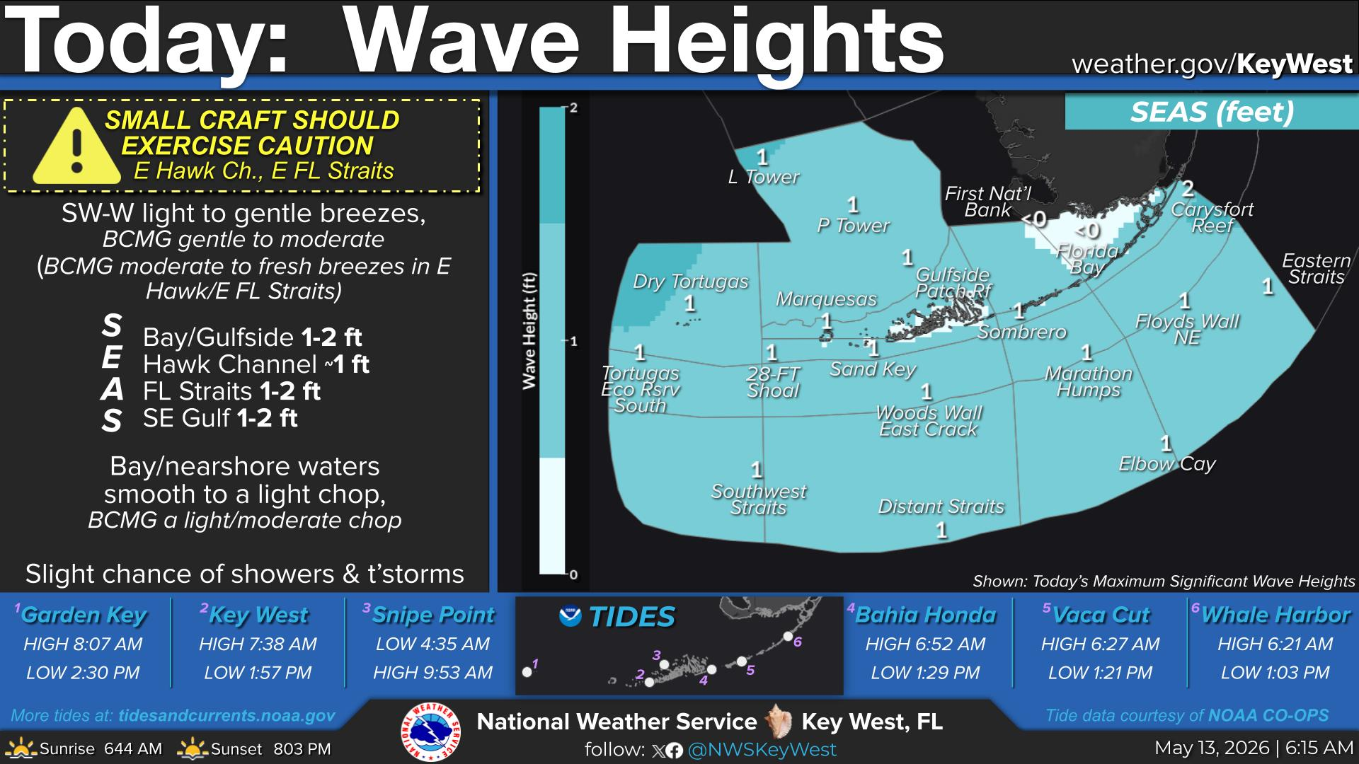
National Weather Service United States Department of Commerce

Areas of Severe Thunderstorms and Excessive Rainfall through This Weekend

A multi-day thunderstorm and heavy rain event will impact the south-central U.S. this Memorial Day weekend. Severe thunderstorms may produce large hail, severe gusts, and a possible tornado or two across portions of the central and southern Plains through Monday. The threat for heavy to excessive rainfall and possible flash flooding will return to the south-central U.S., especially in the Ozarks. Read More >

Click a location below for detailed forecast.

Last Map Update: Sun, May 25, 2025 at 4:50:24 am EDT

Slight Chance of Showers & Thunderstorms Remains in the forecast

Heat indices will approach 100°F each day!

Through Memorial Day:
  • Partly sunny today onward
  • Highs: Upper 80s; Lows: Lower 80s

  • Rain Chances:
  • Slight chance (20%) of showers and thunderstorms today onward

  • Wind:
  • East 5 to 10 mph today; increasing to near 10 mph tonight, becoming east to southeast Sunday night and Memorial Day
  • TONIGHT...Partly cloudy with a slight chance of showers and thunderstorms. Lows in the lower 80s. East winds increasing to near 10 mph. Chance of rain 20 percent.
    TONIGHT...East winds near 10 knots, increasing to 10 to 15 knots. Bay waters a light chop, becoming a light to moderate chop. Scattered showers and isolated thunderstorms.
    TONIGHT...East winds near 10 knots, increasing to 10 to 15 knots. Seas less than 1 foot, building to around 1 foot. Nearshore waters a light chop, becoming a light to moderate chop. Scattered showers and isolated thunderstorms.
    TONIGHT...East winds near 10 knots, increasing to 10 to 15 knots. Seas 1 to 2 feet, building to 1 to 3 feet. Nearshore waters a light chop, becoming a light to moderate chop. Isolated showers and thunderstorms.
    TONIGHT...East winds 10 to 15 knots. Seas 1 to 2 feet, building to 2 to 3 feet. Wave Detail: East 3 feet at 4 seconds. Isolated showers and thunderstorms.
    TONIGHT...Northeast to east winds 5 to 10 knots, becoming east and increasing to 10 to 15 knots. Seas 1 to 2 feet. Wave Detail: East to southeast 2 feet at 3 seconds and northwest to north 1 foot at 4 seconds. Scattered showers and isolated thunderstorms.


    Text Product Selector
    (Selected product opens in a new window) 


    Sunrise & Sunset

    Sunrise & Sunset


    Moon Rise & Set

    Moon Rise & Set


    Moon Illumination

    Moon Illumination


    Tide Information

    Tide Information


    Tropical

    Tropical


    Coastal Flooding

    Coastal Flooding


    Tallship

    Marine


    Nearshore Waves

    Wave Prediction


    Thumbnail for a local waterspouts website, showing 4 waterspouts.

    Waterspouts


    Airplane

    Aviation


    Key West & Marathon Climographs 2020

    Climographs


    Tropical

    Forecast Discussion


    NOAA Weather Radio

    NOAA Weather Radio