Last month entered the record books as the 10th warmest (in a 3-way tie) July for Key West. Overall in the Keys, the month was warmer and drier than the 30-year average. Rainfall deficits ranged from half an inch at Key west to an inch at Marathon.
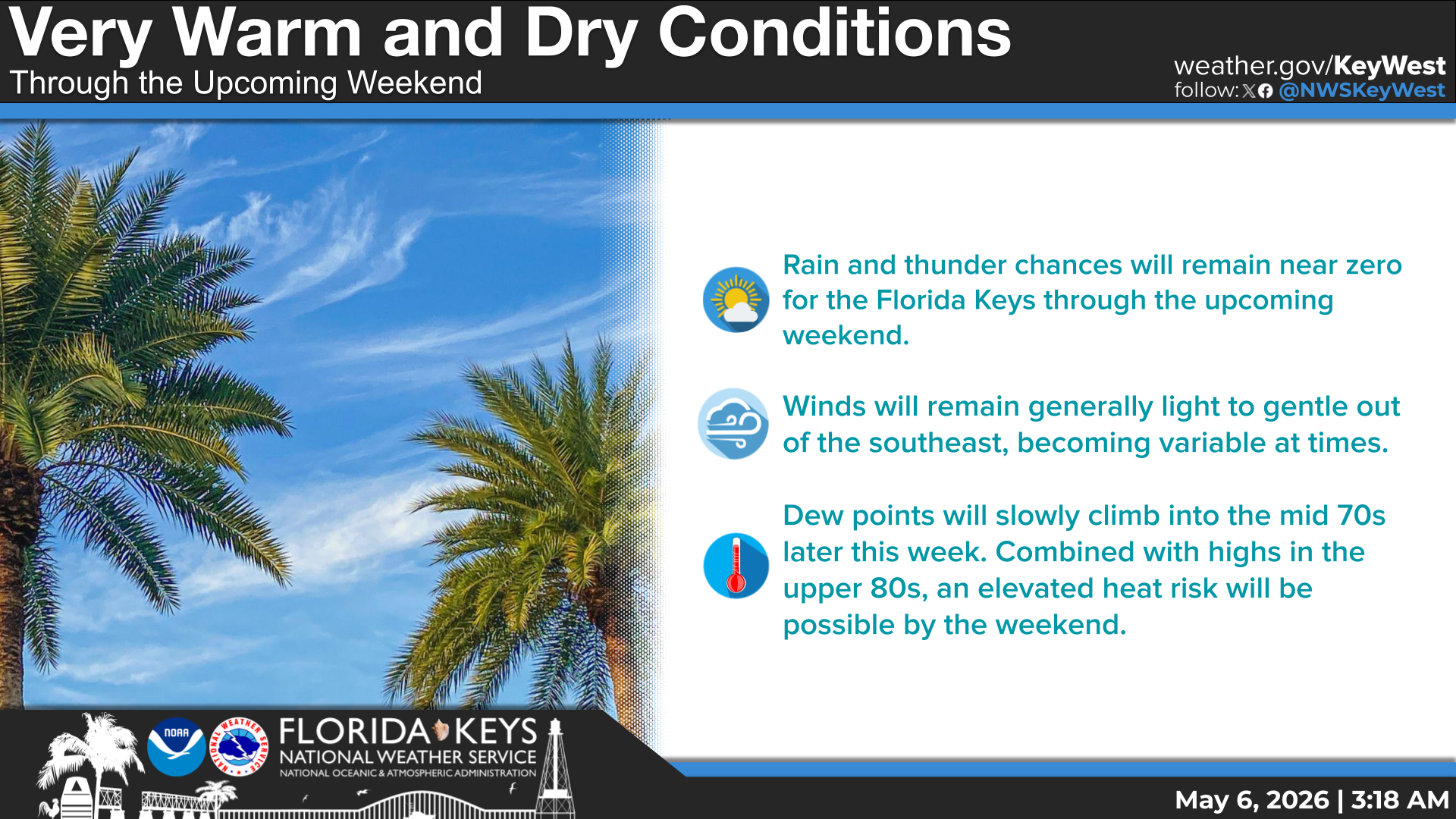
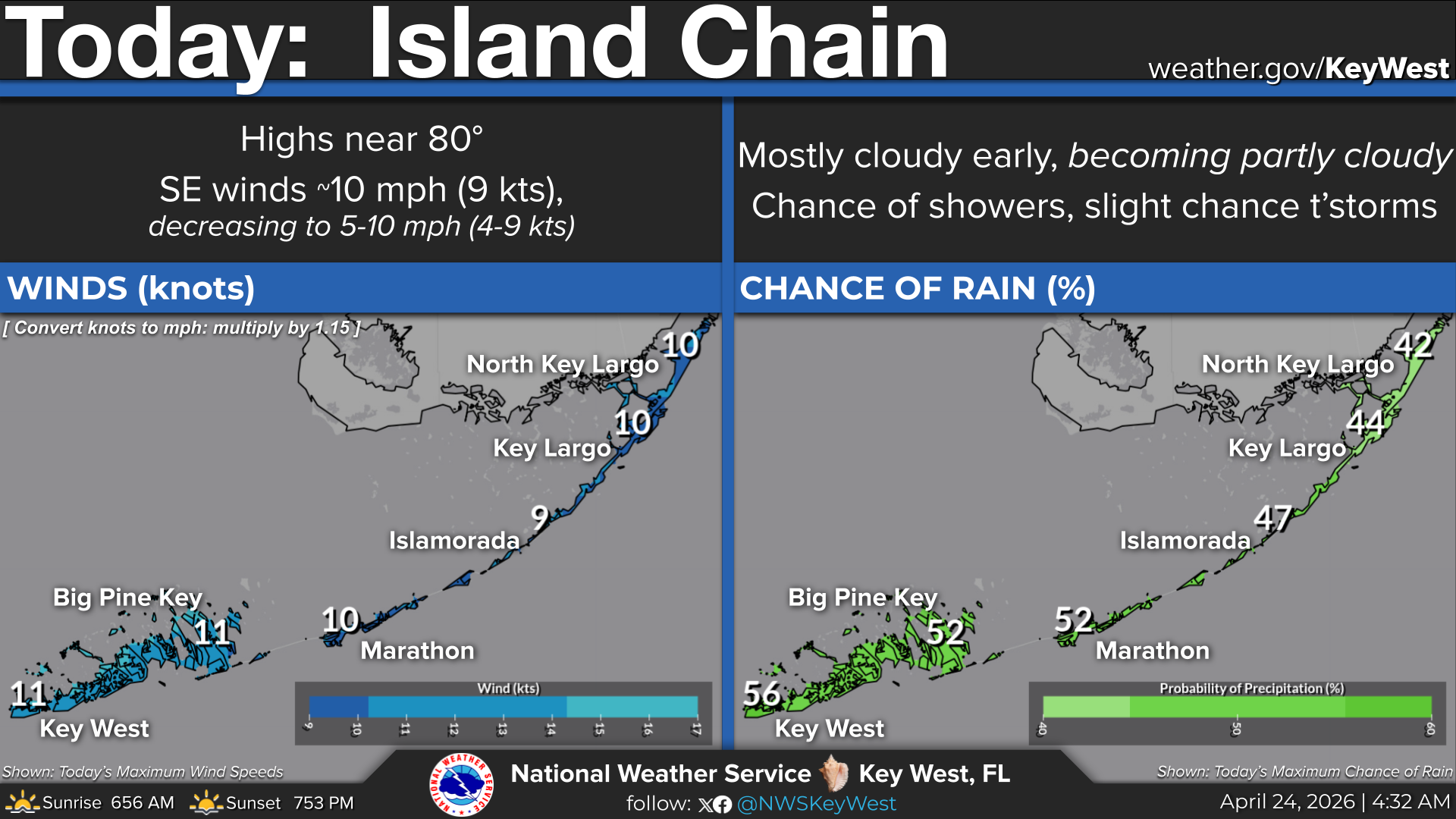
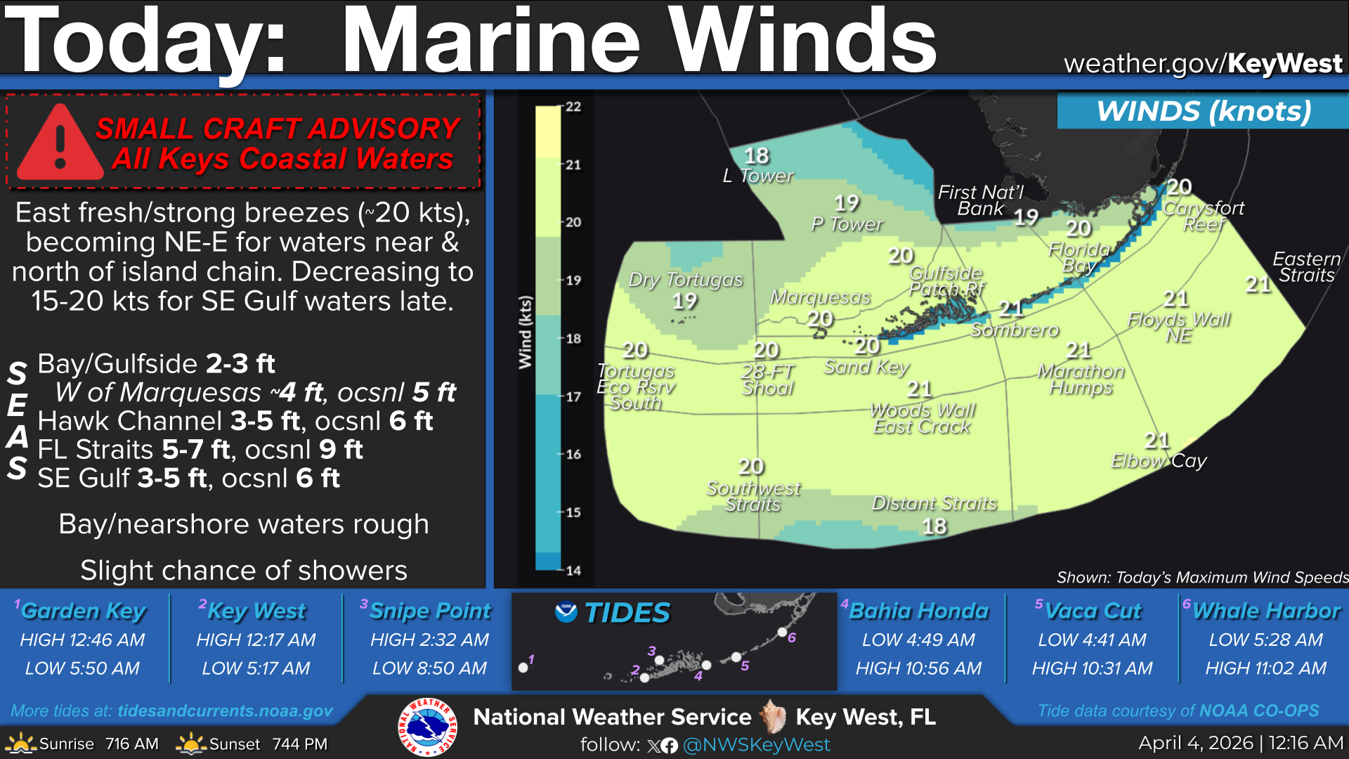
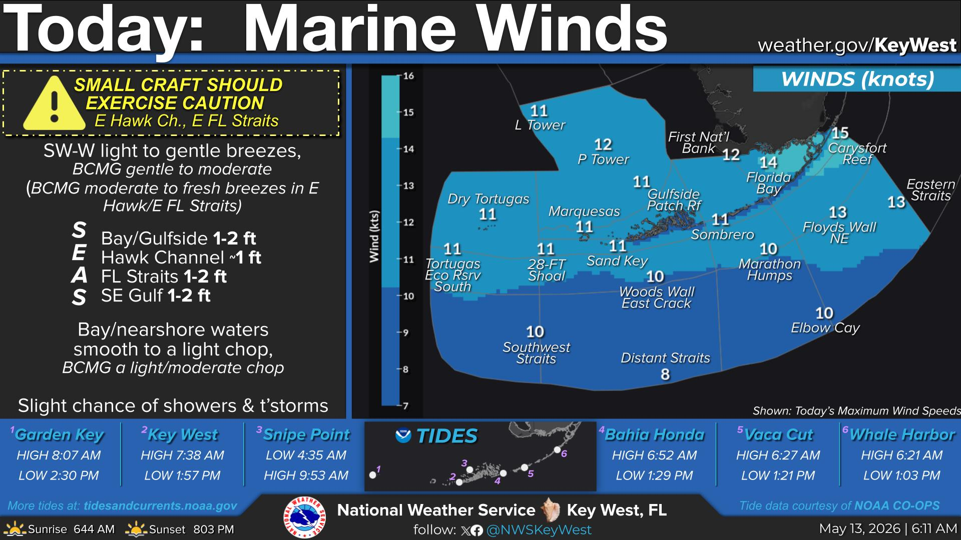
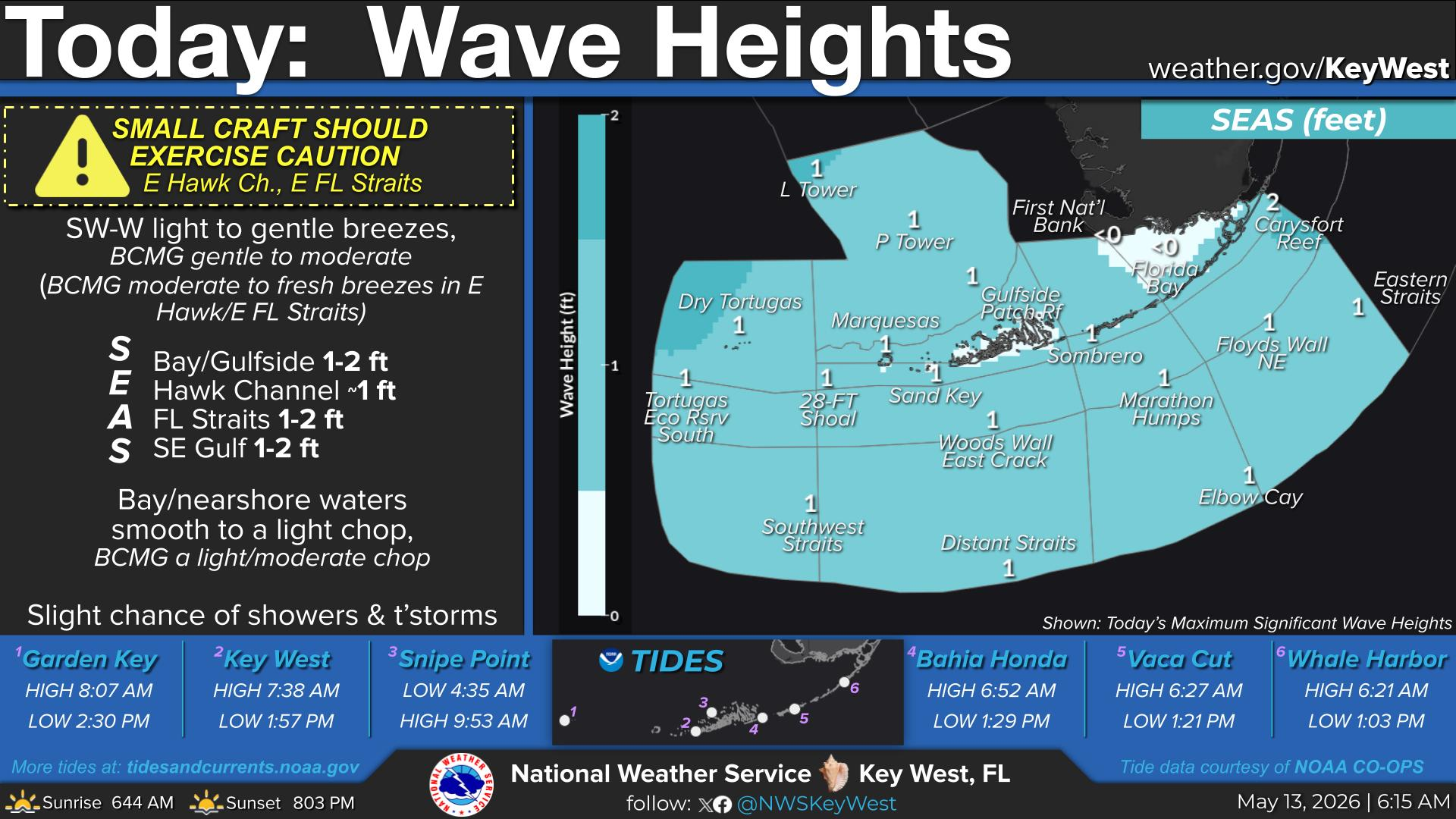
Today... Partly sunny with a slight chance of showers and
thunderstorms. Highs in the lower 90s. Southeast winds 5 to 10
mph. Chance of rain 20 percent.


 Local Radar
 Weather Map
 Graphical Forecast