Overview
|
Severe storms erupted during the early early evening hours of August 16th across the Flint Hills into southeast Kansas. With an abundance of instability, storms quickly became severe producing large hail and damaging winds. The tallest storm of the event was over Cowley County which had tops in the 50,000 to 60,000 foot range! This storm went on to produce tennis ball size hail. |
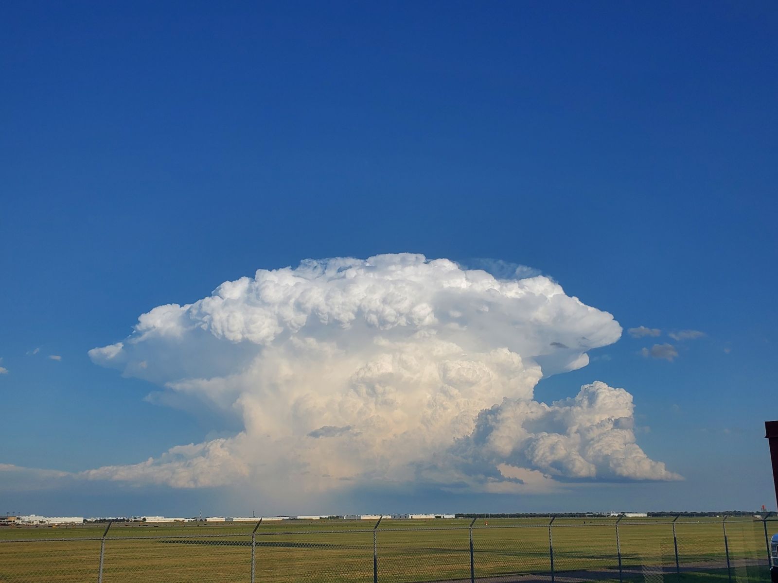 Storm northeast of Winfield viewed from NWS Wichita |
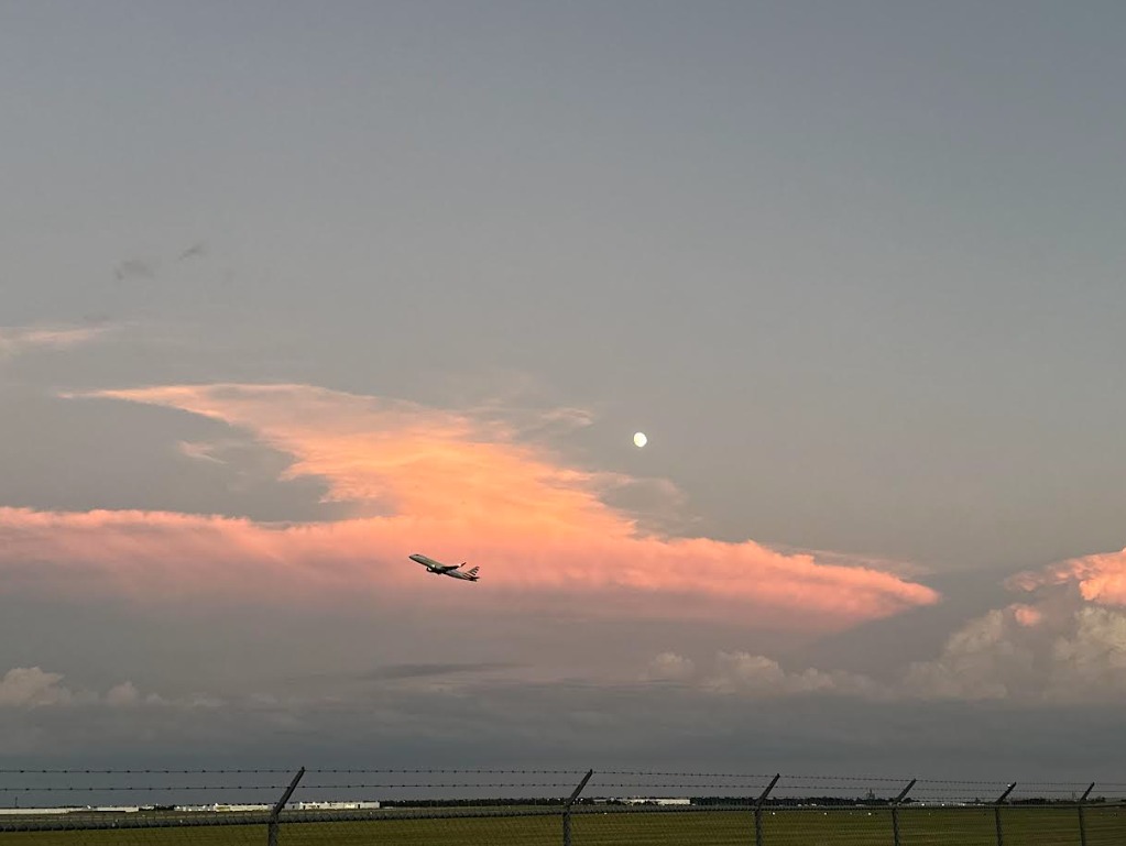
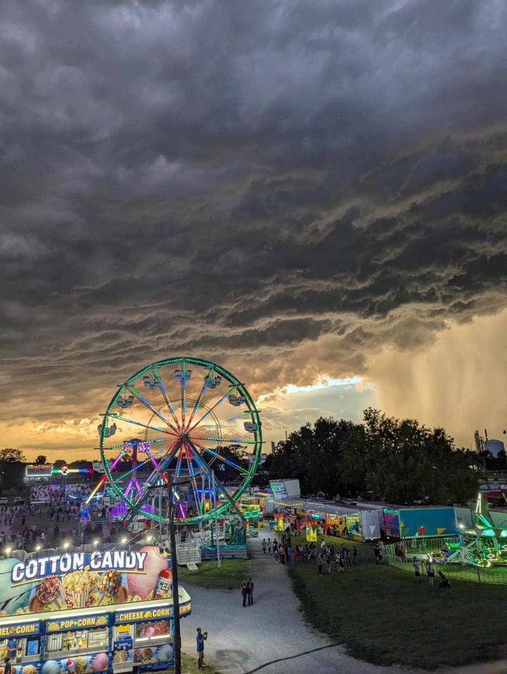
Photos & Video
|
Time lapse of Cowley County supercell taken from west Wichita by Kevin Darmofal |
 |
 |
 |
| Picture of storm taken from NWS Wichita | Picture as storm approached Coffeyville. Taken by Bryant Emerson |
 |
|
|
|
|
here |
Radar
 |
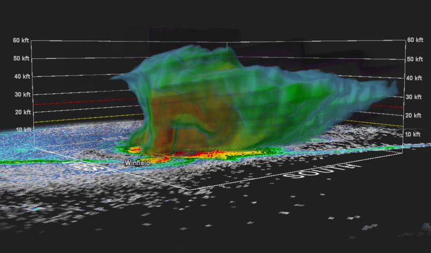 |
| Radar animation | 3-D look at the Cowley county supercell showing tops greater than 50,000 feet! |
Storm Reports
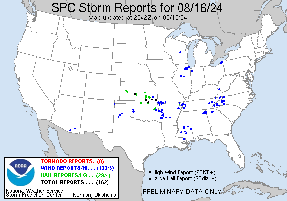
Preliminary Local Storm Report...Summary
National Weather Service Wichita KS
1010 PM CDT Fri Aug 16 2024

..TIME...   ...EVENT...      ...CITY LOCATION...     ...LAT.LON...
..DATE...   ....MAG....      ..COUNTY LOCATION..ST.. ...SOURCE....
            ..REMARKS..

0454 PM     Hail             Marion                  38.35N 97.01W
08/16/2024  M1.00 Inch       Marion             KS   Trained Spotter

            Relayed by emergency management.

0603 PM     Tstm Wnd Gst     Chanute Martin Airport  37.67N 95.49W
08/16/2024  M63 MPH          Neosho             KS   ASOS


0610 PM     Tstm Wnd Gst     Chanute                 37.67N 95.46W
08/16/2024  E60 MPH          Neosho             KS   Public


0654 PM     Tstm Wnd Gst     2 NNE Altamont          37.22N 95.27W
08/16/2024  M68 MPH          Labette            KS   Public

            Measured wind gust from home weather
            observing station.

0709 PM     Tstm Wnd Gst     Oswego                  37.17N 95.11W
08/16/2024  E70 MPH          Labette            KS   Law Enforcement


0715 PM     Hail             Severy                  37.62N 96.23W
08/16/2024  M1.00 Inch       Greenwood          KS   Fire Dept/Rescue


0722 PM     Hail             5 NE Winfield           37.32N 96.91W
08/16/2024  M1.00 Inch       Cowley             KS   Trained Spotter


0731 PM     Hail             7 E Winfield            37.27N 96.84W
08/16/2024  E2.75 Inch       Cowley             KS   Public


0733 PM     Hail             4 NE Winfield           37.32N 96.96W
08/16/2024  E1.25 Inch       Cowley             KS   Public


0737 PM     Hail             5 NNE Winfield          37.33N 96.92W
08/16/2024  E1.75 Inch       Cowley             KS   Public

            Report was 1 mile southwest of Winfield City
            Lake.

0738 PM     Hail             Buxton                  37.44N 95.92W
08/16/2024  E1.00 Inch       Wilson             KS   Trained Spotter


0747 PM     Hail             2 NNE El Dorado         37.85N 96.85W
08/16/2024  E0.75 Inch       Butler             KS   Trained Spotter


0752 PM     Hail             1 N El Dorado           37.84N 96.86W
08/16/2024  E1.00 Inch       Butler             KS   Trained Spotter


0758 PM     Hail             4 SW Dexter             37.13N 96.76W
08/16/2024  E2.50 Inch       Cowley             KS   Trained Spotter


0804 PM     Hail             Leon                    37.69N 96.78W
08/16/2024  E1.00 Inch       Butler             KS   Trained Spotter


0805 PM     Tstm Wnd Gst     1 W Independence        37.23N 95.73W
08/16/2024  M70 MPH          Montgomery         KS   Emergency Mngr


0808 PM     Hail             2 WSW Independence      37.23N 95.74W
08/16/2024  E1.25 Inch       Montgomery         KS   Trained Spotter

            Also had estimated winds to 70 mph with
            large trees over the roadway.

0811 PM     Tstm Wnd Gst     Independence            37.23N 95.71W
08/16/2024  E80 MPH          Montgomery         KS   Law Enforcement

            Reported trees and power lines down in town.

0814 PM     Tstm Wnd Gst     2 S Independence        37.20N 95.72W
08/16/2024  E80 MPH          Montgomery         KS   Trained Spotter


0826 PM     Hail             1 E Coffeyville         37.04N 95.61W
08/16/2024  E1.00 Inch       Montgomery         KS   Public


0827 PM     Tstm Wnd Dmg     1 E Coffeyville         37.04N 95.61W
08/16/2024                   Montgomery         KS   Public

            6 x 8 shed rolled along with metal roof
            peeled off another shed. In addition,
            numerous large tree branches down. Report
            came in via social media and time estimated
            by radar.
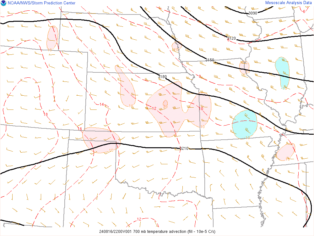
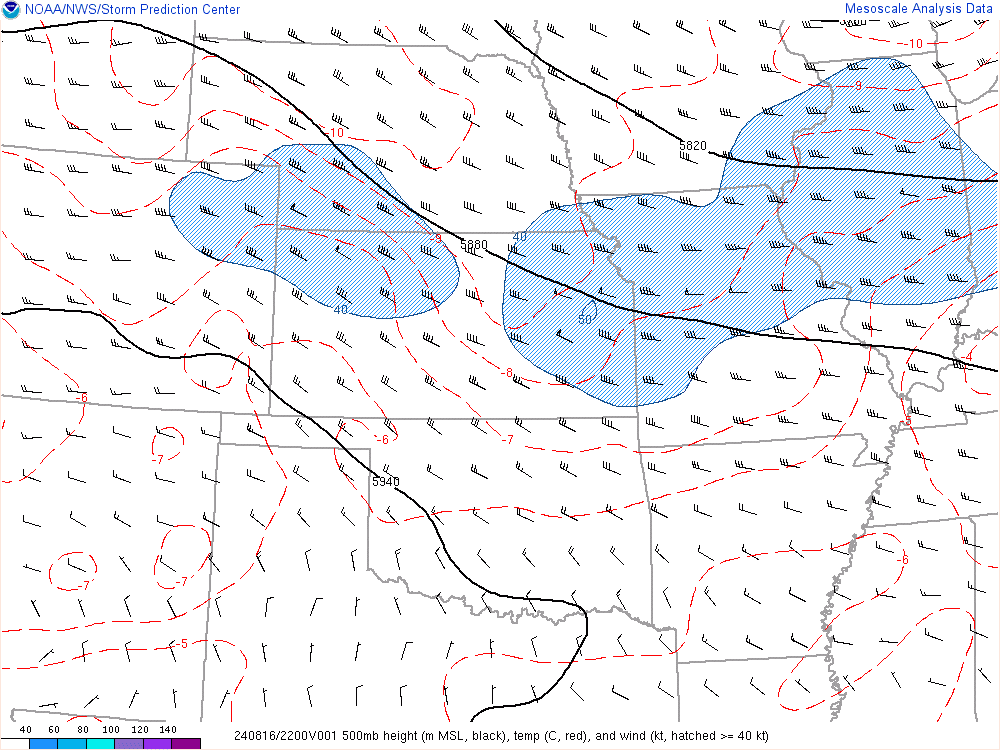
Environment
 |
 |
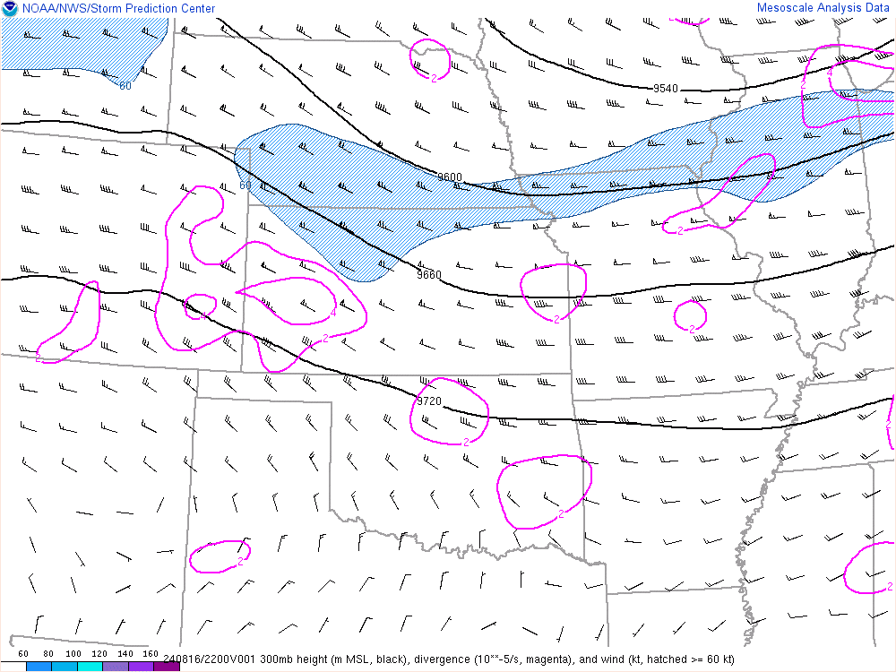 |
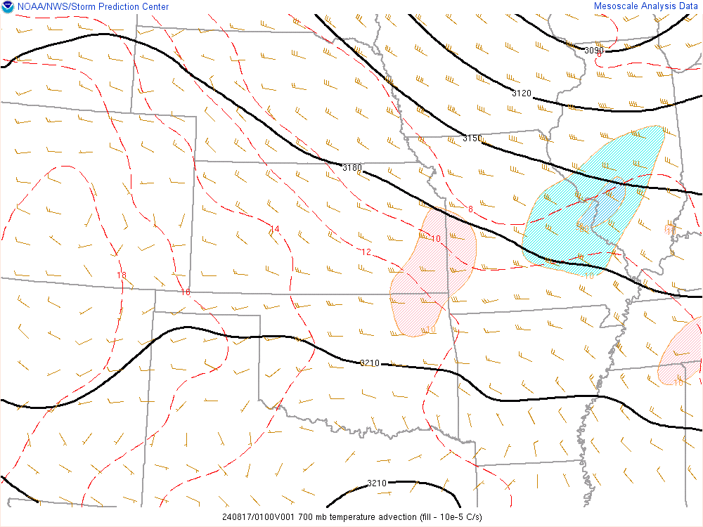
| 5 pm 700mb temp advection | 5 pm 500mb map | 5 pm 300mb map |
 |
 |
 |
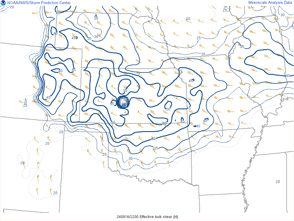
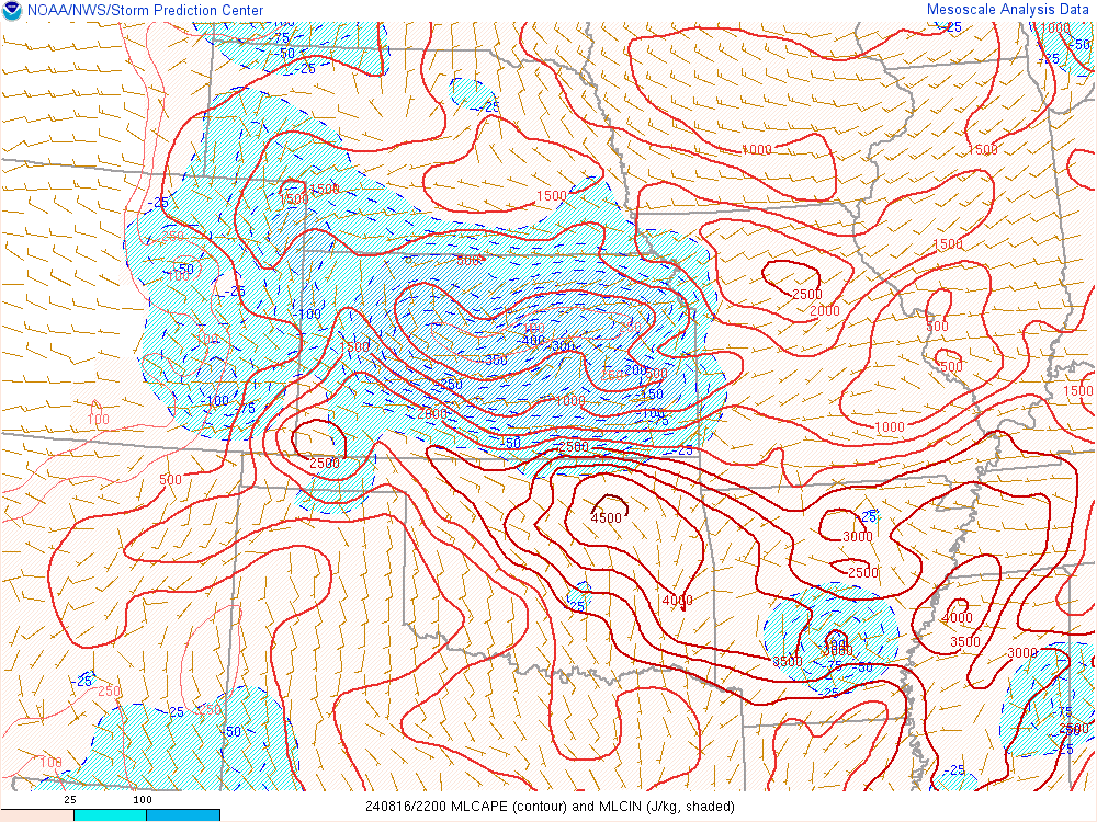
| 5 pm effective bulk shear | 5 pm ML CAPE | 8 pm 700mb temp advection |
 |
 |
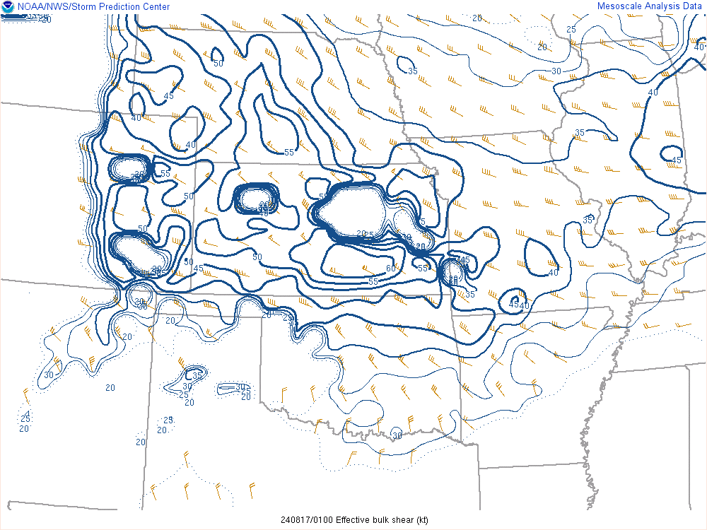 |
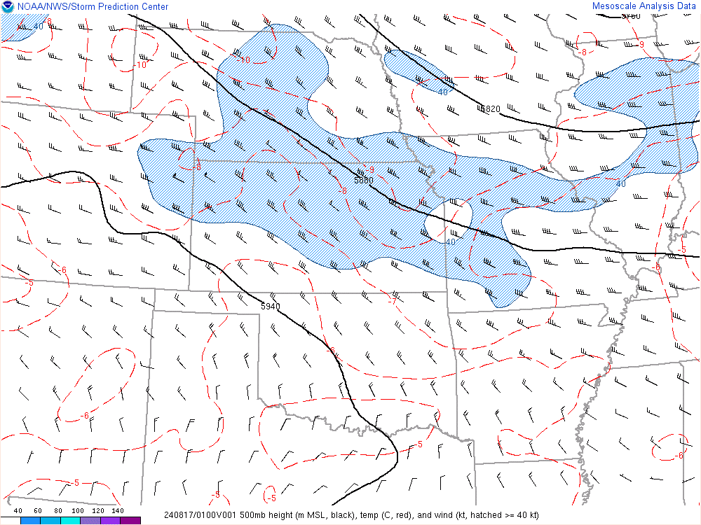
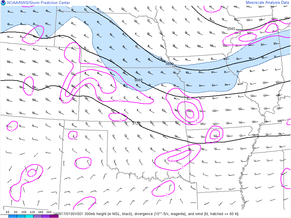
| 8 pm 500mb map | 8 pm 300mb map | 8 pm Effective bulk shear |
 |
 |
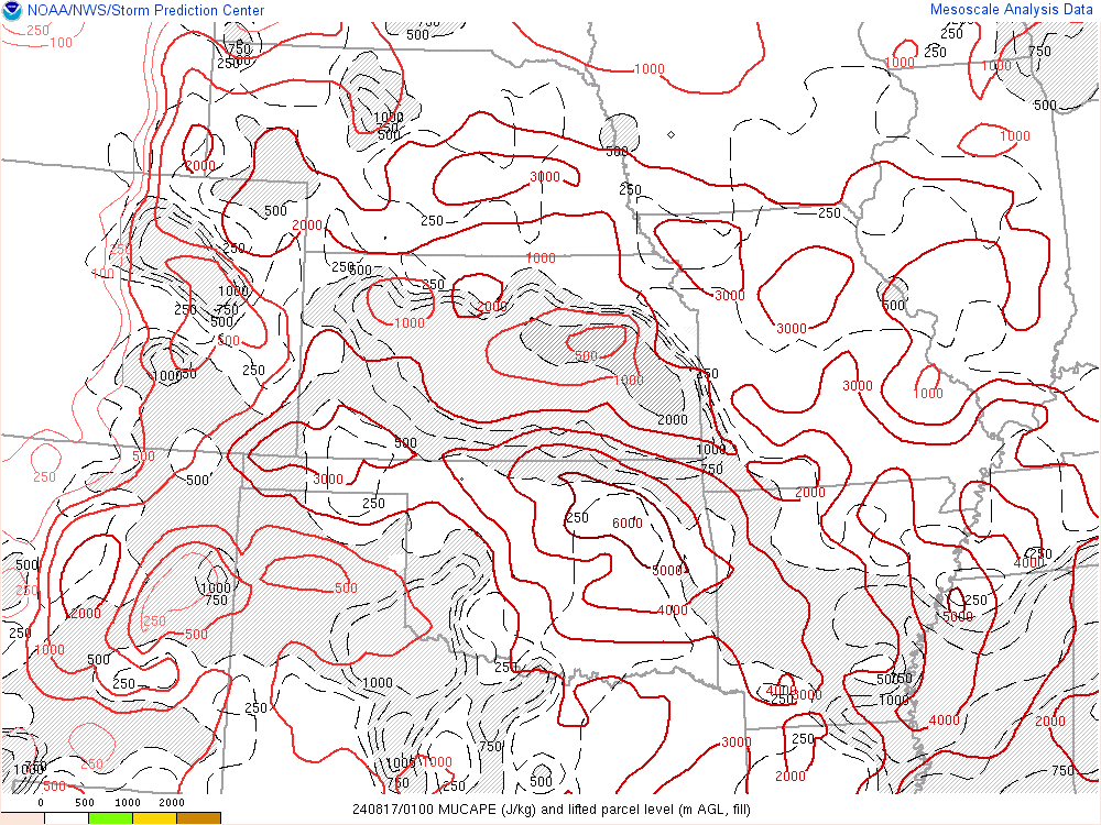 |
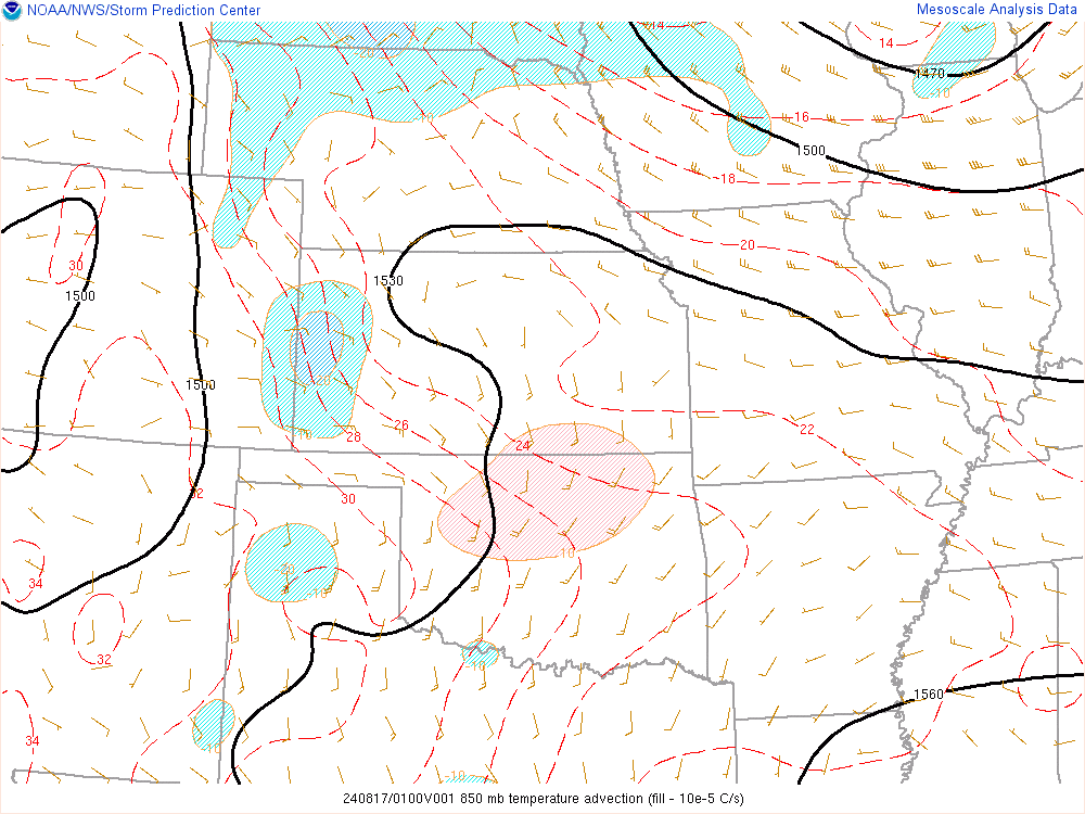
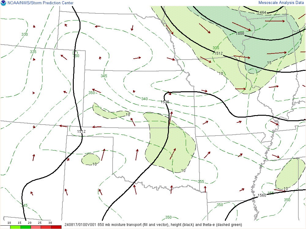
| 8 pm 850mb temp advection | 8 pm 850mb moisture transport | 8 pm most unstable CAPE |
 |
Media use of NWS Web News Stories is encouraged! Please acknowledge the NWS as the source of any news information accessed from this site. |
|


