Overview
|
A powerful upper level low pressure system lifted north out of Mexico and tracked across Texas on New Years Eve. This system eventually tracked across eastern Oklahoma early on New Years Day, spreading a narrow swath of heavy snow from south central Kansas into northeast portions of the state. Wichita picked up 6.5 inches of snow, which turned out to be the snowiest New Years Day on record for Wichita! |
 Picture by Roger Martin |
Photos & Video
 |
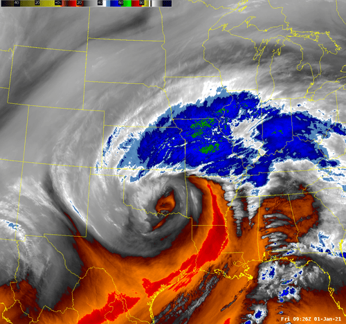 |
| Radar animation during the heaviest snow | Water vapor satellite image showing the upper low lifting across Eastern Oklahoma |
 |
 |
| Fairly crude map showing where the heaviest snow fell | Listing of some of the higher snow totals from this event |
|
|
|
|
|
|
 |
Media use of NWS Web News Stories is encouraged! Please acknowledge the NWS as the source of any news information accessed from this site. |
|

