Overview
|
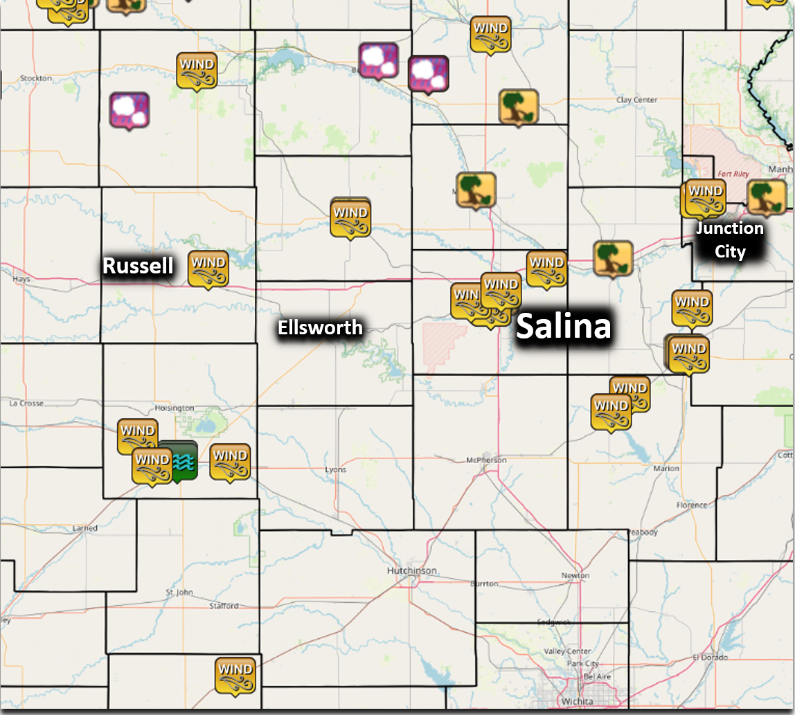
A cold front moved southward across Kansas into a hot and humid airmass during the evening hours on July 31st. This sparked off a line of strong to severe thunderstorms which produced damaging to destructive winds across the northern and central Kansas. The Salina area had extensive tree damage and power outages from thunderstorm wind gusts over 80mph.
|
 Event radar loop during the evening and overnight of July 31. Several clusters of strong to severe storms moved east to southeast across the region. |
Wind:
|
|
|
|
|
|
Storm Reports
 |
..TIME...   ...EVENT...      ...CITY LOCATION...     ...LAT.LON...
..DATE...   ....MAG....      ..COUNTY LOCATION..ST.. ...SOURCE....
            ..REMARKS..

0614 PM     Tstm Wnd Gst     3 NE Bunker Hill        38.90N 98.66W
07/31/2024  M64 MPH          Russell            KS   Mesonet

            Courtesy of Kansas State Mesonet.

0645 PM     Tstm Wnd Dmg     Lincoln                 39.05N 98.15W
07/31/2024                   Lincoln            KS   Trained Spotter

            12 foot tree broken half way up. Approx 6
            inches in diameter at the point of where the
            tree was snapped.

0645 PM     Tstm Wnd Gst     Lincoln                 39.04N 98.15W
07/31/2024  E60 MPH          Lincoln            KS   Trained Spotter


0701 PM     Tstm Wnd Gst     3 ENE New Cambria       38.90N 97.45W
07/31/2024  M59 MPH          Saline             KS   Mesonet


0715 PM     Tstm Wnd Gst     Salina Airport          38.79N 97.65W
07/31/2024  M74 MPH          Saline             KS   ASOS


0755 PM     Tstm Wnd Gst     6 ESE Albert            38.43N 98.91W
07/31/2024  E60 MPH          Barton             KS   Trained Spotter

            Spotter is estimating a few gusts near 60
            mph.

0805 PM     Tstm Wnd Gst     Tampa                   38.55N 97.15W
07/31/2024  E70 MPH          Marion             KS   911 Call Center

            High line electrical transmission line down.

0823 PM     Tstm Wnd Gst     1 N Durham              38.50N 97.22W
07/31/2024  E75 MPH          Marion             KS   Emergency Mngr

            Tree damage reported.

0823 PM     Tstm Wnd Gst     1 WSW Great Bend Airpor 38.35N 98.86W
07/31/2024  M60 MPH          Barton             KS   AWOS


0832 PM     Tstm Wnd Gst     Ellinwood               38.36N 98.58W
07/31/2024  E60 MPH          Barton             KS   Trained Spotter


0916 PM     Tstm Wnd Gst     6 NNW Smolan            38.81N 97.72W
07/31/2024  M89 MPH          Saline             KS   Mesonet

            Courtesy of Union Pacific Railroad.

0917 PM     Tstm Wnd Gst     Salina Airport          38.79N 97.65W
07/31/2024  M77 MPH          Saline             KS   ASOS


0924 PM     Tstm Wnd Dmg     Salina                  38.82N 97.62W
07/31/2024                   Saline             KS   Public

            Delayed report. Per social media posts,
            extensive tree damage in Salina. Time
            estimated from previous reports.

0924 PM     Tstm Wnd Gst     Salina                  38.84N 97.61W
07/31/2024  M95 MPH          Saline             KS   Mesonet

            Measured on the roof of KSAL Radio.

1100 PM     Flood            Great Bend              38.37N 98.77W
07/31/2024                   Barton             KS   Law Enforcement

            Some street flooding in the city, confined
            to typical flood-prone areas.

1103 PM     Flood            Great Bend              38.36N 98.77W
07/31/2024                   Barton             KS   Law Enforcement

            Some street flooding noted in Great Bend.
            The flooding is confined to typical
            flood-prone areas.
 |
Media use of NWS Web News Stories is encouraged! Please acknowledge the NWS as the source of any news information accessed from this site. |
|

