Overview
|
A weak cold front pushed south across the area on Tuesday June 4th and was accompanied by a weak mid level disturbance. Storms developed during the early afternoon hours across west-central Kansas and tracked east into the late afternoon. As they tracked east they expanded in coverage and started to track southeast. The strongest storms produced larger than golf ball size hail across central Kansas along with 60 to 70 mph winds as they tracked southeast. In addition, due to the high moisture content of the airmass, they also produced very high rainfall rates which resulted in pockets of flooding. |
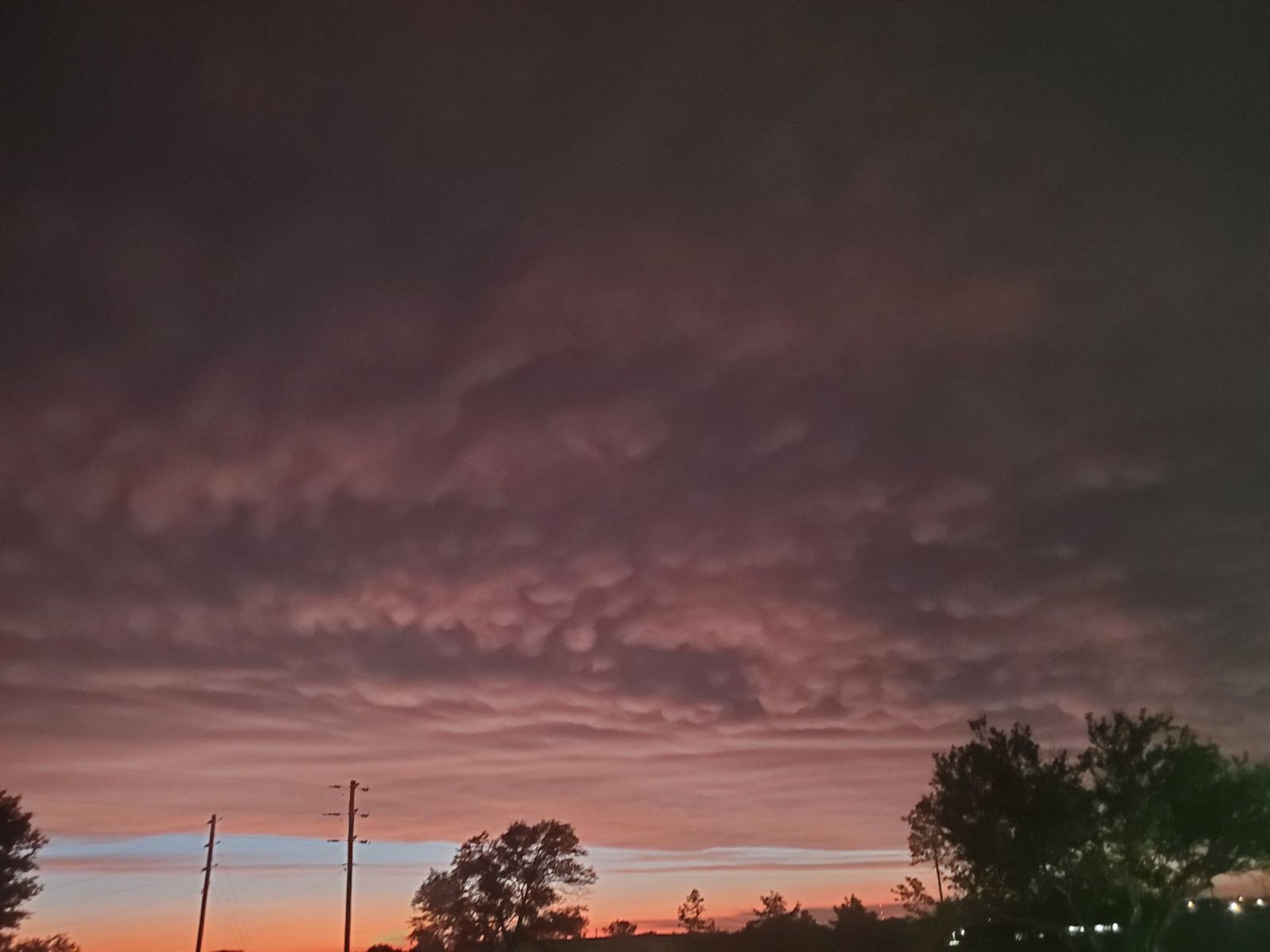
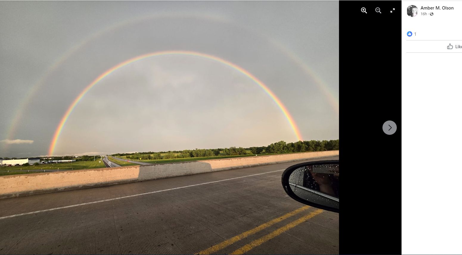
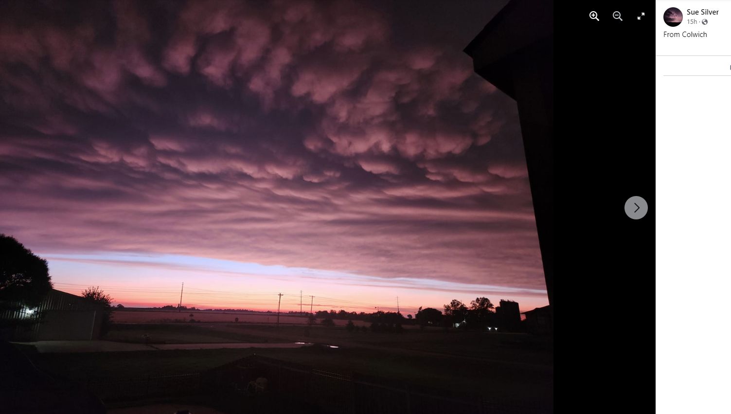 Backside of the storms viewed from Colwich |
Photos & Video
 |
 |
 |
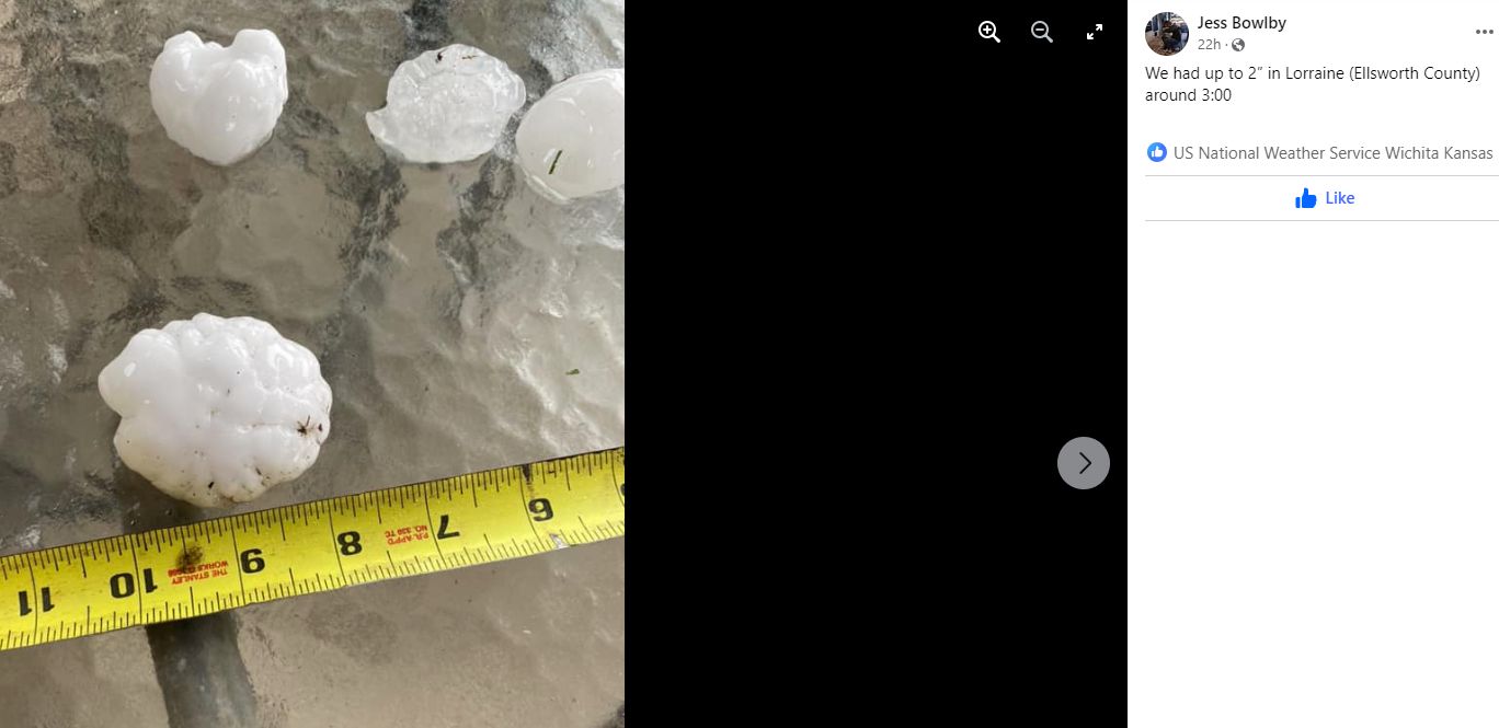 |
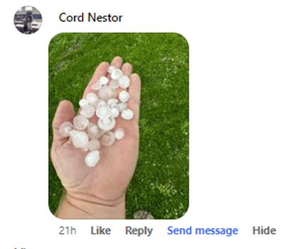
| Hail in McPherson | Hail in McPherson | Hail that fell in Lorraine |
|
Backside of the storms viewed from the NWS Wichita |
 |
|
|
|
|
|
|
|
|
|
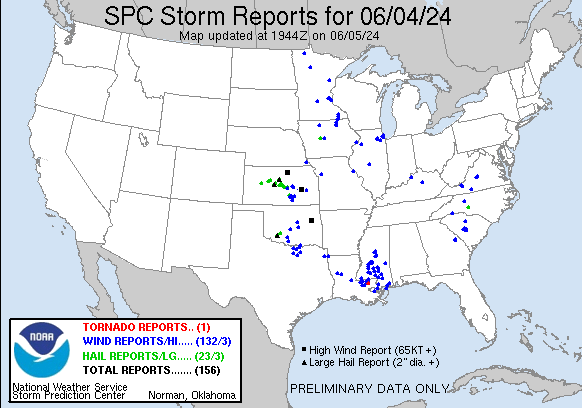
Storm Reports
..TIME...   ...EVENT...      ...CITY LOCATION...     ...LAT.LON...
..DATE...   ....MAG....      ..COUNTY LOCATION..ST.. ...SOURCE....
            ..REMARKS..

0105 PM     Hail             1 SE Galatia            38.62N 98.94W
06/04/2024  E2.50 Inch       Barton             KS   Public

            KAKE relayed a picture of tennis ball sized
            hail. Time is estimated from radar.

0120 PM     Hail             4 E Galatia             38.64N 98.89W
06/04/2024  M1.75 Inch       Barton             KS   CO-OP Observer

            Mostly smaller pea sized hail but a few golf
            ball sized hail pieces.

0141 PM     Hail             3 SSE Lucas             39.01N 98.52W
06/04/2024  M0.88 Inch       Russell            KS   Trained Spotter

            Pea to nickel sized hail.

0143 PM     Hail             4 SSE Lucas             39.00N 98.52W
06/04/2024  E1.25 Inch       Russell            KS   Law Enforcement

            Quarter to half dollar sized hail. Time is
            estimated from radar.

0200 PM     Hail             6 WSW Sylvan Grove      38.97N 98.49W
06/04/2024  E2.00 Inch       Russell            KS   Other Federal

            Army Corps of Engineers had mainly nickel to
            quarter sized with a few larger than golf
            balls. Time is estimated.

0218 PM     Hail             Claflin                 38.52N 98.54W
06/04/2024  E0.75 Inch       Barton             KS   Public


0248 PM     Hail             3 E Claflin             38.52N 98.48W
06/04/2024  M1.50 Inch       Barton             KS   Trained Spotter

            Spotter reported quarter to ping-pong ball
            sized hail.

0250 PM     Hail             Holyrood                38.58N 98.41W
06/04/2024  M1.00 Inch       Ellsworth          KS   Law Enforcement


0302 PM     Hail             Lorraine                38.57N 98.31W
06/04/2024  M1.50 Inch       Ellsworth          KS   Broadcast Media

            Picture relayed via social media from KWCH.

0317 PM     Hail             3 WNW Geneseo           38.54N 98.20W
06/04/2024  M1.00 Inch       Ellsworth          KS   Trained Spotter


0326 PM     Hail             1 NE Frederick          38.52N 98.26W
06/04/2024  E1.75 Inch       Rice               KS   Trained Spotter


0424 PM     Hail             Little River            38.40N 98.01W
06/04/2024  E1.50 Inch       Rice               KS   Public

            Picture on social media relayed via KWCH.

0500 PM     Tstm Wnd Gst     5 NNE Inman             38.29N 97.74W
06/04/2024  E65 MPH          McPherson          KS   Broadcast Media

            KAKE meteorologist reports stronger than 60
            mph winds.

0506 PM     Hail             4 SW Mcpherson          38.33N 97.71W
06/04/2024  E1.50 Inch       McPherson          KS   Broadcast Media

            Along Highway 61. Courtesy of KAKE TV.

0508 PM     Hail             Mcpherson               38.37N 97.66W
06/04/2024  E1.00 Inch       McPherson          KS   Trained Spotter


0509 PM     Hail             Mcpherson               38.37N 97.66W
06/04/2024  E1.00 Inch       McPherson          KS   Public

            Report from mPING: Quarter (1.00 in.).

0512 PM     Hail             Mcpherson               38.37N 97.66W
06/04/2024  M1.75 Inch       McPherson          KS   Public

            Report came in via social media.

0529 PM     Tstm Wnd Gst     4 S Durham              38.43N 97.23W
06/04/2024  M70 MPH          Marion             KS   Mesonet


0547 PM     Tstm Wnd Gst     4 WNW Marion            38.37N 97.10W
06/04/2024  E60 MPH          Marion             KS   Emergency Mngr

            50 to 60 mph at Marion Reservoir.

0641 PM     Tstm Wnd Gst     4 N Matfield Green      38.21N 96.57W
06/04/2024  E70 MPH          Chase              KS   Storm Chaser

            Along Highway 177.

0728 PM     Tstm Wnd Gst     Wichita Eisenhower Airp 37.65N 97.43W
06/04/2024  M58 MPH          Sedgwick           KS   ASOS


0730 PM     Flood            Colwich                 37.79N 97.54W
06/04/2024                   Sedgwick           KS   Public

            Water over 167th St. just north of Colwich.

0736 PM     Tstm Wnd Gst     Madison                 38.14N 96.14W
06/04/2024  M58 MPH          Greenwood          KS   Mesonet

            Measured by a personal weather station.

0742 PM     Hail             4 SE Wichita Eisenhower 37.62N 97.38W
06/04/2024  E0.75 Inch       Sedgwick           KS   Public

            Received via mPING.

0743 PM     Tstm Wnd Gst     3 SSW Downtown Wichita  37.65N 97.35W
06/04/2024  E60 MPH          Sedgwick           KS   Broadcast Media

            Estimating 50 to 60 mph winds near Pawnee
            and Seneca. Courtesy of KS Storm Info.

0746 PM     Tstm Wnd Dmg     3 NW Haysville          37.60N 97.37W
06/04/2024                   Sedgwick           KS   Public

            Report from mPING: 3-inch tree limbs broken;
            Power poles broken.

0759 PM     Flood            1 W East Wichita        37.69N 97.28W
06/04/2024                   Sedgwick           KS   Emergency Mngr

            Flooding along Douglas near Bleckley with a
            vehicle stuck in high water.

0810 PM     Flood            Valley Center           37.84N 97.37W
06/04/2024                   Sedgwick           KS   Trained Spotter

            Flooding in Valley Center along Meridian.

0812 PM     Tstm Wnd Dmg     1 S Augusta             37.68N 96.98W
06/04/2024                   Butler             KS   Public

            Report from mPING: 1-inch tree limbs broken;
            Shingles blown off.

0816 PM     Tstm Wnd Gst     4 E Belle Plaine        37.39N 97.21W
06/04/2024  E60 MPH          Sumner             KS   Trained Spotter

            Large trees bending over.

0816 PM     Tstm Wnd Gst     Derby                   37.55N 97.26W
06/04/2024  M60 MPH          Sedgwick           KS   Trained Spotter
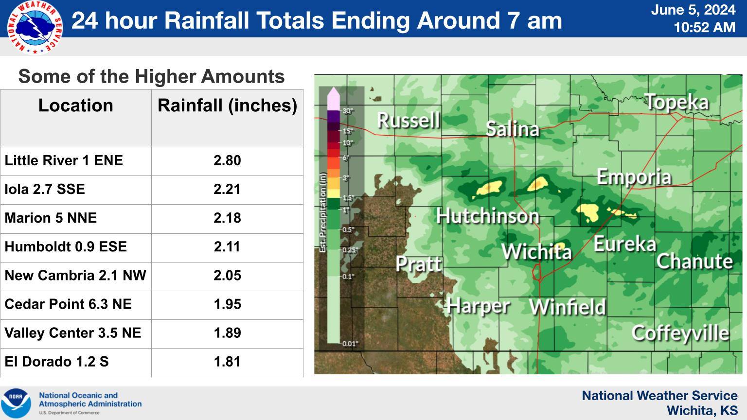
Rain Reports
 |
Media use of NWS Web News Stories is encouraged! Please acknowledge the NWS as the source of any news information accessed from this site. |
|