Overview
A cold front moved into Central Kansas during the afternoon hours of April 30th and storms erupted along it by around 5 pm. Extreme instability allowed storms to quickly become severe producing large hail and a landspout tornado. Storms continued to intensify as they tracked south and east with one of the storms producing up to baseball size hail in Harper county! In addition, before moving into Oklahoma, one storm started to show impressive low level rotation and eventually produced a brief EF-1 tornado north of Sedan.
Tornadoes:
|
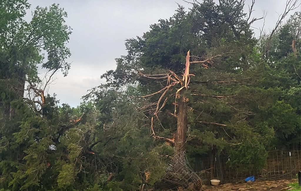
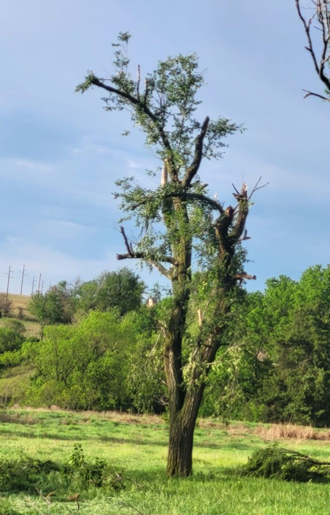
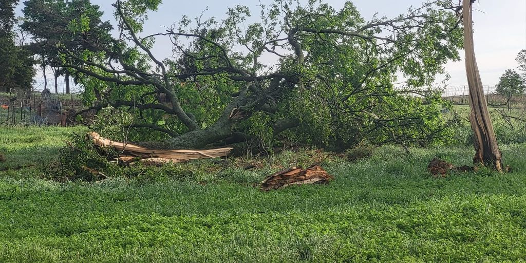
Northwest of Sedan
Track Map 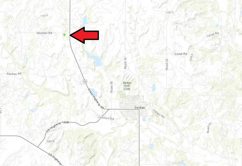 
The following pictures are from Jenna Haver via facebook
|
|||||||||||||||||||
The Enhanced Fujita (EF) Scale classifies tornadoes into the following categories:
| EF0 Weak 65-85 mph |
EF1 Moderate 86-110 mph |
EF2 Significant 111-135 mph |
EF3 Severe 136-165 mph |
EF4 Extreme 166-200 mph |
EF5 Catastrophic 200+ mph |
 |
|||||
Photos & Video
|
 |
 |
 |
h
|
|
|
h
|
h
|
|
|
|
Radar
 |
 |
| Regional radar animation starting around 3 pm | Radar reflectivity and storm relative velocity from the storm that produced the tornado north of Sedan |
Storm Reports
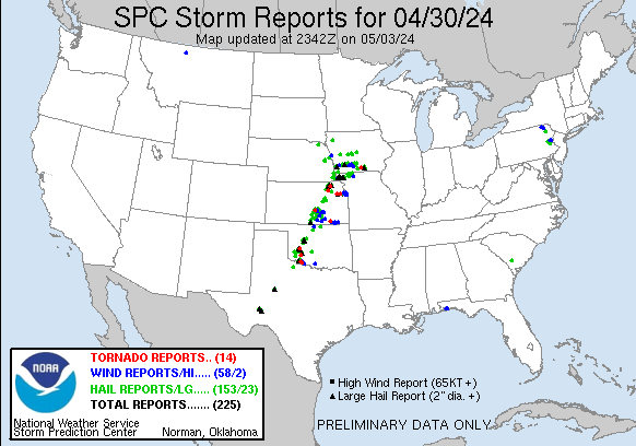 |
Preliminary Local Storm Report...Summary
National Weather Service Wichita KS
333 AM CDT Wed May 1 2024
..TIME... ...EVENT... ...CITY LOCATION... ...LAT.LON...
..DATE... ....MAG.... ..COUNTY LOCATION..ST.. ...SOURCE....
..REMARKS..
0440 PM Landspout 4 ESE Burrton 38.00N 97.60W
04/30/2024 Harvey KS Emergency Mngr
Multiple pictures of a landspout west of
Halstead.
0452 PM Hail 5 NW Halstead 38.05N 97.57W
04/30/2024 E1.00 Inch Harvey KS Trained Spotter
0502 PM Hail Halstead 37.99N 97.51W
04/30/2024 M0.75 Inch Harvey KS Public
0511 PM Hail Mount Hope 37.87N 97.66W
04/30/2024 E1.00 Inch Sedgwick KS Trained Spotter
0516 PM Hail 4 NW Marion 38.38N 97.08W
04/30/2024 E0.70 Inch Marion KS Emergency Mngr
0521 PM Hail 3 NE Andale 37.82N 97.59W
04/30/2024 E0.88 Inch Sedgwick KS Emergency Mngr
0526 PM Hail 1 SW Bentley 37.88N 97.53W
04/30/2024 E0.88 Inch Sedgwick KS Emergency Mngr
0526 PM Hail 5 S Newton 37.97N 97.34W
04/30/2024 E0.75 Inch Harvey KS Trained Spotter
0531 PM Hail 4 S Mt Vernon 37.66N 97.86W
04/30/2024 E1.25 Inch Kingman KS Trained Spotter
0534 PM Hail 5 WSW Newton 38.03N 97.43W
04/30/2024 E1.00 Inch Harvey KS Public
Picture received via Facebook.
0534 PM Hail 2 S Newton 38.02N 97.34W
04/30/2024 E1.75 Inch Harvey KS Trained Spotter
0537 PM Tstm Wnd Dmg 4 NNW Sedgwick 37.97N 97.45W
04/30/2024 Harvey KS Emergency Mngr
Delayed report. Irrigation pivot blew onto
the roadway at 60th and Emma Creek. Time
estimated by radar.
0540 PM Tstm Wnd Dmg 3 E Sedgwick 37.91N 97.37W
04/30/2024 Sedgwick KS Emergency Mngr
Delayed report. Power poles down at 125th
and Meridian. Time estimated by radar.
0543 PM Funnel Cloud 3 W Valley Center 37.84N 97.43W
04/30/2024 Sedgwick KS NWS Employee
Brief funnel cloud. Has since dissipated.
0543 PM Hail Colwich 37.78N 97.54W
04/30/2024 E1.00 Inch Sedgwick KS Emergency Mngr
0556 PM Hail 2 W Whitewater 37.97N 97.19W
04/30/2024 M1.00 Inch Harvey KS NWS Employee
0557 PM Hail 4 S Whitewater 37.91N 97.15W
04/30/2024 E1.00 Inch Butler KS Trained Spotter
0558 PM Hail 3 N Kechi 37.84N 97.28W
04/30/2024 E1.75 Inch Sedgwick KS Trained Spotter
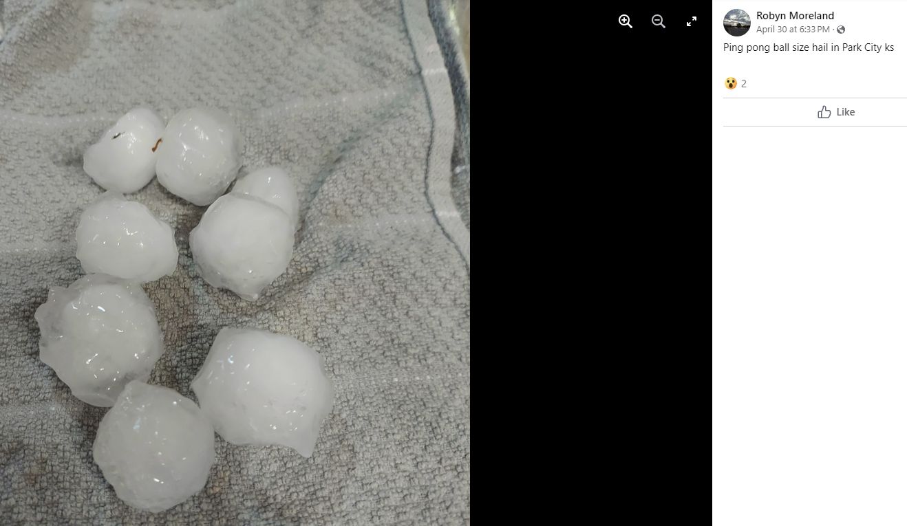
0602 PM Hail Park City 37.80N 97.32W
04/30/2024 E1.50 Inch Sedgwick KS Public
0605 PM Hail Douglass 37.52N 97.01W
04/30/2024 M1.00 Inch Butler KS Trained Spotter
Quarter sized hail with up to 50 mph winds.
0614 PM Hail 1 WNW Benton 37.80N 97.13W
04/30/2024 E1.00 Inch Butler KS Emergency Mngr
0618 PM Hail Norwich 37.46N 97.85W
04/30/2024 E1.00 Inch Kingman KS Trained Spotter
0619 PM Hail 2 S Udall 37.36N 97.12W
04/30/2024 E0.88 Inch Cowley KS Emergency Mngr
0619 PM Hail Norwich 37.46N 97.85W
04/30/2024 E1.75 Inch Kingman KS Trained Spotter
0623 PM Funnel Cloud 3 NW Augusta 37.72N 97.03W
04/30/2024 Butler KS Emergency Mngr
A couple of funnel clouds NW of Augusta.
0630 PM Hail Clearwater 37.51N 97.50W
04/30/2024 E1.00 Inch Sedgwick KS Public
0630 PM Hail 1 ESE East Wichita 37.68N 97.24W
04/30/2024 M1.00 Inch Sedgwick KS Broadcast Media
0632 PM Tstm Wnd Dmg Towanda 37.80N 96.99W
04/30/2024 Butler KS Emergency Mngr
Delayed report. Several tree limbs down in
excess of 10 inches in diameter. Time
estimated by radar.
0632 PM Hail Andover 37.69N 97.14W
04/30/2024 E1.00 Inch Butler KS Public
0633 PM Tstm Wnd Dmg 1 WSW El Dorado 37.82N 96.88W
04/30/2024 Butler KS Emergency Mngr
Power pole down.
0634 PM Hail 1 WSW El Dorado 37.82N 96.87W
04/30/2024 E1.00 Inch Butler KS Emergency Mngr
0635 PM Funnel Cloud 5 SSE Udall 37.32N 97.08W
04/30/2024 Cowley KS Trained Spotter
0635 PM Tstm Wnd Gst 1 WSW El Dorado 37.82N 96.87W
04/30/2024 E65 MPH Butler KS Emergency Mngr
0640 PM Hail 3 ESE Benton 37.77N 97.06W
04/30/2024 E1.00 Inch Butler KS Emergency Mngr
Delayed report. Time estimated by radar.
0640 PM Hail Andover 37.69N 97.14W
04/30/2024 E1.75 Inch Butler KS Emergency Mngr
0648 PM Tstm Wnd Dmg El Dorado 37.82N 96.85W
04/30/2024 Butler KS Emergency Mngr
12-14 inch diameter limb down and another
8-inch diameter tree down.
0649 PM Tstm Wnd Gst 1 ENE Derby 37.56N 97.24W
04/30/2024 E60 MPH Sedgwick KS Trained Spotter
Estimated 60 mph winds in Derby. Delayed
report. Time estimated by radar.
0656 PM Hail Conway Springs 37.39N 97.64W
04/30/2024 E1.00 Inch Sumner KS Public
Social media report.
0700 PM Hail 2 E Harper 37.28N 97.99W
04/30/2024 E1.00 Inch Harper KS Trained Spotter
0701 PM Hail Harper 37.28N 98.02W
04/30/2024 E1.75 Inch Harper KS Public
Video sent via social media.
0703 PM Hail 7 NE Winfield 37.36N 96.90W
04/30/2024 E1.00 Inch Cowley KS Public
Report from mPING: Quarter (1.00 in.).
0710 PM Hail Anthony 37.15N 98.03W
04/30/2024 E1.50 Inch Harper KS Trained Spotter
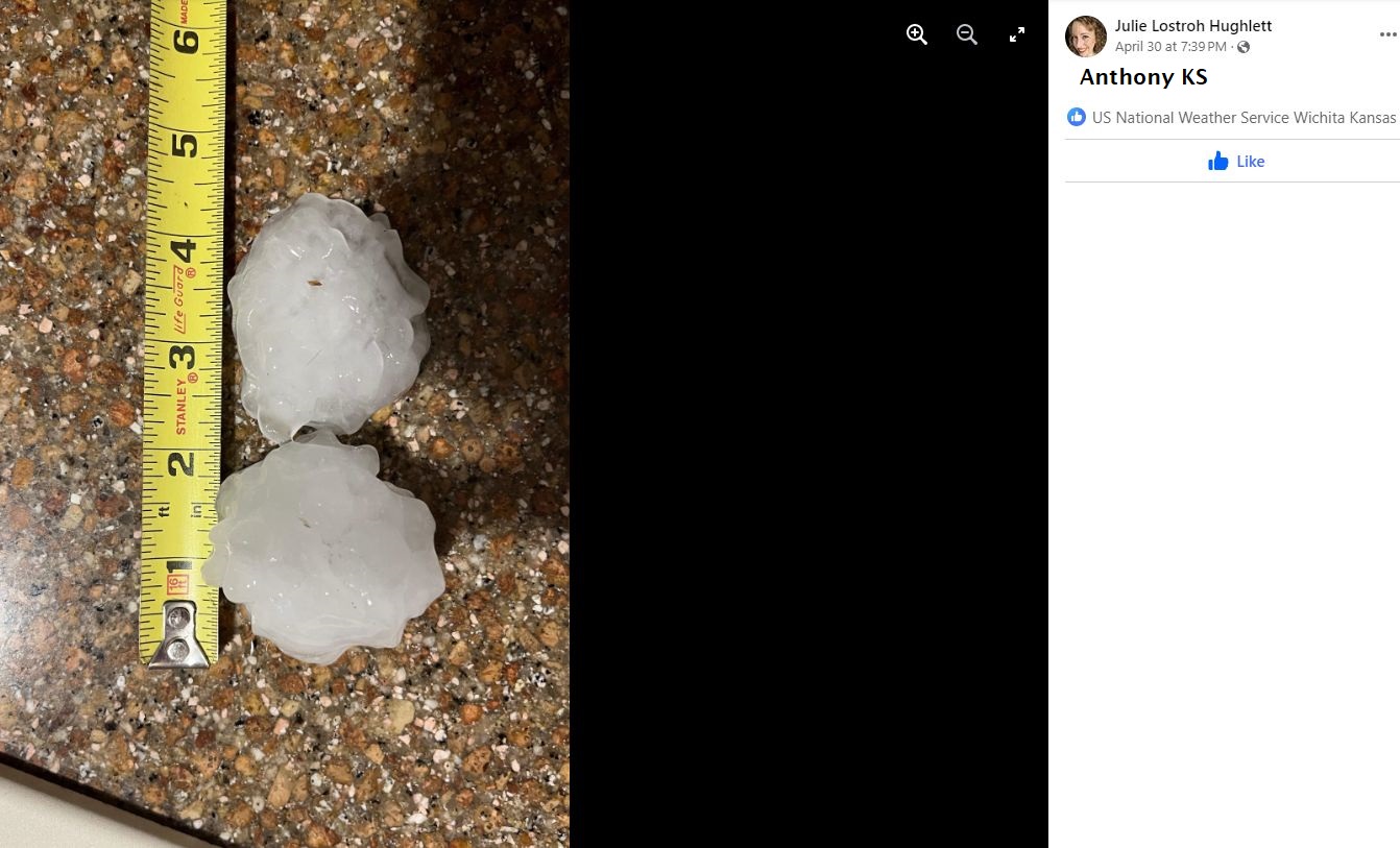
0725 PM Hail Anthony 37.15N 98.03W
04/30/2024 M2.75 Inch Harper KS 911 Call Center
Video of up to baseball size hail in
Anthony. Public call corroborates this
video. Most of the hail is golf ball size.
0730 PM Funnel Cloud 3 NW Burden 37.35N 96.79W
04/30/2024 Cowley KS Broadcast Media
Broadcast media and trained spotters showed
a funnel cloud just northwest of Burden
earlier. Funnel cloud has since dissipated
15 minutes ago.
0746 PM Tstm Wnd Gst Burden 37.32N 96.75W
04/30/2024 E70 MPH Cowley KS Law Enforcement
0800 PM Tstm Wnd Dmg Wellington 37.27N 97.40W
04/30/2024 Sumner KS Public
Large tree down. Report came in via social
media.
0822 PM Tornado 5 WNW Sedan 37.16N 96.27W
04/30/2024 Chautauqua KS Public
Brief tornado touchdown that came in via
social media.
0833 PM Tstm Wnd Gst 7 N Arkansas City 37.17N 97.03W
04/30/2024 M60 MPH Cowley KS ASOS
ASOS station KWLD Strother Field Airport.
0838 PM Tstm Wnd Gst 7 SW Winfield 37.18N 97.04W
04/30/2024 E70 MPH Cowley KS Public
0841 PM Tstm Wnd Gst Sedan 37.13N 96.18W
04/30/2024 E70 MPH Chautauqua KS Trained Spotter
Also had some limbs and trees down.
0905 PM Tstm Wnd Gst 3 NW Tyro 37.07N 95.86W
04/30/2024 E60 MPH Montgomery KS Trained Spotter
0924 PM Tstm Wnd Gst 3 W Tyro 37.04N 95.88W
04/30/2024 E60 MPH Montgomery KS Trained Spotter
0936 PM Tstm Wnd Gst 1 S Coffeyville Airport 37.08N 95.57W
04/30/2024 M60 MPH Montgomery KS ASOS
ASOS station KCFV Coffeyville Municipal
Airpt.
0937 PM Tstm Wnd Gst Coffeyville Airport 37.10N 95.57W
04/30/2024 M60 MPH Montgomery KS ASOS
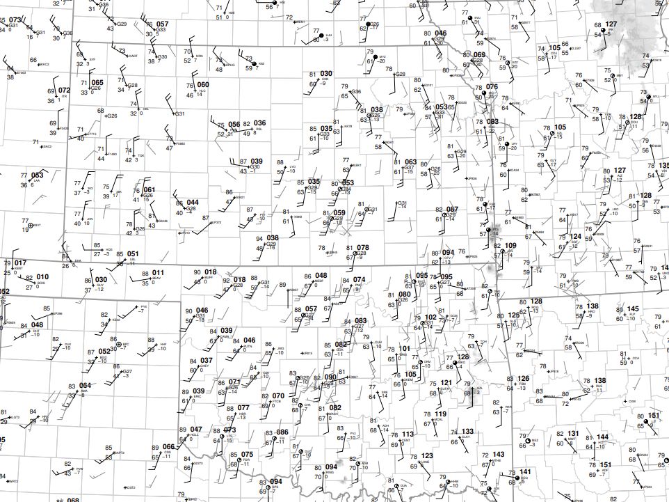
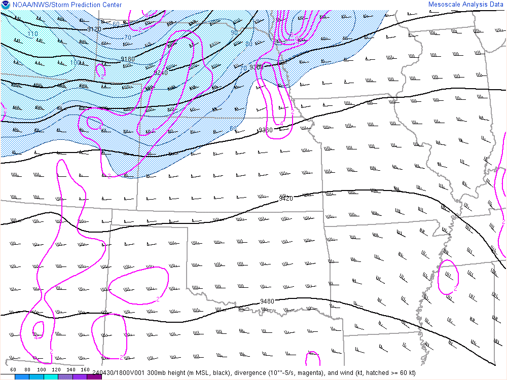
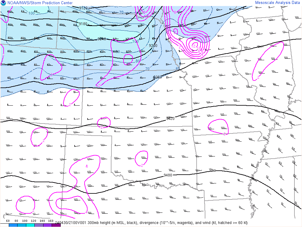
Environment
 |
 |
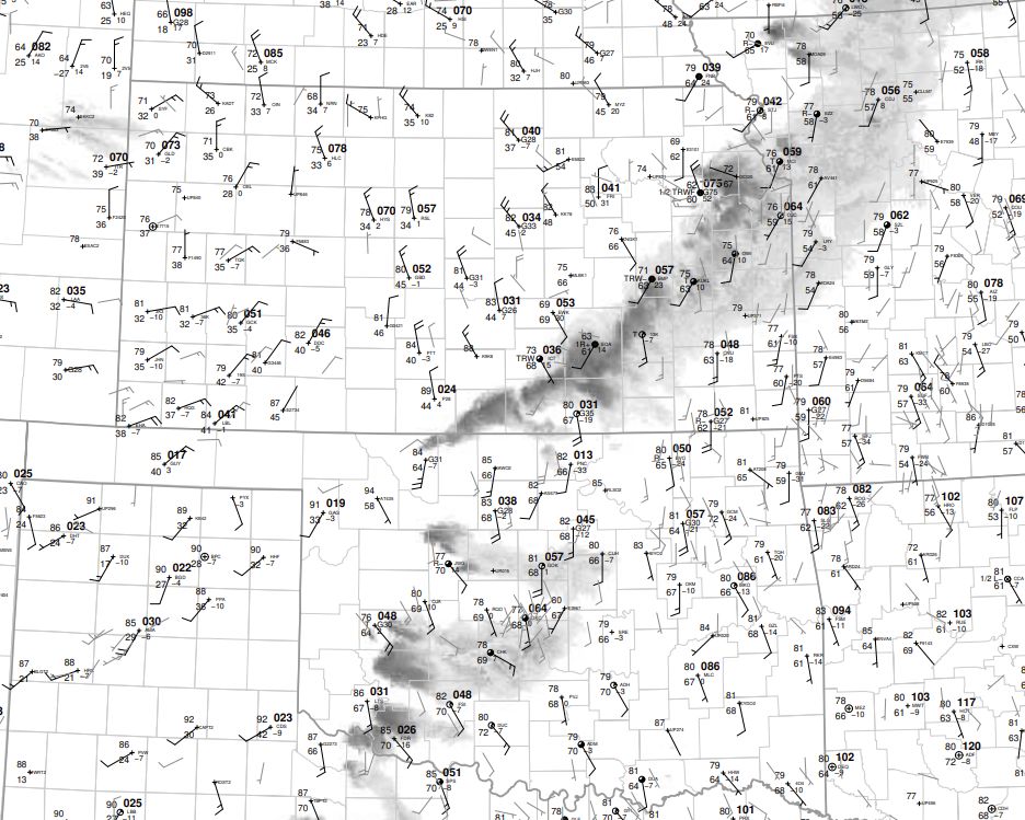 |
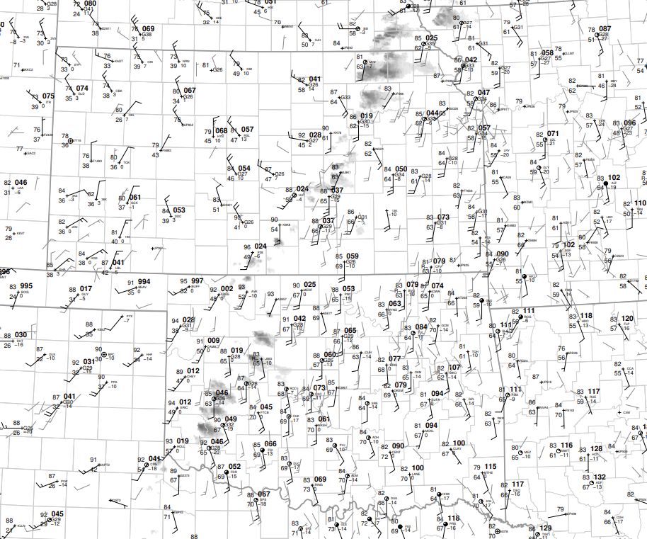
| 18z SFC map | 21z sfc map | 00z sfc map |
 |
 |
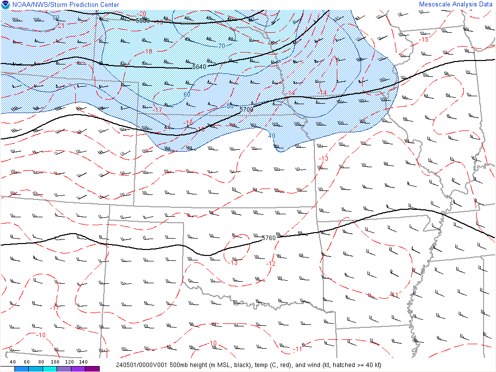 |
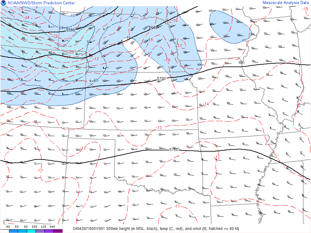
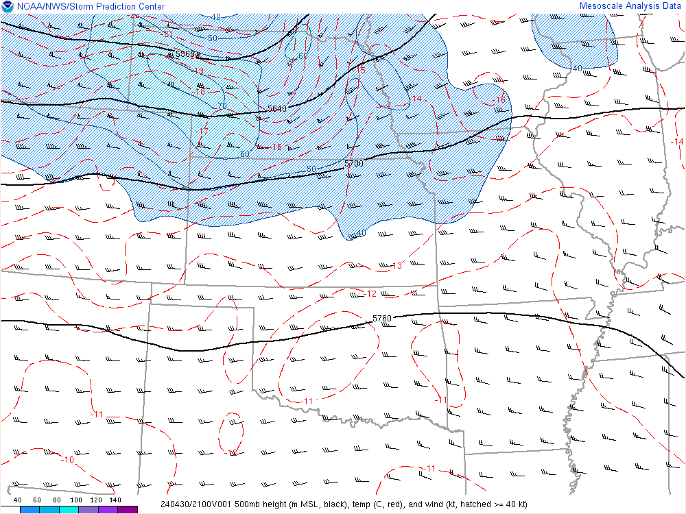
| 18z 500mb | 21z 500mb | 00z 500mb |
 |
 |
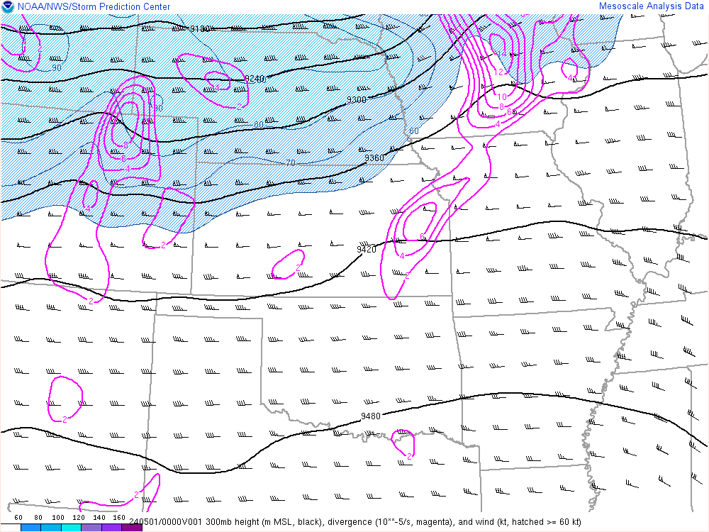 |
| 18z 300mb | 21z 300mb | 00z 300mb |
 |
 |
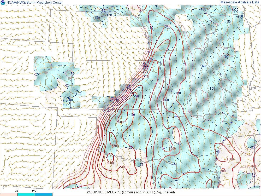 |
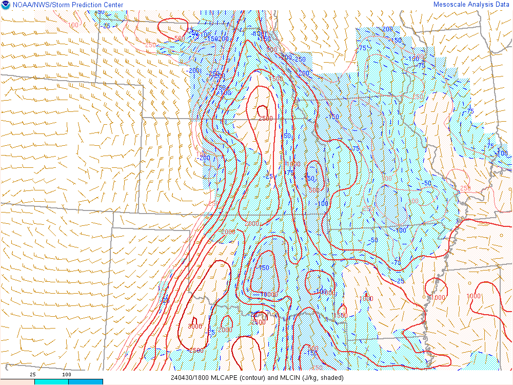
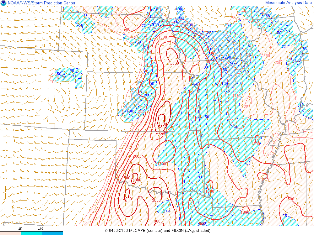
| 18z ML CAPE | 21z ML CAPE | 00z ML CAPE |
 |
 |
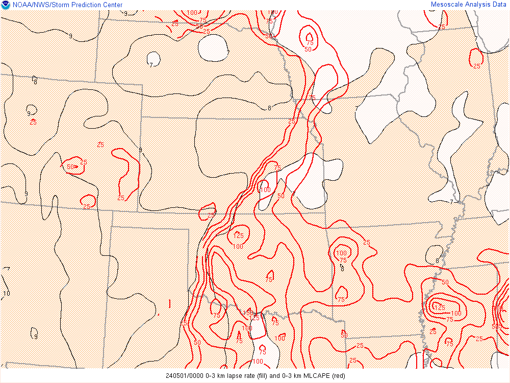 |
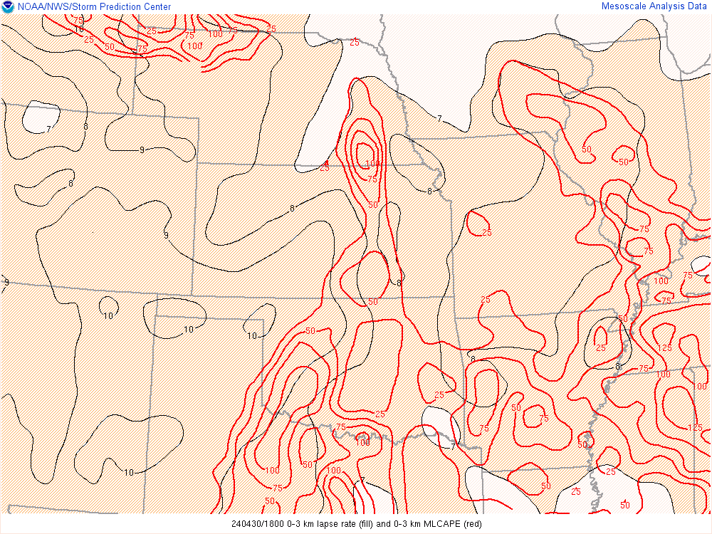
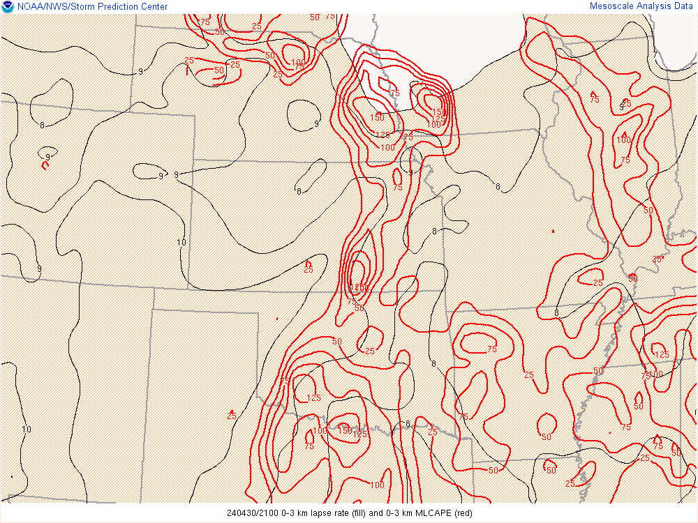
| 18z 0-3km CAPE | 21z 0-3km CAPE | 00z 0-3km CAPE |
 |
 |
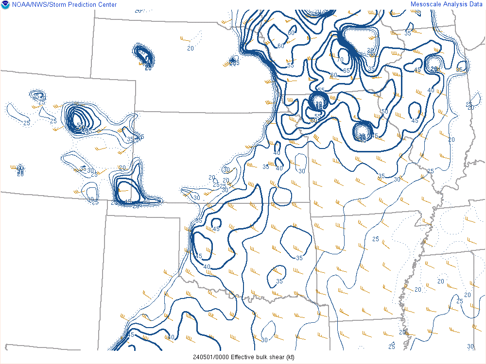 |
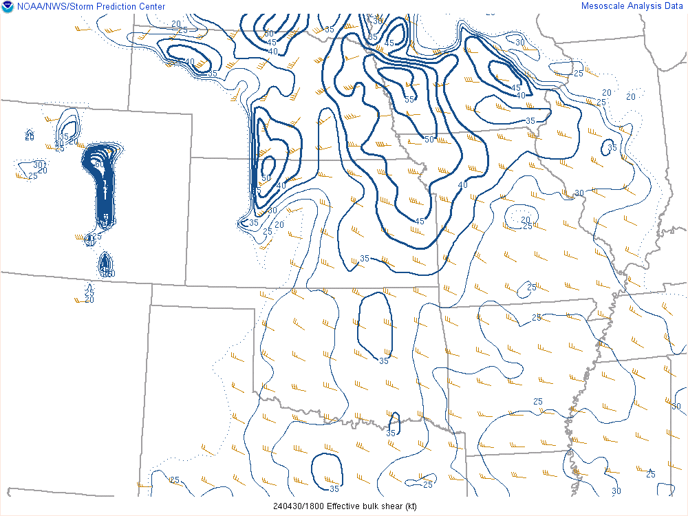
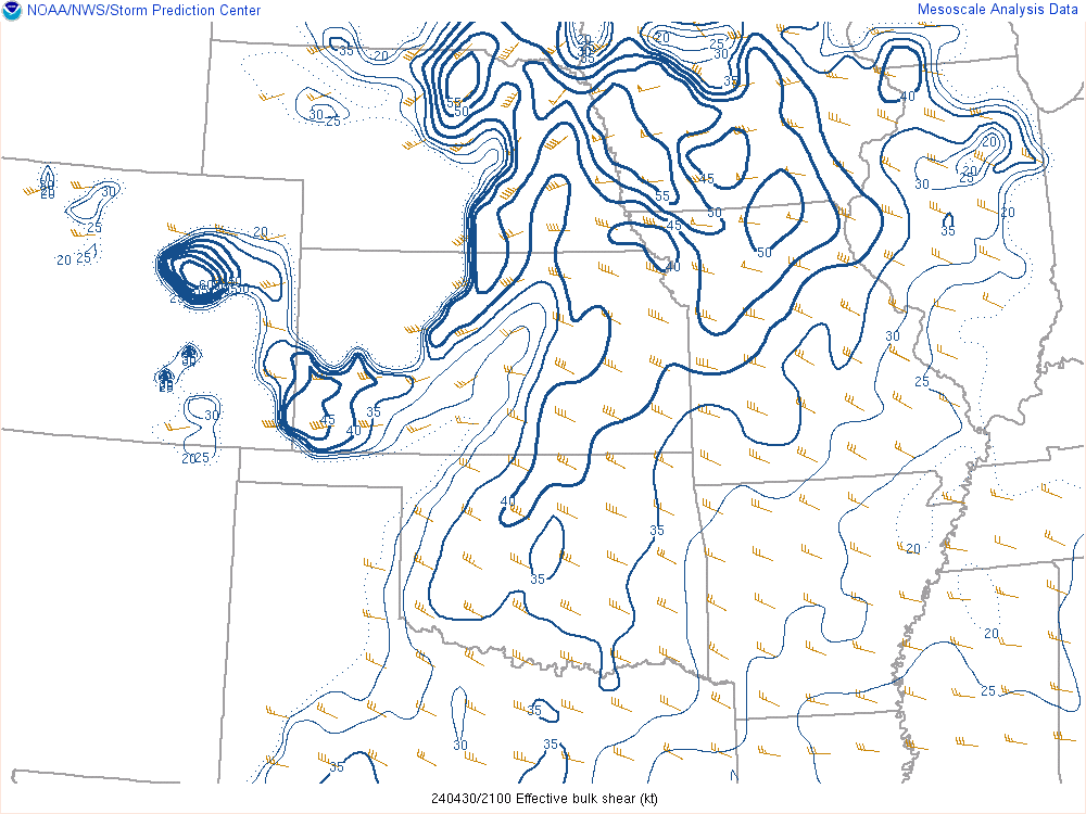
| 18z Effective bulk shear | 21z Effective bulk shear | 00z Effective bulk shear |
 |
 |
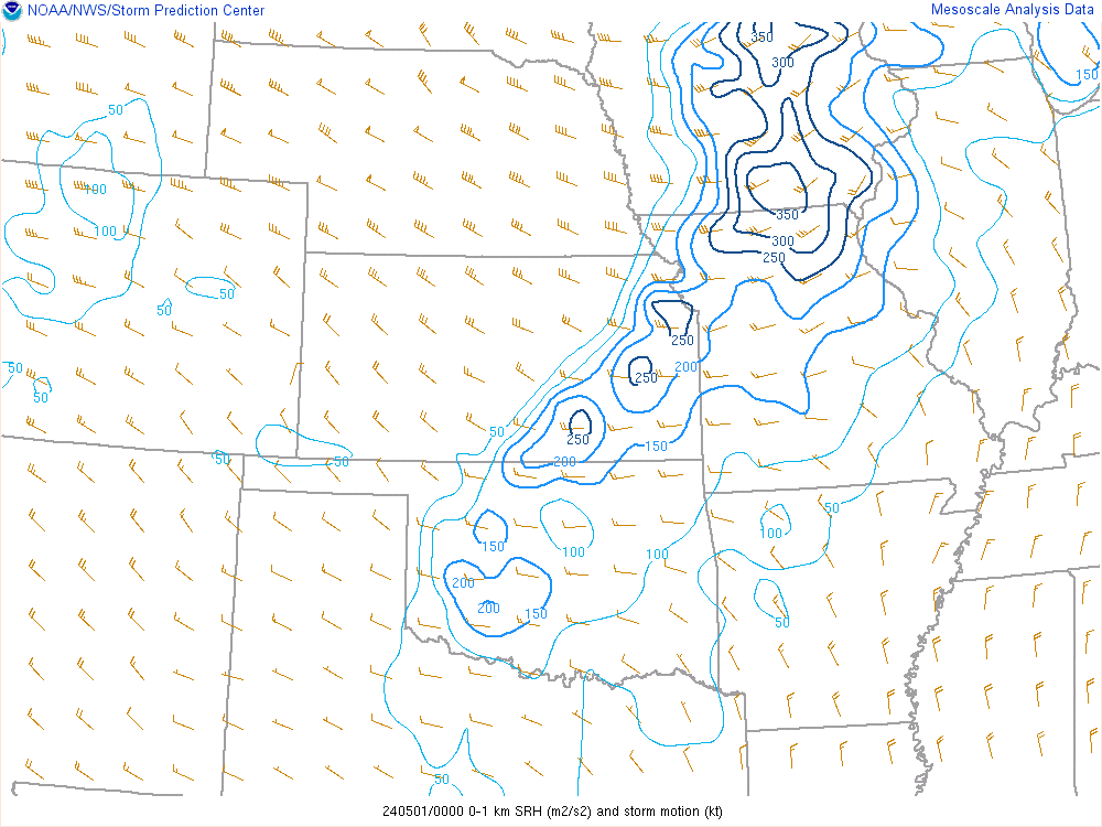 |
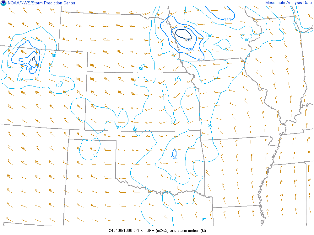
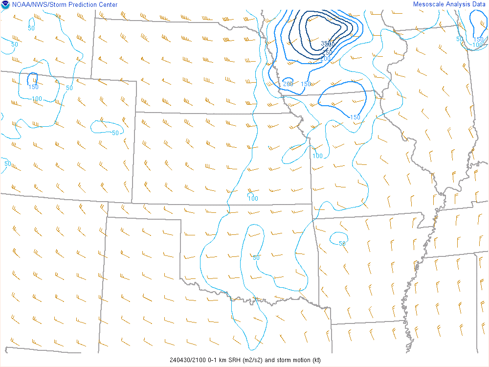
| 18z 0-1km SRH | 21z 0-1km SRH | 00z 0-1km SRH |
 |
 |
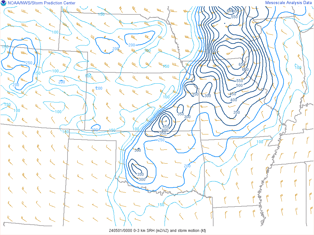 |
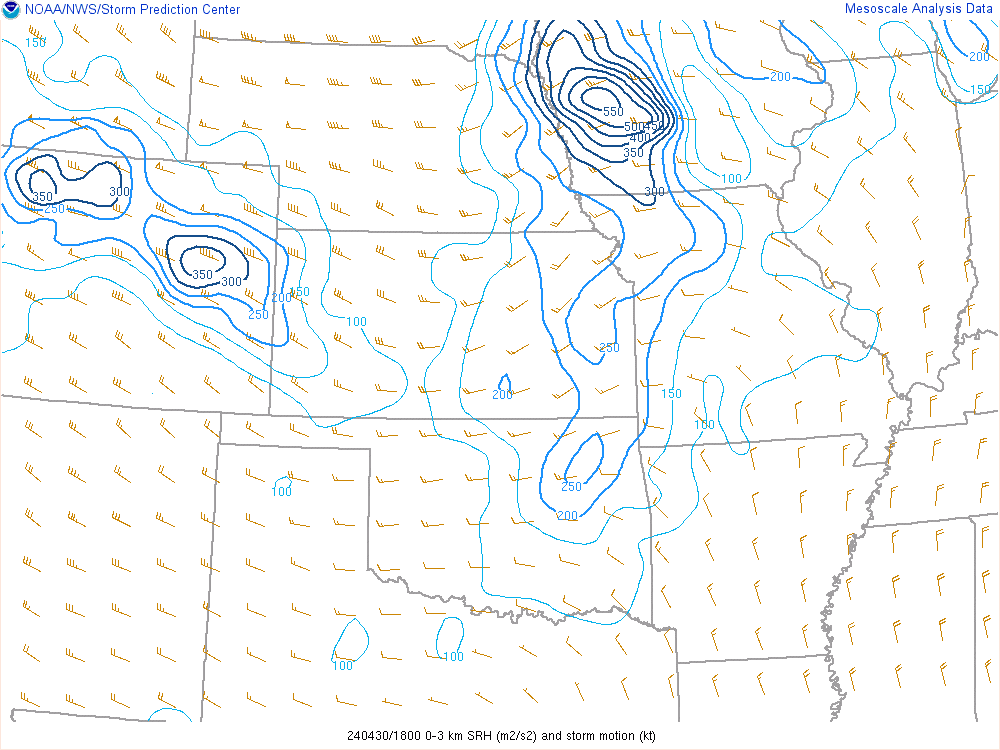
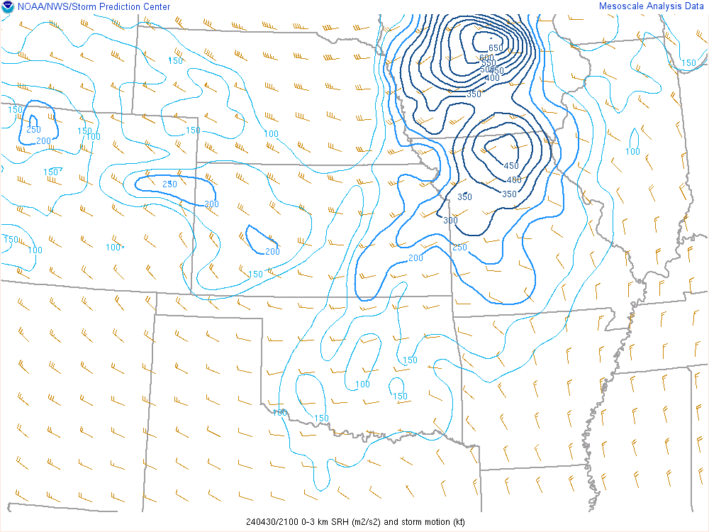
| 18z 0-3km SRH | 21z 0-3km SRH | 00z 0-3km SRH |
 |
 |
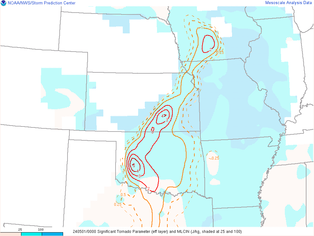 |
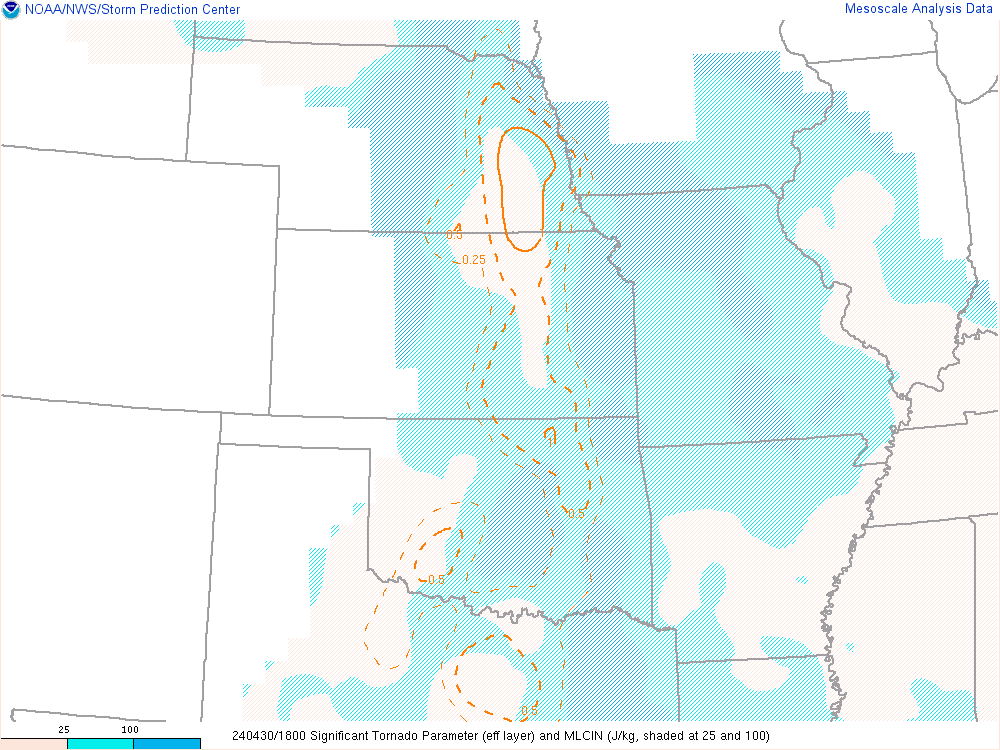
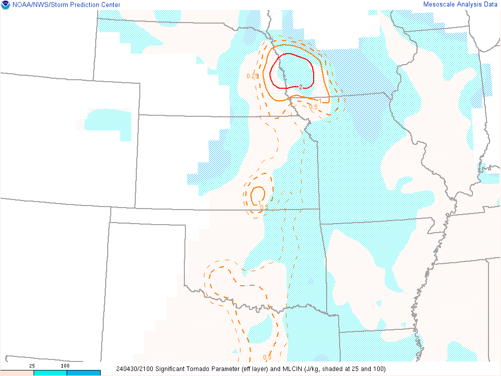
| 18z STP | 21z STP | 00z STP |
 |
Media use of NWS Web News Stories is encouraged! Please acknowledge the NWS as the source of any news information accessed from this site. |
|