Overview
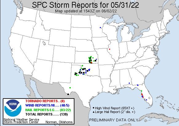
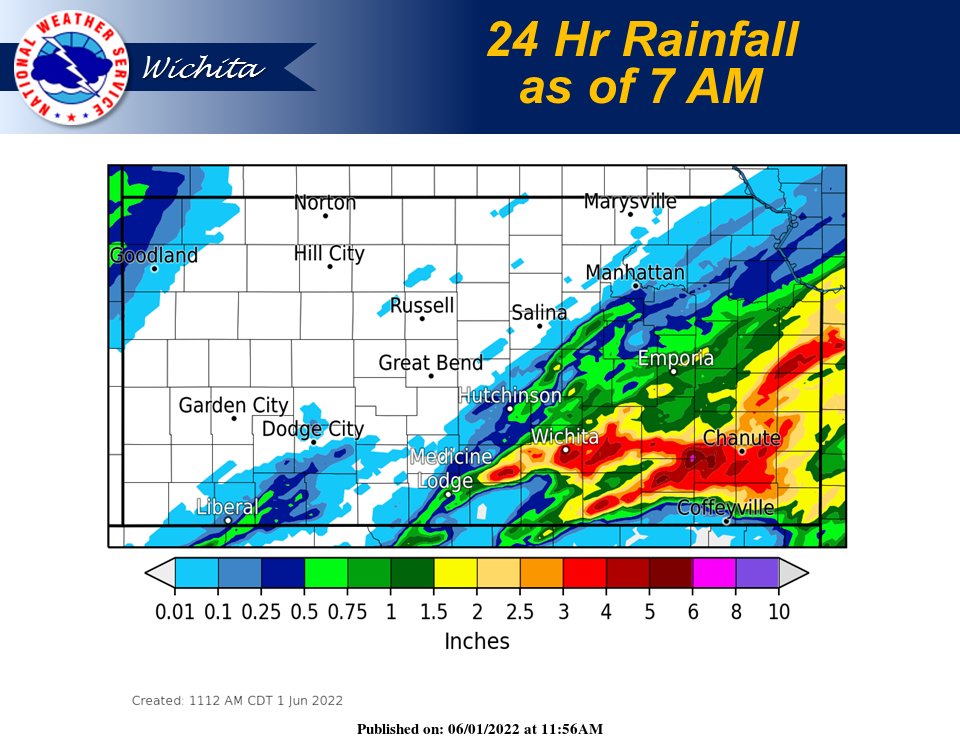
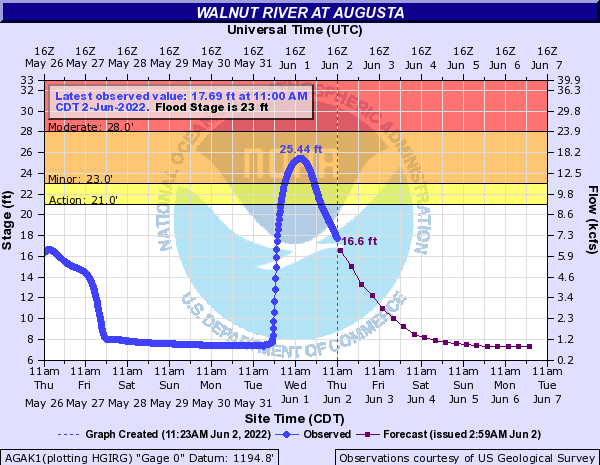
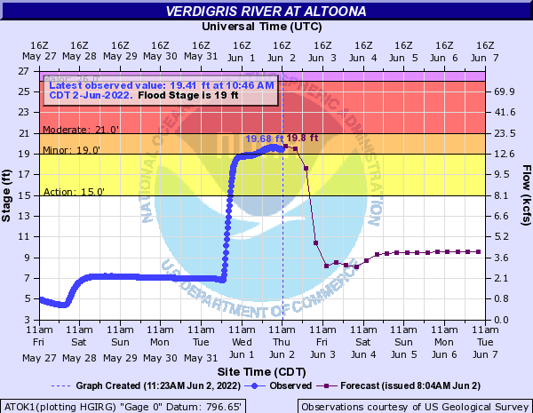
An extremely unstable airmass was in place across southern Kansas on May 31st as storms erupted along a stationary front from western Oklahoma into southern Kansas. Storms quickly became severe producing very large hail along with a couple brief tornadoes. In addition, they also produced very heavy rain that caused flash flooding along with river flooding.Photos & Video
 |
|
| Radar animation form this event | Storm reports |
| Radar animation of the 1st tornado warned storm | Radar animation of the 2nd tornado warned storm |
Hail Pictures
|
|
|
|
|
|
Wall Cloud & Tornado Pictures
|
|
|
|
|
|
Heavy rain and flooding
May 2022 ended up being the 2nd wettest May on record for Wichita Kansas with a monthly total of 12.95 inches.
 |
|
May 2022 rainfall totals |
May 2022 departure from normal rainfall |
Flash flooding
|
|
|
|
River Flooding
 |
 |
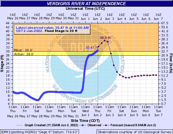 |
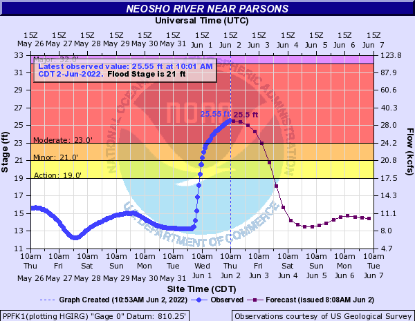 |
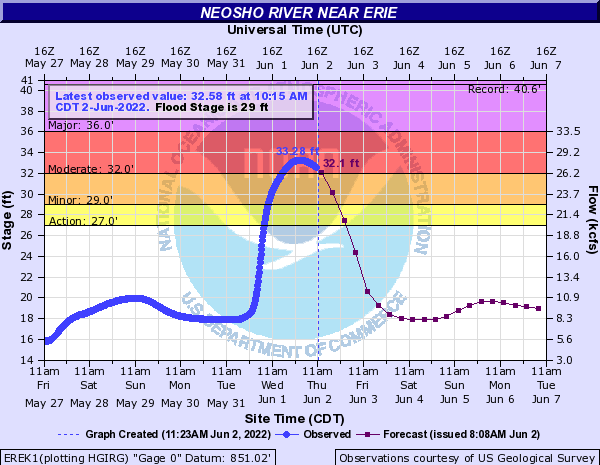 |
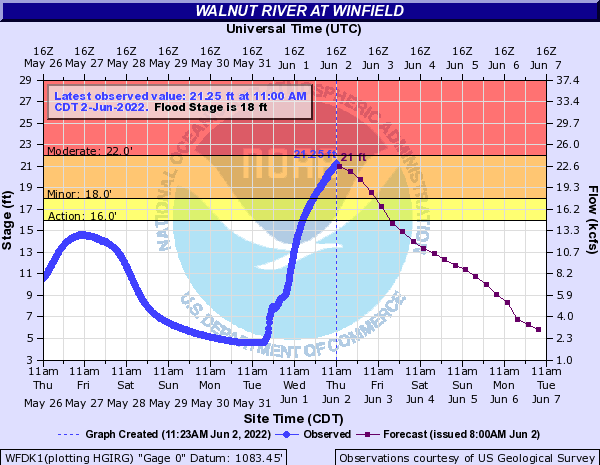 |
 |
Media use of NWS Web News Stories is encouraged! Please acknowledge the NWS as the source of any news information accessed from this site. |
 |