Overview
|
A fast moving but powerful low pressure system brought significant snow to parts of the Central and Southern Plains on Thursday February 17th. The event started off late Wednesday night with thunderstorms producing sleet and freezing rain with the precipitation changing to all snow by early Thursday morning. Strong north winds gusting to 40 mph created whiteout conditions for the morning commute. |
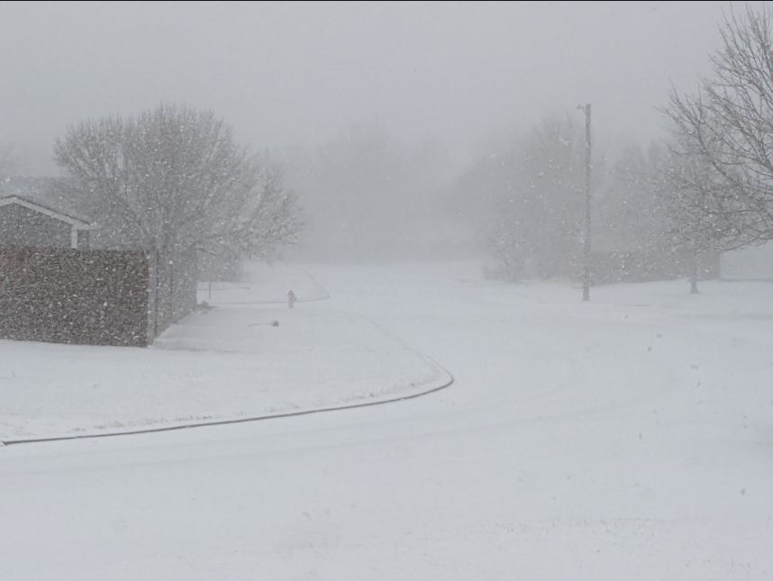 Picture by Roger Martin, on southwest side of Wichita |
Photos & Video
 |
 |
 |
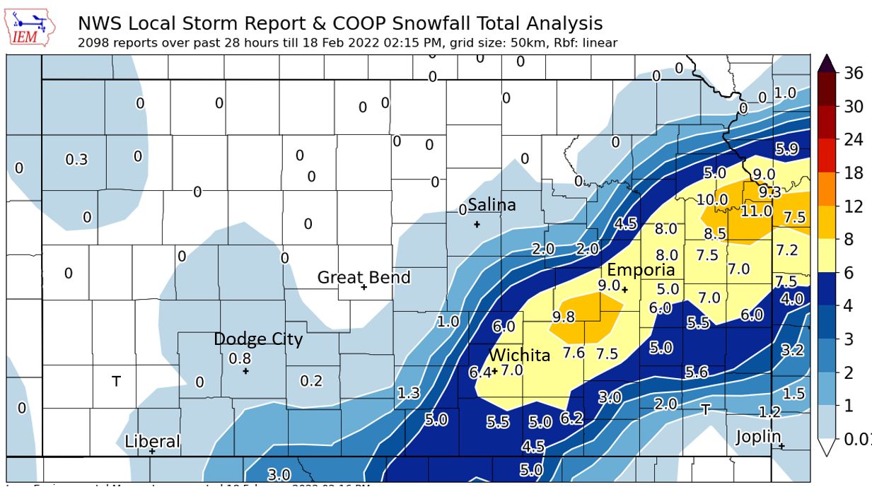
| Map showing where the heaviest snow fell during the event | Satellite imagery showing where the snow fell across southern and eastern Kansas | Radar animation ending during the early afternoon of February 17th |
 |
 |
|
| Meteorologist at the NWS Wichita measuring snow | Snow north of Clearwater. Picture taken by Mick Mcguire |
|
|
|
|
|
|
 |
Media use of NWS Web News Stories is encouraged! Please acknowledge the NWS as the source of any news information accessed from this site. |
|

