Overview
|
An unusual October winter storm affected much of south central Kansas on October 26th and 27th. The event started during the early morning hours of Monday October 26 as a mix of sleet and snow with a second round on Tuesday which consisted of mostly sleet and freezing rain. Locations across Cowley, Chautauqua, Elk and Montogomery counties saw the most significant ice accumulation. The towns of Winfield and especially Arkansas City were hit hard, with numerous reports of widespread power outages along with large trees down.
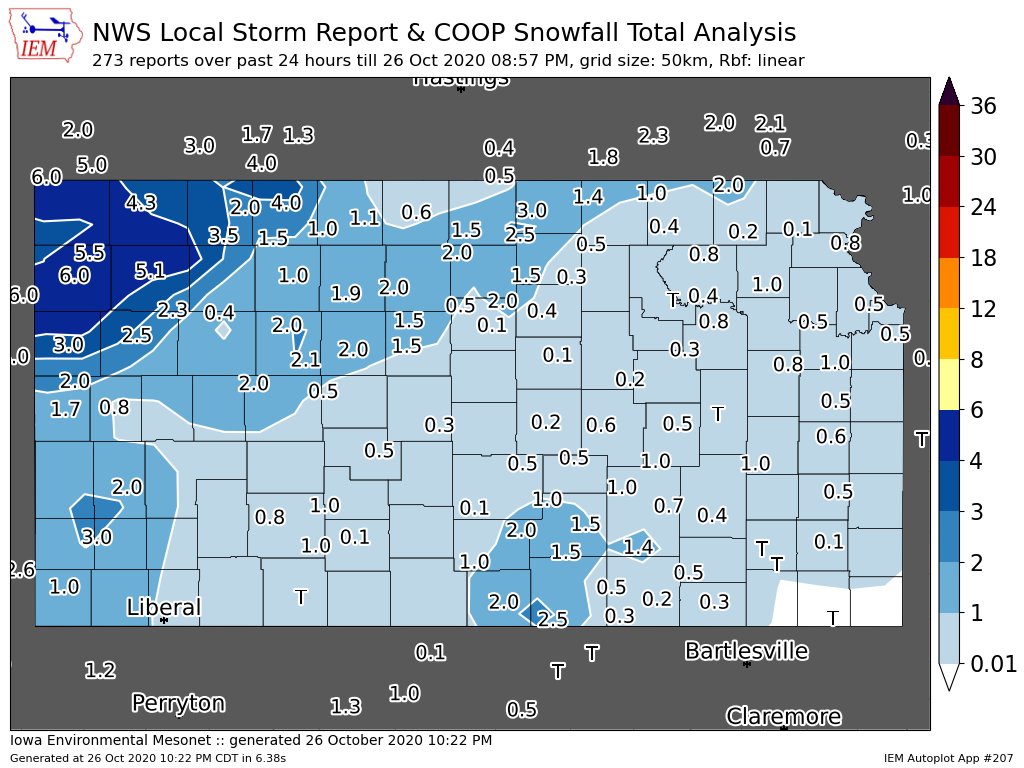
Wichita set new snowfall records for both October 26th and 27th. The 1.3 inches on the 26th was the most snow Wichita has ever received that early. The 1.6 inches from both days combined makes October 2020 the 2nd snowiest October on record for Wichita. |
 Picture from Roger Martin showing fall colors with a rare October snow for Wichita |
Photos & Video
October 26th
 |
 |
|
| Map of snowfall from October 26th | Road conditions across Wichita on the morning of October 26th |
October 27th
 |
|
|
| Surface map from the morning of October 27th showing how unusually cold it was across most of Kansas. |
|
|
|
|
Storm reports from October 27th |
 |
Media use of NWS Web News Stories is encouraged! Please acknowledge the NWS as the source of any news information accessed from this site. |
|