Wichita, Kansas
Weather Forecast Office
Overview
Sub freezing temperatures were in place during the evening of Thursday January 16th as an unseasonably moist airmass was lifted up and over the cold airmass. This resulted in a wintry mix of sleet and snow that eventually changed all over to freezing rain. Some locations over central and northeast Kansas picked-up between a quarter and half inch of ice, with most of this accumulating on elevated surfaces such as trees.
Photos & Video
 |
 |
 |
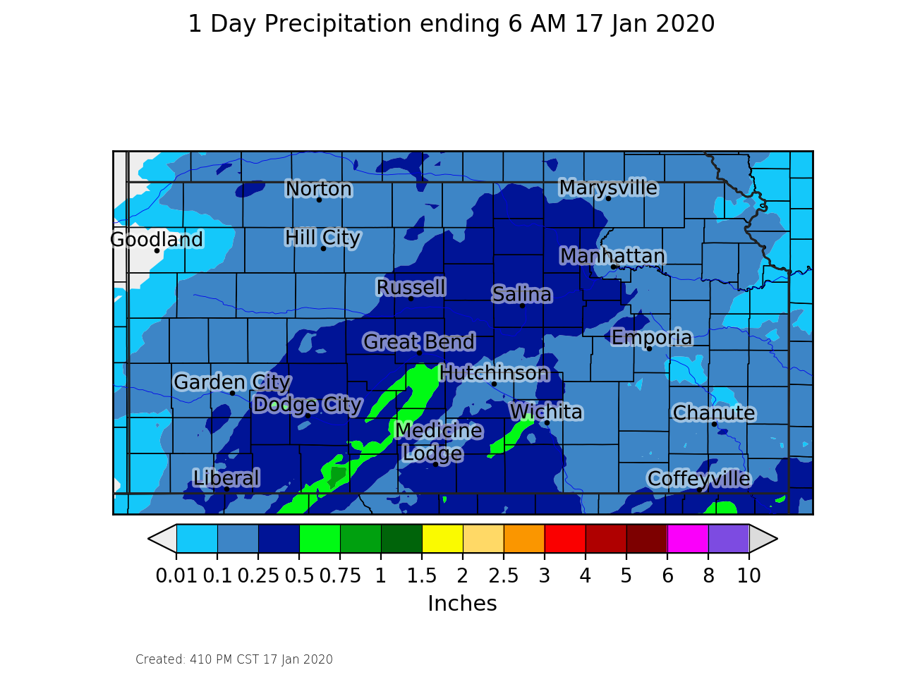
| Radar animation from the evening of Jan 16th into the early morning hours of Jan 17th | Reported ice accumulation | Ice accumulation reports |
 |
 |
 |
| Surface map from around 7 pm on January 16th | 24 hour observed precipitation ending around 6 am on January 17th | This chart shows how rare the amount of low level moisture was for this event. It shows specific humidity values around 4 standard deviations above normal |
|
|
|
 |
Media use of NWS Web News Stories is encouraged! Please acknowledge the NWS as the source of any news information accessed from this site. |
|
Hazards
Briefing pages
Local weather story
Submit a storm report
Storm Prediction Center
Enhanced Hazardous Weather Outlook
Current Conditions
Local Radar
National Radar
Satellite
Hourly weather(text)
Precip Analysis
Snowfall analysis
This day in weather history
7 Day Lightning Archive
Forecasts
Forecast Discussion
Weather Story
Fire Weather
Activity Planner
Aviation Weather
Soaring Forecast
Hurricane Center
Graphical Forecasts
Regional Weather Summary
Probabilistic Snow
Probabilistic QPF
Wet Bulb Globe temp
Climate
Local Climate Page
Daily/Monthly data(F6)
Daily Records
Climate Normals
Local drought page
Latest Climate Report(ICT)
Latest Climate Report(SLN)
Latest Climate Report(CNU)
CoCoRaHS
7 Day Lightning Archive
US Dept of Commerce
National Oceanic and Atmospheric Administration
National Weather Service
Wichita, Kansas
2142 S. Tyler Road
Wichita, KS 67209-3016
316-942-3102
Comments? Questions? Please Contact Us.

