Overview
Social Media
|
|
|
Overview
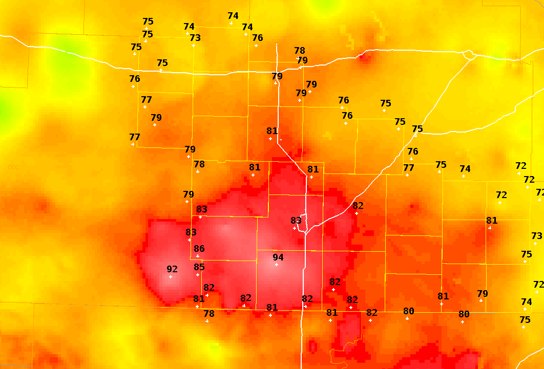
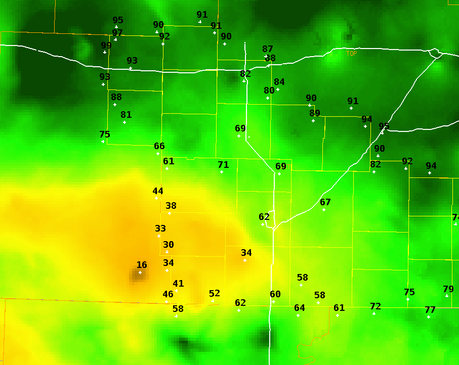
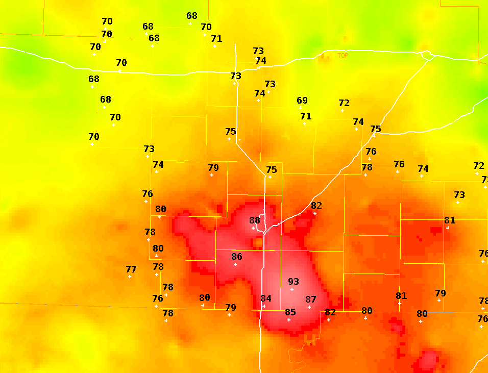
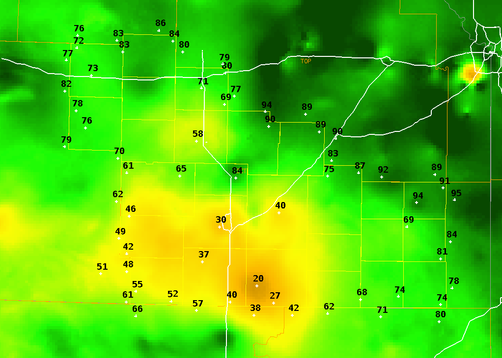
Decaying storms in northern Oklahoma, between midnight and 3 am on August 17th, produced a heat burst across far southern Kansas with temps spiking into the mid and upper 90s. Damaging winds in the 50 to 65 mph range accompanied the heat burst across Harper, Sumner and Cowley counties. Some locations in Sumner county had winds greater than 40 mph for over two hours!
| Peak temp |
Lowest RH |
Peak wind | |
| Medicine Lodge | 94 | 17% | 58 mph |
| Wellington | 89 | 27% | 62 mph |
| Winfield | 95 | 19% | 46 mph |
Radar
 |
| Radar animation showing decaying storms over northern Oklahoma which caused the heat burst. |
|
1 am temperatures on August 17th |
1 am RH values on August 17th |
4 am temperatures on August 17th |
4 am RH values on August 17th |
Medicine Lodge conditions
 |
 |
| Temp and dewpoint graph at Medicine Lodge showing a rise in temp and drop in RH and dewpoint | Wind graph for Medicine Lodge showing the spike in wind. |
Wellington Conditions
 |
 |
| Temp and dewpoint graph at Wellington showing a rise in temp and drop in RH and dewpoint | Wind graph for Wellington showing the spike in wind. |
Winfield conditions
 |
| Temp and dewpoint graph at Winfield showing a rise in temp and drop in RH and dewpoint |
 |
Media use of NWS Web News Stories is encouraged! Please acknowledge the NWS as the source of any news information accessed from this site. |
|