Overview
|
Two rounds of wintry precipitation impacted a large portion of Kansas, causing widespread travel issues. The first round brought heavy snow to the I-70 corridor, with icing occurring across parts of southern Kansas. The second round brought a band of snow across south-central and southeast Kansas, including the Wichita metro. This band of snow wasn't as heavy as what occurred with the first round, but still had an impact. Regionally, several fatalities were attributed to the winter storm, unfortunately. |
.jpg) |
Snowfall amounts and radar
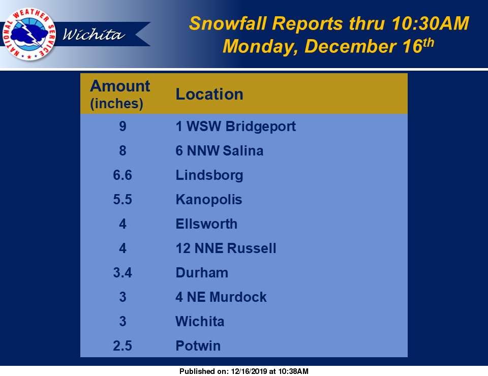
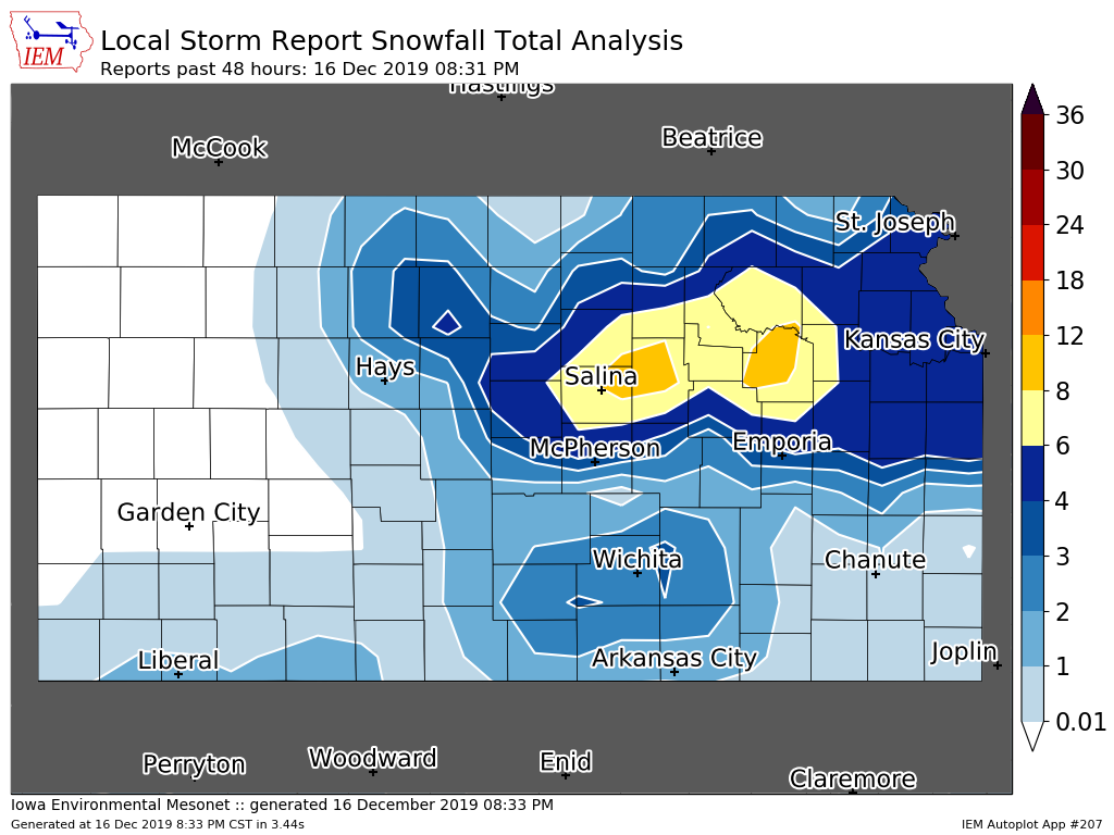
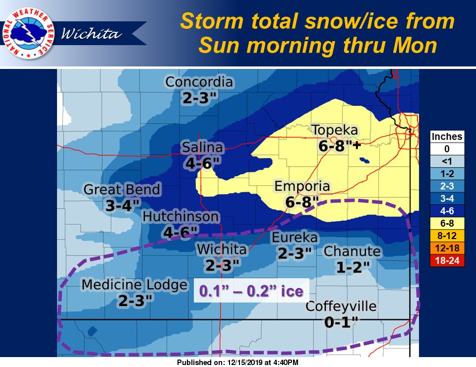
The map below shows the total snowfall amounts that occurred with both rounds of snow. The highest snowfall reports occurred with the band of snow across northern Kansas, with lesser amounts noted to the south with the second band of snow.
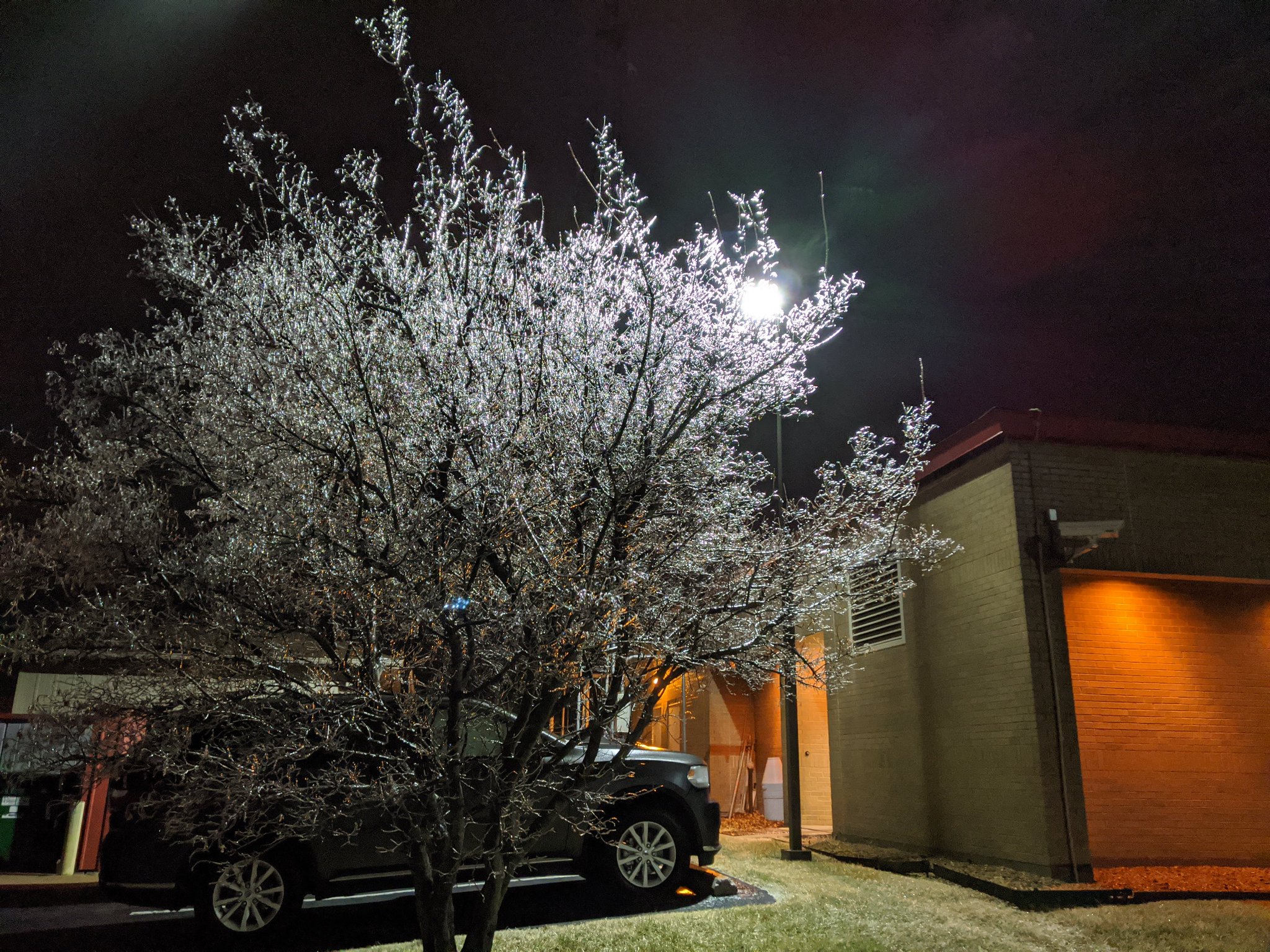
Photos & Video
 |
 |
|
|
|
|
|
|
|
|
|
|
|
Storm Reports
Environment
This winter event was unique in how it impacted the area in two distinct waves with a lull in precipitation between each. A "lead" wave moved out of the Central Rockies ahead of the larger, upper level trough that was moving into the western US (see Figures 1 and 2). This initial wave not only had strong, upper level support and lift, it also had some mesoscale lift and weak instability that likely aided in the heavier snowfall rates that were experienced along the I-70 corridor (see Figure 3). EPV is a way to asses the stability of the airmass where mesoscale lift (frontogenesis, in this case) exists. Negative EPV (red shading in Figure 3) indicates weak, elevated instability which can support multiple bands of heavier snowfall rates.
.PNG) |
.PNG) |
.PNG) |
| Figure 1: Upper level trough moving into the western US (6 am, December 15). | Figure 2: "Lead" wave moving out of the Central Rockies, responsible for the band of heavy snow over northern Kansas (6 am, December 15). | Figure 3: 650-500mb frontogenesis and EPV (12 pm, December 15). |
Round 2 of winter precipitation developed as the main upper trough approached the Central Plains (see Figure 4). Moisture wasn't as expansive as in round 1, but still sufficient for some light to moderate snow. While both rounds had a combination of large scale and mesoscale lifting processes, it appears that a lack of better moisture might have contributed to lower snowfall rates and amounts.
.png) |
.png) |
|
| Figure 4: Upper level trough moving out of the Rockies (6 am, December 16). | Figure 5: 700 mb moisture and convergence (3 am, December 16) |
Radar data from round 1 (Figure 7) shows multiple bands of heavy snow moving along the I-70 corridor from Salina to Kansas City. To the south, freezing drizzle was common across the Wichita metro. Radar data from round 2 (Figure 8) shows a smaller band moving across southern Kansas. Notice the second round was mainly confined south of I-70.
.PNG) |
.PNG) |
|
| Figure 7: 9:25 am, December 15 Radar Image. | Figure 8: 3:25 am, December 16 Radar Image. |
 |
Media use of NWS Web News Stories is encouraged! Please acknowledge the NWS as the source of any news information accessed from this site. |
 |