Overview
|
Unseasonably strong upper disturbance tracked across northern Kansas on Tuesday June 18th, allowing severe storms to erupt by the late afternoon hours. Rich low level moisture resulted in extreme instability which allowed storms to quickly become severe, producing large hail. A few location in Wichita saw hail just smaller than baseballs with several reports of hail up to 2 inches in diameter. This cluster of storms also produced straight-line winds that caused extensive damage just east of Augusta. In addition, the stronger storms produced very high rainfall rates that caused flash flooding. |
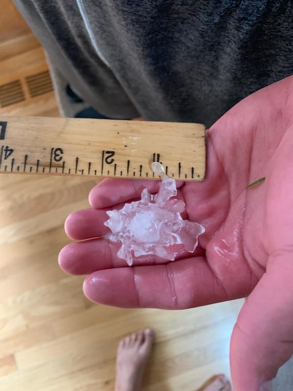
 Hail from around 21st and Tyler. |
Photos & Video
|
Hail from around 21st and Tyler in Wichita. Picture by Bonita Kleinsasser. |
Hail from around 21st and Maize from Janet Salazar. |
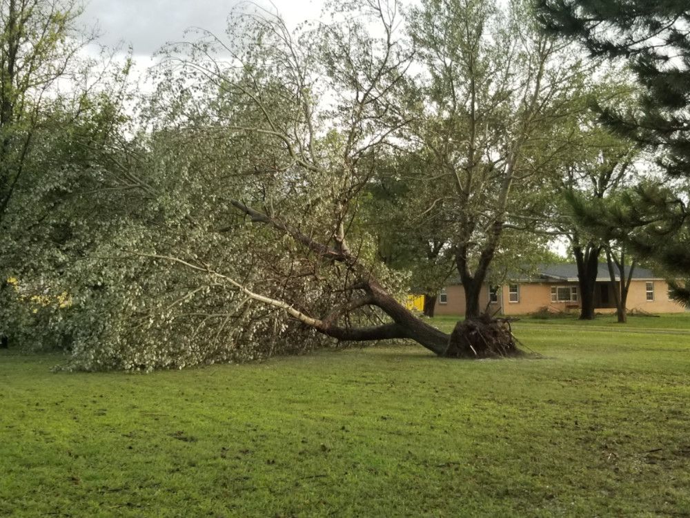
Picture of wind damage just east of Augusta from Butler County Emergency Management. |
|
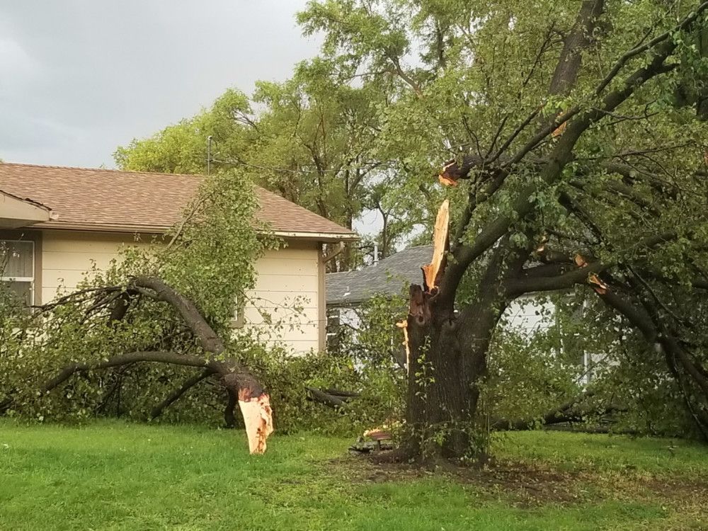
Picture of wind damage just east of Augusta from Butler County Emergency Management. |
Picture of wind damage just east of Augusta from Butler County Emergency Management. |
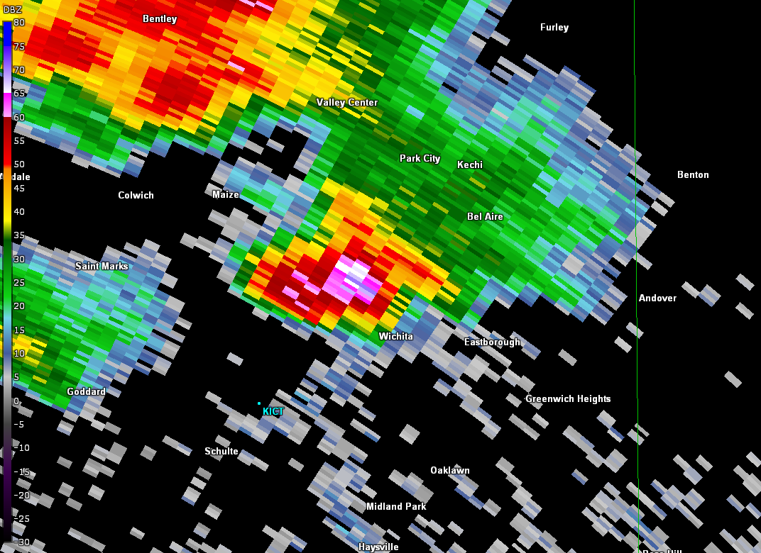
Radar image of the storm that produced the large hail over Wichita. |
|
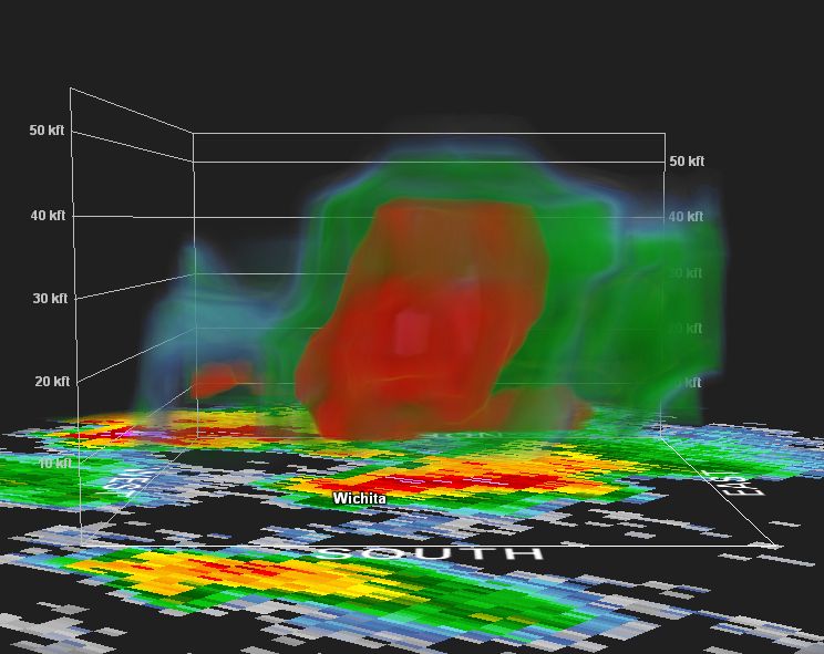
3-D radar image of the storm that produced large hail over parts of Wichita. Note the storm top is over 50,000 ft with the 50 dbz core over 40,000 ft. |
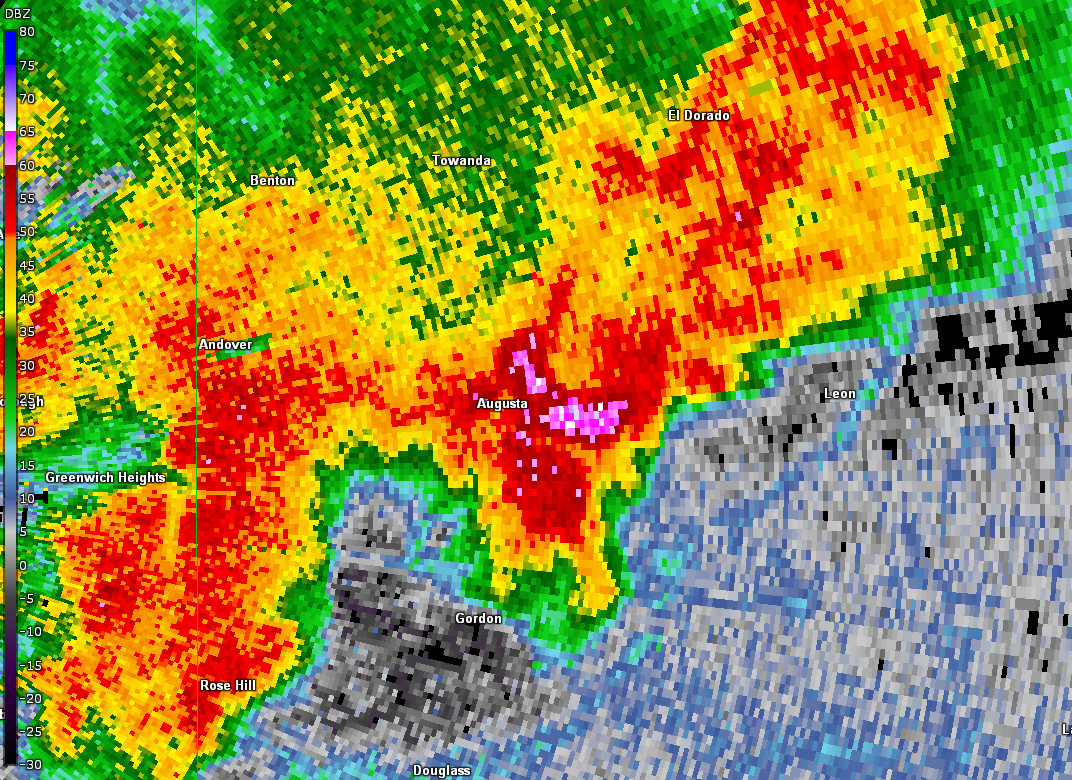
Radar image of the storm that produced the wind damage east of Augusta. |
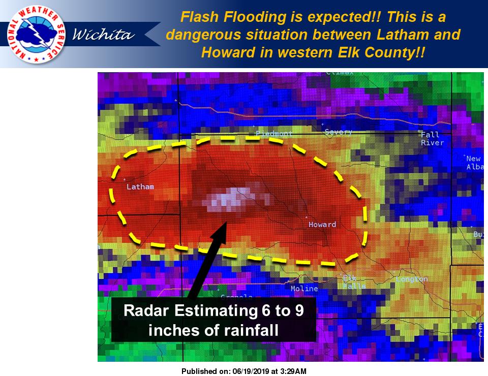
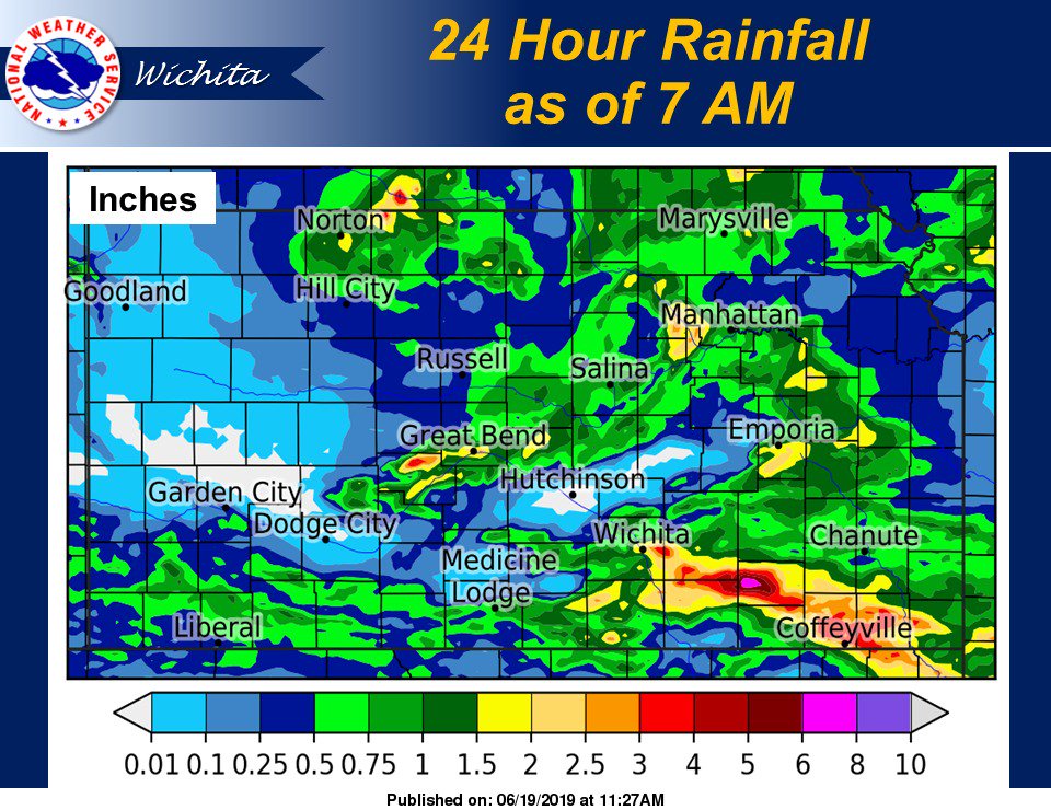
Radar estimation of 6 to 9 inches over parts of Elk County. |
|
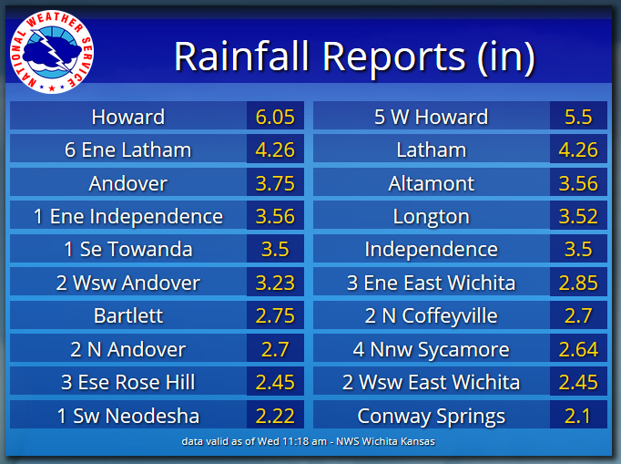
Some of the higher rainfall totals across the area. |
Map of rainfall amounts. |
|
|
|
|
|
|
|
 |
Media use of NWS Web News Stories is encouraged! Please acknowledge the NWS as the source of any news information accessed from this site. |
|


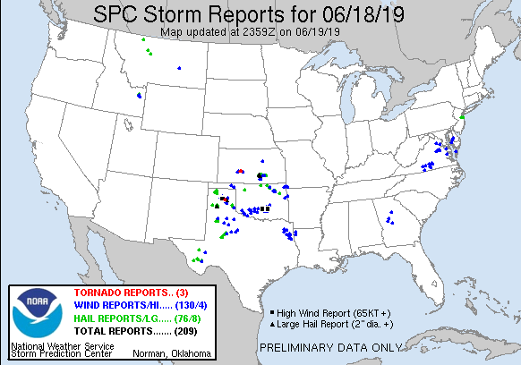 Storm reports from June 18th 2019