Overview
|
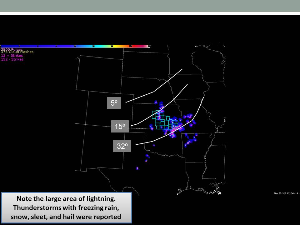
A very shallow Arctic cold front pushed through Kansas on February 5th. By very early February 6th warm air and moisture just above the surface started surging north. This set the stage for widespread freezing drizzle, freezing rain along with some sleet. Warm air above the Arctic airmass at the surface also provided a great setup for scattered storms, with many of them producing sleet and hail. |
 Photo by Michael G. Geiman - near Cassoday |
Photos & Video
|
||
| Iola, KS | McPherson, KS | Harper county, KS |
|
|
|
|
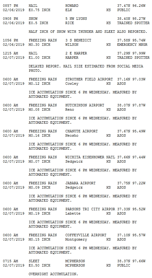
Reports(page 1) |
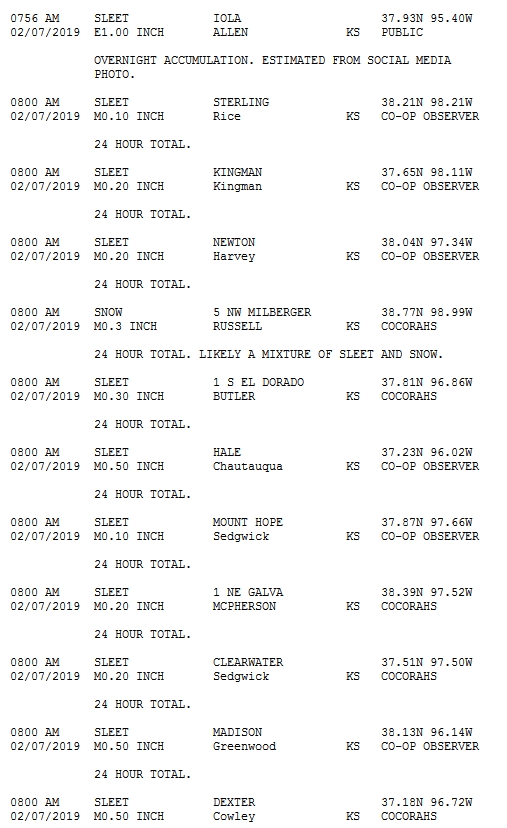
Reports (page 2) |
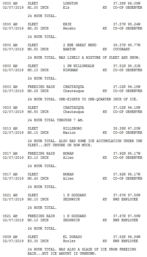
Reports (page 3) |
Environment
Very shallow but extremely cold Arctic airmass was well established by February 5th. Moist warm advection just above the surface ramped up across the southern Plains ahead of an approaching upper shortwave. A wedge of warm air, well above freezing, around 2,000ft kept most of the precip initially as freezing drizzle or freezing rain. Two things started to allow us to see more sleet and snow: First, we started to get cold enough near the surface to see some sleet and snow. Second, we started to see thunder, which helped decrease the warm air aloft allowing for sleet and even some small hail.
 |
 |
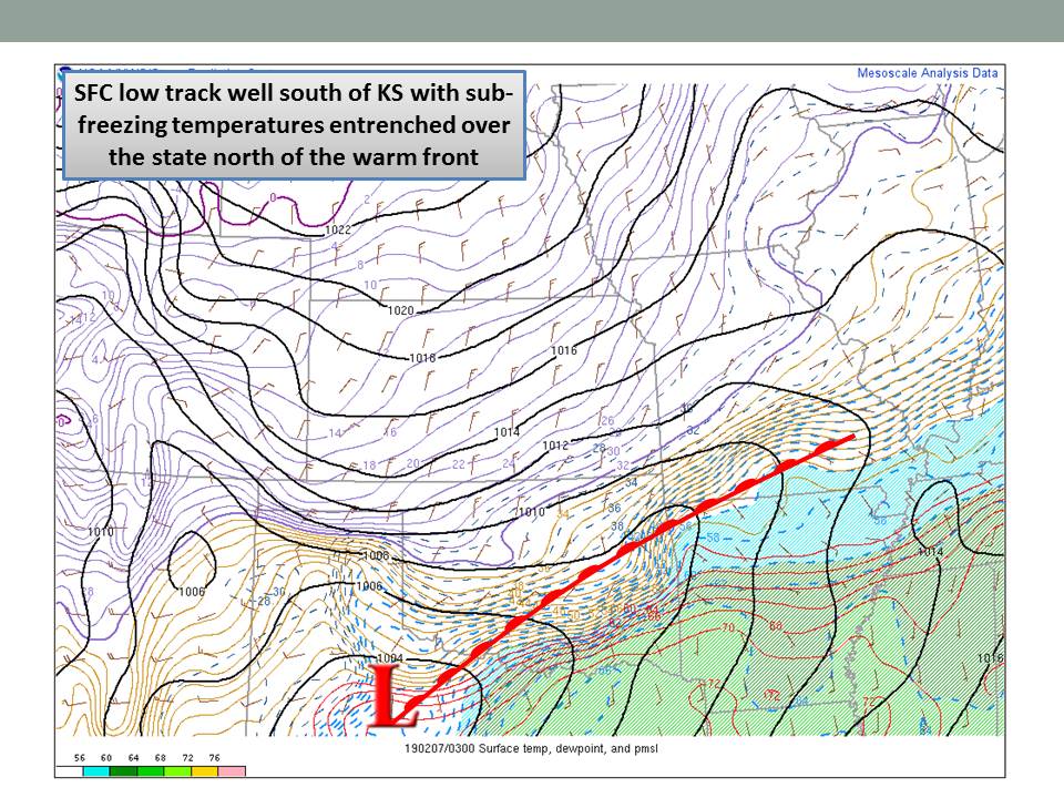 |
| Lightning around 9:30pm with surface temps overlaid | Regional radar around 9:30pm with warm front position | Warm front position with surface temps and dewpoints |
 |
 |
 |
| Warm front position with elevated instability(MUCAPE) | Upper jet | Model sounding for southeast Kansas |
 |
Media use of NWS Web News Stories is encouraged! Please acknowledge the NWS as the source of any news information accessed from this site. |
|