Wichita, Kansas
Weather Forecast Office
Overview
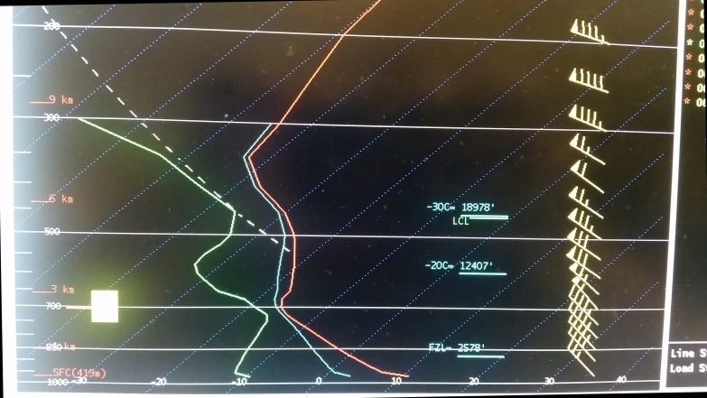
Deep low pressure over Iowa and very deep afternoon mixing set the stage for strong northwest winds across much of the Plains. Gusts topping 60 mph were common across Kansas and Nebraska. These strong winds elevated the grassland fire danger into the extreme and catastrophic categories for much of Kansas and Oklahoma. Numerous large fires were reported in these areas.Photos & Video:
Header
 |
 |
|
|
||
| Wind measurements on March 6th 2018 | Surface map from afternoon of March 6th | ||||
 |
|
|
|||
| Satellite detected fire over Barton County | Model sounding for Wichita showing mixing to 700mb | ||||
 |
Media use of NWS Web News Stories is encouraged! Please acknowledge the NWS as the source of any news information accessed from this site. |
 |
Hazards
Briefing pages
Local weather story
Submit a storm report
Storm Prediction Center
Enhanced Hazardous Weather Outlook
Current Conditions
Local Radar
National Radar
Satellite
Hourly weather(text)
Precip Analysis
Snowfall analysis
This day in weather history
7 Day Lightning Archive
Forecasts
Forecast Discussion
Weather Story
Fire Weather
Activity Planner
Aviation Weather
Soaring Forecast
Hurricane Center
Graphical Forecasts
Regional Weather Summary
Probabilistic Snow
Probabilistic QPF
Wet Bulb Globe temp
Climate
Local Climate Page
Daily/Monthly data(F6)
Daily Records
Climate Normals
Local drought page
Latest Climate Report(ICT)
Latest Climate Report(SLN)
Latest Climate Report(CNU)
CoCoRaHS
7 Day Lightning Archive
US Dept of Commerce
National Oceanic and Atmospheric Administration
National Weather Service
Wichita, Kansas
2142 S. Tyler Road
Wichita, KS 67209-3016
316-942-3102
Comments? Questions? Please Contact Us.


