Wichita, Kansas
Weather Forecast Office
|
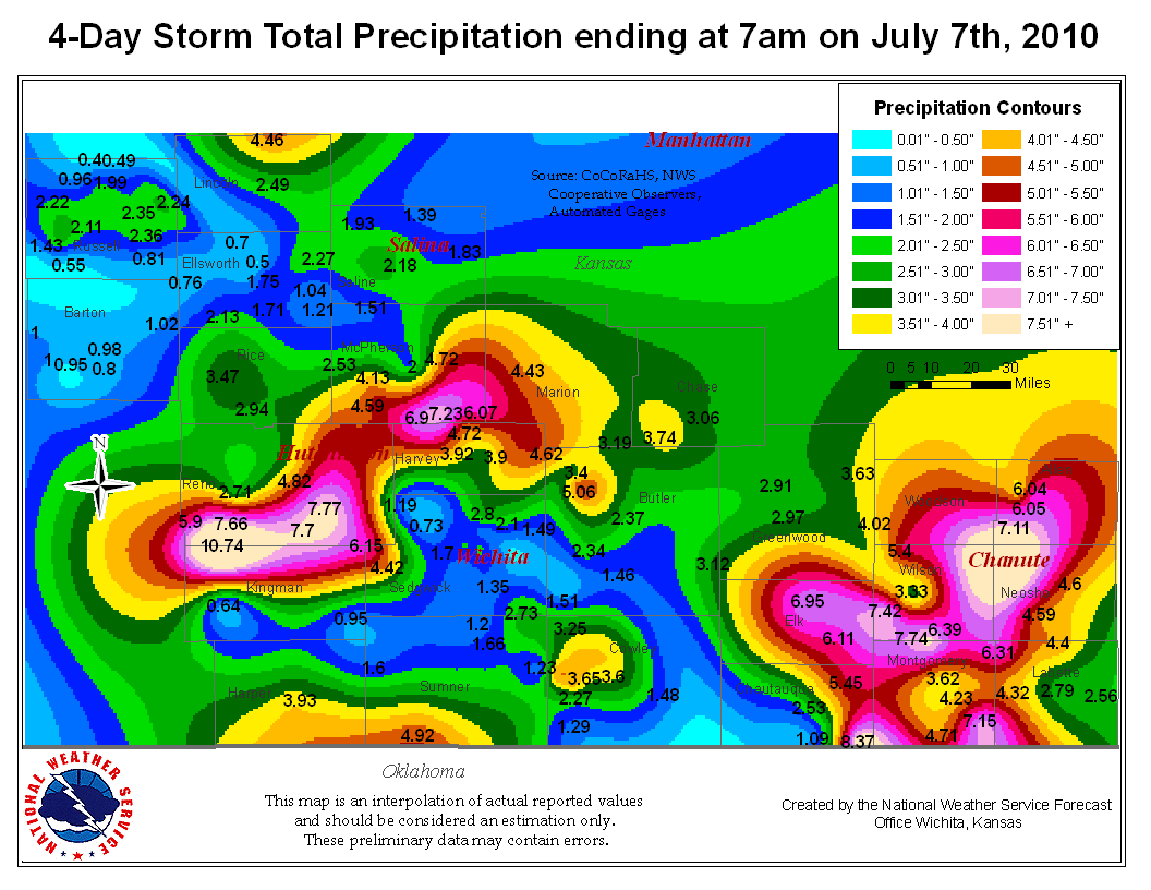
July 2010 started off wet across much of Kansas as remnant tropical moisture from hurricane Alex collided with a slow moving front. The heavy rainfall began on July 4th over Central and South Central Kansas and continued through July 6th as the heavy rain shifted over Southeast Kansas. The heavy rain sent many rivers and streams into flood causing numerous reports of flooded roads.
|
|
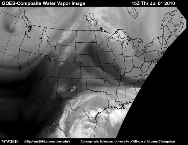
Water Vapor satellite image from July 1st showing hurricane Alex after it made landfall over Mexico. Note the mid and upper level moisture from the tropical system extending into northern Texas. |
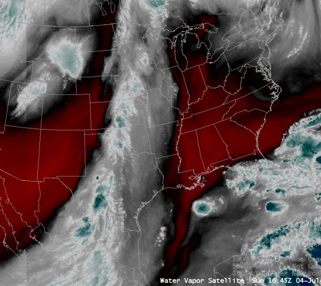
Water vapor satellite image from July 4th showing the remnant tropical moisture extending from the Central Plains down into Southern Mexico. |
|
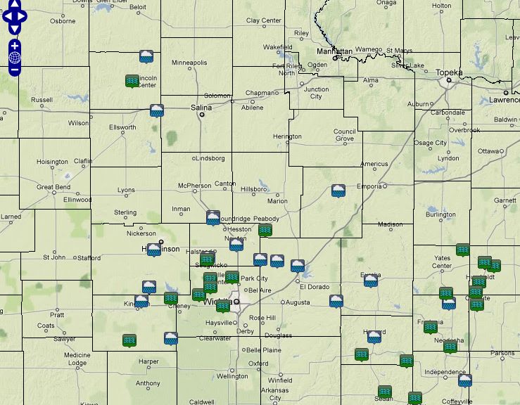
Flooding and heavy rain reports. Click on map for additional details |
Hazards
Briefing pages
Local weather story
Submit a storm report
Storm Prediction Center
Enhanced Hazardous Weather Outlook
Current Conditions
Local Radar
National Radar
Satellite
Hourly weather(text)
Precip Analysis
Snowfall analysis
This day in weather history
7 Day Lightning Archive
Forecasts
Forecast Discussion
Weather Story
Fire Weather
Activity Planner
Aviation Weather
Soaring Forecast
Hurricane Center
Graphical Forecasts
Regional Weather Summary
Probabilistic Snow
Probabilistic QPF
Wet Bulb Globe temp
Climate
Local Climate Page
Daily/Monthly data(F6)
Daily Records
Climate Normals
Local drought page
Latest Climate Report(ICT)
Latest Climate Report(SLN)
Latest Climate Report(CNU)
CoCoRaHS
7 Day Lightning Archive
US Dept of Commerce
National Oceanic and Atmospheric Administration
National Weather Service
Wichita, Kansas
2142 S. Tyler Road
Wichita, KS 67209-3016
316-942-3102
Comments? Questions? Please Contact Us.