Wichita, Kansas
Weather Forecast Office
June 8th and 9th - Severe storms and Flooding
|
Storms first developed late Tuesday afternoon (June 8th) along a cold front that was pushing steadily south. Additional storms formed north of the cold front as the overnight hours progressed providing several rounds of storms for locations generally along and southeast of the Kansas turnpike. Many of these storms quickly became severe with wet microburst winds the main severe threat. However with an extremely moist air mass in place all of the storms produced very high rainfall rates that caused widespread flooding across portions of South Central and especially Southeast Kansas. Below is a rainfall map from 7am on June 8th to 7am on June 9th
|
|
|
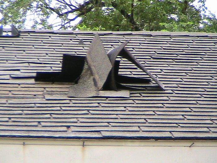
Wind damage near Dennis KS, in Labette County. Picture provided by J.D. Stewart |
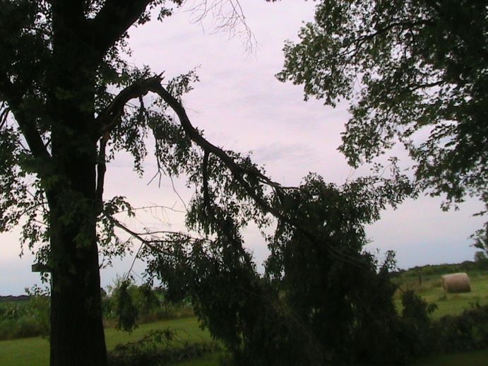 Wind damage near Dennis KS, in Labette County. Picture provided by J.D. Stewart |
Hazards
Briefing pages
Local weather story
Submit a storm report
Storm Prediction Center
Enhanced Hazardous Weather Outlook
Current Conditions
Local Radar
National Radar
Satellite
Hourly weather(text)
Precip Analysis
Snowfall analysis
This day in weather history
7 Day Lightning Archive
Forecasts
Forecast Discussion
Weather Story
Fire Weather
Activity Planner
Aviation Weather
Soaring Forecast
Hurricane Center
Graphical Forecasts
Regional Weather Summary
Probabilistic Snow
Probabilistic QPF
Wet Bulb Globe temp
Climate
Local Climate Page
Daily/Monthly data(F6)
Daily Records
Climate Normals
Local drought page
Latest Climate Report(ICT)
Latest Climate Report(SLN)
Latest Climate Report(CNU)
CoCoRaHS
7 Day Lightning Archive
US Dept of Commerce
National Oceanic and Atmospheric Administration
National Weather Service
Wichita, Kansas
2142 S. Tyler Road
Wichita, KS 67209-3016
316-942-3102
Comments? Questions? Please Contact Us.