Late March Blizzard
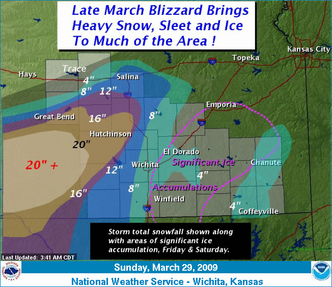
| A very significant late season Winter storm dumped one to two feet of snow across parts of Central, South Central and Southwest Kansas. The heavy snow and strong winds resulted in blizzard conditions in some of these areas from Friday March 27th into early Saturday March 28th. Meanwhile, significant accumulations of ice from freezing rain and sleet also affected the Flint Hills and Southeast Kansas, with some snow accumulations before the wintry precipitation ended Saturday evening. Several areas reported power outages due to the snow, ice and wind. |
 |
|
The above image is a visible satellite image with the white areas snow cover. Click the image to enlarge. |
|
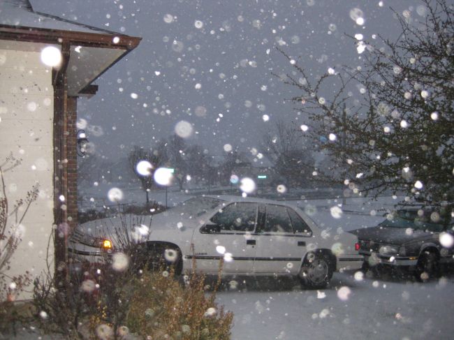
West Wichita - Photo by Brad Ketcham |
Collapse of roof at gas station in Wichita due to accumulation of snow and ice. Photo by John Crosby |
NWS office(SW Wichita) - Photo by Brad Ketcham |
||
|
Tree damage in Wichita due to ice accumulation - Photo by John Crosby |
Tree damage due to ice accumulation in Wichita - Photo by John Crosby |
|
||
|
Ice accumulation in Wichita - Photo by Bryce Kintigh |
|
Snowfall in Wichita - Photo by Bryce Kintigh |
||
|
|
Ice accumulation in Wichita - Photo by Bryce Kintigh |
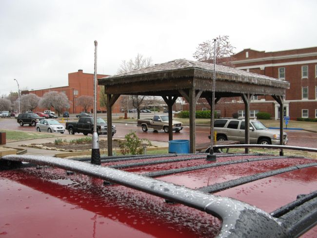
Ice accumulation in Arkansas City - Photo by Bob Frazee |
||
|
Damaged vegetation in Arkansas City - Photo by Bob Frazee |
Tree damage due to ice accumulation in Derby Kansas - photo by James Magyar |
Heavy snowfall in Derby Kansas - Photo by James Magyar |
||
|
Tree damage in Derby due to ice accumulation - Photo by James Magyar |
Tree damage in Derby due to ice accumulation - Photo by James Magyar |
P |
||
|
Heavy snowfall in West Wichita - Photo by Robb Lawson |
|
|
||