Wichita, Kansas
Weather Forecast Office
Evening Supercells Lay a Swath of Large Hail Across Central Kansas!
|
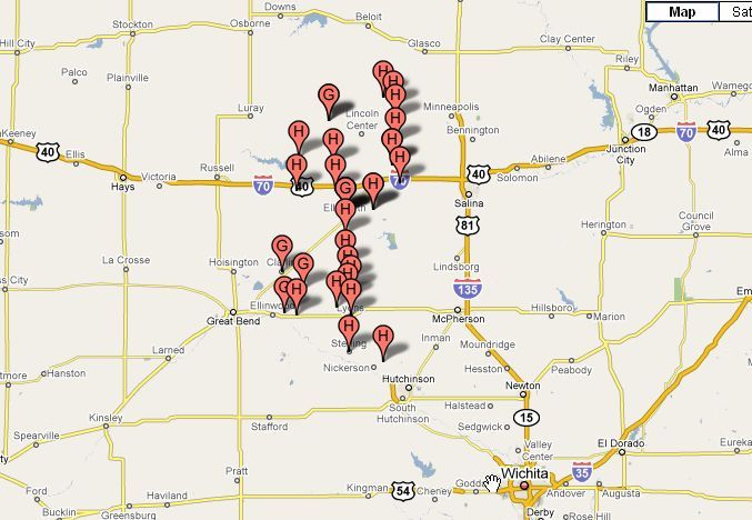
A strong upper level low pressure system tracked out of Eastern Nebraska and in to Northeast Kansas during the evening of September 3rd. Storms first developed during the early evening hours over extreme North-Central Kansas and tracked South in to Central Kansas as the overnight hours progressed. With plenty of wind spear, especially in the mid levels, these storms quickly became supercell thunderstorms producing a large swath of severe hail across Central Kansas. The image below displays the severe weather reports across Central Kansas during the evening of September 3rd.
|
|
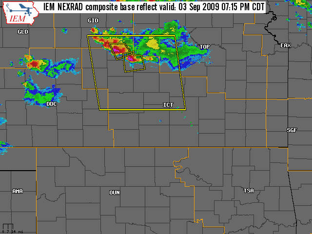
Radar loop showing the path the storms took across Central Kansas |
Large hail that fell in Ellsworth. Picture courtesy of Henry Diehl |
|
|
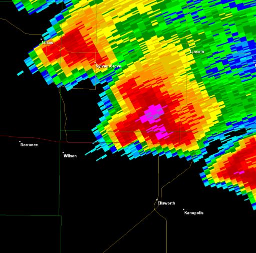
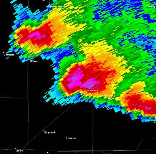
Supercell thunderstorm around 730pm as it enters northern Ellsworth County. |
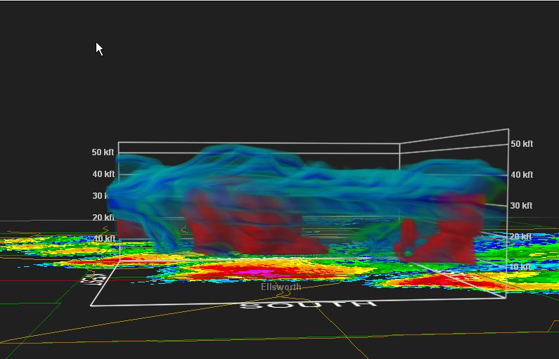
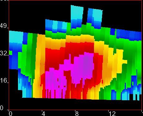
3-D radar view of the same storm as it entered northern Ellsworth County around 730 pm. Note the overshooting top extends to around 50,000ft with the main core of the storm extending to around 40,000ft. |
The same supercell thunderstorm as it enters the town of Ellsworth. |
|
Radar cross-section of the storm when it was southwest of the town of Ellsworth. Note the extremely high reflectivity extending to near 32,000ft. |
||
Hazards
Briefing pages
Local weather story
Submit a storm report
Storm Prediction Center
Enhanced Hazardous Weather Outlook
Current Conditions
Local Radar
National Radar
Satellite
Hourly weather(text)
Precip Analysis
Snowfall analysis
This day in weather history
7 Day Lightning Archive
Forecasts
Forecast Discussion
Weather Story
Fire Weather
Activity Planner
Aviation Weather
Soaring Forecast
Hurricane Center
Graphical Forecasts
Regional Weather Summary
Probabilistic Snow
Probabilistic QPF
Wet Bulb Globe temp
Climate
Local Climate Page
Daily/Monthly data(F6)
Daily Records
Climate Normals
Local drought page
Latest Climate Report(ICT)
Latest Climate Report(SLN)
Latest Climate Report(CNU)
CoCoRaHS
7 Day Lightning Archive
US Dept of Commerce
National Oceanic and Atmospheric Administration
National Weather Service
Wichita, Kansas
2142 S. Tyler Road
Wichita, KS 67209-3016
316-942-3102
Comments? Questions? Please Contact Us.