April 26th Tornadoes and Straight Line Wind Damage
|
Widespread severe storms affected the region on Sunday April 26th. Storms developed early in the afternoon along a dryline in Western Kansas and Western Oklahoma. These storms quickly became severe as they raced northeast. The first damaging storm developed around 330 pm along the Sedgwick-Butler County line. This storm produced a swatch of damage as it tracked northeast through Northern Butler and Southeast Marion Counties. Shortly before 6 pm a small supercell thunderstorm moved into Western Sedgwick County. This storm dropped a brief tornado near Lake Afton which caused damage and injuries. This tornado was rated an EF1 by the National Weather Service. Storms then organized into a line and raced northeast producing straight-line winds at speeds between 70 and 90 mph. These severe winds caused damage across Harvey and Marion Counties.
Additional information(including images) will be added to this weather story. So please check back! |
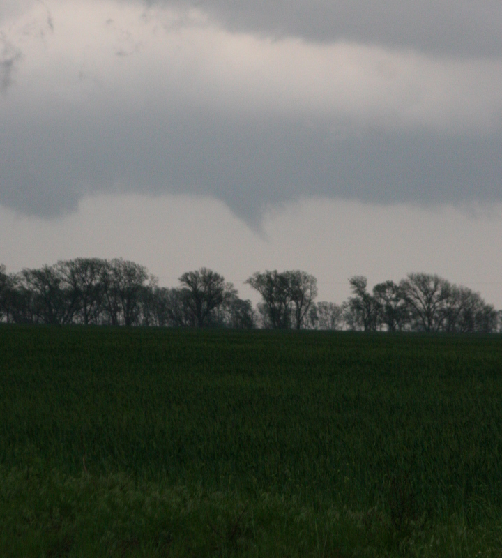 Funnel cloud in Harper County. This is the storm that eventually produced the tornado in Western Sedgwick County. Image courtesy Bryce Kintigh. |
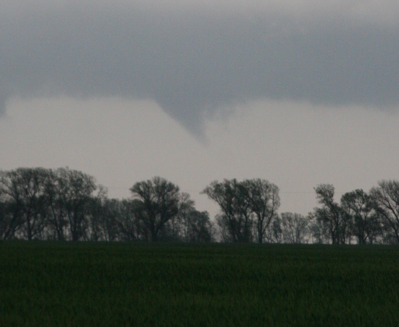 Funnel cloud in Harper County. This is the storm that eventually produced the tornado in Western Sedgwick County. Image courtesy Bryce Kintigh. |
|
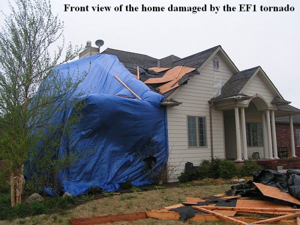
EF1 damage caused by this tornado. |
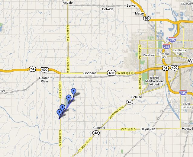
Damage path of this EF1 tornado. |
|
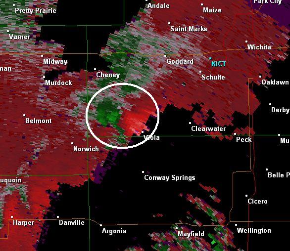
Radar image from Vance AFB of the small supercell that produced the tornado near Lake Afton. |
Radar image from Vance AFB showing storm relative velocity from the storm that produced the tornado near Lake Afton. |
Additional Damage Information
|
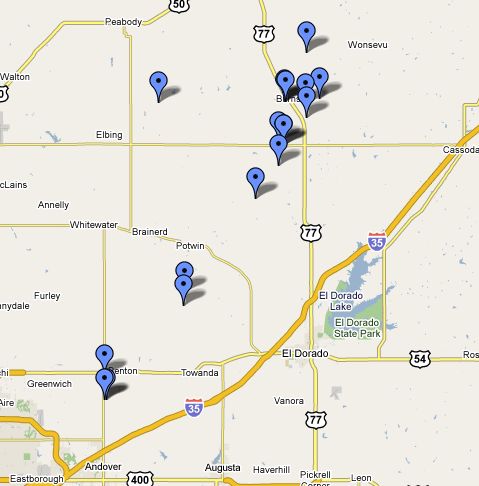
Track of damage path through Northern Butler and Southeast Marion Counties. |
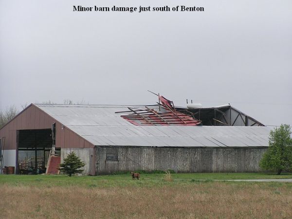
Barn damage south of Benton
|
|
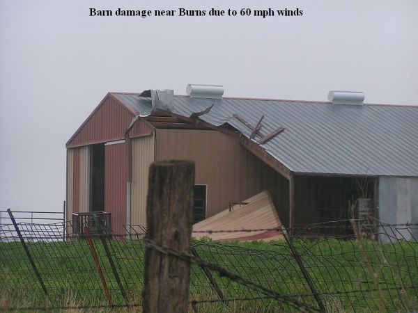
Barn damage near Burns. |
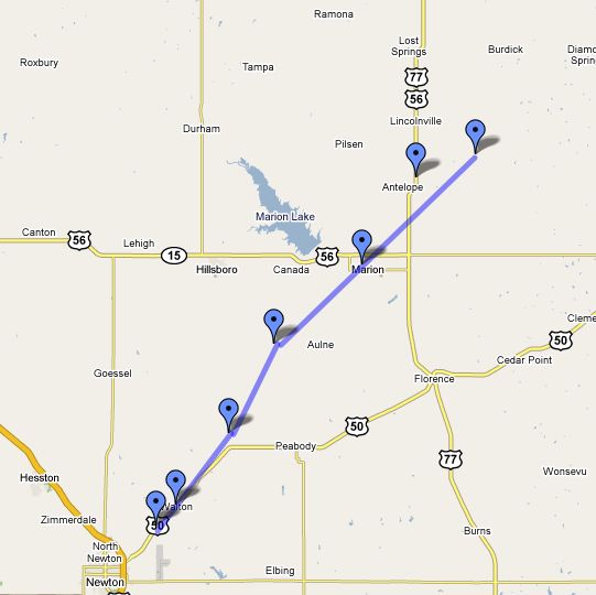
Track of 70-90 mph straight-line winds through Harvey and Marion Counties |
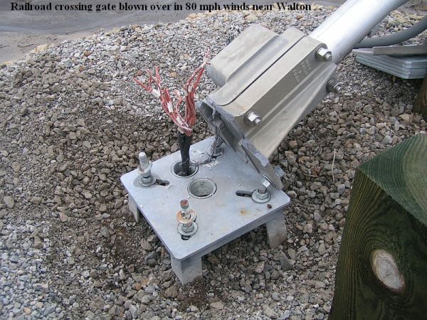 Railroad crossing gate blown down near Walton in Harvey County. |
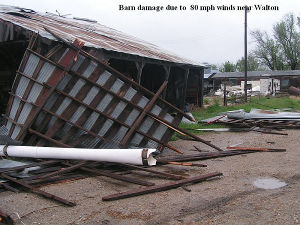 Barn damage near Walton in Harvey County. |
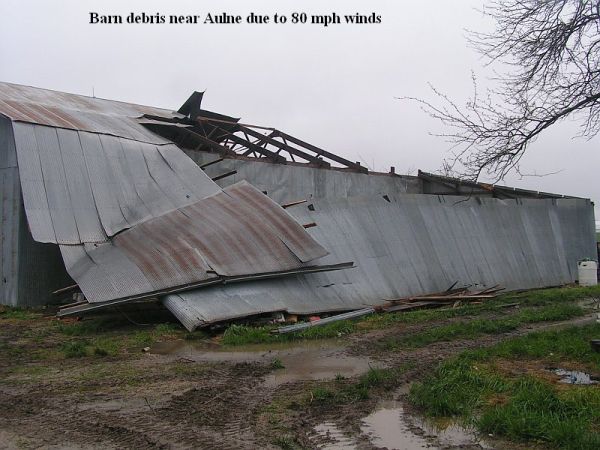
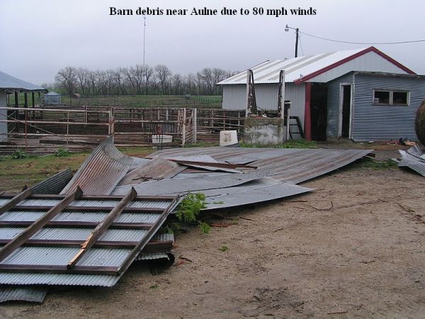 Barn debris near Aulne in Marion County |
 Barn damage near Aulne in Marion County. |
|
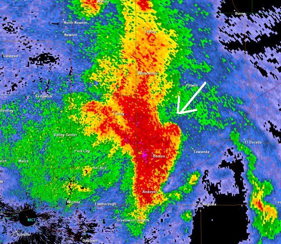
Radar image from the Wichita NWS of the storm that produced the meso-vortex which caused damage. |
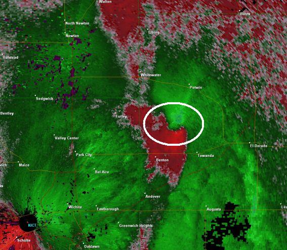
Radar image from the NWS in Wichita showing storm relative velocity . Note the tight circulation(meso-vortex) northwest of Towanda. |


.jpg)