Wichita, Kansas
Weather Forecast Office
Severe Weather Season has arrived in Kansas. On Saturday March 7th a quasi-stationary boundary draped southwest to northeast across central Kansas. The boundary slowly drifted southeastward throughout the day. As the sky began to clear in southwestern and south central Kansas, the sun warmed the air southeast of the boundary, destabilizing it and priming the environment for the development of storms.
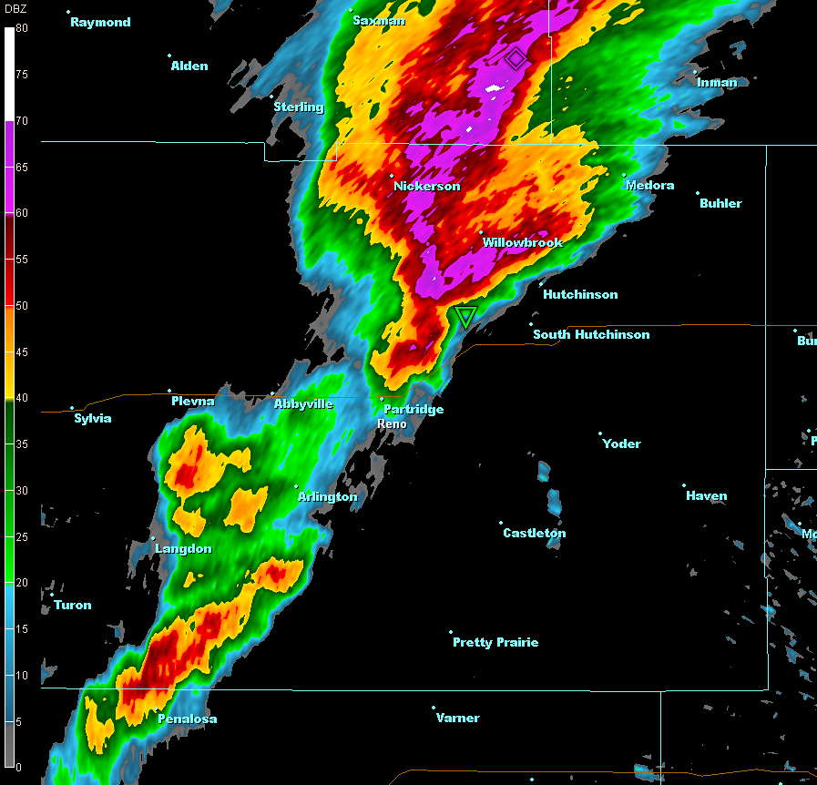
A few of the storms on the evening of March 7th were strong and produced a few weak tornadoes. The first severe storm developed in western Reno county producing large amounts of ¼ inch to ½ inch hail. The storm quickly developed mid-level rotation and a tornado touched down around 4:15pm near Abbyville and Partridge, KS. The tornado touched down a few times in Reno County and passed just south of the Hutchinson airport at 4:36pm. Later Wednesday evening a couple tornadoes were reported in Barber and Harper counties. Preliminary Tornado ratings for all of the tornadoes on March 7th in Reno and Harper counties are EF0. Fortunately no damage was reported with these twisters.
Radar image of 0.5 degree base reflectivity at 4:23pm
Pictures provided by Bryce Kintigh:
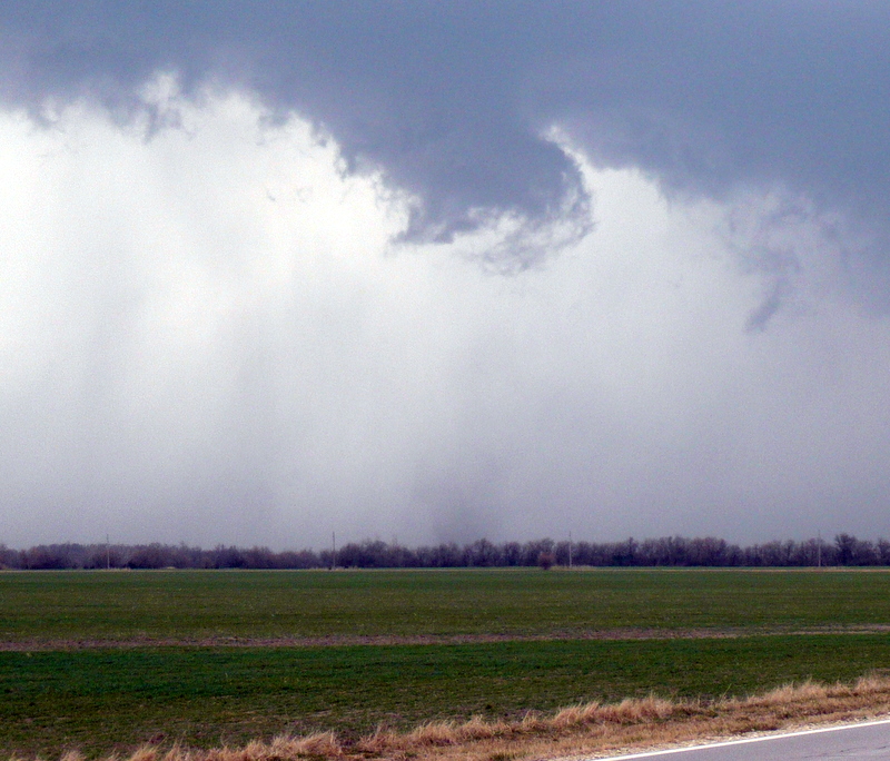
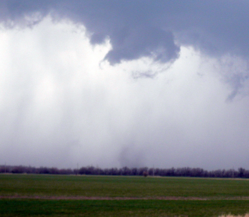
Photos taken South of Hutchinson, KS
Hazards
Briefing pages
Local weather story
Submit a storm report
Storm Prediction Center
Enhanced Hazardous Weather Outlook
Hazardous Weather Outlook Text
Current Conditions
Local Radar
National Radar
Satellite
Hourly weather(text)
Precip Analysis
Snowfall analysis
This day in weather history
7 Day Lightning Archive
Forecasts
Forecast Discussion
Weather Story
Fire Weather
Activity Planner
Aviation Weather
Soaring Forecast
Hurricane Center
Graphical Forecasts
Regional Weather Summary
Probabilistic Snow
Probabilistic QPF
Wet Bulb Globe temp
Climate
Local Climate Page
Daily/Monthly data(F6)
Daily Records
Climate Normals
Local drought page
Latest Climate Report(ICT)
Latest Climate Report(SLN)
Latest Climate Report(CNU)
CoCoRaHS
7 Day Lightning Archive
US Dept of Commerce
National Oceanic and Atmospheric Administration
National Weather Service
Wichita, Kansas
2142 S. Tyler Road
Wichita, KS 67209-3016
316-942-3102
Comments? Questions? Please Contact Us.

